SlideShare una empresa de Scribd logo
1 de 31
Descargar para leer sin conexión
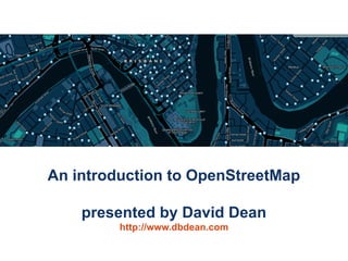
An introduction to OpenStreetMap

    presented by David Dean
         http://www.dbdean.com
What is OpenStreetMap?

• Geographic data
    – For driving, riding,
      walking, boating,
      skiing, hiking, anything
• Free
    – Currently CC-BY-SA,
      moving to ODBL
• Wiki-like editing
                                       http://www.osm.org


 An introduction to OpenStreetMap                           2
Why not just use Google Maps?


                      or WhereIs/Yahoo/Bing Maps?

               or whatever is on your GPS/Phone?


An introduction to OpenStreetMap                    3
Updated rapidly


                    Google                       OpenStreetMap


An introduction to OpenStreetMap                                 4
But, coverage can be poor


An introduction to OpenStreetMap                5
Not just for cars


An introduction to OpenStreetMap   6
Data freely available (and editable)


An introduction to OpenStreetMap              7
Raw traces are available too


An introduction to OpenStreetMap                8
Free data means you can do more neat stuff


  An introduction to OpenStreetMap           9
Lots of Mappers


An introduction to OpenStreetMap   10
Worldwide activity


                                     OSM 2008: A Year of Edits


An introduction to OpenStreetMap                                 11
Available on many devices
                                                          Garmin PNDs


 OffMaps on IPhone
                                                                                                     Garmin GPSs


                                                                        Gosmore on Windows Mobile


AndNav2 on Android
                                         GPSMid on J2ME                          MaemoMapper on Nokia Maemo


      An introduction to OpenStreetMap                                                                        12
Humanitarian OpenStreetMap Team


An introduction to OpenStreetMap      13
OpenStreetMap Gaza Project
                                   Jan 2009: Mikel Maron announces
                                   OpenStreetMap Gaza Project

                                   Feb 2009: Mapping begins with
                                   purchased aerial imagery
                                   (~ $6000)


An introduction to OpenStreetMap                                     14
Gaza Strip today


An introduction to OpenStreetMap                      15
MAP Kibera (April 2009)

• First complete, free and open map of Kibera,
  Nairobi.
• Mapped primarily
  with local volunteers
  with the assistance
  of MAP Kibera.
http://mapkibera.org


 An introduction to OpenStreetMap                  16
Kibera today


An introduction to OpenStreetMap                  17
Haiti earthquake, Jan 2010


An introduction to OpenStreetMap                 18
Haiti earthquake, Jan 2010


                        High-res imagery donated this time. (many providers)
An introduction to OpenStreetMap                                               19
Haiti earthquake, Jan 2010


                        High-res imagery donated this time. (many providers)
An introduction to OpenStreetMap                                               20
http://haiti.ushahidi.com

An introduction to OpenStreetMap                               21
World Bank Situation Room


                                                http://haiti.ushahidi.com

An introduction to OpenStreetMap                                            22
"Hello guys, I just wanted to let you know
                                         that your work on improving the Haiti
                                         maps is really appreciated here. A few
                                         days ago I installed a version on my
                                         Garmin Oregon GPS and the result is
                                         impressive. It has already saved me and
                                         my driver from getting lost twice, and the
                                         alternative would have been long delays.
                                         In the coming days I will try to update our
                                         Red Cross relief GPS receivers with your
                                         map.” - Kjeld Jensen, Red Cross (IFRC)


                    World Bank Situation Room


                                                         http://haiti.ushahidi.com

An introduction to OpenStreetMap                                                       23
So, how can you map?


An introduction to OpenStreetMap                24
(Option 1) Trace aerial imagery


An introduction to OpenStreetMap              25
(Option 2) Go outside

          Take notes, →


  record your trip
     (optional),

   and update the map from your notes at home

An introduction to OpenStreetMap                    26
(Option 3) Tell someone about a problem


An introduction to OpenStreetMap          27
(Option 4) Be social

• Brisbane mapping events occur monthly
  – Alternate between mapping parties and meetups
• Next event: OSM Mapping Meetup
  – 7pm Monday 21st June at Grange Library
  – See http://wiki.osm.org/wiki/Brisbane
• What is a mapping party?
  – A group of people get together to map a large
    area in a single day
  – Example: Macleay Island in November 2009


 An introduction to OpenStreetMap                     28
Data representation

• Geographic information is
  represented as
   – Nodes
   – Ways
          • Ordered collections of nodes
          • Closed ways can be areas
   – Relations
          • Ordered collections of ways
            and nodes
• All can be tagged with
  any key/value pairs

 An introduction to OpenStreetMap                    29
No formal key/value ontology

• Let freedom flourish!
• Common tagging is
  encouraged
    –    Map Features wiki
    –    Editor presets
    –    Renderers
    –    OSMDoc
    –    Tagwatch


 An introduction to OpenStreetMap              30
Questions/Suggestions?


Thanks for listening.


 An introduction to OpenStreetMap               31

Más contenido relacionado

La actualidad más candente

La actualidad más candente (20)

Introduction to WebGIS- Esri norsk BK 2014
Introduction to WebGIS- Esri norsk BK 2014Introduction to WebGIS- Esri norsk BK 2014
Introduction to WebGIS- Esri norsk BK 2014
 
Open Source GIS
Open Source GISOpen Source GIS
Open Source GIS
 
Gis functions
Gis functionsGis functions
Gis functions
 
Chap1 introduction to geographic information system (gis)
Chap1 introduction to geographic information system (gis)Chap1 introduction to geographic information system (gis)
Chap1 introduction to geographic information system (gis)
 
GIS and Decision Making, Literature Review
GIS and Decision Making, Literature ReviewGIS and Decision Making, Literature Review
GIS and Decision Making, Literature Review
 
Basic introduction to GIS and GIS Softwares (QGIS and ArcGIS)
Basic introduction to GIS and GIS Softwares (QGIS and ArcGIS)Basic introduction to GIS and GIS Softwares (QGIS and ArcGIS)
Basic introduction to GIS and GIS Softwares (QGIS and ArcGIS)
 
Introduction to gis
Introduction to gisIntroduction to gis
Introduction to gis
 
GIS
GISGIS
GIS
 
GEOPROCESSING IN QGIS
GEOPROCESSING IN QGISGEOPROCESSING IN QGIS
GEOPROCESSING IN QGIS
 
QGIS Training.pptx
QGIS Training.pptxQGIS Training.pptx
QGIS Training.pptx
 
Introduction to geomatics
Introduction to geomaticsIntroduction to geomatics
Introduction to geomatics
 
Map algebra
Map algebraMap algebra
Map algebra
 
Applications of gis in planning
Applications of gis in planningApplications of gis in planning
Applications of gis in planning
 
QGIS Tutorial 2
QGIS Tutorial 2QGIS Tutorial 2
QGIS Tutorial 2
 
An introduction to geographic information systems (gis) m goulbourne 2007
An introduction to geographic information systems (gis)   m goulbourne 2007An introduction to geographic information systems (gis)   m goulbourne 2007
An introduction to geographic information systems (gis) m goulbourne 2007
 
History of gis
History of gisHistory of gis
History of gis
 
Introduction to GIS
Introduction to GISIntroduction to GIS
Introduction to GIS
 
Network analysis in gis
Network analysis in gisNetwork analysis in gis
Network analysis in gis
 
Slope Modeling & Terrain Analysis (EPAN09)
Slope Modeling & Terrain Analysis (EPAN09)Slope Modeling & Terrain Analysis (EPAN09)
Slope Modeling & Terrain Analysis (EPAN09)
 
QGIS Module 3
QGIS Module 3QGIS Module 3
QGIS Module 3
 

Destacado

Another Game of Chess, Professor Falken?
Another Game of Chess, Professor Falken?Another Game of Chess, Professor Falken?
Another Game of Chess, Professor Falken?Iván Sánchez Ortega
 
Introduction to OpenStreetMap
Introduction to OpenStreetMapIntroduction to OpenStreetMap
Introduction to OpenStreetMapdbdean
 
GeOng presentation about OpenStreetMap
GeOng presentation about OpenStreetMapGeOng presentation about OpenStreetMap
GeOng presentation about OpenStreetMapchippy
 
Safer Schools through Open Mapping and Data Sharing
Safer Schools through Open Mapping and Data SharingSafer Schools through Open Mapping and Data Sharing
Safer Schools through Open Mapping and Data SharingNama Raj Budhathoki
 
Open Data Day 2015- Kathmandu (Nama Budhathoki)
Open Data Day 2015- Kathmandu  (Nama Budhathoki)Open Data Day 2015- Kathmandu  (Nama Budhathoki)
Open Data Day 2015- Kathmandu (Nama Budhathoki)Nama Raj Budhathoki
 
Ctrl+F5 Mumbai, 2016: A Practical Approach to Design Thinking by Simran Talreja
Ctrl+F5 Mumbai, 2016: A Practical Approach to Design Thinking by Simran TalrejaCtrl+F5 Mumbai, 2016: A Practical Approach to Design Thinking by Simran Talreja
Ctrl+F5 Mumbai, 2016: A Practical Approach to Design Thinking by Simran TalrejaResellerClub
 
Volunteered Geographic Information and OpenStreetMap
Volunteered Geographic Information and OpenStreetMapVolunteered Geographic Information and OpenStreetMap
Volunteered Geographic Information and OpenStreetMapchippy
 
Social by Design: Design Thinking & Business
Social by Design: Design Thinking & BusinessSocial by Design: Design Thinking & Business
Social by Design: Design Thinking & BusinessDavid Armano
 
Lean & Design Thinking in Education
Lean & Design Thinking in EducationLean & Design Thinking in Education
Lean & Design Thinking in EducationAndres Ospina
 
Design Thinking for Startups - Are You Design Driven?
Design Thinking for Startups - Are You Design Driven?Design Thinking for Startups - Are You Design Driven?
Design Thinking for Startups - Are You Design Driven?Amir Khella
 
OpenStreetMap (OSM): Mapping from the crowd and on the field open data prepa...
OpenStreetMap (OSM):  Mapping from the crowd and on the field open data prepa...OpenStreetMap (OSM):  Mapping from the crowd and on the field open data prepa...
OpenStreetMap (OSM): Mapping from the crowd and on the field open data prepa...Severin Menard
 
Introducing design thinking
Introducing design thinkingIntroducing design thinking
Introducing design thinkingZaana Jaclyn
 
Design Thinking: The one thing that will transform the way you think
Design Thinking: The one thing that will transform the way you thinkDesign Thinking: The one thing that will transform the way you think
Design Thinking: The one thing that will transform the way you thinkDigital Surgeons
 
Intro to Design Thinking
Intro to Design ThinkingIntro to Design Thinking
Intro to Design ThinkingMike Krieger
 
Team Building PowerPoint PPT Content Modern Sample
Team Building PowerPoint PPT Content Modern SampleTeam Building PowerPoint PPT Content Modern Sample
Team Building PowerPoint PPT Content Modern SampleAndrew Schwartz
 

Destacado (20)

Another Game of Chess, Professor Falken?
Another Game of Chess, Professor Falken?Another Game of Chess, Professor Falken?
Another Game of Chess, Professor Falken?
 
Introduction to OpenStreetMap
Introduction to OpenStreetMapIntroduction to OpenStreetMap
Introduction to OpenStreetMap
 
GeOng presentation about OpenStreetMap
GeOng presentation about OpenStreetMapGeOng presentation about OpenStreetMap
GeOng presentation about OpenStreetMap
 
Presentation OpenStreetMap
Presentation OpenStreetMapPresentation OpenStreetMap
Presentation OpenStreetMap
 
OSM Presentations
OSM PresentationsOSM Presentations
OSM Presentations
 
Safer Schools through Open Mapping and Data Sharing
Safer Schools through Open Mapping and Data SharingSafer Schools through Open Mapping and Data Sharing
Safer Schools through Open Mapping and Data Sharing
 
Open Data Day 2015- Kathmandu (Nama Budhathoki)
Open Data Day 2015- Kathmandu  (Nama Budhathoki)Open Data Day 2015- Kathmandu  (Nama Budhathoki)
Open Data Day 2015- Kathmandu (Nama Budhathoki)
 
Ctrl+F5 Mumbai, 2016: A Practical Approach to Design Thinking by Simran Talreja
Ctrl+F5 Mumbai, 2016: A Practical Approach to Design Thinking by Simran TalrejaCtrl+F5 Mumbai, 2016: A Practical Approach to Design Thinking by Simran Talreja
Ctrl+F5 Mumbai, 2016: A Practical Approach to Design Thinking by Simran Talreja
 
Volunteered Geographic Information and OpenStreetMap
Volunteered Geographic Information and OpenStreetMapVolunteered Geographic Information and OpenStreetMap
Volunteered Geographic Information and OpenStreetMap
 
OSM- An Introduction
OSM- An IntroductionOSM- An Introduction
OSM- An Introduction
 
Design Thinking 101
Design Thinking 101Design Thinking 101
Design Thinking 101
 
Social by Design: Design Thinking & Business
Social by Design: Design Thinking & BusinessSocial by Design: Design Thinking & Business
Social by Design: Design Thinking & Business
 
Lean & Design Thinking in Education
Lean & Design Thinking in EducationLean & Design Thinking in Education
Lean & Design Thinking in Education
 
Design Thinking for Startups - Are You Design Driven?
Design Thinking for Startups - Are You Design Driven?Design Thinking for Startups - Are You Design Driven?
Design Thinking for Startups - Are You Design Driven?
 
OpenStreetMap (OSM): Mapping from the crowd and on the field open data prepa...
OpenStreetMap (OSM):  Mapping from the crowd and on the field open data prepa...OpenStreetMap (OSM):  Mapping from the crowd and on the field open data prepa...
OpenStreetMap (OSM): Mapping from the crowd and on the field open data prepa...
 
Team Building
Team BuildingTeam Building
Team Building
 
Introducing design thinking
Introducing design thinkingIntroducing design thinking
Introducing design thinking
 
Design Thinking: The one thing that will transform the way you think
Design Thinking: The one thing that will transform the way you thinkDesign Thinking: The one thing that will transform the way you think
Design Thinking: The one thing that will transform the way you think
 
Intro to Design Thinking
Intro to Design ThinkingIntro to Design Thinking
Intro to Design Thinking
 
Team Building PowerPoint PPT Content Modern Sample
Team Building PowerPoint PPT Content Modern SampleTeam Building PowerPoint PPT Content Modern Sample
Team Building PowerPoint PPT Content Modern Sample
 

Similar a An Introduction to OpenStreetMap

An introduction to OpenStreetMap (HUMBUG)
An introduction to OpenStreetMap (HUMBUG)An introduction to OpenStreetMap (HUMBUG)
An introduction to OpenStreetMap (HUMBUG)dbdean
 
An Introduction to OpenStreetMap (UQ GIS Students)
An Introduction to OpenStreetMap (UQ GIS Students)An Introduction to OpenStreetMap (UQ GIS Students)
An Introduction to OpenStreetMap (UQ GIS Students)dbdean
 
An introduction to OpenStreetMap for bushwalkers
An introduction to OpenStreetMap for bushwalkersAn introduction to OpenStreetMap for bushwalkers
An introduction to OpenStreetMap for bushwalkersdbdean
 
Intro to OpenStreetMap- UC Merced 4.22.09
Intro to OpenStreetMap- UC Merced 4.22.09Intro to OpenStreetMap- UC Merced 4.22.09
Intro to OpenStreetMap- UC Merced 4.22.09Sarah_Manley
 
Stanford Presentation to GISSIG
Stanford Presentation to GISSIGStanford Presentation to GISSIG
Stanford Presentation to GISSIGSarah_Manley
 
Introduction to OpenStreetMap and Humanitarian OSM Team for Plan Internationa...
Introduction to OpenStreetMap and Humanitarian OSM Team for Plan Internationa...Introduction to OpenStreetMap and Humanitarian OSM Team for Plan Internationa...
Introduction to OpenStreetMap and Humanitarian OSM Team for Plan Internationa...chippy
 
Open Geo Data in Italy and the OpenStreetMap case
Open Geo Data in Italy and the OpenStreetMap caseOpen Geo Data in Italy and the OpenStreetMap case
Open Geo Data in Italy and the OpenStreetMap caseMaurizio Napolitano
 
Presenting OpenStreetMap in Ghana during Project Flood Risk Accra Workshop
Presenting OpenStreetMap in Ghana during Project Flood Risk Accra WorkshopPresenting OpenStreetMap in Ghana during Project Flood Risk Accra Workshop
Presenting OpenStreetMap in Ghana during Project Flood Risk Accra WorkshopEnock Seth Nyamador
 
Answer togoogleearthuniverseandevrythingelse abbreviated
Answer togoogleearthuniverseandevrythingelse abbreviatedAnswer togoogleearthuniverseandevrythingelse abbreviated
Answer togoogleearthuniverseandevrythingelse abbreviatedShashank Singh
 
Talk: "Using Open Data and Crowdsourcing to develop CycleStreets"
Talk: "Using Open Data and Crowdsourcing to develop CycleStreets"Talk: "Using Open Data and Crowdsourcing to develop CycleStreets"
Talk: "Using Open Data and Crowdsourcing to develop CycleStreets"CycleStreets
 
Openstreetmap and its value during emergencies
Openstreetmap and its value during emergenciesOpenstreetmap and its value during emergencies
Openstreetmap and its value during emergenciesErvin Malicdem
 
[Day 3] Agcommons Quickwin: gRoads
[Day 3] Agcommons Quickwin: gRoads[Day 3] Agcommons Quickwin: gRoads
[Day 3] Agcommons Quickwin: gRoadscsi2009
 
OpenStreetMap Sri Lanka
OpenStreetMap Sri LankaOpenStreetMap Sri Lanka
OpenStreetMap Sri LankaJeff Haack
 
From a niche to a global user community: Open Source GIS and OSGeo
From a niche to a global user community: Open Source GIS and OSGeoFrom a niche to a global user community: Open Source GIS and OSGeo
From a niche to a global user community: Open Source GIS and OSGeoMarkus Neteler
 
Open streetmapによる鳥取ガイドの試み3
Open streetmapによる鳥取ガイドの試み3Open streetmapによる鳥取ガイドの試み3
Open streetmapによる鳥取ガイドの試み3Hiroyuki Nakaji
 
DSD-INT 2016 A crowd-sourced spatial database can change the way we work - Va...
DSD-INT 2016 A crowd-sourced spatial database can change the way we work - Va...DSD-INT 2016 A crowd-sourced spatial database can change the way we work - Va...
DSD-INT 2016 A crowd-sourced spatial database can change the way we work - Va...Deltares
 
OpenStreetMap Response to Haiti earthquake
OpenStreetMap Response to Haiti earthquake OpenStreetMap Response to Haiti earthquake
OpenStreetMap Response to Haiti earthquake Shoaib Burq
 
OpenStreetMap and CycleStreets: collaborative map-making and cartography in t...
OpenStreetMap and CycleStreets: collaborative map-making and cartography in t...OpenStreetMap and CycleStreets: collaborative map-making and cartography in t...
OpenStreetMap and CycleStreets: collaborative map-making and cartography in t...CycleStreets
 

Similar a An Introduction to OpenStreetMap (20)

An introduction to OpenStreetMap (HUMBUG)
An introduction to OpenStreetMap (HUMBUG)An introduction to OpenStreetMap (HUMBUG)
An introduction to OpenStreetMap (HUMBUG)
 
An Introduction to OpenStreetMap (UQ GIS Students)
An Introduction to OpenStreetMap (UQ GIS Students)An Introduction to OpenStreetMap (UQ GIS Students)
An Introduction to OpenStreetMap (UQ GIS Students)
 
An introduction to OpenStreetMap for bushwalkers
An introduction to OpenStreetMap for bushwalkersAn introduction to OpenStreetMap for bushwalkers
An introduction to OpenStreetMap for bushwalkers
 
Intro to OpenStreetMap- UC Merced 4.22.09
Intro to OpenStreetMap- UC Merced 4.22.09Intro to OpenStreetMap- UC Merced 4.22.09
Intro to OpenStreetMap- UC Merced 4.22.09
 
Stanford Presentation to GISSIG
Stanford Presentation to GISSIGStanford Presentation to GISSIG
Stanford Presentation to GISSIG
 
Introduction to OpenStreetMap and Humanitarian OSM Team for Plan Internationa...
Introduction to OpenStreetMap and Humanitarian OSM Team for Plan Internationa...Introduction to OpenStreetMap and Humanitarian OSM Team for Plan Internationa...
Introduction to OpenStreetMap and Humanitarian OSM Team for Plan Internationa...
 
Open Geo Data in Italy and the OpenStreetMap case
Open Geo Data in Italy and the OpenStreetMap caseOpen Geo Data in Italy and the OpenStreetMap case
Open Geo Data in Italy and the OpenStreetMap case
 
Osm Presentation
Osm PresentationOsm Presentation
Osm Presentation
 
OpenStreetMap
OpenStreetMapOpenStreetMap
OpenStreetMap
 
Presenting OpenStreetMap in Ghana during Project Flood Risk Accra Workshop
Presenting OpenStreetMap in Ghana during Project Flood Risk Accra WorkshopPresenting OpenStreetMap in Ghana during Project Flood Risk Accra Workshop
Presenting OpenStreetMap in Ghana during Project Flood Risk Accra Workshop
 
Answer togoogleearthuniverseandevrythingelse abbreviated
Answer togoogleearthuniverseandevrythingelse abbreviatedAnswer togoogleearthuniverseandevrythingelse abbreviated
Answer togoogleearthuniverseandevrythingelse abbreviated
 
Talk: "Using Open Data and Crowdsourcing to develop CycleStreets"
Talk: "Using Open Data and Crowdsourcing to develop CycleStreets"Talk: "Using Open Data and Crowdsourcing to develop CycleStreets"
Talk: "Using Open Data and Crowdsourcing to develop CycleStreets"
 
Openstreetmap and its value during emergencies
Openstreetmap and its value during emergenciesOpenstreetmap and its value during emergencies
Openstreetmap and its value during emergencies
 
[Day 3] Agcommons Quickwin: gRoads
[Day 3] Agcommons Quickwin: gRoads[Day 3] Agcommons Quickwin: gRoads
[Day 3] Agcommons Quickwin: gRoads
 
OpenStreetMap Sri Lanka
OpenStreetMap Sri LankaOpenStreetMap Sri Lanka
OpenStreetMap Sri Lanka
 
From a niche to a global user community: Open Source GIS and OSGeo
From a niche to a global user community: Open Source GIS and OSGeoFrom a niche to a global user community: Open Source GIS and OSGeo
From a niche to a global user community: Open Source GIS and OSGeo
 
Open streetmapによる鳥取ガイドの試み3
Open streetmapによる鳥取ガイドの試み3Open streetmapによる鳥取ガイドの試み3
Open streetmapによる鳥取ガイドの試み3
 
DSD-INT 2016 A crowd-sourced spatial database can change the way we work - Va...
DSD-INT 2016 A crowd-sourced spatial database can change the way we work - Va...DSD-INT 2016 A crowd-sourced spatial database can change the way we work - Va...
DSD-INT 2016 A crowd-sourced spatial database can change the way we work - Va...
 
OpenStreetMap Response to Haiti earthquake
OpenStreetMap Response to Haiti earthquake OpenStreetMap Response to Haiti earthquake
OpenStreetMap Response to Haiti earthquake
 
OpenStreetMap and CycleStreets: collaborative map-making and cartography in t...
OpenStreetMap and CycleStreets: collaborative map-making and cartography in t...OpenStreetMap and CycleStreets: collaborative map-making and cartography in t...
OpenStreetMap and CycleStreets: collaborative map-making and cartography in t...
 

Último

"LLMs for Python Engineers: Advanced Data Analysis and Semantic Kernel",Oleks...
"LLMs for Python Engineers: Advanced Data Analysis and Semantic Kernel",Oleks..."LLMs for Python Engineers: Advanced Data Analysis and Semantic Kernel",Oleks...
"LLMs for Python Engineers: Advanced Data Analysis and Semantic Kernel",Oleks...Fwdays
 
DevEX - reference for building teams, processes, and platforms
DevEX - reference for building teams, processes, and platformsDevEX - reference for building teams, processes, and platforms
DevEX - reference for building teams, processes, and platformsSergiu Bodiu
 
What's New in Teams Calling, Meetings and Devices March 2024
What's New in Teams Calling, Meetings and Devices March 2024What's New in Teams Calling, Meetings and Devices March 2024
What's New in Teams Calling, Meetings and Devices March 2024Stephanie Beckett
 
Bun (KitWorks Team Study 노별마루 발표 2024.4.22)
Bun (KitWorks Team Study 노별마루 발표 2024.4.22)Bun (KitWorks Team Study 노별마루 발표 2024.4.22)
Bun (KitWorks Team Study 노별마루 발표 2024.4.22)Wonjun Hwang
 
The Future of Software Development - Devin AI Innovative Approach.pdf
The Future of Software Development - Devin AI Innovative Approach.pdfThe Future of Software Development - Devin AI Innovative Approach.pdf
The Future of Software Development - Devin AI Innovative Approach.pdfSeasiaInfotech2
 
Integration and Automation in Practice: CI/CD in Mule Integration and Automat...
Integration and Automation in Practice: CI/CD in Mule Integration and Automat...Integration and Automation in Practice: CI/CD in Mule Integration and Automat...
Integration and Automation in Practice: CI/CD in Mule Integration and Automat...Patryk Bandurski
 
Kotlin Multiplatform & Compose Multiplatform - Starter kit for pragmatics
Kotlin Multiplatform & Compose Multiplatform - Starter kit for pragmaticsKotlin Multiplatform & Compose Multiplatform - Starter kit for pragmatics
Kotlin Multiplatform & Compose Multiplatform - Starter kit for pragmaticscarlostorres15106
 
Ensuring Technical Readiness For Copilot in Microsoft 365
Ensuring Technical Readiness For Copilot in Microsoft 365Ensuring Technical Readiness For Copilot in Microsoft 365
Ensuring Technical Readiness For Copilot in Microsoft 3652toLead Limited
 
Story boards and shot lists for my a level piece
Story boards and shot lists for my a level pieceStory boards and shot lists for my a level piece
Story boards and shot lists for my a level piececharlottematthew16
 
Powerpoint exploring the locations used in television show Time Clash
Powerpoint exploring the locations used in television show Time ClashPowerpoint exploring the locations used in television show Time Clash
Powerpoint exploring the locations used in television show Time Clashcharlottematthew16
 
Human Factors of XR: Using Human Factors to Design XR Systems
Human Factors of XR: Using Human Factors to Design XR SystemsHuman Factors of XR: Using Human Factors to Design XR Systems
Human Factors of XR: Using Human Factors to Design XR SystemsMark Billinghurst
 
Scanning the Internet for External Cloud Exposures via SSL Certs
Scanning the Internet for External Cloud Exposures via SSL CertsScanning the Internet for External Cloud Exposures via SSL Certs
Scanning the Internet for External Cloud Exposures via SSL CertsRizwan Syed
 
Are Multi-Cloud and Serverless Good or Bad?
Are Multi-Cloud and Serverless Good or Bad?Are Multi-Cloud and Serverless Good or Bad?
Are Multi-Cloud and Serverless Good or Bad?Mattias Andersson
 
AI as an Interface for Commercial Buildings
AI as an Interface for Commercial BuildingsAI as an Interface for Commercial Buildings
AI as an Interface for Commercial BuildingsMemoori
 
Designing IA for AI - Information Architecture Conference 2024
Designing IA for AI - Information Architecture Conference 2024Designing IA for AI - Information Architecture Conference 2024
Designing IA for AI - Information Architecture Conference 2024Enterprise Knowledge
 
Transcript: New from BookNet Canada for 2024: BNC CataList - Tech Forum 2024
Transcript: New from BookNet Canada for 2024: BNC CataList - Tech Forum 2024Transcript: New from BookNet Canada for 2024: BNC CataList - Tech Forum 2024
Transcript: New from BookNet Canada for 2024: BNC CataList - Tech Forum 2024BookNet Canada
 
Search Engine Optimization SEO PDF for 2024.pdf
Search Engine Optimization SEO PDF for 2024.pdfSearch Engine Optimization SEO PDF for 2024.pdf
Search Engine Optimization SEO PDF for 2024.pdfRankYa
 
SIP trunking in Janus @ Kamailio World 2024
SIP trunking in Janus @ Kamailio World 2024SIP trunking in Janus @ Kamailio World 2024
SIP trunking in Janus @ Kamailio World 2024Lorenzo Miniero
 
Vertex AI Gemini Prompt Engineering Tips
Vertex AI Gemini Prompt Engineering TipsVertex AI Gemini Prompt Engineering Tips
Vertex AI Gemini Prompt Engineering TipsMiki Katsuragi
 
Vector Databases 101 - An introduction to the world of Vector Databases
Vector Databases 101 - An introduction to the world of Vector DatabasesVector Databases 101 - An introduction to the world of Vector Databases
Vector Databases 101 - An introduction to the world of Vector DatabasesZilliz
 

Último (20)

"LLMs for Python Engineers: Advanced Data Analysis and Semantic Kernel",Oleks...
"LLMs for Python Engineers: Advanced Data Analysis and Semantic Kernel",Oleks..."LLMs for Python Engineers: Advanced Data Analysis and Semantic Kernel",Oleks...
"LLMs for Python Engineers: Advanced Data Analysis and Semantic Kernel",Oleks...
 
DevEX - reference for building teams, processes, and platforms
DevEX - reference for building teams, processes, and platformsDevEX - reference for building teams, processes, and platforms
DevEX - reference for building teams, processes, and platforms
 
What's New in Teams Calling, Meetings and Devices March 2024
What's New in Teams Calling, Meetings and Devices March 2024What's New in Teams Calling, Meetings and Devices March 2024
What's New in Teams Calling, Meetings and Devices March 2024
 
Bun (KitWorks Team Study 노별마루 발표 2024.4.22)
Bun (KitWorks Team Study 노별마루 발표 2024.4.22)Bun (KitWorks Team Study 노별마루 발표 2024.4.22)
Bun (KitWorks Team Study 노별마루 발표 2024.4.22)
 
The Future of Software Development - Devin AI Innovative Approach.pdf
The Future of Software Development - Devin AI Innovative Approach.pdfThe Future of Software Development - Devin AI Innovative Approach.pdf
The Future of Software Development - Devin AI Innovative Approach.pdf
 
Integration and Automation in Practice: CI/CD in Mule Integration and Automat...
Integration and Automation in Practice: CI/CD in Mule Integration and Automat...Integration and Automation in Practice: CI/CD in Mule Integration and Automat...
Integration and Automation in Practice: CI/CD in Mule Integration and Automat...
 
Kotlin Multiplatform & Compose Multiplatform - Starter kit for pragmatics
Kotlin Multiplatform & Compose Multiplatform - Starter kit for pragmaticsKotlin Multiplatform & Compose Multiplatform - Starter kit for pragmatics
Kotlin Multiplatform & Compose Multiplatform - Starter kit for pragmatics
 
Ensuring Technical Readiness For Copilot in Microsoft 365
Ensuring Technical Readiness For Copilot in Microsoft 365Ensuring Technical Readiness For Copilot in Microsoft 365
Ensuring Technical Readiness For Copilot in Microsoft 365
 
Story boards and shot lists for my a level piece
Story boards and shot lists for my a level pieceStory boards and shot lists for my a level piece
Story boards and shot lists for my a level piece
 
Powerpoint exploring the locations used in television show Time Clash
Powerpoint exploring the locations used in television show Time ClashPowerpoint exploring the locations used in television show Time Clash
Powerpoint exploring the locations used in television show Time Clash
 
Human Factors of XR: Using Human Factors to Design XR Systems
Human Factors of XR: Using Human Factors to Design XR SystemsHuman Factors of XR: Using Human Factors to Design XR Systems
Human Factors of XR: Using Human Factors to Design XR Systems
 
Scanning the Internet for External Cloud Exposures via SSL Certs
Scanning the Internet for External Cloud Exposures via SSL CertsScanning the Internet for External Cloud Exposures via SSL Certs
Scanning the Internet for External Cloud Exposures via SSL Certs
 
Are Multi-Cloud and Serverless Good or Bad?
Are Multi-Cloud and Serverless Good or Bad?Are Multi-Cloud and Serverless Good or Bad?
Are Multi-Cloud and Serverless Good or Bad?
 
AI as an Interface for Commercial Buildings
AI as an Interface for Commercial BuildingsAI as an Interface for Commercial Buildings
AI as an Interface for Commercial Buildings
 
Designing IA for AI - Information Architecture Conference 2024
Designing IA for AI - Information Architecture Conference 2024Designing IA for AI - Information Architecture Conference 2024
Designing IA for AI - Information Architecture Conference 2024
 
Transcript: New from BookNet Canada for 2024: BNC CataList - Tech Forum 2024
Transcript: New from BookNet Canada for 2024: BNC CataList - Tech Forum 2024Transcript: New from BookNet Canada for 2024: BNC CataList - Tech Forum 2024
Transcript: New from BookNet Canada for 2024: BNC CataList - Tech Forum 2024
 
Search Engine Optimization SEO PDF for 2024.pdf
Search Engine Optimization SEO PDF for 2024.pdfSearch Engine Optimization SEO PDF for 2024.pdf
Search Engine Optimization SEO PDF for 2024.pdf
 
SIP trunking in Janus @ Kamailio World 2024
SIP trunking in Janus @ Kamailio World 2024SIP trunking in Janus @ Kamailio World 2024
SIP trunking in Janus @ Kamailio World 2024
 
Vertex AI Gemini Prompt Engineering Tips
Vertex AI Gemini Prompt Engineering TipsVertex AI Gemini Prompt Engineering Tips
Vertex AI Gemini Prompt Engineering Tips
 
Vector Databases 101 - An introduction to the world of Vector Databases
Vector Databases 101 - An introduction to the world of Vector DatabasesVector Databases 101 - An introduction to the world of Vector Databases
Vector Databases 101 - An introduction to the world of Vector Databases
 

An Introduction to OpenStreetMap

  • 1. An introduction to OpenStreetMap presented by David Dean http://www.dbdean.com
  • 2. What is OpenStreetMap? • Geographic data – For driving, riding, walking, boating, skiing, hiking, anything • Free – Currently CC-BY-SA, moving to ODBL • Wiki-like editing http://www.osm.org An introduction to OpenStreetMap 2
  • 3. Why not just use Google Maps? or WhereIs/Yahoo/Bing Maps? or whatever is on your GPS/Phone? An introduction to OpenStreetMap 3
  • 4. Updated rapidly Google OpenStreetMap An introduction to OpenStreetMap 4
  • 5. But, coverage can be poor An introduction to OpenStreetMap 5
  • 6. Not just for cars An introduction to OpenStreetMap 6
  • 7. Data freely available (and editable) An introduction to OpenStreetMap 7
  • 8. Raw traces are available too An introduction to OpenStreetMap 8
  • 9. Free data means you can do more neat stuff An introduction to OpenStreetMap 9
  • 10. Lots of Mappers An introduction to OpenStreetMap 10
  • 11. Worldwide activity OSM 2008: A Year of Edits An introduction to OpenStreetMap 11
  • 12. Available on many devices Garmin PNDs OffMaps on IPhone Garmin GPSs Gosmore on Windows Mobile AndNav2 on Android GPSMid on J2ME MaemoMapper on Nokia Maemo An introduction to OpenStreetMap 12
  • 13. Humanitarian OpenStreetMap Team An introduction to OpenStreetMap 13
  • 14. OpenStreetMap Gaza Project Jan 2009: Mikel Maron announces OpenStreetMap Gaza Project Feb 2009: Mapping begins with purchased aerial imagery (~ $6000) An introduction to OpenStreetMap 14
  • 15. Gaza Strip today An introduction to OpenStreetMap 15
  • 16. MAP Kibera (April 2009) • First complete, free and open map of Kibera, Nairobi. • Mapped primarily with local volunteers with the assistance of MAP Kibera. http://mapkibera.org An introduction to OpenStreetMap 16
  • 17. Kibera today An introduction to OpenStreetMap 17
  • 18. Haiti earthquake, Jan 2010 An introduction to OpenStreetMap 18
  • 19. Haiti earthquake, Jan 2010 High-res imagery donated this time. (many providers) An introduction to OpenStreetMap 19
  • 20. Haiti earthquake, Jan 2010 High-res imagery donated this time. (many providers) An introduction to OpenStreetMap 20
  • 22. World Bank Situation Room http://haiti.ushahidi.com An introduction to OpenStreetMap 22
  • 23. "Hello guys, I just wanted to let you know that your work on improving the Haiti maps is really appreciated here. A few days ago I installed a version on my Garmin Oregon GPS and the result is impressive. It has already saved me and my driver from getting lost twice, and the alternative would have been long delays. In the coming days I will try to update our Red Cross relief GPS receivers with your map.” - Kjeld Jensen, Red Cross (IFRC) World Bank Situation Room http://haiti.ushahidi.com An introduction to OpenStreetMap 23
  • 24. So, how can you map? An introduction to OpenStreetMap 24
  • 25. (Option 1) Trace aerial imagery An introduction to OpenStreetMap 25
  • 26. (Option 2) Go outside Take notes, → record your trip (optional), and update the map from your notes at home An introduction to OpenStreetMap 26
  • 27. (Option 3) Tell someone about a problem An introduction to OpenStreetMap 27
  • 28. (Option 4) Be social • Brisbane mapping events occur monthly – Alternate between mapping parties and meetups • Next event: OSM Mapping Meetup – 7pm Monday 21st June at Grange Library – See http://wiki.osm.org/wiki/Brisbane • What is a mapping party? – A group of people get together to map a large area in a single day – Example: Macleay Island in November 2009 An introduction to OpenStreetMap 28
  • 29. Data representation • Geographic information is represented as – Nodes – Ways • Ordered collections of nodes • Closed ways can be areas – Relations • Ordered collections of ways and nodes • All can be tagged with any key/value pairs An introduction to OpenStreetMap 29
  • 30. No formal key/value ontology • Let freedom flourish! • Common tagging is encouraged – Map Features wiki – Editor presets – Renderers – OSMDoc – Tagwatch An introduction to OpenStreetMap 30
  • 31. Questions/Suggestions? Thanks for listening. An introduction to OpenStreetMap 31