SlideShare una empresa de Scribd logo
1 de 105
Descargar para leer sin conexión
)
)
DEPT. OF DESIGN aCONSTRuctiON
ALA MOANA:
i1T11~~r=::d~~-
L~K:/~::f.'~-:n )~ ...
F ..,;:nc:::n'o·~' "i,
I
I
I
f
,
,
: I
r i
Ii
1
L
I:
11:
I·
I
:::
I 0: :1
"loU;,;., c' ~!JlJJlJv ~ L '~--=' i ~ " ------
,'  , .==c-
E . ~"I ' ~ --2-~-:"' ! If
1 ~ 0 - - - - . . . .<t::::::--=I ·, • , : " I i I I •
~
I . 0 "
- ' . '-'" I  I I ' : I ; ,
..:::, 1 ' , . ! , . -
:::....... . ~ . , '-" " ' ' ' ' 0.;., • ., ••" ....-",...- """",/,...,,,1"""I ' I
-- £' • .-- ~ '"~
THE PEOPLE'S PARK
by RobertVVeyeneth
Prepared for:
Department of Parks and Recreation
1987
)
1.0
2.0
3.0
4.0
5.0
6.0
7.0
CONTENTS
Preface ••.••..•••... ......................................1
Origins of the Park: The 1920·s. ..........................4
1.1
1.2
1.3
Location ••••• .......................................
Acquisition •• .......................................
Site Development.
.4
.5
.6
Designing the Park: The 1930·s •••••• .9
2.1
2.2
2.3
2.4
2.5
2.6
The
The Landscape Architects' Plan ••••• ..................9
Implementing the Landscape Design ••• ·..............
The Architecture of Harry Sims Bent. ·..............
The Canal Bridge •••••• ·.....................2.3.1
2.3.2
2.3.3
2.3.4
The Roosevelt Portals. ·.....................
The Sports Pavilion and Banyan Court.
The Lawn Bowling Green ••••••••••••••••• .....
Boulder Concrete: The Aesthetic of Hard Times.
The Social Context of Recreation •••••••••••••
.10
.13
.14
• 15
.17
.20
.22
.24
Completing the Unfinished Agenda of ,the 1930·s •••••• 26
Park in Wartime: The 1940·s••• ·....................
Creating a Beach Park: The 1950·s.
•• 29
.30·.....................
The Magic Island controversy: The 1960·s. ·..............• 33
Planning for the Future: The 1970·s •••••• ·...............37
Conclusion: The 1980·s •• .................................41
Notes •••• ......................... ....................•45
Appendix •••••••••••• .............. .....................47
Park Chronology ••••
List
Maps
of Park Trees.
and Plans •••••
·...............................•• 48
·...............................•• 51
·...............................•• 53
Photographic Essay ............•..........•........... 64
LIST OF MAPS AND PLANS
Map A: Ala Moana Park on the Island of Oahu •••••••••••••••••• 54
Map B: Landscape Plan by Richards & Thompson, 1932 ••••••••••• 55
Map C: Proposal by Lester McCoy, 1936 •••••••••••••••••••••••• 56
Map D: Ala Moana Park and City of Honolulu, 1941 ••••••••••••• 57
Map E: Proposal by Parks & Recreation, 1949 •••••••••••••••••• 58
Map F: Proposal by Henry J. Kaiser, 1954 ••••••••••••••••••••• 59
Map G:
Map H:
Map I:
Map J:
Proposal by Harbor Commissioners, 1956 •••••••••••••••• 60
Proposal by Belt Collins, 1961 •••••••••••••••••••••••• 61
Proposal by Wilson Okamoto, 1975 •••••••••••••••••••••• 62
Ala Moana Park & Magic Island Peninsula, 1987 ••••••••• 63
The pr~paration of this document was financed in part by the
National Historic Preservation Act of 1966, Public Law 89-665, as
amended, as administered by the National Park Service, United
States Department of the Interior, through the Department of Land
and Natural Resources, State of Hawaii.
ROBERT R. WEYENETH
Studies at the University
environmental and urban
history of urban parks in
is Assistant Professor of American
of Hawaii, where he teaches courses in
history. He is writing a book on the
the United States.
Preface
with its mile-long beach set between views of Diamond Head
to the east and the looming Koolau and Waianae mountain ranges to
the north and west, Ala Moana Park seems at first glance to be
one more example of the breath-taking natural scenery of the
Hawaiian Islands. The white sand beach, offshore coral reef, and
lawns dotted with palms, banyans, and flowering tropical trees
make Ala Moana unquestionably one of the most exotic city parks
in the united States. Surrounded today by downtown Honolulu, Ala
Moana seems to be a piece of unspoiled Hawaii rescued from the
encroaching street grid by far-sighted preservationists.
In fact, however, Ala Moana Beach Park is entirely a man-
made development. Its trees and shrubs are landscaping effects,
arranged by the human hand, that have matured fifty years now.
The park's oceanfront swimming hole has been carved from the
fringing coral reef. The beach is the creation of hydraulic
engineers, who at periodic intervals replenish the sand with
imports from elsewhere on the island of Oahu. Even the site
itself is a human invention, a tidal area filled by excavating
the offshore reef. The passage of five decades has turned the
park into a setting of incomparable natural beauty, but Ala Moana
is what a geographer would call a "cultural" landscape. It is
the product of engineering expertise and landscape design.
The park is the crowning achievement of the golden age of
Honolulu park-building during the 1930's, an attractive and func-
1
tional urban space created in Depression-era America that has
withstood well the test of time. Unlike Kapiolani Park and its
nouveau-riche builders fascinated by polo, horse-racing, and the
Victorian landscape of leisure, Ala Moana was the product of the
hard times of the thirties. From the beginning it was to be a
park for all the people. It grew as a result of the massive
federal experiment with public works projects during the Great
Depression and survives as a monument to the ingenuity, imagina-
tion, and perseverance of local park proponents. Today, in a
period when budgets again constrain municipal
building of Ala Moana Park reminds us of the
limited resources creatively applied.
governments, the
possibilities of
One can read the history of Hawaii over the last sixty years
in the history of Ala Moana Park. The idea for a park on the
site can be traced to the 1920's and an interest in "civic
beautification" among socially prominent Honolulu women. One
group particularly active in promoting the idea was the Outdoor
Circle, an organization of generally affluent women, many the
wives of leading business and political figures in the Territory
of Hawaii. The Outdoor Circle enjoyed a degree of influence in
municipal affairs that was unusual for women's organizations
elsewhere in the United States prior to World War II, largely
because of the territory's unique social structure. In Hawaii,
an economy organized around plantation agriculture sustained a
world of rigid class and racial distinctions. By the 1920's, the
exporting of sugar and the building of Honolulu as the political
and commercial capital of this world had elevated a tight-knit
combination of sugar companies, land monopolists, and development
2
interests to dominance in island life. When the wives of the men
who ran these enterprises embarked on the task of "municipal
housekeeping" (a concern they shared with women in other American
cities at the time), the Outdoor Circle emerged as a potent force
in civic affairs.
Conceived in the twenties, Ala Moana Park was born in the
thirties, with Franklin Roosevelt's New Deal presiding as mid-
wife. A couple of the New Deal's "alphabet soup" federal agen-
cies provided the labor to establish the outlines of the modern
park and complete its most architecturally significant features:
the sports pavilion with its magnificent banyan garden, a lawn
bowling green, the canal bridge, and the Waikiki entrance por-
tals. In addition, relief labor constructed a small boat harbor
and tennis courts, erected dressing rooms and showers, and
planted the landscape. The recreational facilities ensured that
Ala Moana would encourage a range of activities for those enjoy-
ing their leisure and for those who found spare time thrust upon
them by the unemployment of the Depression. Unlike the origins
of Kapiolani Park, Ala Moana would be "the people's park."
War in the forties, and Hawaii's important role in the
Pacific theater, brought Honolulu's parks under temporary mili-
tary jurisdiction. Following the attack on Pearl Harbor, Ala
Moana was conscripted for duty as the site for a makeshift set of
coastal fortifications. As the perception of danger passed in
1945, the wartime installations were dismantled, the landscape
was restored, and the park was returned to public use.
The fifties witnessed different pressures on park land. As
3
the jet age transformed the economy of the fiftieth state from
agriculture to tourism, the pace of real estate development
quickened,
as floods
especially on Oahu. Plane loads of tourists, as well
of new residents, produced calls in the 1950's and
1960's to enlarge park facilities and to reshape the land into a
satellite resort for Waikiki. While park acreage at Ala Moana
was increased in the sixties, pressure to transform the new land
into a hotel district was resisted, a remarkable achievement for
a city (and a state) that have operated largely Obliviously to
the risks of over-development.
Over the years, the integrity of the park's original design
has remained intact. This study will trace the history of Ala
Moana from its origins in the 1920's to the present, with par-
ticular attention on the creation and evolution of the park in
the 1930's. Because the thirties design celebrates its fiftieth
birthday in the 1980's, Ala Moana Park can now be considered for
eligibility on the National Register of Historic Places.
1.0. Origins of the Park: The 1920's
1.1. Location.
Ala Moana Park occupies a site of seventy-six acres,
extending along the ocean for a mile and a quarter from the mouth
of the Ala Wai Canal to Kewalo Basin (see maps A and D). It is
approximately six hundred feet wide. Like most of the oceanfront
real estate in downtown Honolulu today, the park is built on a
coral reef. For this reason, the site has no known pre-contact
or archaeological significance.
4
The historic shoreline in this part of Honolulu was consi-
derably further inland than it is today, along what is now Ala
Moana Boulevard. (The name "Ala Moana" means "ocean street.") A
roadway, the predecessor of Ala Moana Boulevard, ran along this
shoreline between the ocean and an area of wetlands that
stretched almost to the present King street. Prior to the
present age of ecology, the local citizenry referred to the
wetlands as swamps and marshes.
Originally it was called the Moana Park (literally "ocean
park"). In 1947 the city recognized popular usage and renamed it
Ala Moana Park.
1.2. Acquisition.
Title to the future park site passed to the City and.County
of Honolulu only in 1928, even though the city had been using a
portion of the area as a garbage and refuse dump since the turn
of the century. (The story is told that the city's incineration
of refuse inspired local wags -- and a few gullible ship-board
visitors to identify the plumes of smoke as Honolulu's active
downtown volcano.) The site seems to have been among the lands
of the Kingdom of Hawaii transferred by the Republic of Hawaii to
the United States government after annexation. The area was
deeded by the federal government to the Territory of Hawaii (25
October 1927) and then from the territory to the City and County
of Honolulu (16 January 1928). The city received the site on
the condition that the property "be used wholly as a public park
or other public use of like nature, and upon ceasing to be so
used as to the whole or any part thereof said property together
with any and all additions, improvements and appurtenances shall
5
) .
revert to the Territory of Hawaii.- l
1.3. Site Development.
The legislative history of the site suggests that federal
transfer of title accommodated two local development projects:
(1) the dredging of a ship channel th~ough the Ala Moana reef, to
link the Ala Wai Canal with the ocean-access of the Kewalo Basin
Channel and (2) the creation .of new real .estate by filling 9f the
adjacent submerged lands with the excavated coral. Sentiment for
these two enterprises inspired the territorial legislature to
authorize the sale of $200,000 in bonds for a -reclamation pro-
ject- at the reef and to request transfer of title to the
from the United States (3 May 1927). Within six months of
site
this
territorial request, President Calvin Coolidge signed an execu-
tive order transferring seventy-eight acres of the Ala Moana
reef. After the city acquired title in 1928, the Hawaiian Dred-
ging Company, Ltd. received the contract to dredge the channel
and fill the future park site. The work was completed in October
1930.
The precise role of the Hawaiian Dredging Company and its
tycoon owner, Walter Francis . Dillingham, in the legislative his-
tory of the park is not cleatJ":but it seems to have been substan-
tial. As the only dredging company in Hawaii at the time, Dil-
lingham's business stood td profit from any excavation and fill
project in the territory. In addition, Dillingham owned a large
parcel of adjacent real estate (the site of the present Ala Moana
Shopping Center), the value of which would increase if it bor-
dered a park rather than the city dump. However, there is no
6
evidence in the city's land title records that the company deeded
the site to the federal government in 1927 in expectation of
securing a reclamation contract, as some park accounts have
, l' d 2l.mp l.e • It is more likely-that the politically influential
Dillingham encouraged territorial acquisition of the site and
authorization of the $200,000 bond measure because he saw an
opportunity to line up a lucrative government dredging contract
and, at the same time, create an urban space of great public
benefit. At work behind the scenes, no doubt, was Dillingham's
wife, Louise Gaylord Dillingham, president of the Outdoor Circle
(1929-31) and subsequently an important member of the city park
board for over thirty years until her death in 1964. Filling of
acreage on Ala Moana reef was good for the family business, as
well as for the Dillingham reputation as patrons of the city's
parks.
Louise Dillingham's role in guiding the development of Ala
Moana Park was considerable. The idea of a park in the area had
been discussed in Honolulu since at least 1920 by public offi-
cials, visiting municipal reformers, and local civic groups.
Members of the Outdoor Circle had pressed a proposal for a park
with the territorial governor as early as 1925. Through the
twenties, Mrs. Dillingham was one of the park's most outspoken
proponents. The benefits of a park on the reef were obvious, she
asserted: "the dredging of Kewalo Basin, of reclaiming the land
for bathing, boating, and establishing a system of parks and
playgrounds with a tropically planted boulevard along the shore
would indeed add greatly to the beauty of Honolulu." Through her
presidency of the Outdoor Circle between 1929 and 1931 and her
7
membership on the city's Shade Tree Commission, a predecessor of
the Honolulu Park Board, Louise Dillingham helped fashion some of
the first ideas for the park's form. As the filling of the site
progressed in 1929 and 1930, the commission increasingly turned
its attention . to the design of the park. Although the Shade Tree
Commission played a largely advisory role in municipal government
in the 1920's, making recommendations on city-wide street plant-
ings to the mayor and board of supervisors, it is clear that in
these deliberations Mrs. Dillingham's ideas carried significant
weight. Commission members, for example, adopted her proposal
for a waterway "in the scheme of Park beautification," reasoning
that park acreage occupied by water did not require the expensive
maintenance that landscaped grounds did. 3
Through the activities of Louise Dillingham it is clear that
the issue of civic beautification linked the socially prominent
and the politically powerful. In the fall of 1930, for example,
as the filling of the Moana park site neared completion, one
leading citizen took it upon himself to write the territorial
governor on the proper trees for the new park and its adjoining
boulevard: coconut palms and royal ponciana, he suggested. In
the absence of a single, centralized body of park commissioners
charged with responsibility for municipal parks, the governor
turned the matter over to Louise Dillingham. The issue of tree
selection in city parks was not of great consequence in itself,
but this instance does illustrate how, within the provincial
scale of territorial life, Louise Dillingham was functioning
informally as Ala Moana's advocate and first planner.
8
2. Designing the Park: The 1930's
2.1. The Landscape Architects' Plan.
Shortly after the creation of the Honolulu Park Board in
1931, the city employed professionals to plan the park. One of
the first actions of the board, in July 1931, was to approve the
designs of two landscape architects, Catherine Jones Richards and
Robert Oliver Thompson, later Mr. and Mrs. Robert o. Thompson.
The Richards and Thompson plan became the basis for the park's
development in the thirties, although some of its details were
modified in the course of the decade. Their proposals for the
spatial arrangement of the landscape -- two lagoons and alter-
nating areas of massed foliage and wide open spaces -- continue
to delineate the contours of the park's design today (see map B).
Richards and Thompson presented their plan to the public in
a popular monthly magazine late in 1932.
should be both aesthetic and functional.
The park, they argued,
On the one hand, it
should be attractively landscaped: on the other it should provide
a range of recreational opportunities "to handle the huge number
of people wanting entertainment on holidays and over the week-
4
ends."
As landscape architects, Richards and Thompson proposed a
design for the park layout that included six tennis courts, three
baseball fields, volley ball courts, a children's wading pool, a
playground, picnic spots with outdoor grills, a bridle path
linking Ala Moana and Kapiolani parks, a small boat harbor
designed as a public alternative to private yacht clubs, and
9
clubhouses for local rowing clubs. The central architectural
feature was to be an oceanfront recreational complex combining a
dance pavilion, restaurant, and bath house, bordered on the mauka
(mountain) side by a large sunken pool with fountain and allees
(parallel rows) of banyan trees. Instead of a beach, Richards
and Thompson proposed a shaded shoreline promenade.
The setting for these structures was to be a tropical land-
scape that expressed the cultural heritage of Hawaii. The two
proposed lagoons, one at either end of the park, echoed Louise
Dillingham's earlier suggestion of waterways to beautify the site
and keep maintenance costs low. The eastern lagoon was to
provide a setting for a "Hawaiian village" for municipal
pageants: the western lagoon was to offer a "Japanese village"
and teahouse. Chinese pagodas "with all the atmosphere needed for
such" were planned for an oceanfront pier.
2.2. Implementing the Landscape Design.
Some of this plan had been executed by 1932, when Richards
and Thompson described it publicly. The lagoons had been dred-
ged, along with a drainage canal to control the run-off from
mountain showers toward the ocean at the site. Private donations
had planted six hundred coconut palms and one hundred banyan
trees, and the city had erected five "hau lanais." The park's
thoroughfare had been laid out and graded, and a sprinkling
system installed along the waterfront. The terrace on which the
central recreational complex was to sit had been raised with
retaining walls.
Looking back from the perspective of the mid-thirties, the
chairman of the Honolulu Park Board judged the contribution of
10
Richards and Thompson to have been significant. Its utility,
Charles Lester McCoy thought, had been to provide "tentative
studies and layouts" that permitted the city to begin the process
of transforming newly filled land into attractive landscape, as
soon as Depression labor became available: grading roads, con-
structing sea and boundary walls, dredging the lagoons and drain-
age canal, hauling topsoil, establishing a park nursery, and
preliminary planting. with the Richards-Thompson plan in hand,
McCoy had been able to begin roughing out the park as early as
1931, when the territorial legislature, municipal government, and
private
making
One
Thompson
was to
donations responded to the worsening economic crisis by
unemployment relief funds available to the park board.
might add to McCoy's assessment that the Richards-
plan also established the framework in which the park
grow in the thirties: the idea of a people's park that
combined landscaped spaces with sport facilities. Ala Moana was
to be a park open to community-wide use, offering places for a
range of recreational activities, set amid green surroundings.
While a number of specific features were not built, many were
implemented: a recreation center ornamented by a formal garden,
lagoons housing Hawaiian and Oriental culture zones, the boat
harbor, and a link between Ala Moana and Kapiolani Park. The
general emphasis on a self-contained park landscape with archi-
tectural features, rather than a beach park opening to the ocean,
was also to characterize development for two decades.
Territorial relief funds enabled the city to start laying
out the site in 1931, but it was federal assistance beginning in
11
1933 that brought the park to an attractive, functional condi-
tion. The Federal Employment Relief Administration (F.E.R.A.)
and, briefly, the short-lived Civil Works Administration (C.W.A.)
provided the resources for the park board to undertake a major
construction program in the thirties.
labor force reached 800-900 workers.
At its peak, the daily
As chairman of the Honolulu Park Board for ten years,
Charles Lester McCoy presided over the creation of Ala Moana Park
in the thirties, coordinating federal relief, the designs of
professional planners, and the views of fellow board members like
Louise Dillingham. A wealthy man with an interest in public
service, McCoy had retired at age 42 from the wholesale grocery
business and moved with his wife to Honolulu from Peoria, Illi-
nois in 1919. Between 1931 and 1941, he chaired the newly
created park board at a salary of one dollar per year. Remem-
bering McCoy's travails trying to build parks in the midst of
national depression, one former associate recalled that nat times
his dreams of the beautiful outran the limitation of the practi-
cal; and his favorite 'child,' Ala Moana park, never developed as
he hoped it would. nS
Urban critic Lewis Mumford also knew McCoy from their col-
laboration in the thirties. He, as well as anyone, understood the
circumstances that resulted in McCoy's resignation as chairman of
the park board in 1941. Mumford met McCoy on a vacation visit to
Hawaii in 1938 and was subsequently hired to write a report for
the park board on the relation of park development to Honolulu's
future. Some of Mumford's recommendations in the final report
were so controversial -- particularly the proposal for a sweeping
12
reorganization of park administration -- that McCoy felt obliged
to resign from the park board. Mumford recalled McCoy as "a
public-spirited Tory who lived by his principles:"
On some of the most fundamental matters of religion and
politics we were completely at odds; but men of principle
have somet-hing important in common even when their princi-
ples differ: each knows on which side of the line he is
fighting and each knows the extent of their common ground.
A little before settling down to the final drafting of this
report I sought to find out from Mr. McCoy the sort of
topics he thought should be covered, to be sure he accepted
my own interpretation of my duties. His answer should be
engraved in every administrator's heart: "When I ask a
professional man for advice," he said quietly, "I don't
want him to tell me what is in my mind: I want to find out
what is in his." Needless to say, the man who spoke these
words printed the report without challenging a word in it:
and he loyally circulated it and backed it up. Eventually
he resigned his chairmanship when my own drastic proposals
for the reorganizat~on of the Park Board found no favor
among his colleagues.
In spite of these frustrations during his tenure on the
Honolulu Park Board, McCoy was eulogized after his death in 1942
as the "virtual founder of Honolulu's modern park system." A
commemorative plaque at Ala Moana tells visitors that the park
was "envisioned and created" by the "enthusiasm and efforts" of
7
McCoy.
2.3. The Architecture of Harry Sims Bent.
To make good use of the promise of federal assistance,
Lester McCoy hired an architect in 1933, Harry Sims Bent, to
supplement the landscape proposals that Richards and Thompson had
suggested two years previously. The park site was divided into
fifteen or so "construction units," and the architect was asked
to prepare complete working drawings for each unit. Bent's
blueprints, together with the federal relief labor, combined to
produce by the end of the decade a usable urban space with a
13
distinctive architectural identity.
Bent's influence was enormous and his talents considerable. 8
Bent is not well known today, but he was considered one of the
most creative and important architects in Honolulu in the 1920's
and 1930's. He had come to Honolulu about 1927 to supervise
construction of the Academy of Arts and subsequently designed a
number of public buildings and private residences. Bent was also
responsible for virtually all of the plans implemented by the
Honolulu Park Board in the thirties, and these designs remain
some of his best work. It is Bent's work that today give Ala
Moana Park its unique character, exemplified in the whimsical
canal bridge (completed in 1934), the portals at the Waikiki
entrance (named for President Franklin Delano Roosevelt after he
dedicated them in 1934), the sports pavilion and banyan garden
(completed in 1937), and the lawn bowling green (completed in
1939).
In addition to his work at Ala Moana, Bent designed the
layout and structures of a number of smaller parks in Honolulu,
including Mother Waldron Playground, Kawananakoa Playground, the
Lanikila Park comfort station, Kalihi-Waena Playground, Haleiwa
Beach Park, the wall at Hauula Beach Park, Ala Wai Clubhouse, the
park service center near Kapiolani Park, and a design for the
Kalakaua Recreational Center. Many of his park designs combined
the angular zig-zag motifs associated with the Art Deco style
with the curved surfaces typical of Streamline Moderne.
2.3.1. The Canal Bridge.
Bent's first design in Ala Moana Park was for an equestrian
14
bridge to span the park's drainage canal. Seen from the side,
the basic shape of the canal bridge consists of two joined half-
circles. The two half-circles screen the single arch of the path
carried by the bridge. The curved motif is reinforced by the
four arched planes of the bridge walls, the half cylinder mould-
ing which tops them, and the half-circle grille openings which
pierce them. The forms that buttress the bridge in the center
and at the sides are also rounded.
Viewed less literally, the arched forms and inclined ap-
proach can seem like a humpbacked animal with long snout and
tail, momentarily at rest. The bridge buttresses resemble limbs
and suggest to the imaginative passerby that the creature might
actually rise and walk away whenever it wanted. While we have no
clues to what inspired Harry Sims Bent to construct so whimsical
a bridge, a spirit of playfulness is clearly intended. The ele-
ments of surprise and fun evident in the canal bridge became
hallmarks of Bent's park architecture.
The bridge was completed in 1934 as a C.W.A. project. The
undated blueprint at the Department of Parks and Recreation is
entitled "Bridle Path Bridges," suggesting that more than one
structure was planned.
2.3.2. The Roosevelt Portals.
The Roosevelt Portals provide a grand entrance into Ala
Moana Park at its Waikiki end. Here two central openings are
joined to form a single imposing gateway. To the sides of this
central entry structure, two sets of outer portals mark the
beginnings of the scalloped perimeter wall. The height of the
fifteen-foot portals make them reminiscent of a triumphal arch,
15
)
although there is one intriguing difference. Unlike most trium-
phal arches that have arched openings and squared corners, the
Roosevelt Portals have rectangular openings and arched side ele-
vations. The combination of curved and angular shapes, scalloped
walls, and wedge indentations at the Roosevelt portals is seen in
many of Bent's other park designs.
Ornamentation is limited to geometric motifs. A series of
half cylinders top the portals. Prism shapes line the lintels of
the openings. The central niches on both the mauka and makai
sides of the central structure are fluted. Projecting and reces-
sed planes are combined with concave and convex curves. Low
octagonal piers, joined by walls decorated by vertical half-
cylinders, bound the elevated curved plaza in front of the entry
structure. The random pattern and rough surface of the coral
stone paving is a pleasing contrast to the geometric and smooth
surfaces of the concrete portals.
Harry Sims Bent designed the portals and a system of side-
walks and roads so that visitors entered the park through one of
the portal's openings. Today this circulation pattern has been
disrupted. Bent left a generous forty feet between the central
and outer portals for automobile traffic. Because all traffic in
and out of the park is now routed on the west side of the central
portals due to the realignment of Ala Moana Boulevard and its
bridge, the triangular island that Bent designed as the setting
for the central portals no longer remains, compromising the
formal axial symmetry of the original plan. Additional concrete
paving now extends beyond the original coral stone of the central
16
plaza. The road that once exited the park now ends abruptly just
beyond the portals.
The scalloped walls that adjoin the outer portals allow
planting space within their concave recesses. This vegetation,
together with the sectional nature of the wall, the vertical
wedge indentations, and the recessed moulded curves along the top
of the central section of each scallop, break up the long mass of
the wall. The plantings, as well as the vistas framed by the
portals, offer a preliminary view of the park inside. In effect,
Bent's design welcomes people to the park.
The portals were built as a F.E.R.A. project and were for-
mally dedicated in 1934 during a visit by President Roosevelt to
Honolulu. The undated blueprint labelled nEast Portal n suggests
that park officials planned gates at the park's western entrance
as well.
2.3.3. The Sports Pavilion and Banyan Court.
The simple concrete exterior walls of the sports pavilion do
not suggest the exotic richness of the banyan court hidden behind
its walls. The banyan court is probably the best-kept secret in
Honolulu's parks today: it is also perhaps Harry Sims Bent's most
noteworthy design.
The sports pavilion and banyan court were officially com-
pleted in 1937, although much of the sports pavilion had been
finished somewhat earlier, by 1935. The pavilion itself was
designed to be a recreation center, offering rooms for crafts and
games and, across the courtyard, locker facilities for men and
women. Inside, artist Robert Lee Eskridge painted two wall-size
murals depicting the Hawaiian makahiki (sports festival). Tennis
17
courts outside the pavilion were designed, ingeniously and sur-
prisingly effectively, to share a common wall with the tranquil
spaces of the interior courtyard.
The courtyard itself consists of six intricately detailed
stone planters (four contain banyan trees today), surrounded by
exotically shaped reflecting pools. The character of the banyan
court is different from the rest of Bent's park designs because
its motifs are neither Art Deco nor Streamline Moderne. Commen-
tators have variously described the courtyard architecture as
Indian, Persian, and eclectic. Bent himself saw the design as
having essentially a nPacific n inspiration:
The idea for the character of the banyan garden came about
through a series of discussions between Mr. McCoy and
myself. We were looking for a solution that could be ap-
plied to the enclosed rectangular space that would reflect a
flavor of the Pacific basin background. During one of these
discussions Mr. McCoy produced a battered postcard, col-
lected on one of his tours of the Far East, showing a rem-
nant of an old Balinese garden, wherein stone tree boxes
were used adjacent to shaded reflection pools. This germ of
an idea was adopted for its suitability and character and
also because of its simplicity and the fact that it seemed
to offer a mode of construction that would fit in with our
labor-material ratio. With that vague prototype ~s a clue,
I proceeded to design the garden as it now stands.
Plans for the courtyard evolved over the mid-thirties, even
it seems up to the time of actual construction. Park blueprints
early in 1934 show paddle tennis courts on the site that became
the banyan court. Lewis Mumford mentions that one version of the
plans called for a restaurant set in a formal garden. The un-
dated blueprint for the nTennis Pavilion Gardens n shows other
differences from today's banyan court, apparently because some
last-minute changes (not reflected on the plans) were added
during the construction phase.
18
On Bent's plans which survive, no mention is made of the
low-relief sculptures on the courtyard walls nearest the sports
pavilion. Only benches are shown in these areas, and the layout
of the walls is quite different from what was eventually built.
These marble sculptures were , the work of Marguerite Blasingame
and depict stylized Hawaiian figures. On the mauka wall are a
male and female Hawaiian, kneeling back-to-back, playing nose
flutes: on the makai side is a similar pair carved in a sitting
position, with arms and face touching. Figures of Hawaiians
playing traditional games are also present in the coral stone
flagging of the passages of the sports pavilion. One blueprint
for the "Sports Lanai" shows herringbone brick was intended for
the paving of these passages, rather than the colored slate
actually used.
Minor subsequent changes to Bent's plan include installation
of doors between the piers of the pavilion, as well as addition
of less aesthetic elements like a telephone and exposed plumbing
on the curved corner of the building. While plans show "split
Pilgrim shakes" on the central gabled-roof section of the pavil-
ion, it is now tiled.
The most significant change in the original design of the
banyan court and sports pavilion occurred in the early 1970's,
when the McCoy Pavilion was added to the Diamond ' Head side of the
courtyard. Construction of this complex of assembly rooms,
lanais, and offices removed several structures from the thirties:
two sets of locker rooms, a practice tennis court, and a curving
zig-zag wall separating these facilities from the banyan court.
19
When Lester McCoy's widow, Hazel Corning McCoy died in 1968, she
bequeathed $1.2 million the largest gift ever given the city
for construction of a pavilion in Ala Moana Park as a memorial
to her husband. The McCoy Pavilion, designed by Charles J. W.
Chamberlain and completed in 1975, is a sympathetic addition that
does blend well with the older sports pavilion, even though its
placement destroyed some of the original historical fabric of the
banyan court.
2.3.4. The Lawn Bowling Green.
Constructed in 1939, the lawn bowling green was the last of
Harry Sims Bent's designs for Ala Moana Park. It remains today
the only lawn bowling green in Honolulu.
The green is a raised square lawn area of eight lanes,
enclosed by a wide coral stone walkway and a five-foot decorative
cement brick wall. The corners of the brick wall are rounded,
and inside each curve are brick benches topped with tile, very
similar to those in Mother Waldron Playground, a Bent-designed
park completed in 1937. The brick piers of the four gates were
designed with projections and indentations to add interest to
these points of entry. The curved geometric design of the gates
contrasts with the rectangular lines of the brick piers. The
original pergola has been enclosed and enlarged to serve now as a
clubhouse, locker room, and storage area.
Lawn bowling is an import to Hawaii and newcomers have been
largely responsible for supporting the game in Honolulu. The park
board built the green with city funds on the suggestion of an
Australian doctor who had moved to Honolulu and established a
lawn bowling club. The green was completed after six months of
20
construction in May 1939. Neglected during World War II, a
portion of the the site was later used for a children's museum.
In the 1960's interest in the sport was again rekindled when a
mainland visitor prodded the park department into extensively
renovating the area in 1967.
Lawn bowling is not as simple to playas it looks. The
object of the game is to roll a lop-sided wooden ball (called a
bowl) toward a small white ball (called a jack) placed at the
center of play. Each player tries to get his or her ball as
close to the jack as possible, earning points based on proximity.
An average game lasts about two hours. The game was invented in
Great Britain in the thirteenth century and is popular today
primarily with retired people, who enjoy the quiet dignity of its
leisurely pace.
The challenges of rolling lop-sided balls are compounded
immensely if the playing surface is not perfectly level and,
consequently, bowlers spend a good part of ' their non-playing
hours worrying about lawn maintenance. Apparently as early as
the thirties, the original design presented bowlers with some
problems, because the rounded corners of the perimeter wall were
intended as planters for trees, and the spreading roots from the
planters threatened the playing field. In the early 1970's,
bowlers discovered the playing surface varied as much as three
and a half inches from one side of the green to the other and set
about levelling the lawn using sophisticated surveying instru-
ments. Because the expenses of maintaining a perfectly level
lawn are enormous, the private Honolulu Lawn Bowls Club has
21
assumed responsibility for maintenance of the green since 1981.
2.4. Boulder Concrete: The Aesthetic of Hard Times.
Ala Moana Park was the creation of the hard times of the
Depression, and nowhere are these historical origins more evident
than in the erection of the park's walls and terraces. The story
of their construction so closely mirrors the growth of the park
as a whole that it would not be too much of an exaggeration to
say that these modest rock walls symbolize the successful strug-
gle to create the park in the midst of national depression.
While territorial and federal emergency assistance provided
the labor that made park development possible, from the beginning
funds themselves were limited. As a consequence, Bent and McCoy
had to devise construction methods that required only minimum
outlays for materials and tools and that permitted use of inex-
perienced and unskilled relief labor. The solution was a tech-
nique called boulder concrete construction. The process saved
money by using indigenous materials and could be easily learned
by people unfamiliar with the building trades.
In boulder concrete construction, a thin gruel of concrete
was poured into wooden forms packed solid with boulders of coral
and lava rock. Lester McCoy estimated that use of the coral and
lava stone as filler saved one-fourth to one-third of the cost of
regular concrete construction, because the park board simply
collected the rock debris from its properties. The walls were
given shape by a system of removable, repeating wood forms.
Success in constructing solid walls with nicely squared corners
lay, first, in concocting a concrete glue sufficiently thin to
fill the voids around the boulders and, second, in tamping vigor-
22
ously the mixture poured into the forms. Harry Sims Bent acknow-
ledged that the shortage of building materials profoundly af-
fected his designs:
There was some ignorant criticism at the time on the score
of the massive type of construction carried out. The
critics did not know or care that this was mandatory because
the only type of construction possiBle under the material
limitations was "boulder concrete."
The boulder concrete process produced sturdy, functional
constructions, exemplified well in Ala Moana's central terrace
area with its pair of pergolas, constructed early in the thir-
ties. The rough concrete walls with their exposed rock are
unfinished with stucco at the central terrace, and they strike
the casual visitor as suitably rustic features for a park set-
ting, their unsurprising crudeness expressing the distinctly
rural character of the surroundings. In more suitably formal
locations in the park, like the walls at the Roosevelt Portals,
the boulder concrete is finished with a layer of stucco painted
white to hide its humble origins.
with the passage of time, the boulder concrete walls and
terraces have even taken on an aesthetic appeal that transcends
their historic importance as reminders of the park's Depression
origins. While it was a construction technique intended to avoid
the "architectural embellishment and decoration" that added con-
siderably to the material costs of a job, even in the thirties
park officials sensed some of the subsequent appeal of their
work. A passage in one of Lester McCoy's reports, perhaps
drafted by Harry Sims Bent, makes this case well:
In keeping with this simplified system of construction the
architectural design of the various units has resolved it-
23
self logically into a simple interpretation of the plastic
character inherent in a poured system of construction. No
attempt has been made to push the designs along any stylis-
tic paths or grooves, nor on the other hand to deliberately
seek novelties. The sensible course has seemed to be the
one with the least number of pre-conceived notions. Design
studies have in each case started from simple, thoroughly
considered plans, with all practical arrangements and re-
quire-ments established. From this point the attention of
the designer has been focused on the qualities of mass,
proportion, scale, fenestration and the decorative effect of
light and shade as produced by contrasting planes and con-
tours. Under the brilliant sunlight of Hawaii the possi-
bilities of striking and interesting effects through the
play of light and shadow through changes of planes is un-
limited. To give interest and texture to the large plain
wall areas the form marks of the poured walls are left
unconcealed. The exposed concrete surfaces are given a
light wash of Oyster white stucco, which forms an effective
color contrast with the colorful planting of thellslands and
the brillant Lsic] azure tints of sea and water.
As much as any park feature, boulder construction stands as
a monument to the moment in time when the park was created, an
imaginative response to pressing practical considerations.
Through the use of indigenous materials and simple building
techniques, park officials were able to stretch scant resources
and create architecture whose minimalist design symbolizes well
the aesthetic of hard times.
2.5. The Social Context of Recreation.
Government sought to produce sturdy, functional people, as
well, during the Depression. On the one hand, the building of
parks and playgrounds was intended to provide recreational out-
lets for people enjoying their leisure and for those forced by
unemployment to contend with spare time. On the other hand,
public recreation -- if it were "wholesome" was also supposed
to build better citizens. One of the themes that ties together
the history of city parks in the united States is the interest in
using urban space to effect social change. In this respect, the
24
origins of Ala Moana were no exception to the national pattern.
Throughout the 1930's, the Honolulu Park Board reaffirmed the
social purposes of its park planning.
people," its report for 1938 announced.
"Our parks are for
"They are conceived,
designed, built, maintained for one single purpose -- to enrich
the life of people." Toward this end, Ala Moana Park was to be
the people's park, providing recreational space and facilities
tor "all classes of the whole community."
As part of the process of enriching individual lives, offi-
cials hoped to build a sense of community through the parks. In
particular they hoped to revive "lost" island traditions for
present-day citizens to share with the largely displaced native
Hawaiians. Ala Moana Park, for example, was to have a "Hawaiian
Village" of grass huts on the shores of the park's eastern lagoon
to stimulate interest in polynesian arts and crafts. The con-
struction of the Ala Wai Rowing Clubhouse on a proposed parkway
between Ala Moana and Kapiolani parks was intended to resurrect a
sport "in imminent danger of dying out."12
In addition, Ala Moana Park was to play an important social-
izing and acculturating role in the lives of its visitors, parti-
cularly its native Hawaiian and recent immigrant users. Lester
McCoy pointed to the "complex racial mixture and the extreme
congestion that prevails in many parts of the city" to argue that
Honolulu had perhaps the greatest "social need" for "wholesome"
park and recreational facilities of any city in the United States
in 1936. "The local economic structure," McCoy continued, "is
not suited to quick absorbtion [sic] of the oncoming generation
25
in useful employment and the resulting gap places an unusual
burden on civic, social and recreational agencies." The encour-
agement of Polynesian arts and crafts at Ala Moana's "Hawaiian
Village," for example, was intended "to provide a practical
outlet for social and welfare activities among this element of
the population." In short, in the minds of thirties planners,
parks had an important social mission: the task of assimilation
in a culturally diverse city.13
It ought to be mentioned in passing that the actual use of
urban parks often failed to conform with the expectations of
planners and park officials. Ala Moana Park clearly provided a
number of recreational outlets, and Honolulu's diverse population
no doubt mixed in the park, especially after Ala Moana's major
attractions took shape toward the end of the decade. Neverthe-
less, it should be acknowledged that the park could also be the
setting for the expression of social antagonisms. A rape in the
newly created park quickly escalated in the subsequent criminal
proceedings into one of the territory's most notorious trials,
because of the racial and class tensions it exposed. The Massie
Case of 1931 -- initially called the Ala Moana Case by the press
-- suggested that parks divided as well as united communities.
Motives of social reform may have animated the thinking of park
planners in the thirties, but parks alone could by no means
eradicate the tensions of the modern city.
2.6. Completing the Unfinished Agenda of the 1930's.
In an informal report in 1936, Lester McCoy described the
development of the park so far and the plans for the future (see
map C).14 It was a story of progress, he asserted, by which "the
26
once formless and unsightly dump has taken on the form and char-
acter of a real modern park." To make his case, McCoy could
point to the range of projects either completed or near comple-
tion. In addition to the Bent-designed canal bridge, Roosevelt
portals, sports pavilion, banyan court, and bowling green, McCoy
could boast about the landing and docking facilities of the yacht
and boating center (the site of the present Ala Wai Yacht Har-
bor), the Oriental Lagoon with landscaping "in the characteristic
Chinese and Japanese manner," and the Hawaiian Lagoon "featuring
native palms and plants." It is these landscaping and architec-
tural features that represent the park's legacy from the 1930's.
The report is particularly illuminating for what the park
board hoped to build but did not have the funds to implement in
the thirties. On the drawing boards in 1936 were plans for a
"central r~creation unit" with a 4000-seat outdoor auditorium and
stage set amid promenades and plazas, a municipal aquarium, a
"village" of grass huts "harking back to the atmosphere of old
Hawaii," pergolas and a promenade at Kewalo Basin for local
fishermen, and gates at the western entrance. The park still has
no portals at its western gate, and the park board never land-
scaped Kewalo Basin (the territorial governor withdrew land at
the Kewalo end of the park for harbor use in 1949). But the
"Hawaiian Village" of Ulu Mau was constructed in Ala Moana Park
in 1948, and park brochures in the 1950's were advertising its
"authentic grass huts" as must-see sights "for island visitors,"
along with the Oriental Garden and the banyan court.
I5
A new
aquarium was built in the early 1950's but placed in Kapiolani
27
Park. The former sports pavilion (enlarged with a major addition
in the early 1970's and renamed the McCoy Pavilion) today func-
tions as the community center envisioned in the grand "central
recreation unit" of the thirties' plan.
The thirties planners envisioned Ala Moana as part of a park
and parkway system for the city, and this design has largely been
realized, as well. The city acquired the land on the mauka side
of the Ala Wai Canal for park purposes in 1933, and Lester McCoy
set about developing plans for a landscaped boulevard joining Ala
Moana and Kapiolani parks. He planned for a "useful modern Park
and Boulevard system extending for a total of over five miles,
providing a varied assortment of sport and recreational facili-
ties." Although McCoy's proposal for a boulevard was never
constructed along the mauka side of the Ala Wai, as he envisioned
it, the link between the parks was realized two other ways.
Today, the Ala Wai Golf Course and Ala Wai Field (with its rowing
clubhouse designed by Harry Sims Bent in 1936) connect Ala Moana
and Kapiolani parks on the mauka side with a wide expanse of park
land. The Ala Wai Boulevard (with its adjacent promenade) pro-
vides a parkway on the makai (ocean) side.
Finally, there is some reason to believe that Ala Moana Park
is a local success story that defied the national experience with
parks and playgrounds in the thirties. In a recent study of The
Public Landscape of the New Deal
16
, designer Phoebe Cutler argues
that efforts to federalize public recreation during the Depres-
sion produced parks characterized by "the New Deal traits of
utility, standardization, and austerity." In the rush to take
advantage of federal relief in the national emergency, park
28
officials too often sacrificed quality to quantity, she main-
tains, building great numbers of spare and sober recreational
facilities, few with designs of nlasting dignity." If this
generalization is sound, then the Honolulu parks are the excep-
tions to the rule. Clearly, the administrative efforts of Lester
McCoy and the architectural talents of Harry Sims Bent make Ala
Moana Park a treasure from the thirties.
3.0. The Park in wartime: The 1940's
The city's parks were conscripted by the military during the
second world war. A military officer assumed control of the
parks board, and a number of parks, like Ala Moana, were con-
verted into makeshift coastal fortifications. As Hawaii braced
itself for a second Pearl Harbor, gun emplacements, magazines,
barracks, and barbed wire fences sprouted in the park. Trees
were generally left standing, as they served well as natural
camouflage, but smaller plants and lawns usually did not survive
the wartime construction and use.
When the perception of danger passed and the war in the
Pacific began to wind down, military authorities attempted to
maintain jurisdiction over Ala Moana in particular. They
requested that the park be converted into an army air force rest
and recuperation center. The military-controlled park board
approved the request, on condition that the army facility be
permitted for only one year and that it be confined to only half
the park. However, in March 1945, the city's board of supervisors
refused to consider an extension of military jurisdiction.
29
When the public was again welcome at Ala Moana in January
1946, visitors were shocked at the condition of the park. While
authorities had ordered the removal of wartime installations and
the repair of roads and sidewalks, the lawns and shrubbery could
not be so quickly restored. As a consequence, the Board of Public
Parks and Recreation had to weather a storm of criticism for the
conditions citizens discovered. In response, the board's annual
report for 1947 struck a rather defensive note, as it tried to
explain to an impatient public that "camouflage can be painted
out, barbed wire and bomb shelters removed, but nothing can
hasten the recovery of living things which have been neglected
for years."
Park officials were hampered by postwar problems of locating
everything from trucks to operating lawnmowers, as well as funds
for staffing. It was a slow process to restore the parks to their
pre-war condition, but the return of peacetime priorities and
budgets eventually accomplished the task. By 1949, the annual
report was bravely announcing, "Honolulu's parks are green
again." And, within fairly short order, a number of new features
were introduced into Ala Moana Park in particular: the Hawaiian
village of Ulu Mau opened in 1948, the oriental Lagoon was
remodelled after 1950, and a children's center was added to the
sports pavilion in 1954.
4.0. Creating a Beach Park: The 1950's
One major postwar improvement at Ala Moana was the construc-
tion of the beach so popular today. It is important to remember
30
,
that Moana Park was not built as a "beach park.n Prior to the
1950's, Ala Moana had no swimming beach and few facilities for
swimmers. In fact, swimming was discouraged because of the
presence of two nearby sewer outfalls. More fishermen than
swimmers probably made use of the oceanfront at Ala Moana. Local
people often erected modest wooden fishing stands in the water
beyond the park's seawall prior to construction of the swimming
beach.
For the most part, though, Ala Moana was a place for outdoor
recreation but not really ocean or beachfront sports. In the
thirties and forties, the park encouraged visitors to look inward
toward its grounds and structures, rather than outward toward the
ocean. One could gaze at the Pacific from the park, of course,
but actual use of the ocean was constrained by the presence of a
seawall, which symbolically and practically separated landscape
from seascape.
Initially, the waters off the park belonged to boats rather
than swimmers and fishermen. The park, afterall, had been
created in the late 1920's out of a simultaneous effort to dredge
an offshore ship channel (see map D). The channel in front of
the park permitted boats access to the ocean via the Kewalo Basin
exit, but this purpose became obsolete after 1951, when a direct
ocean entrance was dredged for the Ala Wai boat harbor.
In the meantime, population growth in postwar Hawaii had
already made clear the need for greater beach access in the
densely congested downtown district, which Ala Moana served. As
a consequence, plans were made to reroute the sewer lines and
31
accommodate the needs of swimmers. In 1952 the territory built a
jetty that prevented the polluted waters of the Ala Wai Canal
from entering the channel off Ala Moana. Between 1954 and 1955,
a territorial public works project filled part of the old ship-
ping channel to raise a platform on which a beach could be con-
structed. The present beach came into existence in June 1955,
after almost 55,000 cubic yards of sand was imported for the
beach from Oahu's leeward coast. To provide for the thousands of
swimmers attracted to the new beach, the present pair of dressing
room and shower facilities on either side of the McCoy Pavilion
was constructed between 1959 and 1961, replacing the rest rooms
designed by Harry Sims Bent. Lifeguard towers were added in
1969.
In the decades that followed, this artificial beach proved
immensely unstable. under natural conditions, the sand supplied
to a beach and eroded from it are in equilibrium. The position
and size of a beach are affected by seasonal variations in wave
action and sediment load, as well as by general weather patterns.
The small beach at Ala Moana before the 1920's was probably quite
stable, being protected from significant wave action by the wide
shallow reef offshore. Dredging of the boat channel after 1928,
though, disrupted the pattern of sand moving across the reef to
resupply the beach, because the man-made chasm effectively cap-
tured the migrating sand.
Since there was no longer a natural mechanism to replenish
the beach created in 1955, periodic beach restoration projects
must be undertaken at Ala Moana. In 1976, twenty years after the
beach was first built, the dredged coral fill of the underlying
32
platform became exposed, and the entire beach had to be recon-
structed. For the job, 30,000 cubic yards of sand were brought
to Ala Moana from a fossil beach ridge at Mokuleia on the north
17
shore of Oahu.
5.0. The Magic Island Controversy: The 1960's
The sandy beach was one of two major postwar changes at Ala
Moana Park. The second major development occurred in the early
1960's, when a peninsula was built on the reef at the eastern
end. Both changes increased park acreage, but neither has al-
tered substantially the design within the original park (see map
J) •
Today the man-made peninsula is popularly known as Magic
Island. Its thirty-six acres are a welcome addition adjacent to
the crowded municipal park, since they provide a well-landscaped,
spectacularly situated setting for hundreds of visitors to pic-
nic, swim, and jog. Ironically, though, the plan in 1961 that
created Magic Island very nearly demolished the original park and
its thirties design. Initially, the peninsula was conceived and
built as the site for a resort complex to expand Waikiki, not as
a public park. Only after heated controversy was it set aside
exclusively for recreation.
The idea of offshore development appealed both to park
officials anxious to expand beach facilities near the downtown
area and to development interests looking to enlarge the Waikiki
hotel district, which was hemmed in by the ocean, the canal, and
two public parks. In the immediate postwar years, city planners
33
and private developers debated the possibilities of a massive
"reclamation" project to create new real estate. A stream of
reports examined the feasibility of dredging the reef between
Diamond Head and Kewalo Basin. One study in 1949 suggested
building an offshore island as one way to "improve" Waikiki
Beach. The park board endorsed the idea of a new island off Ala
Moana Park as a way to increase significantly the park's size
(see map E). Implicit in the proposal was the assumption that
"reclaimed" land was to be for recreational use.
Development interests had other ideas, though. In 1954,
industrialist Henry J. Kaiser proposed an offshore resort rather
than a public park. Kaiser urged the territory to acquire title
to the reef and then lease the submerged land to the highest
bidder to develop a major tourist center. Kaiser himself pro-
posed spending $50 million to create a "Magic Island" of hotels,
theaters, and swimming pools (see map F). Two years later, in
1956, the board of harbor commissioners and the chamber of
commerce proposed moving Ala Moana Park to an offshore island and
selling the old park for hotel and apartment buildings (see map
G) •
The campaign for statehood altered the terms of discussion
and, as a consequence, plans for the Ala Moana reef. Statehood
in 1959 stimulated debate about Hawaii's future economy, with
important implications for the Magic Island site, which the
Territory of Hawaii had formally acquired from the federal gov-
ernment in 1958. Support coalesced for commercial development of
Ala Moana reef, as sentiment grew that tourism offered a source
34
of revenues and jobs that might offset declines in the sugar and
pineapple industries.
In 1959 the state contracted with a local engineering firm
for a plan to reclaim the reef and develop a tourist resort. The
report by Belt, Collins & Associates was issued in 1961. The
Comprehensive Plan: Ala Moana Reef became the blueprint for the
construction of the present Magic Island in the following year •
•
The Belt Collins engineers planned reef reclamation and develop-
ment with two chief objectives in mind: (1) "expansion of public
beach-park recreation for the people of Oahu" and (2) "approp-
riate resort hotels to supplement the Waikiki district." The
plan (see map H) recommended creation of two peninsulas and an
island: a peninsula along the Ala wai boat harbor, an extension
of the existing peninsula at Kewalo Basin, and a crab-shaped
island in between the two peninsulas, to be called Magic Island.
(As the story turned out, only the eastern peninsula was built,
and the name Magic Island has corne to be attached, somewhat
inappropriately, to this spit.) A system of roadways and bridges
was to link the proposed island with the eastern peninsula.
Belt Collins suggested three different configurations for
the 120 acres of new land: exclusive recreational use (which
would have almost tripled the length of public beach in the Ala
Moana area), heavy resort development (seven hotels), and an
uneasy alliance of public park and five hotels. The engineers
recommended the latter proposal as a "compromise," arguing that
private resort construction could finance the public outlays for
reclamation and park development. In this scheme, hotels were to
be built on the reclaimed eastern peninsula and a new park on the
35
island, with most of Ala Moana Park converted to parking lots.
The state legislature approved plans to build the eastern-most
peninsula as "phase one," and Henry J. Kaiser completed it in
1962 at a cost of $3 million.
The implications of resort development for .. the integrity of
the original design of Ala Moana Park were unimportant to policy
makers at the time. The Belt Collins master plan of 1961 envi-
sioned preserving the park's banyan court but converting most of
the remaining site into huge parking lots, on the assumption that
the new offshore island could "replace" the lost park. Lost,
too, would be the vista of ocean and surf from the park, to be
replaced by a view of the new island and the hotel-studded penin-
sula.
The plan to construct the two peninsulas and island repre-
sented business as usual for Honolulu. "Reclaiming" submerged
lands to invent valuable real estate was an historic pattern of
urban growth in the city. In some ways, the offshore park and
resort development was simply a 1960's elaboration of the origi-
nal 1920's reclamation project. Both represented efforts to
beautify the city and enhance the local economy through the
imaginative rearrangement of nature. From this perspective, the
original landscape and architecture of Ala Moana Park were essen-
tially irrelevant. Afterall, the park hardly qualified as a
preserve of untouched nature. It was an artificially created
open space: the product of the forces that now proposed to trans-
form it in response to the new imperatives of the sixties.
When almost a decade of public controversy followed the
36
construction of Magic Island in 1962, it became clear that large
number of citizens had reconsidered the value of massive coastal
development. In the course of the sixties, three factors encour-
aged reservations about an offshore resort. Generally prosperous
conditions dampened earlier fears about the health of the local
economy. Growing concern about the quality of urban life
heightened concern about the project's environmental conse-
quences. And, finally, backlash against the state's increasing
dependence on tourism raised questions about whether the develop-
ment might benefit visitors (and the tourist industry) more than
residents.
controversy
complex on
As one subsequent assessment concluded,
that accompanied the proposal for a
"the public
hotel-resort
Magic Island focused attention on the tremendous
18
pressures at work to promote development there."
As a result of the public outcry, Magic Island was set aside
exclusively for public recreation in 1970, eight years after it
was built as a hotel site. The state, which continues to have
jurisdiction over the peninsula, developed it into a park and
administers it today as Aina Moana State Recreation Area.
6.0. Planning for the Future: The 1970's
At present, the City and County of Honolulu has a master
plan for Ala Moana Beach Park that is more of an historical
curiosity than a useful guide to the future. written in 1975 by
Wilson Okamoto & Associates, a local engineering and architec-
tural firm, the Ala Moana Beach Park Master Plan Report is pro-
duct of both the debate over Magic Island and the popular percep-
37
tion in the 1970's of an energy crisis. It contains some useful
specific recommendations but also some extraordinarily controver-
sial suggestions that render implementation unlikely and imprac-
tical today.
The report is clearly a legacy of the Magic Island contro-
versy of the previous decade. It begins by tracing the history
of planning attempts in the area, characterizing their "general
thrust" as an effort "to convert large areas of the park to
massive parking lots, and then follow with strategic placement of
hotels and specialized tourist attractions." Noting that there
has been a "change in public and agency attitudes toward the
value of open space, natural areas and recreational lands,
especially as it pertains to the interests of residents," the
1975 plan announces "it is time for a fresh approach."
Curiously and somewhat anachronistically, the report's
"fresh" approach retained the scheme for massive coastal develop-
ment (see map I). pointing out that the pressures for beachfront
parks were only going to increase in the future, the report
endorsed building the offshore island in the long-term, as well
as short-range plans for land reclamation at both the new penin-
sula and the Kewalo basin. The general land configuration pro-
posed by Wilson Okamoto in 1975 was conceptually similar to that
proposed by Belt Collins in 1961, even though Okamoto emphasized
park not resort development.
Truly "freshn was the proposal to evict cars from the park.
Arguing that it was time nto de-emphasize the automobile," the
report advocated converting the park's thoroughfare into a pedes-
trian and bicycle promenade. Lighted at night or in the noonday
38
sun, the promenade would be an attraction in itself, a place to
see and
physical
interior.
be seen. In addition, it would achieve "visual
cohesion" between the beach and the green space of
and
the
Particularly controversial was the proposal to build three
multi-story parking structures in the park to accommodate the
cars prohibited from using roadway parking spots. One was to be
built adjacent to the McCoy Pavilion and two at the outer peri-
pheries. The park's restrooms, food concessions, and maintenance
sheds were also to be relocated into these parking garages,
creating three centralized service facilities. The visual impact
of the structures was to be minimized by attractive landscaping.
Especially visionary was the expectation that cars would
disappear from the American scene altogether. Anticipating that
at some future date the automobile would become "an undesirable
commodity," the planners in 1975 predicted that "public reapprai-
sal of the role of the automobile will bring other transportation
systems into dominance." Toward this end, they recommended the
architecture of the proposed parking structures be "flexible," so
that the spaces could be converted easily to other uses than
storing automobiles.
Ultimately, the master plan of 1975 offered ~ set of contra-
dictory recommendations. Its stated intention of maintaining and
enhancing the open space of the park was seriously compromised by
the suggestion of massive concrete service units. Much of the
rural character would be lost, as the park came to resemble the
urban grid already surrounding it.
39
To its credit, the report viewed the municipal park and the
state recreation area as a single unit for the purposes of coor-
dinated planning, and it did identify two significant issues: the
need for more beachfront park space in Honolulu and the problems
that the automobile had created at Ala Moana. But whether the
car is a blessing or curse, reports of its imminent demise were
clearly exaggerated in 1975. The nation may have become some-
what more aware of energy issues during the 1970's, but there is
by no means consensus today that Americans want to give up their
automobiles or even that the citizens of Honolulu want a system
of mass transportation. From this standpoint, the architects of
the 1975 master plan sound remarkably similar to early park
designers also interested in using parks to achieve a particular
reform vision. Whether the goals are laudable or not, the his-
tory of urban parks suggests that planners experience enormous
difficulty imposing designs that do not enjoy popular support.
The suggestion to create more oceanfront park space in
Honolulu through massive offshore development would be likely to
encounter similar public opposition were planners to propose
implementation. In addition to the arguments of preservation-
minded environmentalists and displaced surfers, the $24 million
price tag (1975 dollars) is a major fiscal deterrent today.
Financially strapped governments in the 1980's will have to
abandon grandiose plans and look for some of the innovative
solutions employed in the 1930's, by scaling down their expecta-
tions and doing more with less.
40
7.0. Conclusion: The 1980's
In the postwar period, the history of Ala Moana Park has
been inseparable from the process of city planning. In the
fifties and sixties, "urban renewal" dominated the thinking of
American planners, justifying massive expenditures of federal
funds in city centers, usually with no concern for the historical
fabric of the area to be "redeveloped." While Ala Moana Park
was never the object of a redevelopment project as such, it was
the target of a similar philosophy at the time: a major infusion
of state money threatened to overwhelm the historic design of the
original park.
In the seventies, "environment" and "ecology" became the
catch words that informed thinking about Ala Moana Park and its
future, just as the terms gained popularity among Americans as a
whole during that decade. Environmentally-minded citizens
turned their efforts to "saving the park," both from developers
and from Ala Moana's car-borne visitors who seemed on the verge
of loving it to death.
Now, in the eighties, "historic preservation" animates dis-
cussions of the park. More attention than ever before is being
paid to the integrity and significance of the park's landscape
design and architectural features, as studies seek to document
their history. Because it is a requirement of the National
Register of Historic Places that listed properties be at least
fifty years old, Ala Moana Park is now in a position to be
considered for nomination to the register and, if found eligible,
receive the legal protection that inclusion offers.
41
Over t~e years, well-meaning (as well as self-interested)
people have proposed .a variety of different uses for the park
site. Remarkably, Ala Moana Park has maintained the integrity of
its original design, in spite of a history of past attempts to
modify it. In 1938, even as Ala Moana was under construction, a
territorial legislator impatient· with the cost and pace of
development proposed dividing the park into 335 residential lots
and leasing the choice property to finance operation of existing
parks. Shortly after World War II, plans were made for a war
memorial at Ala Moana, just as veterans of the first world war
had built the War Memorial Natatorium in Kapiolani Park. One
solution to the postwar housing shortage involved a proposal to
erect almost 400 ·workers' cabins· at the western end of the
park. Others suggested an amusement park for Magic Island,
complete with artificial volcano. More prosaic proposals have
included a freeway in the park and a ferry terminal on the beach.
Just recently, a state legislator recommended building the much-
debated convention center at Ala Moana Park.
Like the plans in the fifties and sixties to move the park
to an offshore island, all of these proposals have one assump-
tion in common: the park is merely empty land and, therefore,
fair game for any project that needs real estate. For its users,
though, the park clearly represents open space and access to open
ocean, not merely empty land. As anyone who has tried to find a
place to park on a weekend afternoon knows, Ala Moana has a large
and devoted following among the local citizenry. It is, with the
exception of Sand Island and Keehi Lagoon, the only beach park
42
between Waikiki and Ewa,
the city.
the most densely populated section of
It is important to remember that the park is also a signifi-
cant cultural landscape, not just open space momentarily pre-
served from development. It is a swatch of the urban fabric of
Honolulu, as much as the buildings and boulevards are, and its
architecture and grounds help define the city's unique identity.
The park is a piece of history that reminds us that people and
places have not always been as they are today. In this sense,
Ala Moana is a cultural artifact from the thirties that merits
preservation for its historical and architectural significance,
as much as for its recreational utility.
The idea that Ala Moana is simply empty space available for
development has been a persistent theme in the history of the
park. Because there is no reason to believe that the perception
will ever disappear entirely, this view represents the single
greatest threat to the park's historic integrity. It is heart-
ening to know that Ala Moana has shown a remarkable ability to
maintain its original design over the last five decades, but
these periodic struggles also remind us that preservation battles
never win conclusive victories. The legal protection of the
moment can always be altered at some point in the future. No
park space -- whether the wild nature of a national park or the
cultural landscape of an urban park can ever be preserved
forever. The only decisions for permanence in the preservation
business are those that erect a dam on a wilderness river or a
multi-story parking garage in an urban park. As long as the
perception persists that a park is merely empty land, preserva-
43
tionists will have to argue that parks are islands in time that
connect the present with the past.
44
NOTES
1. Act 271, Sessions Laws of Hawaii for 1927, p. 346.
2. See for example: The Comprehensive Plan: Ala Moana Reef,
Honolulu, Hawaii (Honolulu: Belt, Collins & Associates and Har-
land Bartholomew & Associates, 1961), p. 8; Ala Moana Beach Park
Master Plan Report (Honolulu: Wilson Okamoto & Associates, 19?5T;
p. 2.
3. "Ala Moana Park," Honolulu Star Bulletin & Advertiser,
11 September 1977; Minutes of the Shade Tree Commission, 10
October 1929, 6 November 1929. The unpublished minutes are
housed at the Department of Parks and Recreation, Honolulu.
4. Catherine Jones Richards and Robert Oliver
"Parks in Honolulu," Paradise of the Pacific, XLV
1932), pp. 21-24. -----
5. Honolulu Star Bulletin, 12 June 1946.
Thompson,
(December
6. Lewis Mumford, City Development (New York, 1945), 85.
7. Honolulu Advertiser, 22 September 1953.
8. The architectural description in this section, as well
as portions of the material on Bent's park architecture, were
written by Ann K. Yoklavich of SpencerMason Architects, Honolulu.
9. Loraine E. Kuck, "Honolulu's Banyan Court Garden," Para-
dise of the Pacific, LIX (Christmas 1947), p. 61.
10. Quoted by Steve Salis, "Playful Architecture: The Legacy
of Harry Sims Bent," Hawaii Architect, 14 (June 1985), p. 12.
11. Lester McCoy, "Ala Moana Park, Honolulu, Territory of
Hawaii: Outline prepared by and under the direction of the Park
Board of the City and County of Honolulu," [1936], p. 10. Type-
script in files of Department of Parks and Recreation. Also
published under the byline of Jan Jabulka as "Moana Park: Newest
Link in Honolulu's Chain of Playgrounds," Honolulu Star Bulletin,
7 March 1936.
12. Park Board of the City and County of Honolulu, Your
Parks: Annual Report for 1938 (Honolulu, 1938), pp. 3, 10.
13. McCoy, "Ala Moana Park: Outline," pp. 1-2, 6.
14. Ibid.
15. Board of Public Parks and Recreation, Everybody Can Have
Fun in Honolulu's Parks and Playgrounds: Annual Report for 1954
(Honolulu, 1954).
45
16. Phoebe Cutler, The Public Landscape of the New Deal (New
Haven: Yale Uni versi ty Press, (1985]), pp. 15-16, 19.
17. J. Frisbee Campbell and Ralph Moberly, Ala Moana Beach
Erosion: Monitoring and Recommendations (Honolulu: Hawaii Insti-
tute of Geophysics, 1978).
18. Ala Moana Beach Park Master Plan Report (Honolulu:
Wilson Okamoto & Associates, 1975), p. 2.
46
Lv
XION2dd'i
1897
c. 1900
1920
1925
1927
1927
1928
1928
1930
1929
ALA MOANA BEACH PARK: CHRONOLOGY
u.s. government assumes title to site from Republic of
Hawaii
Use of portion .of present site as a dump begins
Shade Tree Commission established
Outdoor Circle discusses idea of park on site with
Governor Charles McCarthy
May 3. Territorial legislature authorizes $200,000
Kewalo reclamation project through Act 271
Oct. 25. Presidential proclamation deeds site to
Territory
Jan. 16. Territory deeds site to city for use as park
Permit issued to Hawaiian Dredging Company for channel
fro. Kewalo to Waikiki (Ala Wai)
Jan.-Oct. Filling of site with 400,000 cuyds. of fill
Shade Tree Commission discusses features of park
1931 July 7. First meeting of Honolulu Park Board
1931
1931
1933
1933
1934
1934
1936
1937
1938
1939
1941-6
1946
July 10. General plan by Richards & Thompson approved
Landscape work begins with territorial relief labor;
nursery established
FERA and CWA assistance begins
Harry Sims Bent hired as park architect
Canal bridge completed
July 27. President Roosevelt dedicates entrance portals
Lester McCoy describes progress on park
Sports Pavilion, Banyan Garden, Eskridge murals completed
Proposal to divide park into 335 residential lots
Bowling green completed
Military occupation of park
Board of Parks and Recreation established
48
1947
1948
1948
1949
1949
1950
1951
1952
1954
1954
1954-5
1955
1957
1958
1959
1959
1959
1960
1961
1961
1961
1962
1966-7
1968
1969
1970
Name changed from Moana Park to Ala Moana Park
Village of Ulu Mau opens
u.s. Army Corps of Engineers feasibility study of reef
development
Waikiki Beach Improvement study by Law & Wilson
recommends off-shore development
Park roadway paved
Plans approved for remodelled Oriental Lagoon
Ala Wai entrance channel dredged
City planning commission proposes off-shore island for
use as park
Children's Center in pavilion opens
Kaiser proposes $50 million resort on Ala Moana Reef
Sand beach constructed
Park board orders study of offshore island
Concession stand built on Diamond Head side
Aug. 18. Federal government deeds reef to territory
Statehood
Department of Parks and Recreation established
Bathhouse built on Diamond Head side
ulu Mau renovated
Belt Collins comprehensive plan
Phase one (eastern peninsula) approved
Bathhouse and concession stand built on ewa side
Kaiser builds phase one (Magic Island)
Bowling green renovated.
Bequest by Hazel Corning McCoy to city to build McCoy
Pavilion in memory of her late husband
Lifeguard towers built
Decision that Magic Island is to be used only for recreation
49
1975
1975
1976-7
Wilson Okamoto master plan
Completion of McCoy Pavilion
Beach reconstructed with North Shore sand
50
LIST OF PARK TREES
The variety of trees in Ala Moana Park today gives it an interest
and diversity more commonly associated with a botanical garden
than the typical city park. Included here are the scientific and
common names of park trees. The Department of Parks and Recrea-
tion has on file a planting map showing tree locations.
Peltophorum inerme
Enterolobium cyclocarpun
Erthrina variegata, var. orientalis
Platymiscium pinnatum
Adansonia digitata
Mimusops elengi
Catalpa longissima
Messerschmidia argentea
Samanea saman
Noronhia emarginata
Calophyllum inophyllum
pterocarpus indicus
Cinnamomum camphora
Spathodea campanulata
Tabebuia pentaphylla
Brassaia actinophylla
Pimenta officinalis
Agathis robusta
Guaiacum officinal
Tamarindus indicus
Cordia Subcordata
Sapindus saponaria
Ligustrum ovalifolium
Crescentia cujete
Albizzia sp.
Bougainvillea glabra
Olea europaea
Tipuana tipu
Elaeodendron orientale
Swietenia mahagoni
Guasuma ulmifolia
Terminalia sp.
Dolichandrone spathacea
Conocarpus erectus
Heritiera littoralis
Piscidia piscipula
Brexia madagascariensis
Parkia javanica
Sterculia urens
Bucida buceras
Wallaceodendron celebicum
Schotia brachypetala
Sterculia foetida
Lagunaria patersonii
51
Yellow Poinciana
Earpod
wiliwili
Roble
Bottle Tree
Pogada
Yoke-Wood
Tree Heliotrope
Monkey Pod
Madagascar Olive
Native Kamani
Narra
Camphor Tree
African Tulip
Pink Tecoma
Umbrella Tree
Allspice Tree
Kauri Pine
Lignum Vitae
Tamarind
Kou
Soapberry
Privet
Calabash Tree
Siris Tree
Bougainvillea
Olive
Tipu
False Olive
Mahogany
Bastard Cedar
Mangrove Trumpet Tree
Buttonwood
Looking Glass Tree
Fish Poison Tree
Brexia
Parkia
Gular
Jucaro
Banuyo
Schotia
Skunk Tree
Whitewood
Clusia rosea
Bombax malabarica
Ochrosia elliptica
Citharexylum spinosum
Melicocca bijuga
Ficus sp.
Cassis fistula
Kigelia africana
Artocarpus incisus
Pandanus sp.
Brownea sp.
52
scotch Attorney
Redsilk Cotton Tree
Ochrosia
Fiddlewood
Spanish Lime
Banyan
Golden Shower
Sausage Tree
Breadfruit
Hala
Brownea
SNV'Id QNV SdVW
VI
,...
»
z
o
o
"o
»
:r
c
r,
I ". - •...
~, '
VI
VI
B. Landscape Plan by Richards and Thompson, 1932
'.
-
~l"""""
.,.
In
0
• • .... y II •
--- ------ --- - ...-. --. - ~
- .AJ:.Jl -.fit.OilK.Jl .. ~.Jl~ -
- :i)EUJJCO!P.AiJJKT"-
--Iit ..--~ ""'7
.--c~..
"--'-~ ---.,.".,. ""''''~N'
$~'-"-
.. .._,,.~ .........i.....
o ,.........,... I.e"";... ..rI
~ ....u 6.1" ",.,1,0"
I
__pi./f.,(ion
JbIftlI"tDn tD~
I/t¥wf:n'iQI'F "'11a~
o A_II ,,-,..,
~ Jl<>cH/ , 1Joo/"" t:.,.I.,
., Ila .-0, ~,.,d!•
S ~_1tCIW T.a /I.t.HI,.
c.
G Sports Pavilion
..
A Fishermen;s Jetty
B West Portal
C Aquarium
D Oriental Lagoon
H lvomen I s Bath Pavilion
J Central Recreation Unit
K ~!en I S Bath Pavilion
E Park Administration
F Bowling Green
L" Comfort Station
M Hawaiian Laggon
t • A 1 1
"'
o<::CJ
'.<7 {]
c o Ii.
M Hawaiian Lagoon
N Hawaiian Village
o t(oosevelt Portal
A
P Yacht and Boating Center
R Ala Wai Bridge
S Japanese Tea House
/
~~-
/
~ .........
/
C. Proposal by Lester McCoy, 1936
n
-~ -1
"> -<"-
0 0,0 ."
- ~~
CIt
.. i :t
0
,0
...
-
..
rn ~.
0
:s-
~
~
%
." 0
r- r-
">
z
c::
r-
c::
8~
"PUBlS1 a~oqsJJo ~U1MOqS 46~61 4uo1~Ba~Oa~ pUE S~~Ed JO P~BOH Aq IBsodo~d "a
V>
'"
F.pllll1 by HnH'Y }, la;ser- 19H Proposal shows resort on new island off the park.
G. Proposal by Board of Harbor Conunissioners, 1956, to fill park with hotels and apartments.
60
0'1
I-'
"'~''''h'' 8L.Y 0
W£WAlO
{l D. ~ IN
A STUDY FOR POSSIBLE DEVELOPMENT
OF PORTIONS OF ALA MOANA REEF
LAND USE
AND DETAILS OF THE PLAN
"HAlED f 0 1
om COMMI; 'ONU Of ' UI UC l ...NOS
~~Al ~ OJ' n"'WAII
H. Proposal by Belt Collins, 1961


.t'-'~__

'·'¥!!l
4l A,- ""W·... I
"1':-
'r 0." Ji T
PLANN'NG STUOY BY
8HT,C.OlLNS a ..:n~"lts.LTD.
....."l,.6HO I'AMtHOll.IlI[-' & ASIOC.
.. oIOII'IIT -oI'(HTU",r D£C "'0
PLATE 4
H
"
I-d
t1
o
"d
o
en
Pl
I-'
~
~
1-"
I-'
en
o
::l
o
irt
o..
r-
o
zc.,
~
zC')
ITI
"tI
r-
):>
z
r-
):>
z
c(/)
n
):>
"tI
Z
C')
Z9
"
··•
·
II ···1"
·
AKY
DPR
HSA
MRRC
RRW
PHOTOGRAPHIC ESSAY
Key to Abbreviations
Ann K. Yoklavich.
Department of Parks and Recreation, City and
County of Honolulu.
Hawaii State Archives, Honolulu.
Municipal Reference and Records Center, Honolulu.
Robert R. weyeneth.
64
.... .
~
~.
m
•
...,,-
•
"~
eo
'""e'
P-
"•~
....
'"'"".
~
0-
'<
0:
~
"'<
<h
"~.
'"•
""~ •
~~
I
The Banyan Court : "useful Qeauty has supplanted the former dwnp." (Park Report for 1938)
in 1970' s . (HSA)
Walls and Pools of Banyan Court (MRRC)
(prior to construction of McCoy Pavilion)
n
g
""
,
I'D
~
I'D
Ii
.....
o
Ii
<....I'D
~
Sports Pavilion with Gate to Banyan Court (MRRC)
"isH 1
rt ,
" !'0
% ie·
....
~e·
0
"
,•,
~
,,. ,
i:j
~
,
" !•
".... 1~
",
"'0
~
",
dii I
~
.,
§
'"~
"'"'0
"""~
>
<:j
~
§.,
to
~
§
"0 ,
"H
"~
'"i!~
'"
•0
~~.
6l
""••
"~
iii>:
~
to
0
" ,~.... J;f
Ii'H
<">
, -'
0 .
" I'
-:1
0
H
,
•"•
'"~....m
• ~
" •<"> '<
•
""H
~
....
• 1-
•H
H
•0
•• "
,
E
, <
~
• • o-
",
m
",
Ii' f
,
~
~
• •
~
"
. ~
.' ~
M
co
H
H
III
o
CO
..
o.
......
0
lJ1
o
(
~
~
.....' ~
....... . 'r':
.--'" .."
Io!;- ,~
.-~
r ""'. :, .•
.,
-
•
•,
v
....",'
,.
"'"
~ ""'... • .".
•
f- 1_ ....
_....".
-"C •
.. W"' ··...- . _.'''' ,,-""to-. -....,....~
.. ~,T
~. '*~ .;.;. 1 . . . .~
- #: ~",""" ... -'" ..;
. -,-
•
.f-
..-
•
~ -- t
--
, .•-
:.......!'-'i,PI
." •
- • ~ ..
.....'
,
-...c....,..
'"if" -..".
~ ,1""'''' a .n'"
-,~_,* ~ <r
~-
•
"
..,.!!. , - ."..-.
.' --:,6~ 'R: .. sR' '"
(!
)~-
The Sand Beach. Line of exposed coral in water marks outer edge of channel dredged i n 1928. CRRW)
~
H
o
•
",.
•
:l'
Jlo
....
•o
~
~
n
•fH
~
:;'
H
H
•o
•
I
"~
I .
I'
(~da)
O~6T-t£6T 'pn!OS :l{:IPd 'lrnI.l1:l1"£'I.O '~ ~SE71
)
Taro Patch and Grass Huts at "Hawaiian" Vill age of Ulu Mau, c . 1950 (MRRC)
)
Eastern Lagoon, showing vi sual intrusion of recent buildings al ong park boundary. (RRW)
The drainage canal directs run-off of tropical showers and links p~rk lagoons. (RRW)
Ala Moana   The People's Park Book

Más contenido relacionado

La actualidad más candente

George town as a core city
George town as a core cityGeorge town as a core city
George town as a core cityFarhana Farhath
 
Study of a city dubai.
Study of a  city   dubai.Study of a  city   dubai.
Study of a city dubai.Soumitra Smart
 
Urban and architectural features of traditional built environment of Farasan ...
Urban and architectural features of traditional built environment of Farasan ...Urban and architectural features of traditional built environment of Farasan ...
Urban and architectural features of traditional built environment of Farasan ...Alternative Expertise House, KAU
 
Kuching waterfront-tales-of-three-cities1
Kuching waterfront-tales-of-three-cities1Kuching waterfront-tales-of-three-cities1
Kuching waterfront-tales-of-three-cities1Andrew Law
 
Trivandrum Monorail Preliminary Study
Trivandrum Monorail Preliminary StudyTrivandrum Monorail Preliminary Study
Trivandrum Monorail Preliminary StudyAjay Prasad
 
Thesis Topic presentation on Eco Resort and Adventure Camp
Thesis Topic presentation on Eco Resort and Adventure CampThesis Topic presentation on Eco Resort and Adventure Camp
Thesis Topic presentation on Eco Resort and Adventure CampLunibha Manandhar
 
kolkata and Rajarhat City Planning: A Brief Description
kolkata and Rajarhat City Planning: A Brief Descriptionkolkata and Rajarhat City Planning: A Brief Description
kolkata and Rajarhat City Planning: A Brief DescriptionMihir Adhikary
 
Cheong gye cheon restoration project
Cheong gye cheon restoration projectCheong gye cheon restoration project
Cheong gye cheon restoration projectsimrc
 
Grp site analysis
Grp site analysisGrp site analysis
Grp site analysisYaseen Syed
 
Fourth Year Architecture Portfolio
Fourth Year Architecture PortfolioFourth Year Architecture Portfolio
Fourth Year Architecture PortfolioKhadija Mahmoud
 
TOURISTIC RESORT THESIS
TOURISTIC RESORT THESISTOURISTIC RESORT THESIS
TOURISTIC RESORT THESISAysha Asaad
 
Ancient monuments and archaeological sites and remains act
Ancient monuments and archaeological sites and remains actAncient monuments and archaeological sites and remains act
Ancient monuments and archaeological sites and remains actSHARATH P G
 
Site Analysis-Dhaka, Bangladesh
Site Analysis-Dhaka, BangladeshSite Analysis-Dhaka, Bangladesh
Site Analysis-Dhaka, BangladeshRifahMashiat
 
SERRAMAR PAQUE SHOPPING MALL
SERRAMAR PAQUE SHOPPING MALLSERRAMAR PAQUE SHOPPING MALL
SERRAMAR PAQUE SHOPPING MALLShivani Nandgowle
 

La actualidad más candente (20)

George town as a core city
George town as a core cityGeorge town as a core city
George town as a core city
 
Study of a city dubai.
Study of a  city   dubai.Study of a  city   dubai.
Study of a city dubai.
 
Urban and architectural features of traditional built environment of Farasan ...
Urban and architectural features of traditional built environment of Farasan ...Urban and architectural features of traditional built environment of Farasan ...
Urban and architectural features of traditional built environment of Farasan ...
 
Kuching waterfront-tales-of-three-cities1
Kuching waterfront-tales-of-three-cities1Kuching waterfront-tales-of-three-cities1
Kuching waterfront-tales-of-three-cities1
 
Trivandrum Monorail Preliminary Study
Trivandrum Monorail Preliminary StudyTrivandrum Monorail Preliminary Study
Trivandrum Monorail Preliminary Study
 
Thesis Topic presentation on Eco Resort and Adventure Camp
Thesis Topic presentation on Eco Resort and Adventure CampThesis Topic presentation on Eco Resort and Adventure Camp
Thesis Topic presentation on Eco Resort and Adventure Camp
 
kolkata and Rajarhat City Planning: A Brief Description
kolkata and Rajarhat City Planning: A Brief Descriptionkolkata and Rajarhat City Planning: A Brief Description
kolkata and Rajarhat City Planning: A Brief Description
 
Cheong gye cheon restoration project
Cheong gye cheon restoration projectCheong gye cheon restoration project
Cheong gye cheon restoration project
 
DLF Mall of India Noida, Sector 18, Noida
DLF Mall of India Noida, Sector 18, NoidaDLF Mall of India Noida, Sector 18, Noida
DLF Mall of India Noida, Sector 18, Noida
 
Grp site analysis
Grp site analysisGrp site analysis
Grp site analysis
 
Fourth Year Architecture Portfolio
Fourth Year Architecture PortfolioFourth Year Architecture Portfolio
Fourth Year Architecture Portfolio
 
Eco resorts-Indian Context
Eco resorts-Indian ContextEco resorts-Indian Context
Eco resorts-Indian Context
 
TOURISTIC RESORT THESIS
TOURISTIC RESORT THESISTOURISTIC RESORT THESIS
TOURISTIC RESORT THESIS
 
Ancient monuments and archaeological sites and remains act
Ancient monuments and archaeological sites and remains actAncient monuments and archaeological sites and remains act
Ancient monuments and archaeological sites and remains act
 
5 star Hotel Design
5 star Hotel Design5 star Hotel Design
5 star Hotel Design
 
Site Analysis-Dhaka, Bangladesh
Site Analysis-Dhaka, BangladeshSite Analysis-Dhaka, Bangladesh
Site Analysis-Dhaka, Bangladesh
 
Dubai sports city
Dubai sports cityDubai sports city
Dubai sports city
 
SERRAMAR PAQUE SHOPPING MALL
SERRAMAR PAQUE SHOPPING MALLSERRAMAR PAQUE SHOPPING MALL
SERRAMAR PAQUE SHOPPING MALL
 
Urban redevelopment
Urban redevelopmentUrban redevelopment
Urban redevelopment
 
Embassy Office Parks - Brochure
Embassy Office Parks - BrochureEmbassy Office Parks - Brochure
Embassy Office Parks - Brochure
 

Destacado

Övergripande presentation om självmord i Sverige - Carl von Essen
Övergripande presentation om självmord i Sverige - Carl von EssenÖvergripande presentation om självmord i Sverige - Carl von Essen
Övergripande presentation om självmord i Sverige - Carl von EssenMind
 
LE NUMÉRIQUE, POUR TRANSFORMER L’ÉTAT
LE NUMÉRIQUE, POUR TRANSFORMER L’ÉTATLE NUMÉRIQUE, POUR TRANSFORMER L’ÉTAT
LE NUMÉRIQUE, POUR TRANSFORMER L’ÉTATYves Buisson
 
Evaluation question 05
Evaluation question 05Evaluation question 05
Evaluation question 0507HH
 
User Requirements is a Fallacy
User Requirements is a FallacyUser Requirements is a Fallacy
User Requirements is a FallacyJoAnna Cheshire
 
Codemotion Amsterdam: a conference for the tech community
Codemotion Amsterdam: a conference for the tech communityCodemotion Amsterdam: a conference for the tech community
Codemotion Amsterdam: a conference for the tech communityCarlo Sciolla
 
The united states and canada
The united states and canadaThe united states and canada
The united states and canadaMrO97
 
Teacamp_assessment_Euca_Online_EACEA_workshop
Teacamp_assessment_Euca_Online_EACEA_workshopTeacamp_assessment_Euca_Online_EACEA_workshop
Teacamp_assessment_Euca_Online_EACEA_workshopAirina Volungeviciene
 
Koller Zurich - Zeichnungen Auktion Dienstag, - Old Master Drawings Auction
Koller Zurich  -  Zeichnungen Auktion Dienstag, - Old Master Drawings AuctionKoller Zurich  -  Zeichnungen Auktion Dienstag, - Old Master Drawings Auction
Koller Zurich - Zeichnungen Auktion Dienstag, - Old Master Drawings AuctionKoller Auctions
 
Ke ipsos spec_poll_press_release_presentation_3rd_september_2015
Ke ipsos spec_poll_press_release_presentation_3rd_september_2015Ke ipsos spec_poll_press_release_presentation_3rd_september_2015
Ke ipsos spec_poll_press_release_presentation_3rd_september_2015The Star Newspaper
 
Balogh Kitti: Szövegbányászat
Balogh Kitti: SzövegbányászatBalogh Kitti: Szövegbányászat
Balogh Kitti: SzövegbányászatZoltan Varju
 
Proyecto final de las tic maestria
Proyecto final de las tic maestriaProyecto final de las tic maestria
Proyecto final de las tic maestriapetramalena
 
Montagna Viva, The Living Mountain: Conversing with an experiment in making (...
Montagna Viva, The Living Mountain: Conversing with an experiment in making (...Montagna Viva, The Living Mountain: Conversing with an experiment in making (...
Montagna Viva, The Living Mountain: Conversing with an experiment in making (...Brave New Alps
 
Produksi sapi transgenetik
Produksi sapi transgenetikProduksi sapi transgenetik
Produksi sapi transgenetikEaster Tawy
 
Technori August 2016 - Adam Tilton
Technori August 2016 - Adam Tilton Technori August 2016 - Adam Tilton
Technori August 2016 - Adam Tilton Rithmio
 

Destacado (18)

Övergripande presentation om självmord i Sverige - Carl von Essen
Övergripande presentation om självmord i Sverige - Carl von EssenÖvergripande presentation om självmord i Sverige - Carl von Essen
Övergripande presentation om självmord i Sverige - Carl von Essen
 
LE NUMÉRIQUE, POUR TRANSFORMER L’ÉTAT
LE NUMÉRIQUE, POUR TRANSFORMER L’ÉTATLE NUMÉRIQUE, POUR TRANSFORMER L’ÉTAT
LE NUMÉRIQUE, POUR TRANSFORMER L’ÉTAT
 
Evaluation question 05
Evaluation question 05Evaluation question 05
Evaluation question 05
 
User Requirements is a Fallacy
User Requirements is a FallacyUser Requirements is a Fallacy
User Requirements is a Fallacy
 
Codemotion Amsterdam: a conference for the tech community
Codemotion Amsterdam: a conference for the tech communityCodemotion Amsterdam: a conference for the tech community
Codemotion Amsterdam: a conference for the tech community
 
The united states and canada
The united states and canadaThe united states and canada
The united states and canada
 
Happy Denim day
Happy Denim dayHappy Denim day
Happy Denim day
 
Teacamp_assessment_Euca_Online_EACEA_workshop
Teacamp_assessment_Euca_Online_EACEA_workshopTeacamp_assessment_Euca_Online_EACEA_workshop
Teacamp_assessment_Euca_Online_EACEA_workshop
 
3D Man Arrows
3D Man Arrows3D Man Arrows
3D Man Arrows
 
Koller Zurich - Zeichnungen Auktion Dienstag, - Old Master Drawings Auction
Koller Zurich  -  Zeichnungen Auktion Dienstag, - Old Master Drawings AuctionKoller Zurich  -  Zeichnungen Auktion Dienstag, - Old Master Drawings Auction
Koller Zurich - Zeichnungen Auktion Dienstag, - Old Master Drawings Auction
 
The need of Air Purifiers
The need of Air PurifiersThe need of Air Purifiers
The need of Air Purifiers
 
Ke ipsos spec_poll_press_release_presentation_3rd_september_2015
Ke ipsos spec_poll_press_release_presentation_3rd_september_2015Ke ipsos spec_poll_press_release_presentation_3rd_september_2015
Ke ipsos spec_poll_press_release_presentation_3rd_september_2015
 
Balogh Kitti: Szövegbányászat
Balogh Kitti: SzövegbányászatBalogh Kitti: Szövegbányászat
Balogh Kitti: Szövegbányászat
 
Proyecto final de las tic maestria
Proyecto final de las tic maestriaProyecto final de las tic maestria
Proyecto final de las tic maestria
 
Montagna Viva, The Living Mountain: Conversing with an experiment in making (...
Montagna Viva, The Living Mountain: Conversing with an experiment in making (...Montagna Viva, The Living Mountain: Conversing with an experiment in making (...
Montagna Viva, The Living Mountain: Conversing with an experiment in making (...
 
Produksi sapi transgenetik
Produksi sapi transgenetikProduksi sapi transgenetik
Produksi sapi transgenetik
 
Technori August 2016 - Adam Tilton
Technori August 2016 - Adam Tilton Technori August 2016 - Adam Tilton
Technori August 2016 - Adam Tilton
 
Os Raysmith
Os RaysmithOs Raysmith
Os Raysmith
 

Similar a Ala Moana The People's Park Book

The Little Park on the River
The Little Park on the RiverThe Little Park on the River
The Little Park on the RiverJeffrey B. Evans
 
Forest Park Photography
Forest Park PhotographyForest Park Photography
Forest Park PhotographyMark Milford
 
Class: LANDMARKS. Cultura Inglesa
Class: LANDMARKS. Cultura InglesaClass: LANDMARKS. Cultura Inglesa
Class: LANDMARKS. Cultura InglesaSamantha Hernández
 
Frankfinn Travel Assignment
Frankfinn Travel AssignmentFrankfinn Travel Assignment
Frankfinn Travel AssignmentGaurav Kumar
 
Leonard walker the big apple powerpoint
Leonard walker the big apple powerpointLeonard walker the big apple powerpoint
Leonard walker the big apple powerpointleo_matic
 
Intro to CNY Heritage - updated
Intro to CNY Heritage - updatedIntro to CNY Heritage - updated
Intro to CNY Heritage - updatedBradley Shipps
 
5 Unique Things to Do in San Francisco.pdf
5 Unique Things to Do in San Francisco.pdf5 Unique Things to Do in San Francisco.pdf
5 Unique Things to Do in San Francisco.pdfLowest Flight Fares
 
Most Recent Downtown Flushing Powerpoint
Most Recent Downtown Flushing PowerpointMost Recent Downtown Flushing Powerpoint
Most Recent Downtown Flushing Powerpointiijoos
 
Top Attractions in Atlanta
Top Attractions in AtlantaTop Attractions in Atlanta
Top Attractions in Atlanta49ThingstoDo
 
5 Postcards from a US-35 Roadtrip
5 Postcards from a US-35 Roadtrip5 Postcards from a US-35 Roadtrip
5 Postcards from a US-35 RoadtripDonald Dale Milne
 
American parks Landscape design Central park new york case study
American parks Landscape design Central park new york case studyAmerican parks Landscape design Central park new york case study
American parks Landscape design Central park new york case studyAr.Farooqh A
 
The New York City Waterfalls: Guide for Children and Adults
The New York City Waterfalls: Guide for Children and AdultsThe New York City Waterfalls: Guide for Children and Adults
The New York City Waterfalls: Guide for Children and AdultsElizabeth LoNigro
 
Prospect Heights PowerPoint
Prospect Heights PowerPointProspect Heights PowerPoint
Prospect Heights PowerPointshanymd
 

Similar a Ala Moana The People's Park Book (20)

The Little Park on the River
The Little Park on the RiverThe Little Park on the River
The Little Park on the River
 
Forest Park Photography
Forest Park PhotographyForest Park Photography
Forest Park Photography
 
Class: LANDMARKS. Cultura Inglesa
Class: LANDMARKS. Cultura InglesaClass: LANDMARKS. Cultura Inglesa
Class: LANDMARKS. Cultura Inglesa
 
Frankfinn Travel Assignment
Frankfinn Travel AssignmentFrankfinn Travel Assignment
Frankfinn Travel Assignment
 
Final packet
Final packetFinal packet
Final packet
 
Leonard walker the big apple powerpoint
Leonard walker the big apple powerpointLeonard walker the big apple powerpoint
Leonard walker the big apple powerpoint
 
Intro to CNY Heritage - updated
Intro to CNY Heritage - updatedIntro to CNY Heritage - updated
Intro to CNY Heritage - updated
 
5 Unique Things to Do in San Francisco.pdf
5 Unique Things to Do in San Francisco.pdf5 Unique Things to Do in San Francisco.pdf
5 Unique Things to Do in San Francisco.pdf
 
URBAN LANDSCAPE
URBAN LANDSCAPEURBAN LANDSCAPE
URBAN LANDSCAPE
 
Most Recent Downtown Flushing Powerpoint
Most Recent Downtown Flushing PowerpointMost Recent Downtown Flushing Powerpoint
Most Recent Downtown Flushing Powerpoint
 
Panhandle Paper
Panhandle PaperPanhandle Paper
Panhandle Paper
 
Top Attractions in Atlanta
Top Attractions in AtlantaTop Attractions in Atlanta
Top Attractions in Atlanta
 
Touristic places
Touristic placesTouristic places
Touristic places
 
5 Postcards from a US-35 Roadtrip
5 Postcards from a US-35 Roadtrip5 Postcards from a US-35 Roadtrip
5 Postcards from a US-35 Roadtrip
 
Lawrence Halprin
Lawrence HalprinLawrence Halprin
Lawrence Halprin
 
American parks Landscape design Central park new york case study
American parks Landscape design Central park new york case studyAmerican parks Landscape design Central park new york case study
American parks Landscape design Central park new york case study
 
The New York City Waterfalls: Guide for Children and Adults
The New York City Waterfalls: Guide for Children and AdultsThe New York City Waterfalls: Guide for Children and Adults
The New York City Waterfalls: Guide for Children and Adults
 
Portfolio_CoverNEW_Spring
Portfolio_CoverNEW_SpringPortfolio_CoverNEW_Spring
Portfolio_CoverNEW_Spring
 
Prospect Heights PowerPoint
Prospect Heights PowerPointProspect Heights PowerPoint
Prospect Heights PowerPoint
 
Best Places To Visit in New York.pdf
Best Places To Visit in New York.pdfBest Places To Visit in New York.pdf
Best Places To Visit in New York.pdf
 

Más de Darin Dinsmore

Eureka WEP Appendices A and B_May12.pdf
Eureka WEP Appendices A and B_May12.pdfEureka WEP Appendices A and B_May12.pdf
Eureka WEP Appendices A and B_May12.pdfDarin Dinsmore
 
Eureka WEP Public Review_May12.pdf
Eureka WEP Public Review_May12.pdfEureka WEP Public Review_May12.pdf
Eureka WEP Public Review_May12.pdfDarin Dinsmore
 
Waterfront Eureka - AFFORDABLE HOUSING AND ANTI-DISPLACEMENT STRATEGIES
Waterfront Eureka - AFFORDABLE HOUSING AND ANTI-DISPLACEMENT STRATEGIESWaterfront Eureka - AFFORDABLE HOUSING AND ANTI-DISPLACEMENT STRATEGIES
Waterfront Eureka - AFFORDABLE HOUSING AND ANTI-DISPLACEMENT STRATEGIESDarin Dinsmore
 
Background Report DRAFT.pdf
Background Report DRAFT.pdfBackground Report DRAFT.pdf
Background Report DRAFT.pdfDarin Dinsmore
 
Plan Area Profile DRAFT.pdf
Plan Area Profile DRAFT.pdfPlan Area Profile DRAFT.pdf
Plan Area Profile DRAFT.pdfDarin Dinsmore
 
Gather Tiny House Village - Artist Renderings
Gather Tiny House Village  - Artist RenderingsGather Tiny House Village  - Artist Renderings
Gather Tiny House Village - Artist RenderingsDarin Dinsmore
 
Gather by TinyCamp - Village Coming Soon!
Gather by TinyCamp - Village Coming Soon!Gather by TinyCamp - Village Coming Soon!
Gather by TinyCamp - Village Coming Soon!Darin Dinsmore
 
Gather by TinyCamp - Sustainable Conservation Design Tiny House Village
Gather by TinyCamp - Sustainable Conservation Design Tiny House VillageGather by TinyCamp - Sustainable Conservation Design Tiny House Village
Gather by TinyCamp - Sustainable Conservation Design Tiny House VillageDarin Dinsmore
 
Tiny houses & Missing Middle Housing presentation
Tiny houses & Missing Middle Housing presentationTiny houses & Missing Middle Housing presentation
Tiny houses & Missing Middle Housing presentationDarin Dinsmore
 
Las vegas crowdbrite proposal sm
Las vegas crowdbrite proposal smLas vegas crowdbrite proposal sm
Las vegas crowdbrite proposal smDarin Dinsmore
 
Tying it all together meeting materials
Tying it all together meeting materialsTying it all together meeting materials
Tying it all together meeting materialsDarin Dinsmore
 
Brea ATP Draft_October-2019
Brea ATP Draft_October-2019Brea ATP Draft_October-2019
Brea ATP Draft_October-2019Darin Dinsmore
 
Brea atp open house_presentation_evening public workshop
Brea atp open house_presentation_evening public workshopBrea atp open house_presentation_evening public workshop
Brea atp open house_presentation_evening public workshopDarin Dinsmore
 
City of Brea Student Site Walk audit presentation
City of Brea Student Site Walk audit presentationCity of Brea Student Site Walk audit presentation
City of Brea Student Site Walk audit presentationDarin Dinsmore
 
PHX Block planning Presentation Final by CRTKL powered by Crowdbrite
PHX Block planning Presentation Final by CRTKL powered by CrowdbritePHX Block planning Presentation Final by CRTKL powered by Crowdbrite
PHX Block planning Presentation Final by CRTKL powered by CrowdbriteDarin Dinsmore
 
Rapo presentation 10 16 crowdbrite
Rapo presentation 10 16 crowdbriteRapo presentation 10 16 crowdbrite
Rapo presentation 10 16 crowdbriteDarin Dinsmore
 
Implement PHX Community Meeting #1 Summary
Implement PHX Community Meeting #1 Summary Implement PHX Community Meeting #1 Summary
Implement PHX Community Meeting #1 Summary Darin Dinsmore
 
PHX Community Workshop - Quick Hits Ideas
PHX Community Workshop - Quick Hits IdeasPHX Community Workshop - Quick Hits Ideas
PHX Community Workshop - Quick Hits IdeasDarin Dinsmore
 

Más de Darin Dinsmore (20)

Eureka WEP Appendices A and B_May12.pdf
Eureka WEP Appendices A and B_May12.pdfEureka WEP Appendices A and B_May12.pdf
Eureka WEP Appendices A and B_May12.pdf
 
Eureka WEP Public Review_May12.pdf
Eureka WEP Public Review_May12.pdfEureka WEP Public Review_May12.pdf
Eureka WEP Public Review_May12.pdf
 
Waterfront Eureka - AFFORDABLE HOUSING AND ANTI-DISPLACEMENT STRATEGIES
Waterfront Eureka - AFFORDABLE HOUSING AND ANTI-DISPLACEMENT STRATEGIESWaterfront Eureka - AFFORDABLE HOUSING AND ANTI-DISPLACEMENT STRATEGIES
Waterfront Eureka - AFFORDABLE HOUSING AND ANTI-DISPLACEMENT STRATEGIES
 
Background Report DRAFT.pdf
Background Report DRAFT.pdfBackground Report DRAFT.pdf
Background Report DRAFT.pdf
 
Plan Area Profile DRAFT.pdf
Plan Area Profile DRAFT.pdfPlan Area Profile DRAFT.pdf
Plan Area Profile DRAFT.pdf
 
Gather Tiny House Village - Artist Renderings
Gather Tiny House Village  - Artist RenderingsGather Tiny House Village  - Artist Renderings
Gather Tiny House Village - Artist Renderings
 
Gather by TinyCamp - Village Coming Soon!
Gather by TinyCamp - Village Coming Soon!Gather by TinyCamp - Village Coming Soon!
Gather by TinyCamp - Village Coming Soon!
 
Gather by TinyCamp - Sustainable Conservation Design Tiny House Village
Gather by TinyCamp - Sustainable Conservation Design Tiny House VillageGather by TinyCamp - Sustainable Conservation Design Tiny House Village
Gather by TinyCamp - Sustainable Conservation Design Tiny House Village
 
Tiny houses & Missing Middle Housing presentation
Tiny houses & Missing Middle Housing presentationTiny houses & Missing Middle Housing presentation
Tiny houses & Missing Middle Housing presentation
 
Las vegas crowdbrite proposal sm
Las vegas crowdbrite proposal smLas vegas crowdbrite proposal sm
Las vegas crowdbrite proposal sm
 
Tying it all together meeting materials
Tying it all together meeting materialsTying it all together meeting materials
Tying it all together meeting materials
 
Brea ATP Draft_October-2019
Brea ATP Draft_October-2019Brea ATP Draft_October-2019
Brea ATP Draft_October-2019
 
Brea atp open house_presentation_evening public workshop
Brea atp open house_presentation_evening public workshopBrea atp open house_presentation_evening public workshop
Brea atp open house_presentation_evening public workshop
 
City of Brea Student Site Walk audit presentation
City of Brea Student Site Walk audit presentationCity of Brea Student Site Walk audit presentation
City of Brea Student Site Walk audit presentation
 
Existing Conditions
Existing Conditions Existing Conditions
Existing Conditions
 
PHX Block planning Presentation Final by CRTKL powered by Crowdbrite
PHX Block planning Presentation Final by CRTKL powered by CrowdbritePHX Block planning Presentation Final by CRTKL powered by Crowdbrite
PHX Block planning Presentation Final by CRTKL powered by Crowdbrite
 
Future State Slides
Future State Slides   Future State Slides
Future State Slides
 
Rapo presentation 10 16 crowdbrite
Rapo presentation 10 16 crowdbriteRapo presentation 10 16 crowdbrite
Rapo presentation 10 16 crowdbrite
 
Implement PHX Community Meeting #1 Summary
Implement PHX Community Meeting #1 Summary Implement PHX Community Meeting #1 Summary
Implement PHX Community Meeting #1 Summary
 
PHX Community Workshop - Quick Hits Ideas
PHX Community Workshop - Quick Hits IdeasPHX Community Workshop - Quick Hits Ideas
PHX Community Workshop - Quick Hits Ideas
 

Último

call girls in DLF Phase 1 gurgaon 🔝 >༒9540349809 🔝 genuine Escort Service 🔝...
call girls in DLF Phase 1  gurgaon  🔝 >༒9540349809 🔝 genuine Escort Service 🔝...call girls in DLF Phase 1  gurgaon  🔝 >༒9540349809 🔝 genuine Escort Service 🔝...
call girls in DLF Phase 1 gurgaon 🔝 >༒9540349809 🔝 genuine Escort Service 🔝...saminamagar
 
Angels_EDProgrammes & Services 2024.pptx
Angels_EDProgrammes & Services 2024.pptxAngels_EDProgrammes & Services 2024.pptx
Angels_EDProgrammes & Services 2024.pptxLizelle Coombs
 
call girls in Vasant Kunj DELHI 🔝 >༒9540349809 🔝 genuine Escort Service 🔝✔️✔️
call girls in Vasant Kunj DELHI 🔝 >༒9540349809 🔝 genuine Escort Service 🔝✔️✔️call girls in Vasant Kunj DELHI 🔝 >༒9540349809 🔝 genuine Escort Service 🔝✔️✔️
call girls in Vasant Kunj DELHI 🔝 >༒9540349809 🔝 genuine Escort Service 🔝✔️✔️saminamagar
 
2024: The FAR, Federal Acquisition Regulations - Part 25
2024: The FAR, Federal Acquisition Regulations - Part 252024: The FAR, Federal Acquisition Regulations - Part 25
2024: The FAR, Federal Acquisition Regulations - Part 25JSchaus & Associates
 
Professional Conduct and ethics lecture.pptx
Professional Conduct and ethics lecture.pptxProfessional Conduct and ethics lecture.pptx
Professional Conduct and ethics lecture.pptxjennysansano2
 
2024: The FAR, Federal Acquisition Regulations - Part 26
2024: The FAR, Federal Acquisition Regulations - Part 262024: The FAR, Federal Acquisition Regulations - Part 26
2024: The FAR, Federal Acquisition Regulations - Part 26JSchaus & Associates
 
Russian Call Girl Hebbagodi ! 7001305949 ₹2999 Only and Free Hotel Delivery 2...
Russian Call Girl Hebbagodi ! 7001305949 ₹2999 Only and Free Hotel Delivery 2...Russian Call Girl Hebbagodi ! 7001305949 ₹2999 Only and Free Hotel Delivery 2...
Russian Call Girl Hebbagodi ! 7001305949 ₹2999 Only and Free Hotel Delivery 2...narwatsonia7
 
call girls in sector 22 Gurgaon 🔝 >༒9540349809 🔝 genuine Escort Service 🔝✔️✔️
call girls in sector 22 Gurgaon  🔝 >༒9540349809 🔝 genuine Escort Service 🔝✔️✔️call girls in sector 22 Gurgaon  🔝 >༒9540349809 🔝 genuine Escort Service 🔝✔️✔️
call girls in sector 22 Gurgaon 🔝 >༒9540349809 🔝 genuine Escort Service 🔝✔️✔️saminamagar
 
Panet vs.Plastics - Earth Day 2024 - 22 APRIL
Panet vs.Plastics - Earth Day 2024 - 22 APRILPanet vs.Plastics - Earth Day 2024 - 22 APRIL
Panet vs.Plastics - Earth Day 2024 - 22 APRILChristina Parmionova
 
Call Girls Near Surya International Hotel New Delhi 9873777170
Call Girls Near Surya International Hotel New Delhi 9873777170Call Girls Near Surya International Hotel New Delhi 9873777170
Call Girls Near Surya International Hotel New Delhi 9873777170Sonam Pathan
 
call girls in Kirti Nagar DELHI 🔝 >༒9540349809 🔝 genuine Escort Service 🔝✔️✔️
call girls in Kirti Nagar DELHI 🔝 >༒9540349809 🔝 genuine Escort Service 🔝✔️✔️call girls in Kirti Nagar DELHI 🔝 >༒9540349809 🔝 genuine Escort Service 🔝✔️✔️
call girls in Kirti Nagar DELHI 🔝 >༒9540349809 🔝 genuine Escort Service 🔝✔️✔️saminamagar
 
Call Girl Benson Town - Phone No 7001305949 For Ultimate Sexual Urges
Call Girl Benson Town - Phone No 7001305949 For Ultimate Sexual UrgesCall Girl Benson Town - Phone No 7001305949 For Ultimate Sexual Urges
Call Girl Benson Town - Phone No 7001305949 For Ultimate Sexual Urgesnarwatsonia7
 
(多少钱)Dal毕业证国外本科学位证
(多少钱)Dal毕业证国外本科学位证(多少钱)Dal毕业证国外本科学位证
(多少钱)Dal毕业证国外本科学位证mbetknu
 
If there is a Hell on Earth, it is the Lives of Children in Gaza.pdf
If there is a Hell on Earth, it is the Lives of Children in Gaza.pdfIf there is a Hell on Earth, it is the Lives of Children in Gaza.pdf
If there is a Hell on Earth, it is the Lives of Children in Gaza.pdfKatrina Sriranpong
 
call girls in Mayapuri DELHI 🔝 >༒9540349809 🔝 genuine Escort Service 🔝✔️✔️
call girls in Mayapuri DELHI 🔝 >༒9540349809 🔝 genuine Escort Service 🔝✔️✔️call girls in Mayapuri DELHI 🔝 >༒9540349809 🔝 genuine Escort Service 🔝✔️✔️
call girls in Mayapuri DELHI 🔝 >༒9540349809 🔝 genuine Escort Service 🔝✔️✔️saminamagar
 
Earth Day 2024 - AMC "COMMON GROUND'' movie night.
Earth Day 2024 - AMC "COMMON GROUND'' movie night.Earth Day 2024 - AMC "COMMON GROUND'' movie night.
Earth Day 2024 - AMC "COMMON GROUND'' movie night.Christina Parmionova
 
call girls in Punjabi Bagh DELHI 🔝 >༒9540349809 🔝 genuine Escort Service 🔝✔️✔️
call girls in Punjabi Bagh DELHI 🔝 >༒9540349809 🔝 genuine Escort Service 🔝✔️✔️call girls in Punjabi Bagh DELHI 🔝 >༒9540349809 🔝 genuine Escort Service 🔝✔️✔️
call girls in Punjabi Bagh DELHI 🔝 >༒9540349809 🔝 genuine Escort Service 🔝✔️✔️saminamagar
 
办理约克大学毕业证成绩单|购买加拿大文凭证书
办理约克大学毕业证成绩单|购买加拿大文凭证书办理约克大学毕业证成绩单|购买加拿大文凭证书
办理约克大学毕业证成绩单|购买加拿大文凭证书zdzoqco
 
Press Freedom in Europe - Time to turn the tide.
Press Freedom in Europe - Time to turn the tide.Press Freedom in Europe - Time to turn the tide.
Press Freedom in Europe - Time to turn the tide.Christina Parmionova
 

Último (20)

call girls in DLF Phase 1 gurgaon 🔝 >༒9540349809 🔝 genuine Escort Service 🔝...
call girls in DLF Phase 1  gurgaon  🔝 >༒9540349809 🔝 genuine Escort Service 🔝...call girls in DLF Phase 1  gurgaon  🔝 >༒9540349809 🔝 genuine Escort Service 🔝...
call girls in DLF Phase 1 gurgaon 🔝 >༒9540349809 🔝 genuine Escort Service 🔝...
 
Angels_EDProgrammes & Services 2024.pptx
Angels_EDProgrammes & Services 2024.pptxAngels_EDProgrammes & Services 2024.pptx
Angels_EDProgrammes & Services 2024.pptx
 
call girls in Vasant Kunj DELHI 🔝 >༒9540349809 🔝 genuine Escort Service 🔝✔️✔️
call girls in Vasant Kunj DELHI 🔝 >༒9540349809 🔝 genuine Escort Service 🔝✔️✔️call girls in Vasant Kunj DELHI 🔝 >༒9540349809 🔝 genuine Escort Service 🔝✔️✔️
call girls in Vasant Kunj DELHI 🔝 >༒9540349809 🔝 genuine Escort Service 🔝✔️✔️
 
2024: The FAR, Federal Acquisition Regulations - Part 25
2024: The FAR, Federal Acquisition Regulations - Part 252024: The FAR, Federal Acquisition Regulations - Part 25
2024: The FAR, Federal Acquisition Regulations - Part 25
 
Professional Conduct and ethics lecture.pptx
Professional Conduct and ethics lecture.pptxProfessional Conduct and ethics lecture.pptx
Professional Conduct and ethics lecture.pptx
 
2024: The FAR, Federal Acquisition Regulations - Part 26
2024: The FAR, Federal Acquisition Regulations - Part 262024: The FAR, Federal Acquisition Regulations - Part 26
2024: The FAR, Federal Acquisition Regulations - Part 26
 
Russian Call Girl Hebbagodi ! 7001305949 ₹2999 Only and Free Hotel Delivery 2...
Russian Call Girl Hebbagodi ! 7001305949 ₹2999 Only and Free Hotel Delivery 2...Russian Call Girl Hebbagodi ! 7001305949 ₹2999 Only and Free Hotel Delivery 2...
Russian Call Girl Hebbagodi ! 7001305949 ₹2999 Only and Free Hotel Delivery 2...
 
call girls in sector 22 Gurgaon 🔝 >༒9540349809 🔝 genuine Escort Service 🔝✔️✔️
call girls in sector 22 Gurgaon  🔝 >༒9540349809 🔝 genuine Escort Service 🔝✔️✔️call girls in sector 22 Gurgaon  🔝 >༒9540349809 🔝 genuine Escort Service 🔝✔️✔️
call girls in sector 22 Gurgaon 🔝 >༒9540349809 🔝 genuine Escort Service 🔝✔️✔️
 
Panet vs.Plastics - Earth Day 2024 - 22 APRIL
Panet vs.Plastics - Earth Day 2024 - 22 APRILPanet vs.Plastics - Earth Day 2024 - 22 APRIL
Panet vs.Plastics - Earth Day 2024 - 22 APRIL
 
Call Girls Near Surya International Hotel New Delhi 9873777170
Call Girls Near Surya International Hotel New Delhi 9873777170Call Girls Near Surya International Hotel New Delhi 9873777170
Call Girls Near Surya International Hotel New Delhi 9873777170
 
call girls in Kirti Nagar DELHI 🔝 >༒9540349809 🔝 genuine Escort Service 🔝✔️✔️
call girls in Kirti Nagar DELHI 🔝 >༒9540349809 🔝 genuine Escort Service 🔝✔️✔️call girls in Kirti Nagar DELHI 🔝 >༒9540349809 🔝 genuine Escort Service 🔝✔️✔️
call girls in Kirti Nagar DELHI 🔝 >༒9540349809 🔝 genuine Escort Service 🔝✔️✔️
 
Call Girl Benson Town - Phone No 7001305949 For Ultimate Sexual Urges
Call Girl Benson Town - Phone No 7001305949 For Ultimate Sexual UrgesCall Girl Benson Town - Phone No 7001305949 For Ultimate Sexual Urges
Call Girl Benson Town - Phone No 7001305949 For Ultimate Sexual Urges
 
(多少钱)Dal毕业证国外本科学位证
(多少钱)Dal毕业证国外本科学位证(多少钱)Dal毕业证国外本科学位证
(多少钱)Dal毕业证国外本科学位证
 
If there is a Hell on Earth, it is the Lives of Children in Gaza.pdf
If there is a Hell on Earth, it is the Lives of Children in Gaza.pdfIf there is a Hell on Earth, it is the Lives of Children in Gaza.pdf
If there is a Hell on Earth, it is the Lives of Children in Gaza.pdf
 
call girls in Mayapuri DELHI 🔝 >༒9540349809 🔝 genuine Escort Service 🔝✔️✔️
call girls in Mayapuri DELHI 🔝 >༒9540349809 🔝 genuine Escort Service 🔝✔️✔️call girls in Mayapuri DELHI 🔝 >༒9540349809 🔝 genuine Escort Service 🔝✔️✔️
call girls in Mayapuri DELHI 🔝 >༒9540349809 🔝 genuine Escort Service 🔝✔️✔️
 
Earth Day 2024 - AMC "COMMON GROUND'' movie night.
Earth Day 2024 - AMC "COMMON GROUND'' movie night.Earth Day 2024 - AMC "COMMON GROUND'' movie night.
Earth Day 2024 - AMC "COMMON GROUND'' movie night.
 
Hot Sexy call girls in Palam Vihar🔝 9953056974 🔝 escort Service
Hot Sexy call girls in Palam Vihar🔝 9953056974 🔝 escort ServiceHot Sexy call girls in Palam Vihar🔝 9953056974 🔝 escort Service
Hot Sexy call girls in Palam Vihar🔝 9953056974 🔝 escort Service
 
call girls in Punjabi Bagh DELHI 🔝 >༒9540349809 🔝 genuine Escort Service 🔝✔️✔️
call girls in Punjabi Bagh DELHI 🔝 >༒9540349809 🔝 genuine Escort Service 🔝✔️✔️call girls in Punjabi Bagh DELHI 🔝 >༒9540349809 🔝 genuine Escort Service 🔝✔️✔️
call girls in Punjabi Bagh DELHI 🔝 >༒9540349809 🔝 genuine Escort Service 🔝✔️✔️
 
办理约克大学毕业证成绩单|购买加拿大文凭证书
办理约克大学毕业证成绩单|购买加拿大文凭证书办理约克大学毕业证成绩单|购买加拿大文凭证书
办理约克大学毕业证成绩单|购买加拿大文凭证书
 
Press Freedom in Europe - Time to turn the tide.
Press Freedom in Europe - Time to turn the tide.Press Freedom in Europe - Time to turn the tide.
Press Freedom in Europe - Time to turn the tide.
 

Ala Moana The People's Park Book

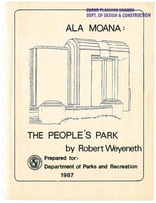
  • 1. ) ) DEPT. OF DESIGN aCONSTRuctiON ALA MOANA: i1T11~~r=::d~~- L~K:/~::f.'~-:n )~ ... F ..,;:nc:::n'o·~' "i, I I I f , , : I r i Ii 1 L I: 11: I· I ::: I 0: :1 "loU;,;., c' ~!JlJJlJv ~ L '~--=' i ~ " ------ ,' , .==c- E . ~"I ' ~ --2-~-:"' ! If 1 ~ 0 - - - - . . . .<t::::::--=I ·, • , : " I i I I • ~ I . 0 " - ' . '-'" I I I ' : I ; , ..:::, 1 ' , . ! , . - :::....... . ~ . , '-" " ' ' ' ' 0.;., • ., ••" ....-",...- """",/,...,,,1"""I ' I -- £' • .-- ~ '"~ THE PEOPLE'S PARK by RobertVVeyeneth Prepared for: Department of Parks and Recreation 1987
  • 2. ) 1.0 2.0 3.0 4.0 5.0 6.0 7.0 CONTENTS Preface ••.••..•••... ......................................1 Origins of the Park: The 1920·s. ..........................4 1.1 1.2 1.3 Location ••••• ....................................... Acquisition •• ....................................... Site Development. .4 .5 .6 Designing the Park: The 1930·s •••••• .9 2.1 2.2 2.3 2.4 2.5 2.6 The The Landscape Architects' Plan ••••• ..................9 Implementing the Landscape Design ••• ·.............. The Architecture of Harry Sims Bent. ·.............. The Canal Bridge •••••• ·.....................2.3.1 2.3.2 2.3.3 2.3.4 The Roosevelt Portals. ·..................... The Sports Pavilion and Banyan Court. The Lawn Bowling Green ••••••••••••••••• ..... Boulder Concrete: The Aesthetic of Hard Times. The Social Context of Recreation ••••••••••••• .10 .13 .14 • 15 .17 .20 .22 .24 Completing the Unfinished Agenda of ,the 1930·s •••••• 26 Park in Wartime: The 1940·s••• ·.................... Creating a Beach Park: The 1950·s. •• 29 .30·..................... The Magic Island controversy: The 1960·s. ·..............• 33 Planning for the Future: The 1970·s •••••• ·...............37 Conclusion: The 1980·s •• .................................41 Notes •••• ......................... ....................•45 Appendix •••••••••••• .............. .....................47 Park Chronology •••• List Maps of Park Trees. and Plans ••••• ·...............................•• 48 ·...............................•• 51 ·...............................•• 53 Photographic Essay ............•..........•........... 64
  • 3. LIST OF MAPS AND PLANS Map A: Ala Moana Park on the Island of Oahu •••••••••••••••••• 54 Map B: Landscape Plan by Richards & Thompson, 1932 ••••••••••• 55 Map C: Proposal by Lester McCoy, 1936 •••••••••••••••••••••••• 56 Map D: Ala Moana Park and City of Honolulu, 1941 ••••••••••••• 57 Map E: Proposal by Parks & Recreation, 1949 •••••••••••••••••• 58 Map F: Proposal by Henry J. Kaiser, 1954 ••••••••••••••••••••• 59 Map G: Map H: Map I: Map J: Proposal by Harbor Commissioners, 1956 •••••••••••••••• 60 Proposal by Belt Collins, 1961 •••••••••••••••••••••••• 61 Proposal by Wilson Okamoto, 1975 •••••••••••••••••••••• 62 Ala Moana Park & Magic Island Peninsula, 1987 ••••••••• 63
  • 4. The pr~paration of this document was financed in part by the National Historic Preservation Act of 1966, Public Law 89-665, as amended, as administered by the National Park Service, United States Department of the Interior, through the Department of Land and Natural Resources, State of Hawaii. ROBERT R. WEYENETH Studies at the University environmental and urban history of urban parks in is Assistant Professor of American of Hawaii, where he teaches courses in history. He is writing a book on the the United States.
  • 5. Preface with its mile-long beach set between views of Diamond Head to the east and the looming Koolau and Waianae mountain ranges to the north and west, Ala Moana Park seems at first glance to be one more example of the breath-taking natural scenery of the Hawaiian Islands. The white sand beach, offshore coral reef, and lawns dotted with palms, banyans, and flowering tropical trees make Ala Moana unquestionably one of the most exotic city parks in the united States. Surrounded today by downtown Honolulu, Ala Moana seems to be a piece of unspoiled Hawaii rescued from the encroaching street grid by far-sighted preservationists. In fact, however, Ala Moana Beach Park is entirely a man- made development. Its trees and shrubs are landscaping effects, arranged by the human hand, that have matured fifty years now. The park's oceanfront swimming hole has been carved from the fringing coral reef. The beach is the creation of hydraulic engineers, who at periodic intervals replenish the sand with imports from elsewhere on the island of Oahu. Even the site itself is a human invention, a tidal area filled by excavating the offshore reef. The passage of five decades has turned the park into a setting of incomparable natural beauty, but Ala Moana is what a geographer would call a "cultural" landscape. It is the product of engineering expertise and landscape design. The park is the crowning achievement of the golden age of Honolulu park-building during the 1930's, an attractive and func- 1
  • 6. tional urban space created in Depression-era America that has withstood well the test of time. Unlike Kapiolani Park and its nouveau-riche builders fascinated by polo, horse-racing, and the Victorian landscape of leisure, Ala Moana was the product of the hard times of the thirties. From the beginning it was to be a park for all the people. It grew as a result of the massive federal experiment with public works projects during the Great Depression and survives as a monument to the ingenuity, imagina- tion, and perseverance of local park proponents. Today, in a period when budgets again constrain municipal building of Ala Moana Park reminds us of the limited resources creatively applied. governments, the possibilities of One can read the history of Hawaii over the last sixty years in the history of Ala Moana Park. The idea for a park on the site can be traced to the 1920's and an interest in "civic beautification" among socially prominent Honolulu women. One group particularly active in promoting the idea was the Outdoor Circle, an organization of generally affluent women, many the wives of leading business and political figures in the Territory of Hawaii. The Outdoor Circle enjoyed a degree of influence in municipal affairs that was unusual for women's organizations elsewhere in the United States prior to World War II, largely because of the territory's unique social structure. In Hawaii, an economy organized around plantation agriculture sustained a world of rigid class and racial distinctions. By the 1920's, the exporting of sugar and the building of Honolulu as the political and commercial capital of this world had elevated a tight-knit combination of sugar companies, land monopolists, and development 2
  • 7. interests to dominance in island life. When the wives of the men who ran these enterprises embarked on the task of "municipal housekeeping" (a concern they shared with women in other American cities at the time), the Outdoor Circle emerged as a potent force in civic affairs. Conceived in the twenties, Ala Moana Park was born in the thirties, with Franklin Roosevelt's New Deal presiding as mid- wife. A couple of the New Deal's "alphabet soup" federal agen- cies provided the labor to establish the outlines of the modern park and complete its most architecturally significant features: the sports pavilion with its magnificent banyan garden, a lawn bowling green, the canal bridge, and the Waikiki entrance por- tals. In addition, relief labor constructed a small boat harbor and tennis courts, erected dressing rooms and showers, and planted the landscape. The recreational facilities ensured that Ala Moana would encourage a range of activities for those enjoy- ing their leisure and for those who found spare time thrust upon them by the unemployment of the Depression. Unlike the origins of Kapiolani Park, Ala Moana would be "the people's park." War in the forties, and Hawaii's important role in the Pacific theater, brought Honolulu's parks under temporary mili- tary jurisdiction. Following the attack on Pearl Harbor, Ala Moana was conscripted for duty as the site for a makeshift set of coastal fortifications. As the perception of danger passed in 1945, the wartime installations were dismantled, the landscape was restored, and the park was returned to public use. The fifties witnessed different pressures on park land. As 3
  • 8. the jet age transformed the economy of the fiftieth state from agriculture to tourism, the pace of real estate development quickened, as floods especially on Oahu. Plane loads of tourists, as well of new residents, produced calls in the 1950's and 1960's to enlarge park facilities and to reshape the land into a satellite resort for Waikiki. While park acreage at Ala Moana was increased in the sixties, pressure to transform the new land into a hotel district was resisted, a remarkable achievement for a city (and a state) that have operated largely Obliviously to the risks of over-development. Over the years, the integrity of the park's original design has remained intact. This study will trace the history of Ala Moana from its origins in the 1920's to the present, with par- ticular attention on the creation and evolution of the park in the 1930's. Because the thirties design celebrates its fiftieth birthday in the 1980's, Ala Moana Park can now be considered for eligibility on the National Register of Historic Places. 1.0. Origins of the Park: The 1920's 1.1. Location. Ala Moana Park occupies a site of seventy-six acres, extending along the ocean for a mile and a quarter from the mouth of the Ala Wai Canal to Kewalo Basin (see maps A and D). It is approximately six hundred feet wide. Like most of the oceanfront real estate in downtown Honolulu today, the park is built on a coral reef. For this reason, the site has no known pre-contact or archaeological significance. 4
  • 9. The historic shoreline in this part of Honolulu was consi- derably further inland than it is today, along what is now Ala Moana Boulevard. (The name "Ala Moana" means "ocean street.") A roadway, the predecessor of Ala Moana Boulevard, ran along this shoreline between the ocean and an area of wetlands that stretched almost to the present King street. Prior to the present age of ecology, the local citizenry referred to the wetlands as swamps and marshes. Originally it was called the Moana Park (literally "ocean park"). In 1947 the city recognized popular usage and renamed it Ala Moana Park. 1.2. Acquisition. Title to the future park site passed to the City and.County of Honolulu only in 1928, even though the city had been using a portion of the area as a garbage and refuse dump since the turn of the century. (The story is told that the city's incineration of refuse inspired local wags -- and a few gullible ship-board visitors to identify the plumes of smoke as Honolulu's active downtown volcano.) The site seems to have been among the lands of the Kingdom of Hawaii transferred by the Republic of Hawaii to the United States government after annexation. The area was deeded by the federal government to the Territory of Hawaii (25 October 1927) and then from the territory to the City and County of Honolulu (16 January 1928). The city received the site on the condition that the property "be used wholly as a public park or other public use of like nature, and upon ceasing to be so used as to the whole or any part thereof said property together with any and all additions, improvements and appurtenances shall 5
  • 10. ) . revert to the Territory of Hawaii.- l 1.3. Site Development. The legislative history of the site suggests that federal transfer of title accommodated two local development projects: (1) the dredging of a ship channel th~ough the Ala Moana reef, to link the Ala Wai Canal with the ocean-access of the Kewalo Basin Channel and (2) the creation .of new real .estate by filling 9f the adjacent submerged lands with the excavated coral. Sentiment for these two enterprises inspired the territorial legislature to authorize the sale of $200,000 in bonds for a -reclamation pro- ject- at the reef and to request transfer of title to the from the United States (3 May 1927). Within six months of site this territorial request, President Calvin Coolidge signed an execu- tive order transferring seventy-eight acres of the Ala Moana reef. After the city acquired title in 1928, the Hawaiian Dred- ging Company, Ltd. received the contract to dredge the channel and fill the future park site. The work was completed in October 1930. The precise role of the Hawaiian Dredging Company and its tycoon owner, Walter Francis . Dillingham, in the legislative his- tory of the park is not cleatJ":but it seems to have been substan- tial. As the only dredging company in Hawaii at the time, Dil- lingham's business stood td profit from any excavation and fill project in the territory. In addition, Dillingham owned a large parcel of adjacent real estate (the site of the present Ala Moana Shopping Center), the value of which would increase if it bor- dered a park rather than the city dump. However, there is no 6
  • 11. evidence in the city's land title records that the company deeded the site to the federal government in 1927 in expectation of securing a reclamation contract, as some park accounts have , l' d 2l.mp l.e • It is more likely-that the politically influential Dillingham encouraged territorial acquisition of the site and authorization of the $200,000 bond measure because he saw an opportunity to line up a lucrative government dredging contract and, at the same time, create an urban space of great public benefit. At work behind the scenes, no doubt, was Dillingham's wife, Louise Gaylord Dillingham, president of the Outdoor Circle (1929-31) and subsequently an important member of the city park board for over thirty years until her death in 1964. Filling of acreage on Ala Moana reef was good for the family business, as well as for the Dillingham reputation as patrons of the city's parks. Louise Dillingham's role in guiding the development of Ala Moana Park was considerable. The idea of a park in the area had been discussed in Honolulu since at least 1920 by public offi- cials, visiting municipal reformers, and local civic groups. Members of the Outdoor Circle had pressed a proposal for a park with the territorial governor as early as 1925. Through the twenties, Mrs. Dillingham was one of the park's most outspoken proponents. The benefits of a park on the reef were obvious, she asserted: "the dredging of Kewalo Basin, of reclaiming the land for bathing, boating, and establishing a system of parks and playgrounds with a tropically planted boulevard along the shore would indeed add greatly to the beauty of Honolulu." Through her presidency of the Outdoor Circle between 1929 and 1931 and her 7
  • 12. membership on the city's Shade Tree Commission, a predecessor of the Honolulu Park Board, Louise Dillingham helped fashion some of the first ideas for the park's form. As the filling of the site progressed in 1929 and 1930, the commission increasingly turned its attention . to the design of the park. Although the Shade Tree Commission played a largely advisory role in municipal government in the 1920's, making recommendations on city-wide street plant- ings to the mayor and board of supervisors, it is clear that in these deliberations Mrs. Dillingham's ideas carried significant weight. Commission members, for example, adopted her proposal for a waterway "in the scheme of Park beautification," reasoning that park acreage occupied by water did not require the expensive maintenance that landscaped grounds did. 3 Through the activities of Louise Dillingham it is clear that the issue of civic beautification linked the socially prominent and the politically powerful. In the fall of 1930, for example, as the filling of the Moana park site neared completion, one leading citizen took it upon himself to write the territorial governor on the proper trees for the new park and its adjoining boulevard: coconut palms and royal ponciana, he suggested. In the absence of a single, centralized body of park commissioners charged with responsibility for municipal parks, the governor turned the matter over to Louise Dillingham. The issue of tree selection in city parks was not of great consequence in itself, but this instance does illustrate how, within the provincial scale of territorial life, Louise Dillingham was functioning informally as Ala Moana's advocate and first planner. 8
  • 13. 2. Designing the Park: The 1930's 2.1. The Landscape Architects' Plan. Shortly after the creation of the Honolulu Park Board in 1931, the city employed professionals to plan the park. One of the first actions of the board, in July 1931, was to approve the designs of two landscape architects, Catherine Jones Richards and Robert Oliver Thompson, later Mr. and Mrs. Robert o. Thompson. The Richards and Thompson plan became the basis for the park's development in the thirties, although some of its details were modified in the course of the decade. Their proposals for the spatial arrangement of the landscape -- two lagoons and alter- nating areas of massed foliage and wide open spaces -- continue to delineate the contours of the park's design today (see map B). Richards and Thompson presented their plan to the public in a popular monthly magazine late in 1932. should be both aesthetic and functional. The park, they argued, On the one hand, it should be attractively landscaped: on the other it should provide a range of recreational opportunities "to handle the huge number of people wanting entertainment on holidays and over the week- 4 ends." As landscape architects, Richards and Thompson proposed a design for the park layout that included six tennis courts, three baseball fields, volley ball courts, a children's wading pool, a playground, picnic spots with outdoor grills, a bridle path linking Ala Moana and Kapiolani parks, a small boat harbor designed as a public alternative to private yacht clubs, and 9
  • 14. clubhouses for local rowing clubs. The central architectural feature was to be an oceanfront recreational complex combining a dance pavilion, restaurant, and bath house, bordered on the mauka (mountain) side by a large sunken pool with fountain and allees (parallel rows) of banyan trees. Instead of a beach, Richards and Thompson proposed a shaded shoreline promenade. The setting for these structures was to be a tropical land- scape that expressed the cultural heritage of Hawaii. The two proposed lagoons, one at either end of the park, echoed Louise Dillingham's earlier suggestion of waterways to beautify the site and keep maintenance costs low. The eastern lagoon was to provide a setting for a "Hawaiian village" for municipal pageants: the western lagoon was to offer a "Japanese village" and teahouse. Chinese pagodas "with all the atmosphere needed for such" were planned for an oceanfront pier. 2.2. Implementing the Landscape Design. Some of this plan had been executed by 1932, when Richards and Thompson described it publicly. The lagoons had been dred- ged, along with a drainage canal to control the run-off from mountain showers toward the ocean at the site. Private donations had planted six hundred coconut palms and one hundred banyan trees, and the city had erected five "hau lanais." The park's thoroughfare had been laid out and graded, and a sprinkling system installed along the waterfront. The terrace on which the central recreational complex was to sit had been raised with retaining walls. Looking back from the perspective of the mid-thirties, the chairman of the Honolulu Park Board judged the contribution of 10
  • 15. Richards and Thompson to have been significant. Its utility, Charles Lester McCoy thought, had been to provide "tentative studies and layouts" that permitted the city to begin the process of transforming newly filled land into attractive landscape, as soon as Depression labor became available: grading roads, con- structing sea and boundary walls, dredging the lagoons and drain- age canal, hauling topsoil, establishing a park nursery, and preliminary planting. with the Richards-Thompson plan in hand, McCoy had been able to begin roughing out the park as early as 1931, when the territorial legislature, municipal government, and private making One Thompson was to donations responded to the worsening economic crisis by unemployment relief funds available to the park board. might add to McCoy's assessment that the Richards- plan also established the framework in which the park grow in the thirties: the idea of a people's park that combined landscaped spaces with sport facilities. Ala Moana was to be a park open to community-wide use, offering places for a range of recreational activities, set amid green surroundings. While a number of specific features were not built, many were implemented: a recreation center ornamented by a formal garden, lagoons housing Hawaiian and Oriental culture zones, the boat harbor, and a link between Ala Moana and Kapiolani Park. The general emphasis on a self-contained park landscape with archi- tectural features, rather than a beach park opening to the ocean, was also to characterize development for two decades. Territorial relief funds enabled the city to start laying out the site in 1931, but it was federal assistance beginning in 11
  • 16. 1933 that brought the park to an attractive, functional condi- tion. The Federal Employment Relief Administration (F.E.R.A.) and, briefly, the short-lived Civil Works Administration (C.W.A.) provided the resources for the park board to undertake a major construction program in the thirties. labor force reached 800-900 workers. At its peak, the daily As chairman of the Honolulu Park Board for ten years, Charles Lester McCoy presided over the creation of Ala Moana Park in the thirties, coordinating federal relief, the designs of professional planners, and the views of fellow board members like Louise Dillingham. A wealthy man with an interest in public service, McCoy had retired at age 42 from the wholesale grocery business and moved with his wife to Honolulu from Peoria, Illi- nois in 1919. Between 1931 and 1941, he chaired the newly created park board at a salary of one dollar per year. Remem- bering McCoy's travails trying to build parks in the midst of national depression, one former associate recalled that nat times his dreams of the beautiful outran the limitation of the practi- cal; and his favorite 'child,' Ala Moana park, never developed as he hoped it would. nS Urban critic Lewis Mumford also knew McCoy from their col- laboration in the thirties. He, as well as anyone, understood the circumstances that resulted in McCoy's resignation as chairman of the park board in 1941. Mumford met McCoy on a vacation visit to Hawaii in 1938 and was subsequently hired to write a report for the park board on the relation of park development to Honolulu's future. Some of Mumford's recommendations in the final report were so controversial -- particularly the proposal for a sweeping 12
  • 17. reorganization of park administration -- that McCoy felt obliged to resign from the park board. Mumford recalled McCoy as "a public-spirited Tory who lived by his principles:" On some of the most fundamental matters of religion and politics we were completely at odds; but men of principle have somet-hing important in common even when their princi- ples differ: each knows on which side of the line he is fighting and each knows the extent of their common ground. A little before settling down to the final drafting of this report I sought to find out from Mr. McCoy the sort of topics he thought should be covered, to be sure he accepted my own interpretation of my duties. His answer should be engraved in every administrator's heart: "When I ask a professional man for advice," he said quietly, "I don't want him to tell me what is in my mind: I want to find out what is in his." Needless to say, the man who spoke these words printed the report without challenging a word in it: and he loyally circulated it and backed it up. Eventually he resigned his chairmanship when my own drastic proposals for the reorganizat~on of the Park Board found no favor among his colleagues. In spite of these frustrations during his tenure on the Honolulu Park Board, McCoy was eulogized after his death in 1942 as the "virtual founder of Honolulu's modern park system." A commemorative plaque at Ala Moana tells visitors that the park was "envisioned and created" by the "enthusiasm and efforts" of 7 McCoy. 2.3. The Architecture of Harry Sims Bent. To make good use of the promise of federal assistance, Lester McCoy hired an architect in 1933, Harry Sims Bent, to supplement the landscape proposals that Richards and Thompson had suggested two years previously. The park site was divided into fifteen or so "construction units," and the architect was asked to prepare complete working drawings for each unit. Bent's blueprints, together with the federal relief labor, combined to produce by the end of the decade a usable urban space with a 13
  • 18. distinctive architectural identity. Bent's influence was enormous and his talents considerable. 8 Bent is not well known today, but he was considered one of the most creative and important architects in Honolulu in the 1920's and 1930's. He had come to Honolulu about 1927 to supervise construction of the Academy of Arts and subsequently designed a number of public buildings and private residences. Bent was also responsible for virtually all of the plans implemented by the Honolulu Park Board in the thirties, and these designs remain some of his best work. It is Bent's work that today give Ala Moana Park its unique character, exemplified in the whimsical canal bridge (completed in 1934), the portals at the Waikiki entrance (named for President Franklin Delano Roosevelt after he dedicated them in 1934), the sports pavilion and banyan garden (completed in 1937), and the lawn bowling green (completed in 1939). In addition to his work at Ala Moana, Bent designed the layout and structures of a number of smaller parks in Honolulu, including Mother Waldron Playground, Kawananakoa Playground, the Lanikila Park comfort station, Kalihi-Waena Playground, Haleiwa Beach Park, the wall at Hauula Beach Park, Ala Wai Clubhouse, the park service center near Kapiolani Park, and a design for the Kalakaua Recreational Center. Many of his park designs combined the angular zig-zag motifs associated with the Art Deco style with the curved surfaces typical of Streamline Moderne. 2.3.1. The Canal Bridge. Bent's first design in Ala Moana Park was for an equestrian 14
  • 19. bridge to span the park's drainage canal. Seen from the side, the basic shape of the canal bridge consists of two joined half- circles. The two half-circles screen the single arch of the path carried by the bridge. The curved motif is reinforced by the four arched planes of the bridge walls, the half cylinder mould- ing which tops them, and the half-circle grille openings which pierce them. The forms that buttress the bridge in the center and at the sides are also rounded. Viewed less literally, the arched forms and inclined ap- proach can seem like a humpbacked animal with long snout and tail, momentarily at rest. The bridge buttresses resemble limbs and suggest to the imaginative passerby that the creature might actually rise and walk away whenever it wanted. While we have no clues to what inspired Harry Sims Bent to construct so whimsical a bridge, a spirit of playfulness is clearly intended. The ele- ments of surprise and fun evident in the canal bridge became hallmarks of Bent's park architecture. The bridge was completed in 1934 as a C.W.A. project. The undated blueprint at the Department of Parks and Recreation is entitled "Bridle Path Bridges," suggesting that more than one structure was planned. 2.3.2. The Roosevelt Portals. The Roosevelt Portals provide a grand entrance into Ala Moana Park at its Waikiki end. Here two central openings are joined to form a single imposing gateway. To the sides of this central entry structure, two sets of outer portals mark the beginnings of the scalloped perimeter wall. The height of the fifteen-foot portals make them reminiscent of a triumphal arch, 15
  • 20. ) although there is one intriguing difference. Unlike most trium- phal arches that have arched openings and squared corners, the Roosevelt Portals have rectangular openings and arched side ele- vations. The combination of curved and angular shapes, scalloped walls, and wedge indentations at the Roosevelt portals is seen in many of Bent's other park designs. Ornamentation is limited to geometric motifs. A series of half cylinders top the portals. Prism shapes line the lintels of the openings. The central niches on both the mauka and makai sides of the central structure are fluted. Projecting and reces- sed planes are combined with concave and convex curves. Low octagonal piers, joined by walls decorated by vertical half- cylinders, bound the elevated curved plaza in front of the entry structure. The random pattern and rough surface of the coral stone paving is a pleasing contrast to the geometric and smooth surfaces of the concrete portals. Harry Sims Bent designed the portals and a system of side- walks and roads so that visitors entered the park through one of the portal's openings. Today this circulation pattern has been disrupted. Bent left a generous forty feet between the central and outer portals for automobile traffic. Because all traffic in and out of the park is now routed on the west side of the central portals due to the realignment of Ala Moana Boulevard and its bridge, the triangular island that Bent designed as the setting for the central portals no longer remains, compromising the formal axial symmetry of the original plan. Additional concrete paving now extends beyond the original coral stone of the central 16
  • 21. plaza. The road that once exited the park now ends abruptly just beyond the portals. The scalloped walls that adjoin the outer portals allow planting space within their concave recesses. This vegetation, together with the sectional nature of the wall, the vertical wedge indentations, and the recessed moulded curves along the top of the central section of each scallop, break up the long mass of the wall. The plantings, as well as the vistas framed by the portals, offer a preliminary view of the park inside. In effect, Bent's design welcomes people to the park. The portals were built as a F.E.R.A. project and were for- mally dedicated in 1934 during a visit by President Roosevelt to Honolulu. The undated blueprint labelled nEast Portal n suggests that park officials planned gates at the park's western entrance as well. 2.3.3. The Sports Pavilion and Banyan Court. The simple concrete exterior walls of the sports pavilion do not suggest the exotic richness of the banyan court hidden behind its walls. The banyan court is probably the best-kept secret in Honolulu's parks today: it is also perhaps Harry Sims Bent's most noteworthy design. The sports pavilion and banyan court were officially com- pleted in 1937, although much of the sports pavilion had been finished somewhat earlier, by 1935. The pavilion itself was designed to be a recreation center, offering rooms for crafts and games and, across the courtyard, locker facilities for men and women. Inside, artist Robert Lee Eskridge painted two wall-size murals depicting the Hawaiian makahiki (sports festival). Tennis 17
  • 22. courts outside the pavilion were designed, ingeniously and sur- prisingly effectively, to share a common wall with the tranquil spaces of the interior courtyard. The courtyard itself consists of six intricately detailed stone planters (four contain banyan trees today), surrounded by exotically shaped reflecting pools. The character of the banyan court is different from the rest of Bent's park designs because its motifs are neither Art Deco nor Streamline Moderne. Commen- tators have variously described the courtyard architecture as Indian, Persian, and eclectic. Bent himself saw the design as having essentially a nPacific n inspiration: The idea for the character of the banyan garden came about through a series of discussions between Mr. McCoy and myself. We were looking for a solution that could be ap- plied to the enclosed rectangular space that would reflect a flavor of the Pacific basin background. During one of these discussions Mr. McCoy produced a battered postcard, col- lected on one of his tours of the Far East, showing a rem- nant of an old Balinese garden, wherein stone tree boxes were used adjacent to shaded reflection pools. This germ of an idea was adopted for its suitability and character and also because of its simplicity and the fact that it seemed to offer a mode of construction that would fit in with our labor-material ratio. With that vague prototype ~s a clue, I proceeded to design the garden as it now stands. Plans for the courtyard evolved over the mid-thirties, even it seems up to the time of actual construction. Park blueprints early in 1934 show paddle tennis courts on the site that became the banyan court. Lewis Mumford mentions that one version of the plans called for a restaurant set in a formal garden. The un- dated blueprint for the nTennis Pavilion Gardens n shows other differences from today's banyan court, apparently because some last-minute changes (not reflected on the plans) were added during the construction phase. 18
  • 23. On Bent's plans which survive, no mention is made of the low-relief sculptures on the courtyard walls nearest the sports pavilion. Only benches are shown in these areas, and the layout of the walls is quite different from what was eventually built. These marble sculptures were , the work of Marguerite Blasingame and depict stylized Hawaiian figures. On the mauka wall are a male and female Hawaiian, kneeling back-to-back, playing nose flutes: on the makai side is a similar pair carved in a sitting position, with arms and face touching. Figures of Hawaiians playing traditional games are also present in the coral stone flagging of the passages of the sports pavilion. One blueprint for the "Sports Lanai" shows herringbone brick was intended for the paving of these passages, rather than the colored slate actually used. Minor subsequent changes to Bent's plan include installation of doors between the piers of the pavilion, as well as addition of less aesthetic elements like a telephone and exposed plumbing on the curved corner of the building. While plans show "split Pilgrim shakes" on the central gabled-roof section of the pavil- ion, it is now tiled. The most significant change in the original design of the banyan court and sports pavilion occurred in the early 1970's, when the McCoy Pavilion was added to the Diamond ' Head side of the courtyard. Construction of this complex of assembly rooms, lanais, and offices removed several structures from the thirties: two sets of locker rooms, a practice tennis court, and a curving zig-zag wall separating these facilities from the banyan court. 19
  • 24. When Lester McCoy's widow, Hazel Corning McCoy died in 1968, she bequeathed $1.2 million the largest gift ever given the city for construction of a pavilion in Ala Moana Park as a memorial to her husband. The McCoy Pavilion, designed by Charles J. W. Chamberlain and completed in 1975, is a sympathetic addition that does blend well with the older sports pavilion, even though its placement destroyed some of the original historical fabric of the banyan court. 2.3.4. The Lawn Bowling Green. Constructed in 1939, the lawn bowling green was the last of Harry Sims Bent's designs for Ala Moana Park. It remains today the only lawn bowling green in Honolulu. The green is a raised square lawn area of eight lanes, enclosed by a wide coral stone walkway and a five-foot decorative cement brick wall. The corners of the brick wall are rounded, and inside each curve are brick benches topped with tile, very similar to those in Mother Waldron Playground, a Bent-designed park completed in 1937. The brick piers of the four gates were designed with projections and indentations to add interest to these points of entry. The curved geometric design of the gates contrasts with the rectangular lines of the brick piers. The original pergola has been enclosed and enlarged to serve now as a clubhouse, locker room, and storage area. Lawn bowling is an import to Hawaii and newcomers have been largely responsible for supporting the game in Honolulu. The park board built the green with city funds on the suggestion of an Australian doctor who had moved to Honolulu and established a lawn bowling club. The green was completed after six months of 20
  • 25. construction in May 1939. Neglected during World War II, a portion of the the site was later used for a children's museum. In the 1960's interest in the sport was again rekindled when a mainland visitor prodded the park department into extensively renovating the area in 1967. Lawn bowling is not as simple to playas it looks. The object of the game is to roll a lop-sided wooden ball (called a bowl) toward a small white ball (called a jack) placed at the center of play. Each player tries to get his or her ball as close to the jack as possible, earning points based on proximity. An average game lasts about two hours. The game was invented in Great Britain in the thirteenth century and is popular today primarily with retired people, who enjoy the quiet dignity of its leisurely pace. The challenges of rolling lop-sided balls are compounded immensely if the playing surface is not perfectly level and, consequently, bowlers spend a good part of ' their non-playing hours worrying about lawn maintenance. Apparently as early as the thirties, the original design presented bowlers with some problems, because the rounded corners of the perimeter wall were intended as planters for trees, and the spreading roots from the planters threatened the playing field. In the early 1970's, bowlers discovered the playing surface varied as much as three and a half inches from one side of the green to the other and set about levelling the lawn using sophisticated surveying instru- ments. Because the expenses of maintaining a perfectly level lawn are enormous, the private Honolulu Lawn Bowls Club has 21
  • 26. assumed responsibility for maintenance of the green since 1981. 2.4. Boulder Concrete: The Aesthetic of Hard Times. Ala Moana Park was the creation of the hard times of the Depression, and nowhere are these historical origins more evident than in the erection of the park's walls and terraces. The story of their construction so closely mirrors the growth of the park as a whole that it would not be too much of an exaggeration to say that these modest rock walls symbolize the successful strug- gle to create the park in the midst of national depression. While territorial and federal emergency assistance provided the labor that made park development possible, from the beginning funds themselves were limited. As a consequence, Bent and McCoy had to devise construction methods that required only minimum outlays for materials and tools and that permitted use of inex- perienced and unskilled relief labor. The solution was a tech- nique called boulder concrete construction. The process saved money by using indigenous materials and could be easily learned by people unfamiliar with the building trades. In boulder concrete construction, a thin gruel of concrete was poured into wooden forms packed solid with boulders of coral and lava rock. Lester McCoy estimated that use of the coral and lava stone as filler saved one-fourth to one-third of the cost of regular concrete construction, because the park board simply collected the rock debris from its properties. The walls were given shape by a system of removable, repeating wood forms. Success in constructing solid walls with nicely squared corners lay, first, in concocting a concrete glue sufficiently thin to fill the voids around the boulders and, second, in tamping vigor- 22
  • 27. ously the mixture poured into the forms. Harry Sims Bent acknow- ledged that the shortage of building materials profoundly af- fected his designs: There was some ignorant criticism at the time on the score of the massive type of construction carried out. The critics did not know or care that this was mandatory because the only type of construction possiBle under the material limitations was "boulder concrete." The boulder concrete process produced sturdy, functional constructions, exemplified well in Ala Moana's central terrace area with its pair of pergolas, constructed early in the thir- ties. The rough concrete walls with their exposed rock are unfinished with stucco at the central terrace, and they strike the casual visitor as suitably rustic features for a park set- ting, their unsurprising crudeness expressing the distinctly rural character of the surroundings. In more suitably formal locations in the park, like the walls at the Roosevelt Portals, the boulder concrete is finished with a layer of stucco painted white to hide its humble origins. with the passage of time, the boulder concrete walls and terraces have even taken on an aesthetic appeal that transcends their historic importance as reminders of the park's Depression origins. While it was a construction technique intended to avoid the "architectural embellishment and decoration" that added con- siderably to the material costs of a job, even in the thirties park officials sensed some of the subsequent appeal of their work. A passage in one of Lester McCoy's reports, perhaps drafted by Harry Sims Bent, makes this case well: In keeping with this simplified system of construction the architectural design of the various units has resolved it- 23
  • 28. self logically into a simple interpretation of the plastic character inherent in a poured system of construction. No attempt has been made to push the designs along any stylis- tic paths or grooves, nor on the other hand to deliberately seek novelties. The sensible course has seemed to be the one with the least number of pre-conceived notions. Design studies have in each case started from simple, thoroughly considered plans, with all practical arrangements and re- quire-ments established. From this point the attention of the designer has been focused on the qualities of mass, proportion, scale, fenestration and the decorative effect of light and shade as produced by contrasting planes and con- tours. Under the brilliant sunlight of Hawaii the possi- bilities of striking and interesting effects through the play of light and shadow through changes of planes is un- limited. To give interest and texture to the large plain wall areas the form marks of the poured walls are left unconcealed. The exposed concrete surfaces are given a light wash of Oyster white stucco, which forms an effective color contrast with the colorful planting of thellslands and the brillant Lsic] azure tints of sea and water. As much as any park feature, boulder construction stands as a monument to the moment in time when the park was created, an imaginative response to pressing practical considerations. Through the use of indigenous materials and simple building techniques, park officials were able to stretch scant resources and create architecture whose minimalist design symbolizes well the aesthetic of hard times. 2.5. The Social Context of Recreation. Government sought to produce sturdy, functional people, as well, during the Depression. On the one hand, the building of parks and playgrounds was intended to provide recreational out- lets for people enjoying their leisure and for those forced by unemployment to contend with spare time. On the other hand, public recreation -- if it were "wholesome" was also supposed to build better citizens. One of the themes that ties together the history of city parks in the united States is the interest in using urban space to effect social change. In this respect, the 24
  • 29. origins of Ala Moana were no exception to the national pattern. Throughout the 1930's, the Honolulu Park Board reaffirmed the social purposes of its park planning. people," its report for 1938 announced. "Our parks are for "They are conceived, designed, built, maintained for one single purpose -- to enrich the life of people." Toward this end, Ala Moana Park was to be the people's park, providing recreational space and facilities tor "all classes of the whole community." As part of the process of enriching individual lives, offi- cials hoped to build a sense of community through the parks. In particular they hoped to revive "lost" island traditions for present-day citizens to share with the largely displaced native Hawaiians. Ala Moana Park, for example, was to have a "Hawaiian Village" of grass huts on the shores of the park's eastern lagoon to stimulate interest in polynesian arts and crafts. The con- struction of the Ala Wai Rowing Clubhouse on a proposed parkway between Ala Moana and Kapiolani parks was intended to resurrect a sport "in imminent danger of dying out."12 In addition, Ala Moana Park was to play an important social- izing and acculturating role in the lives of its visitors, parti- cularly its native Hawaiian and recent immigrant users. Lester McCoy pointed to the "complex racial mixture and the extreme congestion that prevails in many parts of the city" to argue that Honolulu had perhaps the greatest "social need" for "wholesome" park and recreational facilities of any city in the United States in 1936. "The local economic structure," McCoy continued, "is not suited to quick absorbtion [sic] of the oncoming generation 25
  • 30. in useful employment and the resulting gap places an unusual burden on civic, social and recreational agencies." The encour- agement of Polynesian arts and crafts at Ala Moana's "Hawaiian Village," for example, was intended "to provide a practical outlet for social and welfare activities among this element of the population." In short, in the minds of thirties planners, parks had an important social mission: the task of assimilation in a culturally diverse city.13 It ought to be mentioned in passing that the actual use of urban parks often failed to conform with the expectations of planners and park officials. Ala Moana Park clearly provided a number of recreational outlets, and Honolulu's diverse population no doubt mixed in the park, especially after Ala Moana's major attractions took shape toward the end of the decade. Neverthe- less, it should be acknowledged that the park could also be the setting for the expression of social antagonisms. A rape in the newly created park quickly escalated in the subsequent criminal proceedings into one of the territory's most notorious trials, because of the racial and class tensions it exposed. The Massie Case of 1931 -- initially called the Ala Moana Case by the press -- suggested that parks divided as well as united communities. Motives of social reform may have animated the thinking of park planners in the thirties, but parks alone could by no means eradicate the tensions of the modern city. 2.6. Completing the Unfinished Agenda of the 1930's. In an informal report in 1936, Lester McCoy described the development of the park so far and the plans for the future (see map C).14 It was a story of progress, he asserted, by which "the 26
  • 31. once formless and unsightly dump has taken on the form and char- acter of a real modern park." To make his case, McCoy could point to the range of projects either completed or near comple- tion. In addition to the Bent-designed canal bridge, Roosevelt portals, sports pavilion, banyan court, and bowling green, McCoy could boast about the landing and docking facilities of the yacht and boating center (the site of the present Ala Wai Yacht Har- bor), the Oriental Lagoon with landscaping "in the characteristic Chinese and Japanese manner," and the Hawaiian Lagoon "featuring native palms and plants." It is these landscaping and architec- tural features that represent the park's legacy from the 1930's. The report is particularly illuminating for what the park board hoped to build but did not have the funds to implement in the thirties. On the drawing boards in 1936 were plans for a "central r~creation unit" with a 4000-seat outdoor auditorium and stage set amid promenades and plazas, a municipal aquarium, a "village" of grass huts "harking back to the atmosphere of old Hawaii," pergolas and a promenade at Kewalo Basin for local fishermen, and gates at the western entrance. The park still has no portals at its western gate, and the park board never land- scaped Kewalo Basin (the territorial governor withdrew land at the Kewalo end of the park for harbor use in 1949). But the "Hawaiian Village" of Ulu Mau was constructed in Ala Moana Park in 1948, and park brochures in the 1950's were advertising its "authentic grass huts" as must-see sights "for island visitors," along with the Oriental Garden and the banyan court. I5 A new aquarium was built in the early 1950's but placed in Kapiolani 27
  • 32. Park. The former sports pavilion (enlarged with a major addition in the early 1970's and renamed the McCoy Pavilion) today func- tions as the community center envisioned in the grand "central recreation unit" of the thirties' plan. The thirties planners envisioned Ala Moana as part of a park and parkway system for the city, and this design has largely been realized, as well. The city acquired the land on the mauka side of the Ala Wai Canal for park purposes in 1933, and Lester McCoy set about developing plans for a landscaped boulevard joining Ala Moana and Kapiolani parks. He planned for a "useful modern Park and Boulevard system extending for a total of over five miles, providing a varied assortment of sport and recreational facili- ties." Although McCoy's proposal for a boulevard was never constructed along the mauka side of the Ala Wai, as he envisioned it, the link between the parks was realized two other ways. Today, the Ala Wai Golf Course and Ala Wai Field (with its rowing clubhouse designed by Harry Sims Bent in 1936) connect Ala Moana and Kapiolani parks on the mauka side with a wide expanse of park land. The Ala Wai Boulevard (with its adjacent promenade) pro- vides a parkway on the makai (ocean) side. Finally, there is some reason to believe that Ala Moana Park is a local success story that defied the national experience with parks and playgrounds in the thirties. In a recent study of The Public Landscape of the New Deal 16 , designer Phoebe Cutler argues that efforts to federalize public recreation during the Depres- sion produced parks characterized by "the New Deal traits of utility, standardization, and austerity." In the rush to take advantage of federal relief in the national emergency, park 28
  • 33. officials too often sacrificed quality to quantity, she main- tains, building great numbers of spare and sober recreational facilities, few with designs of nlasting dignity." If this generalization is sound, then the Honolulu parks are the excep- tions to the rule. Clearly, the administrative efforts of Lester McCoy and the architectural talents of Harry Sims Bent make Ala Moana Park a treasure from the thirties. 3.0. The Park in wartime: The 1940's The city's parks were conscripted by the military during the second world war. A military officer assumed control of the parks board, and a number of parks, like Ala Moana, were con- verted into makeshift coastal fortifications. As Hawaii braced itself for a second Pearl Harbor, gun emplacements, magazines, barracks, and barbed wire fences sprouted in the park. Trees were generally left standing, as they served well as natural camouflage, but smaller plants and lawns usually did not survive the wartime construction and use. When the perception of danger passed and the war in the Pacific began to wind down, military authorities attempted to maintain jurisdiction over Ala Moana in particular. They requested that the park be converted into an army air force rest and recuperation center. The military-controlled park board approved the request, on condition that the army facility be permitted for only one year and that it be confined to only half the park. However, in March 1945, the city's board of supervisors refused to consider an extension of military jurisdiction. 29
  • 34. When the public was again welcome at Ala Moana in January 1946, visitors were shocked at the condition of the park. While authorities had ordered the removal of wartime installations and the repair of roads and sidewalks, the lawns and shrubbery could not be so quickly restored. As a consequence, the Board of Public Parks and Recreation had to weather a storm of criticism for the conditions citizens discovered. In response, the board's annual report for 1947 struck a rather defensive note, as it tried to explain to an impatient public that "camouflage can be painted out, barbed wire and bomb shelters removed, but nothing can hasten the recovery of living things which have been neglected for years." Park officials were hampered by postwar problems of locating everything from trucks to operating lawnmowers, as well as funds for staffing. It was a slow process to restore the parks to their pre-war condition, but the return of peacetime priorities and budgets eventually accomplished the task. By 1949, the annual report was bravely announcing, "Honolulu's parks are green again." And, within fairly short order, a number of new features were introduced into Ala Moana Park in particular: the Hawaiian village of Ulu Mau opened in 1948, the oriental Lagoon was remodelled after 1950, and a children's center was added to the sports pavilion in 1954. 4.0. Creating a Beach Park: The 1950's One major postwar improvement at Ala Moana was the construc- tion of the beach so popular today. It is important to remember 30
  • 35. , that Moana Park was not built as a "beach park.n Prior to the 1950's, Ala Moana had no swimming beach and few facilities for swimmers. In fact, swimming was discouraged because of the presence of two nearby sewer outfalls. More fishermen than swimmers probably made use of the oceanfront at Ala Moana. Local people often erected modest wooden fishing stands in the water beyond the park's seawall prior to construction of the swimming beach. For the most part, though, Ala Moana was a place for outdoor recreation but not really ocean or beachfront sports. In the thirties and forties, the park encouraged visitors to look inward toward its grounds and structures, rather than outward toward the ocean. One could gaze at the Pacific from the park, of course, but actual use of the ocean was constrained by the presence of a seawall, which symbolically and practically separated landscape from seascape. Initially, the waters off the park belonged to boats rather than swimmers and fishermen. The park, afterall, had been created in the late 1920's out of a simultaneous effort to dredge an offshore ship channel (see map D). The channel in front of the park permitted boats access to the ocean via the Kewalo Basin exit, but this purpose became obsolete after 1951, when a direct ocean entrance was dredged for the Ala Wai boat harbor. In the meantime, population growth in postwar Hawaii had already made clear the need for greater beach access in the densely congested downtown district, which Ala Moana served. As a consequence, plans were made to reroute the sewer lines and 31
  • 36. accommodate the needs of swimmers. In 1952 the territory built a jetty that prevented the polluted waters of the Ala Wai Canal from entering the channel off Ala Moana. Between 1954 and 1955, a territorial public works project filled part of the old ship- ping channel to raise a platform on which a beach could be con- structed. The present beach came into existence in June 1955, after almost 55,000 cubic yards of sand was imported for the beach from Oahu's leeward coast. To provide for the thousands of swimmers attracted to the new beach, the present pair of dressing room and shower facilities on either side of the McCoy Pavilion was constructed between 1959 and 1961, replacing the rest rooms designed by Harry Sims Bent. Lifeguard towers were added in 1969. In the decades that followed, this artificial beach proved immensely unstable. under natural conditions, the sand supplied to a beach and eroded from it are in equilibrium. The position and size of a beach are affected by seasonal variations in wave action and sediment load, as well as by general weather patterns. The small beach at Ala Moana before the 1920's was probably quite stable, being protected from significant wave action by the wide shallow reef offshore. Dredging of the boat channel after 1928, though, disrupted the pattern of sand moving across the reef to resupply the beach, because the man-made chasm effectively cap- tured the migrating sand. Since there was no longer a natural mechanism to replenish the beach created in 1955, periodic beach restoration projects must be undertaken at Ala Moana. In 1976, twenty years after the beach was first built, the dredged coral fill of the underlying 32
  • 37. platform became exposed, and the entire beach had to be recon- structed. For the job, 30,000 cubic yards of sand were brought to Ala Moana from a fossil beach ridge at Mokuleia on the north 17 shore of Oahu. 5.0. The Magic Island Controversy: The 1960's The sandy beach was one of two major postwar changes at Ala Moana Park. The second major development occurred in the early 1960's, when a peninsula was built on the reef at the eastern end. Both changes increased park acreage, but neither has al- tered substantially the design within the original park (see map J) • Today the man-made peninsula is popularly known as Magic Island. Its thirty-six acres are a welcome addition adjacent to the crowded municipal park, since they provide a well-landscaped, spectacularly situated setting for hundreds of visitors to pic- nic, swim, and jog. Ironically, though, the plan in 1961 that created Magic Island very nearly demolished the original park and its thirties design. Initially, the peninsula was conceived and built as the site for a resort complex to expand Waikiki, not as a public park. Only after heated controversy was it set aside exclusively for recreation. The idea of offshore development appealed both to park officials anxious to expand beach facilities near the downtown area and to development interests looking to enlarge the Waikiki hotel district, which was hemmed in by the ocean, the canal, and two public parks. In the immediate postwar years, city planners 33
  • 38. and private developers debated the possibilities of a massive "reclamation" project to create new real estate. A stream of reports examined the feasibility of dredging the reef between Diamond Head and Kewalo Basin. One study in 1949 suggested building an offshore island as one way to "improve" Waikiki Beach. The park board endorsed the idea of a new island off Ala Moana Park as a way to increase significantly the park's size (see map E). Implicit in the proposal was the assumption that "reclaimed" land was to be for recreational use. Development interests had other ideas, though. In 1954, industrialist Henry J. Kaiser proposed an offshore resort rather than a public park. Kaiser urged the territory to acquire title to the reef and then lease the submerged land to the highest bidder to develop a major tourist center. Kaiser himself pro- posed spending $50 million to create a "Magic Island" of hotels, theaters, and swimming pools (see map F). Two years later, in 1956, the board of harbor commissioners and the chamber of commerce proposed moving Ala Moana Park to an offshore island and selling the old park for hotel and apartment buildings (see map G) • The campaign for statehood altered the terms of discussion and, as a consequence, plans for the Ala Moana reef. Statehood in 1959 stimulated debate about Hawaii's future economy, with important implications for the Magic Island site, which the Territory of Hawaii had formally acquired from the federal gov- ernment in 1958. Support coalesced for commercial development of Ala Moana reef, as sentiment grew that tourism offered a source 34
  • 39. of revenues and jobs that might offset declines in the sugar and pineapple industries. In 1959 the state contracted with a local engineering firm for a plan to reclaim the reef and develop a tourist resort. The report by Belt, Collins & Associates was issued in 1961. The Comprehensive Plan: Ala Moana Reef became the blueprint for the construction of the present Magic Island in the following year • • The Belt Collins engineers planned reef reclamation and develop- ment with two chief objectives in mind: (1) "expansion of public beach-park recreation for the people of Oahu" and (2) "approp- riate resort hotels to supplement the Waikiki district." The plan (see map H) recommended creation of two peninsulas and an island: a peninsula along the Ala wai boat harbor, an extension of the existing peninsula at Kewalo Basin, and a crab-shaped island in between the two peninsulas, to be called Magic Island. (As the story turned out, only the eastern peninsula was built, and the name Magic Island has corne to be attached, somewhat inappropriately, to this spit.) A system of roadways and bridges was to link the proposed island with the eastern peninsula. Belt Collins suggested three different configurations for the 120 acres of new land: exclusive recreational use (which would have almost tripled the length of public beach in the Ala Moana area), heavy resort development (seven hotels), and an uneasy alliance of public park and five hotels. The engineers recommended the latter proposal as a "compromise," arguing that private resort construction could finance the public outlays for reclamation and park development. In this scheme, hotels were to be built on the reclaimed eastern peninsula and a new park on the 35
  • 40. island, with most of Ala Moana Park converted to parking lots. The state legislature approved plans to build the eastern-most peninsula as "phase one," and Henry J. Kaiser completed it in 1962 at a cost of $3 million. The implications of resort development for .. the integrity of the original design of Ala Moana Park were unimportant to policy makers at the time. The Belt Collins master plan of 1961 envi- sioned preserving the park's banyan court but converting most of the remaining site into huge parking lots, on the assumption that the new offshore island could "replace" the lost park. Lost, too, would be the vista of ocean and surf from the park, to be replaced by a view of the new island and the hotel-studded penin- sula. The plan to construct the two peninsulas and island repre- sented business as usual for Honolulu. "Reclaiming" submerged lands to invent valuable real estate was an historic pattern of urban growth in the city. In some ways, the offshore park and resort development was simply a 1960's elaboration of the origi- nal 1920's reclamation project. Both represented efforts to beautify the city and enhance the local economy through the imaginative rearrangement of nature. From this perspective, the original landscape and architecture of Ala Moana Park were essen- tially irrelevant. Afterall, the park hardly qualified as a preserve of untouched nature. It was an artificially created open space: the product of the forces that now proposed to trans- form it in response to the new imperatives of the sixties. When almost a decade of public controversy followed the 36
  • 41. construction of Magic Island in 1962, it became clear that large number of citizens had reconsidered the value of massive coastal development. In the course of the sixties, three factors encour- aged reservations about an offshore resort. Generally prosperous conditions dampened earlier fears about the health of the local economy. Growing concern about the quality of urban life heightened concern about the project's environmental conse- quences. And, finally, backlash against the state's increasing dependence on tourism raised questions about whether the develop- ment might benefit visitors (and the tourist industry) more than residents. controversy complex on As one subsequent assessment concluded, that accompanied the proposal for a "the public hotel-resort Magic Island focused attention on the tremendous 18 pressures at work to promote development there." As a result of the public outcry, Magic Island was set aside exclusively for public recreation in 1970, eight years after it was built as a hotel site. The state, which continues to have jurisdiction over the peninsula, developed it into a park and administers it today as Aina Moana State Recreation Area. 6.0. Planning for the Future: The 1970's At present, the City and County of Honolulu has a master plan for Ala Moana Beach Park that is more of an historical curiosity than a useful guide to the future. written in 1975 by Wilson Okamoto & Associates, a local engineering and architec- tural firm, the Ala Moana Beach Park Master Plan Report is pro- duct of both the debate over Magic Island and the popular percep- 37
  • 42. tion in the 1970's of an energy crisis. It contains some useful specific recommendations but also some extraordinarily controver- sial suggestions that render implementation unlikely and imprac- tical today. The report is clearly a legacy of the Magic Island contro- versy of the previous decade. It begins by tracing the history of planning attempts in the area, characterizing their "general thrust" as an effort "to convert large areas of the park to massive parking lots, and then follow with strategic placement of hotels and specialized tourist attractions." Noting that there has been a "change in public and agency attitudes toward the value of open space, natural areas and recreational lands, especially as it pertains to the interests of residents," the 1975 plan announces "it is time for a fresh approach." Curiously and somewhat anachronistically, the report's "fresh" approach retained the scheme for massive coastal develop- ment (see map I). pointing out that the pressures for beachfront parks were only going to increase in the future, the report endorsed building the offshore island in the long-term, as well as short-range plans for land reclamation at both the new penin- sula and the Kewalo basin. The general land configuration pro- posed by Wilson Okamoto in 1975 was conceptually similar to that proposed by Belt Collins in 1961, even though Okamoto emphasized park not resort development. Truly "freshn was the proposal to evict cars from the park. Arguing that it was time nto de-emphasize the automobile," the report advocated converting the park's thoroughfare into a pedes- trian and bicycle promenade. Lighted at night or in the noonday 38
  • 43. sun, the promenade would be an attraction in itself, a place to see and physical interior. be seen. In addition, it would achieve "visual cohesion" between the beach and the green space of and the Particularly controversial was the proposal to build three multi-story parking structures in the park to accommodate the cars prohibited from using roadway parking spots. One was to be built adjacent to the McCoy Pavilion and two at the outer peri- pheries. The park's restrooms, food concessions, and maintenance sheds were also to be relocated into these parking garages, creating three centralized service facilities. The visual impact of the structures was to be minimized by attractive landscaping. Especially visionary was the expectation that cars would disappear from the American scene altogether. Anticipating that at some future date the automobile would become "an undesirable commodity," the planners in 1975 predicted that "public reapprai- sal of the role of the automobile will bring other transportation systems into dominance." Toward this end, they recommended the architecture of the proposed parking structures be "flexible," so that the spaces could be converted easily to other uses than storing automobiles. Ultimately, the master plan of 1975 offered ~ set of contra- dictory recommendations. Its stated intention of maintaining and enhancing the open space of the park was seriously compromised by the suggestion of massive concrete service units. Much of the rural character would be lost, as the park came to resemble the urban grid already surrounding it. 39
  • 44. To its credit, the report viewed the municipal park and the state recreation area as a single unit for the purposes of coor- dinated planning, and it did identify two significant issues: the need for more beachfront park space in Honolulu and the problems that the automobile had created at Ala Moana. But whether the car is a blessing or curse, reports of its imminent demise were clearly exaggerated in 1975. The nation may have become some- what more aware of energy issues during the 1970's, but there is by no means consensus today that Americans want to give up their automobiles or even that the citizens of Honolulu want a system of mass transportation. From this standpoint, the architects of the 1975 master plan sound remarkably similar to early park designers also interested in using parks to achieve a particular reform vision. Whether the goals are laudable or not, the his- tory of urban parks suggests that planners experience enormous difficulty imposing designs that do not enjoy popular support. The suggestion to create more oceanfront park space in Honolulu through massive offshore development would be likely to encounter similar public opposition were planners to propose implementation. In addition to the arguments of preservation- minded environmentalists and displaced surfers, the $24 million price tag (1975 dollars) is a major fiscal deterrent today. Financially strapped governments in the 1980's will have to abandon grandiose plans and look for some of the innovative solutions employed in the 1930's, by scaling down their expecta- tions and doing more with less. 40
  • 45. 7.0. Conclusion: The 1980's In the postwar period, the history of Ala Moana Park has been inseparable from the process of city planning. In the fifties and sixties, "urban renewal" dominated the thinking of American planners, justifying massive expenditures of federal funds in city centers, usually with no concern for the historical fabric of the area to be "redeveloped." While Ala Moana Park was never the object of a redevelopment project as such, it was the target of a similar philosophy at the time: a major infusion of state money threatened to overwhelm the historic design of the original park. In the seventies, "environment" and "ecology" became the catch words that informed thinking about Ala Moana Park and its future, just as the terms gained popularity among Americans as a whole during that decade. Environmentally-minded citizens turned their efforts to "saving the park," both from developers and from Ala Moana's car-borne visitors who seemed on the verge of loving it to death. Now, in the eighties, "historic preservation" animates dis- cussions of the park. More attention than ever before is being paid to the integrity and significance of the park's landscape design and architectural features, as studies seek to document their history. Because it is a requirement of the National Register of Historic Places that listed properties be at least fifty years old, Ala Moana Park is now in a position to be considered for nomination to the register and, if found eligible, receive the legal protection that inclusion offers. 41
  • 46. Over t~e years, well-meaning (as well as self-interested) people have proposed .a variety of different uses for the park site. Remarkably, Ala Moana Park has maintained the integrity of its original design, in spite of a history of past attempts to modify it. In 1938, even as Ala Moana was under construction, a territorial legislator impatient· with the cost and pace of development proposed dividing the park into 335 residential lots and leasing the choice property to finance operation of existing parks. Shortly after World War II, plans were made for a war memorial at Ala Moana, just as veterans of the first world war had built the War Memorial Natatorium in Kapiolani Park. One solution to the postwar housing shortage involved a proposal to erect almost 400 ·workers' cabins· at the western end of the park. Others suggested an amusement park for Magic Island, complete with artificial volcano. More prosaic proposals have included a freeway in the park and a ferry terminal on the beach. Just recently, a state legislator recommended building the much- debated convention center at Ala Moana Park. Like the plans in the fifties and sixties to move the park to an offshore island, all of these proposals have one assump- tion in common: the park is merely empty land and, therefore, fair game for any project that needs real estate. For its users, though, the park clearly represents open space and access to open ocean, not merely empty land. As anyone who has tried to find a place to park on a weekend afternoon knows, Ala Moana has a large and devoted following among the local citizenry. It is, with the exception of Sand Island and Keehi Lagoon, the only beach park 42
  • 47. between Waikiki and Ewa, the city. the most densely populated section of It is important to remember that the park is also a signifi- cant cultural landscape, not just open space momentarily pre- served from development. It is a swatch of the urban fabric of Honolulu, as much as the buildings and boulevards are, and its architecture and grounds help define the city's unique identity. The park is a piece of history that reminds us that people and places have not always been as they are today. In this sense, Ala Moana is a cultural artifact from the thirties that merits preservation for its historical and architectural significance, as much as for its recreational utility. The idea that Ala Moana is simply empty space available for development has been a persistent theme in the history of the park. Because there is no reason to believe that the perception will ever disappear entirely, this view represents the single greatest threat to the park's historic integrity. It is heart- ening to know that Ala Moana has shown a remarkable ability to maintain its original design over the last five decades, but these periodic struggles also remind us that preservation battles never win conclusive victories. The legal protection of the moment can always be altered at some point in the future. No park space -- whether the wild nature of a national park or the cultural landscape of an urban park can ever be preserved forever. The only decisions for permanence in the preservation business are those that erect a dam on a wilderness river or a multi-story parking garage in an urban park. As long as the perception persists that a park is merely empty land, preserva- 43
  • 48. tionists will have to argue that parks are islands in time that connect the present with the past. 44
  • 49. NOTES 1. Act 271, Sessions Laws of Hawaii for 1927, p. 346. 2. See for example: The Comprehensive Plan: Ala Moana Reef, Honolulu, Hawaii (Honolulu: Belt, Collins & Associates and Har- land Bartholomew & Associates, 1961), p. 8; Ala Moana Beach Park Master Plan Report (Honolulu: Wilson Okamoto & Associates, 19?5T; p. 2. 3. "Ala Moana Park," Honolulu Star Bulletin & Advertiser, 11 September 1977; Minutes of the Shade Tree Commission, 10 October 1929, 6 November 1929. The unpublished minutes are housed at the Department of Parks and Recreation, Honolulu. 4. Catherine Jones Richards and Robert Oliver "Parks in Honolulu," Paradise of the Pacific, XLV 1932), pp. 21-24. ----- 5. Honolulu Star Bulletin, 12 June 1946. Thompson, (December 6. Lewis Mumford, City Development (New York, 1945), 85. 7. Honolulu Advertiser, 22 September 1953. 8. The architectural description in this section, as well as portions of the material on Bent's park architecture, were written by Ann K. Yoklavich of SpencerMason Architects, Honolulu. 9. Loraine E. Kuck, "Honolulu's Banyan Court Garden," Para- dise of the Pacific, LIX (Christmas 1947), p. 61. 10. Quoted by Steve Salis, "Playful Architecture: The Legacy of Harry Sims Bent," Hawaii Architect, 14 (June 1985), p. 12. 11. Lester McCoy, "Ala Moana Park, Honolulu, Territory of Hawaii: Outline prepared by and under the direction of the Park Board of the City and County of Honolulu," [1936], p. 10. Type- script in files of Department of Parks and Recreation. Also published under the byline of Jan Jabulka as "Moana Park: Newest Link in Honolulu's Chain of Playgrounds," Honolulu Star Bulletin, 7 March 1936. 12. Park Board of the City and County of Honolulu, Your Parks: Annual Report for 1938 (Honolulu, 1938), pp. 3, 10. 13. McCoy, "Ala Moana Park: Outline," pp. 1-2, 6. 14. Ibid. 15. Board of Public Parks and Recreation, Everybody Can Have Fun in Honolulu's Parks and Playgrounds: Annual Report for 1954 (Honolulu, 1954). 45
  • 50. 16. Phoebe Cutler, The Public Landscape of the New Deal (New Haven: Yale Uni versi ty Press, (1985]), pp. 15-16, 19. 17. J. Frisbee Campbell and Ralph Moberly, Ala Moana Beach Erosion: Monitoring and Recommendations (Honolulu: Hawaii Insti- tute of Geophysics, 1978). 18. Ala Moana Beach Park Master Plan Report (Honolulu: Wilson Okamoto & Associates, 1975), p. 2. 46
  • 52. 1897 c. 1900 1920 1925 1927 1927 1928 1928 1930 1929 ALA MOANA BEACH PARK: CHRONOLOGY u.s. government assumes title to site from Republic of Hawaii Use of portion .of present site as a dump begins Shade Tree Commission established Outdoor Circle discusses idea of park on site with Governor Charles McCarthy May 3. Territorial legislature authorizes $200,000 Kewalo reclamation project through Act 271 Oct. 25. Presidential proclamation deeds site to Territory Jan. 16. Territory deeds site to city for use as park Permit issued to Hawaiian Dredging Company for channel fro. Kewalo to Waikiki (Ala Wai) Jan.-Oct. Filling of site with 400,000 cuyds. of fill Shade Tree Commission discusses features of park 1931 July 7. First meeting of Honolulu Park Board 1931 1931 1933 1933 1934 1934 1936 1937 1938 1939 1941-6 1946 July 10. General plan by Richards & Thompson approved Landscape work begins with territorial relief labor; nursery established FERA and CWA assistance begins Harry Sims Bent hired as park architect Canal bridge completed July 27. President Roosevelt dedicates entrance portals Lester McCoy describes progress on park Sports Pavilion, Banyan Garden, Eskridge murals completed Proposal to divide park into 335 residential lots Bowling green completed Military occupation of park Board of Parks and Recreation established 48
  • 53. 1947 1948 1948 1949 1949 1950 1951 1952 1954 1954 1954-5 1955 1957 1958 1959 1959 1959 1960 1961 1961 1961 1962 1966-7 1968 1969 1970 Name changed from Moana Park to Ala Moana Park Village of Ulu Mau opens u.s. Army Corps of Engineers feasibility study of reef development Waikiki Beach Improvement study by Law & Wilson recommends off-shore development Park roadway paved Plans approved for remodelled Oriental Lagoon Ala Wai entrance channel dredged City planning commission proposes off-shore island for use as park Children's Center in pavilion opens Kaiser proposes $50 million resort on Ala Moana Reef Sand beach constructed Park board orders study of offshore island Concession stand built on Diamond Head side Aug. 18. Federal government deeds reef to territory Statehood Department of Parks and Recreation established Bathhouse built on Diamond Head side ulu Mau renovated Belt Collins comprehensive plan Phase one (eastern peninsula) approved Bathhouse and concession stand built on ewa side Kaiser builds phase one (Magic Island) Bowling green renovated. Bequest by Hazel Corning McCoy to city to build McCoy Pavilion in memory of her late husband Lifeguard towers built Decision that Magic Island is to be used only for recreation 49
  • 54. 1975 1975 1976-7 Wilson Okamoto master plan Completion of McCoy Pavilion Beach reconstructed with North Shore sand 50
  • 55. LIST OF PARK TREES The variety of trees in Ala Moana Park today gives it an interest and diversity more commonly associated with a botanical garden than the typical city park. Included here are the scientific and common names of park trees. The Department of Parks and Recrea- tion has on file a planting map showing tree locations. Peltophorum inerme Enterolobium cyclocarpun Erthrina variegata, var. orientalis Platymiscium pinnatum Adansonia digitata Mimusops elengi Catalpa longissima Messerschmidia argentea Samanea saman Noronhia emarginata Calophyllum inophyllum pterocarpus indicus Cinnamomum camphora Spathodea campanulata Tabebuia pentaphylla Brassaia actinophylla Pimenta officinalis Agathis robusta Guaiacum officinal Tamarindus indicus Cordia Subcordata Sapindus saponaria Ligustrum ovalifolium Crescentia cujete Albizzia sp. Bougainvillea glabra Olea europaea Tipuana tipu Elaeodendron orientale Swietenia mahagoni Guasuma ulmifolia Terminalia sp. Dolichandrone spathacea Conocarpus erectus Heritiera littoralis Piscidia piscipula Brexia madagascariensis Parkia javanica Sterculia urens Bucida buceras Wallaceodendron celebicum Schotia brachypetala Sterculia foetida Lagunaria patersonii 51 Yellow Poinciana Earpod wiliwili Roble Bottle Tree Pogada Yoke-Wood Tree Heliotrope Monkey Pod Madagascar Olive Native Kamani Narra Camphor Tree African Tulip Pink Tecoma Umbrella Tree Allspice Tree Kauri Pine Lignum Vitae Tamarind Kou Soapberry Privet Calabash Tree Siris Tree Bougainvillea Olive Tipu False Olive Mahogany Bastard Cedar Mangrove Trumpet Tree Buttonwood Looking Glass Tree Fish Poison Tree Brexia Parkia Gular Jucaro Banuyo Schotia Skunk Tree Whitewood
  • 56. Clusia rosea Bombax malabarica Ochrosia elliptica Citharexylum spinosum Melicocca bijuga Ficus sp. Cassis fistula Kigelia africana Artocarpus incisus Pandanus sp. Brownea sp. 52 scotch Attorney Redsilk Cotton Tree Ochrosia Fiddlewood Spanish Lime Banyan Golden Shower Sausage Tree Breadfruit Hala Brownea
  • 59. VI VI B. Landscape Plan by Richards and Thompson, 1932 '. - ~l"""""
  • 60. .,. In 0 • • .... y II • --- ------ --- - ...-. --. - ~ - .AJ:.Jl -.fit.OilK.Jl .. ~.Jl~ - - :i)EUJJCO!P.AiJJKT"- --Iit ..--~ ""'7 .--c~.. "--'-~ ---.,.".,. ""''''~N' $~'-"- .. .._,,.~ .........i..... o ,.........,... I.e"";... ..rI ~ ....u 6.1" ",.,1,0" I __pi./f.,(ion JbIftlI"tDn tD~ I/t¥wf:n'iQI'F "'11a~ o A_II ,,-,.., ~ Jl<>cH/ , 1Joo/"" t:.,.I., ., Ila .-0, ~,.,d!• S ~_1tCIW T.a /I.t.HI,. c. G Sports Pavilion .. A Fishermen;s Jetty B West Portal C Aquarium D Oriental Lagoon H lvomen I s Bath Pavilion J Central Recreation Unit K ~!en I S Bath Pavilion E Park Administration F Bowling Green L" Comfort Station M Hawaiian Laggon t • A 1 1 "' o<::CJ '.<7 {] c o Ii. M Hawaiian Lagoon N Hawaiian Village o t(oosevelt Portal A P Yacht and Boating Center R Ala Wai Bridge S Japanese Tea House / ~~- / ~ ......... / C. Proposal by Lester McCoy, 1936
  • 61. n -~ -1 "> -<"- 0 0,0 ." - ~~ CIt .. i :t 0 ,0 ... - .. rn ~. 0 :s- ~ ~ % ." 0 r- r- "> z c:: r- c::
  • 62. 8~ "PUBlS1 a~oqsJJo ~U1MOqS 46~61 4uo1~Ba~Oa~ pUE S~~Ed JO P~BOH Aq IBsodo~d "a
  • 63. V> '" F.pllll1 by HnH'Y }, la;ser- 19H Proposal shows resort on new island off the park.
  • 64. G. Proposal by Board of Harbor Conunissioners, 1956, to fill park with hotels and apartments. 60
  • 65. 0'1 I-' "'~''''h'' 8L.Y 0 W£WAlO {l D. ~ IN A STUDY FOR POSSIBLE DEVELOPMENT OF PORTIONS OF ALA MOANA REEF LAND USE AND DETAILS OF THE PLAN "HAlED f 0 1 om COMMI; 'ONU Of ' UI UC l ...NOS ~~Al ~ OJ' n"'WAII H. Proposal by Belt Collins, 1961 .t'-'~__ '·'¥!!l 4l A,- ""W·... I "1':- 'r 0." Ji T PLANN'NG STUOY BY 8HT,C.OlLNS a ..:n~"lts.LTD. ....."l,.6HO I'AMtHOll.IlI[-' & ASIOC. .. oIOII'IIT -oI'(HTU",r D£C "'0 PLATE 4
  • 67.
  • 68. AKY DPR HSA MRRC RRW PHOTOGRAPHIC ESSAY Key to Abbreviations Ann K. Yoklavich. Department of Parks and Recreation, City and County of Honolulu. Hawaii State Archives, Honolulu. Municipal Reference and Records Center, Honolulu. Robert R. weyeneth. 64
  • 71.
  • 72.
  • 73.
  • 74. I
  • 75.
  • 76.
  • 77. The Banyan Court : "useful Qeauty has supplanted the former dwnp." (Park Report for 1938)
  • 78. in 1970' s . (HSA)
  • 79.
  • 80. Walls and Pools of Banyan Court (MRRC) (prior to construction of McCoy Pavilion)
  • 83. Sports Pavilion with Gate to Banyan Court (MRRC)
  • 84. "isH 1 rt , " !'0 % ie· .... ~e· 0 " ,•, ~ ,,. , i:j ~
  • 85. , " !• ".... 1~ ", "'0 ~ ", dii I ~ ., § '"~ "'"'0 """~ > <:j ~
  • 86.
  • 89.
  • 90. to 0 " ,~.... J;f Ii'H <"> , -' 0 . " I' -:1 0 H , •"• '"~....m • ~ " •<"> '< • ""H ~ .... • 1- •H H •0 •• " , E , < ~ • • o- ", m ", Ii' f , ~ ~ • • ~
  • 93.
  • 94.
  • 95.
  • 96. (
  • 97. ~ ~ .....' ~ ....... . 'r': .--'" .." Io!;- ,~ .-~ r ""'. :, .• ., - • •, v ....",' ,. "'" ~ ""'... • .". • f- 1_ .... _....". -"C • .. W"' ··...- . _.'''' ,,-""to-. -....,....~ .. ~,T ~. '*~ .;.;. 1 . . . .~ - #: ~",""" ... -'" ..; . -,- • .f- ..- • ~ -- t -- , .•- :.......!'-'i,PI ." • - • ~ .. .....' , -...c....,.. '"if" -..". ~ ,1""'''' a .n'" -,~_,* ~ <r ~- • " ..,.!!. , - ."..-. .' --:,6~ 'R: .. sR' '" (! )~- The Sand Beach. Line of exposed coral in water marks outer edge of channel dredged i n 1928. CRRW)
  • 99. I "~ I . I' (~da) O~6T-t£6T 'pn!OS :l{:IPd 'lrnI.l1:l1"£'I.O '~ ~SE71
  • 100.
  • 101. ) Taro Patch and Grass Huts at "Hawaiian" Vill age of Ulu Mau, c . 1950 (MRRC) )
  • 102. Eastern Lagoon, showing vi sual intrusion of recent buildings al ong park boundary. (RRW)
  • 103.
  • 104. The drainage canal directs run-off of tropical showers and links p~rk lagoons. (RRW)