SlideShare una empresa de Scribd logo
1 de 96
Descargar para leer sin conexión
BLUE MARBLE Dec 7 1972, Apollo 17
Summary for Policymakers
Climate Change and Land
An IPCC Special Report on climate change, desertification, land
degradation, sustainable land management, food security, and
greenhouse gas fluxes in terrestrial ecosystems
WG I WG II WG III WG I WG II
The Ocean and Cryosphere
in a Changing Climate
This Summary for Policymakers was formally approved at the Second Joint Session
of Working Groups I and II of the IPCC and accepted by the 51th Session of the IPCC,
Principality of Monaco, 24th September 2019
Summary for Policymakers
Figure ES.4. Global GHG emissions under different scenarios and the emissions gap by 2030
EmissionsGapReport2019
2°C
range
1.8°C
range
1.5°C
range
Turquoise area shows
pathways limiting global
temperature increase to
below 2°C with
about 66% chance
Green area shows pathways
limiting global temperature
increase to below 1.5°C
by 2100 and peak below
1.7°C (both with 66% chance)
Current policy scenario
Cond.NDCcase
Uncond.NDCcase
Cond.NDCcase
Uncond.NDCcase
Remaining gap
to stay within
2°C limit
Remaining gap
to stay within
2°C limit
Remaining gap
to stay within
1.5°C limit
Conditional
NDC scenario
Unconditional NDC scenario
15GtCO2e
32GtCO2e
29GtCO2e
Median
estimate
of level
consistent
with 2°C:
41 GtCODže
(range 39-46)
Median estimate
of level consistent
with 1.5°C:
25 GtCODže
(range 22-31)
2005-Policies scenario
Current policy scenario
Conditional NDC scenario
Unconditional NDC scenario
2005-Policies scenario
2°C
range
1.8°C
range1.5°C
range
GtCO2e
12
20
30
40
50
60
70
2015 2020 2025 2030
0
10
20
30
40
50
60
70
2010 2020 2030 2040 2050
GtCOǖe
(median estimate and 10th to 90th percentile range).
I
Emissions Gap Report 2019
Emissions Gap
Report 2019
P
oliticians, economists and even
some natural scientists have tended
to assume that tipping points1
in the
Earth system — such as the loss of
the Amazon rainforest or the West
Antarcticicesheet—areoflowprobabilityand
little understood. Yet evidence is mounting
thattheseeventscouldbemorelikelythanwas
thought,havehighimpactsandareintercon-
nected across different biophysical systems,
potentiallycommittingtheworldtolong-term
irreversible changes.
Herewesummarizeevidenceonthethreat
of exceeding tipping points, identify knowl-
edge gaps and suggest how these should
be plugged. We explore the effects of such
large-scale changes, how quickly they might
unfold and whether we still have any control
over them.
In our view, the consideration of tipping
points helps to define that we are in a climate
emergency and strengthens this year’s
chorus of calls for urgent climate action —
from schoolchildren to scientists, cities and
countries.
The Intergovernmental Panel on Climate
Change (IPCC) introduced the idea of tipping
points two decades ago. At that time, these
‘large-scale discontinuities’ in the climate
system were considered likely only if global
warming exceeded 5 °C above pre-industrial
levels. Information summarized in the two
most recent IPCC Special Reports (published
in2018andinSeptemberthisyear)2,3
suggests
that tipping points could be exceeded even
between1and2 °Cofwarming(see‘Tooclose
forcomfort’).
Ifcurrentnationalpledgestoreducegreen-
house-gas emissions are implemented — and
that’s a big ‘if’ — they are likely to result in at
least 3 °C of global warming. This is despite
the goal of the 2015 Paris agreement to limit
warmingtowellbelow2 °C.Someeconomists,
Thegrowingthreatofabrupt
andirreversibleclimate
changesmustcompel
politicalandeconomic
actiononemissions.
Climatetippingpoints—
tooriskytobetagainst
Timothy M. Lenton, Johan Rockström, Owen Gaffney, Stefan Rahmstorf,
Katherine Richardson, Will Steffen & Hans Joachim Schellnhuber
assuming that climate tipping points are of
very low probability (even if they would be
catastrophic),havesuggestedthat3 °Cwarm-
ingisoptimalfromacost–benefitperspective.
However, if tipping points are looking more
likely,thenthe‘optimalpolicy’recommenda-
tionofsimplecost–benefitclimate-economy
models4
aligns with those of the recent IPCC
report2
. In other words, warming must be
limited to 1.5 °C. This requires an emergency
response.
Icecollapse
We think that several cryosphere tipping
points are dangerously close, but mitigating
greenhouse-gas emissions could still slow
downtheinevitableaccumulationofimpacts
and help us to adapt.
Research in the past decade has shown
that the Amundsen Sea embayment of West
Antarcticamighthavepassedatippingpoint3
:
the‘groundingline’whereice,oceanandbed-
rock meet is retreating irreversibly. A model
studyshows5
thatwhenthissectorcollapses,it
coulddestabilizetherestoftheWestAntarctic
icesheetliketopplingdominoes—leadingto
about3metresofsea-levelriseonatimescale
of centuries to millennia. Palaeo-evidence
shows that such widespread collapse of the
WestAntarcticicesheethasoccurredrepeat-
edly in the past.
The latest data show that part of the East
Antarctic ice sheet — the Wilkes Basin —
might be similarly unstable3
. Modelling work
suggeststhatitcouldaddanother3–4 mtosea
level on timescales beyond a century.
The Greenland ice sheet is melting at an
accelerating rate3
. It could add a further 7 m
tosealeveloverthousandsofyearsifitpasses
a particular threshold. Beyond that, as the
elevation of the ice sheet lowers, it melts fur-
ther,exposingthesurfacetoever-warmerair.
Models suggest that the Greenland ice sheet
couldbedoomedat1.5 °Cofwarming3
,which
could happen as soon as 2030.
Thus, we might already have committed
future generations to living with sea-level
risesofaround10 moverthousandsofyears3
.
But that timescale is still under our control.
The rate of melting depends on the magni-
tude of warming above the tipping point. At
1.5 °C, it could take 10,000 years to unfold3
;
above2 °Citcouldtakelessthan1,000years6
.
592 | Nature | Vol 575 | 28 November 2019
Comment
An aeroplane flies over a glacier in the Wrangell St Elias National Park in Alaska.
Researchers need more observational data
toestablishwhethericesheetsarereachinga
tippingpoint,andrequirebettermodelscon-
strained by past and present data to resolve
how soon and how fast the ice sheets could
collapse.
Whatever those data show, action must be
takentoslowsea-levelrise.Thiswillaidadapta-
tion,includingtheeventualresettlingoflarge,
low-lying population centres.
A further key impetus to limit warming to
1.5 °C is that other tipping points could be
triggeredatlowlevelsofglobalwarming.The
latestIPCCmodelsprojectedaclusterofabrupt
shifts7
between1.5 °Cand2 °C,severalofwhich
involve sea ice. This ice is already shrinking
rapidlyintheArctic,indicatingthat,at2 °Cof
warming, the region has a 10–35% chance3
of
becominglargelyice-freeinsummer.
Biosphereboundaries
Climate change and other human activities
risktriggeringbiospheretippingpointsacross
arangeofecosystemsandscales(see‘Raising
the alarm’).
Ocean heatwaves have led to mass coral
bleaching and to the loss of half of the
shallow-water corals on Australia’s Great
BarrierReef.Astaggering99%oftropicalcorals
areprojected2
tobelostifglobalaveragetem-
perature rises by 2 °C, owing to interactions
betweenwarming,oceanacidificationandpol-
lution.Thiswouldrepresentaprofoundlossof
marinebiodiversityandhumanlivelihoods.
As well as undermining our life-support
system, biosphere tipping points can trigger
abruptcarbonreleasebacktotheatmosphere.
This can amplify climate change and reduce
remaining emission budgets.
Deforestation and climate change are
destabilizingtheAmazon—theworld’slargest
rainforest,whichishometooneintenknown
species.EstimatesofwhereanAmazontipping
pointcouldlierangefrom40%deforestation
to just 20% forest-cover loss8
. About 17% has
been lost since 1970. The rate of deforest-
ation varies with changes in policy. Find-
ing the tipping point requires models that
include deforestation and climate change as
interacting drivers, and that incorporate fire
and climate feedbacks as interacting tipping
mechanisms across scales.
With the Arctic warming at least twice
as quickly as the global average, the boreal
forest in the subarctic is increasingly vulner-
able. Already, warming has triggered large-
scale insect disturbances and an increase
“Theclearestemergency
wouldbeifwewere
approachingaglobal
cascadeoftippingpoints.”
FRANSLANTING/NAT.GEO.IMAGECOLLECTION
Nature | Vol 575 | 28 November 2019 | 593
ning to irreversibly thaw and release carbon
dioxideandmethane—agreenhousegasthat
isaround30timesmorepotentthanCO2 over
a 100-year period.
Researchers need to improve their under-
standing of these observed changes in major
ecosystems, as well as where future tipping
points might lie. Existing carbon stores and
potential releases of CO2 and methane need
better quantification.
The world’s remaining emissions budget
for a 50:50 chance of staying within 1.5 °C of
warmingisonlyabout500 gigatonnes(Gt)of
CO2.Permafrostemissionscouldtakeanesti-
mated20%(100 Gt CO2)offthisbudget10
,and
that’s without including methane from deep
permafrost or undersea hydrates. If forests
are close to tipping points, Amazon dieback
could release another 90 Gt CO2 and boreal
forests a further 110 Gt CO2 (ref. 11). With
global total CO2 emissions still at more than
40 Gt per year, the remaining budget could
be all but erased already.
Globalcascade
In our view, the clearest emergency would
be if we were approaching a global cascade
of tipping points that led to a new, less habit-
able, ‘hothouse’ climate state11
. Interactions
clima
of th
from
that e
can in
ers.S
inter
In
obse
is am
warm
ing a
Atlan
slowd
ofthe
latio
salt t
of th
down
West
in Af
AMO
East
upin
erate
Th
such
lion y
andf
2001 2007 2013 2018
Year of IPCC report
Globalmeansurfacetemperature(ºC)
1
2
3
4
5
6
0
Global average
temperature:
~1 ºC above
pre-industrial
levels
Level of risk
Very high
High
Moderate
Low
Undetectable
TOOCLOSEFORCOMFORT
Abrupt and irreversible changes in the
climate system have become a higher risk
at lower global average temperatures.
594 | Nature | Vol 575 | 28 November 2019
Researchers need more observational data
toestablishwhethericesheetsarereachinga
tippingpoint,andrequirebettermodelscon
strained by past and present data to resolve
how soon and how fast the ice sheets could
collapse.
Whatever those data show, action must be
takentoslowsea-levelrise.Thiswillaidadapta
tion,includingtheeventualresettlingoflarge
low-lying population centres.
A further key impetus to limit warming to
1.5 °C is that other tipping points could be
triggeredatlowlevelsofglobalwarming.The
“Theclearestemergency
wouldbeifwewere
approachingaglobal
cascadeoftippingpoints.”
m-
t-
e,
he
s).
he
at
ss
ly
’s
s-
on
es
an
.
en
ne
st
ne
er
is
te
si-
en
ng
and‘hothouse’climatestatesshouldincrease
confidenceintheirabilitytoforecastthese.
the Potsdam Institute for Climate Impact
Research, Germany. Owen Gaffney is a
Tipping points
Connectivity
RAISINGTHEALARM
Evidence that tipping points
are under way has mounted
in the past decade. Domino
effects have also been
proposed.
Wilkes Basin,
East Antarctica
Ice loss accelerating
Coral reefs
Large-scale die-offs
Permafrost
Thawing
Arctic sea ice
Reduction in area
Atlantic circulation
In slowdown since 1950s
West Antarctic ice sheet
Ice loss accelerating
Amazon rainforest
Frequent droughts
Boreal forest
Fires and pests
changing
Greenland ice sheet
Ice loss accelerating
SOURCE:T.M.LENTONETAL.
FLOODED FUTURE:
Global vulnerability
to sea level rise
worse than previously
understood
October 29, 2019
Report by
Climate Central
Flooding in Jakarta, Indonesia, February 2017.
Source: World Meteorological Organization / Flickr
ARTICLE
New elevation data triple estimates of global
vulnerability to sea-level rise and coastal flooding
Scott A. Kulp1* & Benjamin H. Strauss 1
Most estimates of global mean sea-level rise this century fall below 2 m. This quantity is
comparable to the positive vertical bias of the principle digital elevation model (DEM) used to
assess global and national population exposures to extreme coastal water levels, NASA’s
SRTM. CoastalDEM is a new DEM utilizing neural networks to reduce SRTM error. Here we
show – employing CoastalDEM—that 190 M people (150–250 M, 90% CI) currently occupy
global land below projected high tide lines for 2100 under low carbon emissions, up from 110
M today, for a median increase of 80 M. These figures triple SRTM-based values. Under high
emissions, CoastalDEM indicates up to 630 M people live on land below projected annual
flood levels for 2100, and up to 340 M for mid-century, versus roughly 250 M at present. We
estimate one billion people now occupy land less than 10 m above current high tide lines,
including 250 M below 1 m.
https://doi.org/10.1038/s41467-019-12808-z OPEN
1 Climate Central, Palmer Square #402, Princeton, NJ 08542, USA. *email: skulp@climatecentral.org
NATURE COMMUNICATIONS | (2019)10:4844 | https://doi.org/10.1038/s41467-019-12808-z | www.nature.com/naturecommunications 1
1234567890():,;
climate crisis is a water crisis
2018
wildfires California
typhoon Mangkhut Philipines
floods Japan
droughts Africa
understand
Blue planet?
All Earth's water, liquid fresh water, and water in lakes and rivers
Spheres showing:
(1) All water (sphere over western U.S., 860 miles in diameter)
(2) Fresh liquid water in the ground, lakes, swamps, and rivers (sphere over Kentucky, 169.5 miles in
diameter), and
(3) Fresh-water lakes and rivers (sphere over Georgia, 34.9 miles in diameter).
Credit: Howard Perlman, USGS; globe illustration by Jack Cook, Woods Hole Oceanographic Institution (©); Adam Nieman.
Rising
temperatures
Desertification
Water consumption
2010 versus 2050 in km3
Source: Utrecht
University, PBL
2050
2010
Electricity
Industry
Households
IrrigationDeveloped
countries
Latin America
and Caribbean
North Africa,
the Middle East
and Russia
Sub-Saharan
Africa
South Asia and
East Asia Pacific
0 300 600 900 1200 1500
Agriculture uses the most
water, by far, with a water
use of more than 80%. In
particular, in South and East
Asia, agricultural production
heavily depends on irrigation.
Groundwater
abstraction
Groundwater
depletion
Agri-
culture Industry and
power plants
Urbanisation HouseholdsShrinking
lakes
300 million
Rural population 2050
Arid
Semi-arid
Dry sub-humid
Humid
Dryland areas are
the most vulnerable
Drylands’ rural
population and food
production will
especially be affected
by changes in water
availability, as a result
of climate change.
Source: PBL
Abstraction
for irrigation
Challenges
Climate change, which brings
higher average temperatures and
changing precipitation patterns,
combined with increasing compe-
tition for water resources, may
result in substantial increases in
the number of people living
under severe water stress.
Between now and 2050, global
water consumption is expected
to increase by 25%, due to the
growing number of households,
the growth in industrial produc-
tion and agricultural expansion
and intensification.
Growing water demand and
—in some regions— declining
precipitation will increase the
pressure on the available water
resources, resulting in high levels
of water stress in many regions.
Areas with increasing
water stress 2010–2050
Source: Utrecht University
No to low water stress
Increasing compe-
tition for water
Water stress may
have a negative
impact on agricultural
production and eco-
nomic development.
Moderate water stress
High water stress
Severe water stress
Water consumption is increasing, especially that of households
and industries. Agriculture will remain the largest user, though.
High levels of regional water stress may limit agricultural production.
WATER STRESS BY 2050
THE GEOGRAPHY OF FUTURE WATER CHALLENGES 2 MAPPING HOTSPOTS 3130
THE GEOGRAPHY OF
FUTURE WATER CHALLENGES
Source: CRED
Ethiopia
2.5
million
China
16.5
million
India
17.5
million
Bangladesh
5
million
China
67
million
India
19
million
Flooding events
1996–2015
Flooding events lead
to casualties, result
in temporary dis-
placement out of
the area and high
economic losses
affecting both indus-
tries and households.
Number of
occurrences
100
Source: CRED
People annually
affected by drought
1996–2015
Droughts lead to
water scarcity for
people, severe agri-
cultural production
loss, local food
shortages, and
wildfires.
Number of people
affected, annually
10 million
Source: CRED
People annually
affected by flooding
1996–2015
Flooding occurs all
over the world, but
the majority of the
people affected live
in Southeast Asia.
Number of people
affected, annually
35 million
Drought occurrences
1996–2015
Droughts occur on
all continents, but
predominantly in the
southern hemisphere.
Number of
occurrences
10
Source: CRED
THE GEOGRAPHY OF
DROUGHTS AND FLOODS
The impact of too much waterThe impact of too little water
1716 THE GEOGRAPHY OF FUTURE WATER CHALLENGES 1 SETTING THE SCENE
THE GEOGRAPHY OF
FUTURE WATER CHALLENGES
Global
Population
growth
Young adults
population
growth
Urban
population
growth
The Bangladesh Government
expects to have 20 million
migrants around 2050, if the
worst-case sea level rise
scenarios become a reality.
Small islands in
the Pacific Ocean
are particularly
vulnerable to sea
level rise.
Moderate
High
Very high
Potential levels of migration
Hotspots of potential
migration due to
1 metre sea level rise
People living below sea level + 1 metre
Drylands Rest of the worldGlobal population distributionStrong population
growth and urbanisation
in drylands
The population growth
rate in drylands exceeds
the global rate. The dryland
population is projected to
grow from 2.7 billion today
to over 4 billion by 2050, an
increase of 40% to 50%.
Source: PBL
Potential levels of migration
Dryland hotspots of
potential migration
associated with water
stress
Between 2000 and 2010,
an estimated 40 million
people migrated out of
drylands, mostly in South
America, Africa and Asia.
Moderate
High
Very high
No data
A high likelihood of water stress, strong population growth with
a large share of young adults, and low income per capita, can be
associated with water-stress-related migration. By 2050, these
factors may all affect migration in many Sub-Saharan dryland
regions.
Drylands African drylands
Millions of people live in coastal
areas within the reach of 1m sea
level rise. Sea level rise, therefore,
will eventually become a potential
driver of migration in areas without
the capacity to help people adapt.
Hotspots of migration may be found
especially in Southeast Asia, the
Small Island Developing States and in
Africa, based on projected coping
capacity and number of people at risk.
2015
2050
36%
64%
59%
41%
33%
2%
76%
42%
9%
96%
83%
64%
168%
Drylands compared
to global averages
Strong population growth,
especially in combination
with a large share of
young adults, affects
migration processes.
This is projected to be
particularly the case for
the African drylands.
Source: PBL
Source: PBL
Source: PBL
Migration from rural areas to cities is among other variables associated
with a lack of rural economic perspective, population growth and increased
water stress. For 2050, water availability and soil quality are particularly
expected to deteriorate in the drier and poorer areas of the world.
HOTSPOTS OF MIGRATION
THE GEOGRAPHY OF FUTURE WATER CHALLENGES 2 MAPPING HOTSPOTS 7776
THE GEOGRAPHY OF
FUTURE WATER CHALLENGES
Somali refugees wait outside a UNHCR processing center at a
refugee camp outside Dadaab, eastern Kenya, on Aug. 5, 2011.
Climate change contributed to low rain levels in East Africa in 2011,
making global warming one of the causes of Somalia's famine.
Somali refugees displaced from their homes by floods cross a
swollen river in Kenya
Challenges
As urban areas expand, trillions of dollars worth
of infrastructure, industrial plants, office buildings
and homes will be increasingly at risk of flooding.
Latin
America
and Caribbean
Annual economic damage
in billion USD
Annually exposed population,
in millions
North Africa,
the Middle East
and Central Asia
Developed
countries
South Asia
and East
Asia Pacific
Sub-
Saharan
Africa
2010
2050
2050 contribution due to climate change
Between now and
2050, the focal point
of economic damage
will shift to Asia.
9
1.4
2.0
35
8
2.1
2.9
30
9
1.4
1.7
93
19
28.1
43.3
215
4
5.7
15.1
33
Most of the people at risk live in
developing countries, especially
in the South Asia and East Asia
Pacific regions. Their numbers
will increase.
Source: Deltares, IVM
1,450 million
people at risk in
developing countries
200 million people at
risk in developed
countries
2050
Source: PBL
Risks for people are unequally distributed
While the developed countries will face
most of the economic damage, the majority
of people at risk live in developing countries.
2010 2050
Millions of people
are living in flood-
prone areas
Deltas
Coastal
zones
Rivers
Source: PBL
1,095
1,650
People living in
flood-prone areas
2010–2050: The
Business-as-usual
scenario projects a
30% increase in the
number of people
potentially exposed
to flooding and a
threefold increase in
economic damage.
Many more people
are potentially
exposed to river
flooding than to
coastal flooding.
Soil
subsidence
Slums in
risky locations
Growing
economy
Extreme
precipitation
Disappearing
mangroves Sea level
rise
River
flooding
Storm surges and
coastal flooding
Flood risk increases mainly due to population
and economic development
Overall, more extreme precipitation will increase
the risk of river flooding. Without additional
flood protection and following the projected
strong increase in economic value in flood-prone
areas, the focal point of damage will shift to Asia.
In 2010, around 1 billion people around the world were living in flood-
prone areas, potentially exposed to either river or coastal flooding.
This number is projected to increase to over 1.6 billion by 2050.
STRONG INCREASE IN
POTENTIAL FLOOD RISKS
THE GEOGRAPHY OF FUTURE WATER CHALLENGES 2 MAPPING HOTSPOTS 4746
THE GEOGRAPHY OF
FUTURE WATER CHALLENGES
an urban world
Source: PBL
Cities and population
density, 2050
Cities 2010
Cities 2050
Inhabitants
(millions)
10
20
30
Population density
(number of people
per 30'' grid cell)
1–100
101–500
501–1,000
> 1,000
Source: PBL
Kinshasa will
grow from
7.8 million
to 28.3 million
inhabitants
By 2050 Mumbai
will be the biggest
city (31.6 million)
0 2,0002,000 4,0004,000 6,000
Delta
Coast
Drylands
Global
UrbanRural Millions
Strong population
growth in urban
areas
In deltas and drylands
the urban population
will almost double
2050
2010
Change in urban and
rural populations,
per type of area,
2010–2050
Fast urban growth,
more than doubling
city sizes, occurs
especially in the
developing countries
of East and South
Asia and Sub-Saharan
Africa.
URBANISATION CHANGES
GLOBAL VULNERABILITY
In the urbanising world, cities will increasingly become
centres of population growth and economic development.
By 2050, 70% of the world population is projected to live
in an urban environment, and the 600 major cities in the
world are expected to provide 60% of global GDP. The
global urban area is expected to expand by more than 70%,
not only in riparian and coastal areas and in deltas, but also
in water-stressed regions, such as drylands. By 2050, 70%
of the global population will be living on 0.5% of the global
land area.
The challenge of inclusive urban
development
Today, about one billion people
are living in urban slums. The
rapidly growing urban population
strongly increases the pressure on
local resources, local environmen-
tal conditions, food availability,
labour opportunities, and public
services. Reducing inequality, inse-
curity and poverty in cities may be
some of the major challenges, on
the path towards 2050.
Because of continued global urbanisation, water-related risks will
increasingly be concentrated in cities.
2120 THE GEOGRAPHY OF FUTURE WATER CHALLENGES 1 SETTING THE SCENE
THE GEOGRAPHY OF
FUTURE WATER CHALLENGES
Cities Flood Risk Hotspots
Rotterdam is #12 $ 82 B
global flood losses coastal cities will tenfold in 2050 US$52 billion / year
all losses global flood damage will cost US$1 trillion a year (OECD / WB)
Flood-prone urban population, in millions
Flood-prone rural population, in millions
Deltas
Coastal zones
Deltas
Coastal zones
2050 1,175305170
Most people potentially
exposed to flooding live
in cities along rivers.
Source: PBL
Built-up and flood-prone
areas in Mumbai
From 1990 to 2014, the
built-up area of Mumbai
expanded by 26%, with
a relatively large share of
the expansion in flood-
prone areas. This trend
is projected to continue
towards 2050, by which
time around 60% of
Mumbai will be located
in flood-prone areas.
If sea levels would rise
by one metre, the flood-
prone area would become
even larger and the num-
ber of people potentially
exposed would increase
further.
2010 114 182 799
Rivers
Rivers
0 100%
Safe up to 1990
Built-up area in km2
Flood-prone built-up area in km2
Safe 1990–2014
Safe 2014–2050
Safe 2014–2050 Flood-prone built-up area in case of 1m sea level rise
Source: JRC, PBL
Water
Built-up, up to 2014
Flood-prone area, 2050
2014–2050 Water
0 10 km
Global population growth will concentrate in cities
Globally, the population is increasingly concentrated in cities,
most of which are located near rivers or the coast. This trend is
projected to continue, between now and 2050. How flood risks
and protection of formal and informal settlements will develop,
depends on future flood-risk strategies.
Informal settlements
are the most exposed
In many cities, especially
in developing countries,
the inhabitants of infor-
mal settlements make
up more than 50% of the
urban population. Water-
and climate-related
disasters disproportion-
ately affect people living
in informal settlements.
The number of people in flood-prone areas in the developing world
is expanding rapidly. Without attention, flood protection inequality
between urban formal and informal settlements will increase.
Formal settlement
Built on landfill
Informal settlement
Built directly on the riverbed
RiverbedLandfill
UNEQUAL FLOOD
RISKS WITHIN CITIES
THE GEOGRAPHY OF FUTURE WATER CHALLENGES 2 MAPPING HOTSPOTS 5150
THE GEOGRAPHY OF
FUTURE WATER CHALLENGES
Unsafe for
human health
Sewage
pipes not
separated
from storm
drains
Safe for
human
health
Threat to
aquaculture,
tourism,
fishery and
industry
No water
treatment
Water
pollution
Sewage
discharges to
surface water
Groundwater
pollution
Unsafe for riverine
ecosystems and
for human use
Local
farmland
Access to clean drinking water
Access to basic sanitation
Present situation, safe drinking
water and basic sanitation
Percentage of population
Developed
countries
Latin America
and the Caribbean
North Africa,
the Middle East
and Russia
Sub-Saharan
Africa
South Asia and
East Asia Pacific
Average number of deaths
per year, 1980–2015
x 1,000
0
20
40
60
80
100%
Source: CRED, WHO
Source: WHO, Unicef
75Conflicts
63Natural
disasters
780Unsafe water
Challenges
A century ago, the dominant
flow for nutrients was their
reuse in agriculture. Today,
nutrients mostly end up in
surface water. The increase in
nutrient emissions may lead to
algal blooms and deoxygenation,
affecting the ecological quality
as well as economic activities in
these waters, such as fisheries,
aquaculture and tourism.
Lack of access to clean drinking
water and lack of sanitation are
two of the major causes of human
illness and mortality. In combin-
ation, their impact leads to almost
800,000 human deaths, annually,
in low- and middle-income
countries. This is far more than
the number of annual casualties
from flooding, drought, or violent
conflict.
One in eight people in the world
have no access to clean drinking
water and almost one in three
lack basic sanitation facilities
Although access to clean drinking
water and sanitation facilities has
improved over the last decades,
large differences remain between
world regions. For instance,
although since 1990, 2.6 billion
people have gained access to
clean drinking water, today 660
million people are still without,
especially in Sub-Saharan Africa.
In addition, at least 1.8 billion
people around the world use
a drinking water source that is
faecally contaminated. Improving
sanitation in Asian and African
countries is one of the major
challenges, for the coming decades.
In Africa, diseases such as diarrhoea
are mainly caused by contaminated
drinking water and poor sanitation,
and are responsible for over 10% of
infant mortality, which is 25times
higher than in developed countries.
Although major improvements have been made, globally,
one in eight people still lack access to clean drinking water,
and one in three lack adequate sanitation facilities.
DIRTY WATER: A THREAT
TO HUMAN HEALTH
THE GEOGRAPHY OF FUTURE WATER CHALLENGES 2 MAPPING HOTSPOTS 3938
THE GEOGRAPHY OF
FUTURE WATER CHALLENGES
Agricultural production
in million tonnes
dry matter
per year
Agricultural
production
2010
Food and
feed crops
3 Mt
Grass and
fodder
3 Mt
Wood
1 Mt
Energy
crops
0 Mt
Agricultural
production
2050
Food and
feed crops
5 Mt
Grass and fodder
3 Mt
Wood
2 Mt
Energy
crops
2 Mt
Source: PBL
Groundwater
abstraction
Abstraction
for irrigation
Gap in crop yields
0–20%
20–40%
>40%
Source: Wageningen
University & Research
Gap in crop yields
rainfed agriculture,
by 2050
Water shortages
cause large yield
gaps in many areas
around the world.
Improved water
management may
increase crop yields
in rainfed agriculture,
by 40% to over 60%.
Gap in crop yields
0–20%
20–40%
>40%
Source: Wageningen
University & Research
Gap in crop yields
irrigated agriculture,
by 2050
Improved water
management may
also increase crop
yields in irrigated
agriculture.
Under the Business-as-usual scenario,
total agricultural production is expected
to increase by 70%, mainly due to more
food and feed production and more
energy crop production. These increases
are projected to be about 10% lower than
they would have been without climate
change. This is mostly due to water
shortages and too high temperatures.
Especially the agriculture in tropical and
subtropical regions are projected to be
affected.
Twenty percent of the global agricultural area
is irrigated, which represents 40% of the total
in agricultural production. The remaining area
(80%) fully depends on precipitation.
Water is a prerequisite for crop production.
Water shortages directly lead to reduced crop
production. In water-stressed areas, agricul-
tural production levels can be increased by
improving water management and increasing
water efficiency (‘more crop per drop’).
Without improved water management, rainfed and irrigated agriculture
are expected to experience substantial yield gaps by 2050.
LOW CROP YIELDS REQUIRE
WATER MANAGEMENT
THE GEOGRAPHY OF FUTURE WATER CHALLENGES 2 MAPPING HOTSPOTS 3332
Potential in PWh
(per region)
0
0.25
0.75
0.50
1.00
Planned dams
(capacity in MW)
10,000
Technical potential
Economic potential
Ecological potential Source: PBL
Additional
hydropower
potential (PWh)
by 2050,
compared
with 2010
Planned hydropower
increase is especially
large in the Amazon river
basin, the Congo river
basin, the Yangtze basin
and the Himalayan river
basins.
Ecological requirements would
substantially lower hydropower
potential, in many places around
the world. This is especially the
case for the river systems of high
ecological quality of the Amazon
and Congo, where hydropower
potential would be close to zero
if ecological quality is to be pre-
served. If all economic potential
would be utilised, an estimated
8 million people could be at risk
of displacement.
In addition to the current 8600 larger dams,
primarily designed for hydropower, 3700
new dams are planned, each with more
than 1 MW capacity, over 500 of which are
already under construction.
PLANS FOR
3700 NEW DAMS
THE GEOGRAPHY OF FUTURE WATER CHALLENGES 2 MAPPING HOTSPOTS 5958
Level of loss
in 2010
Decline in freshwater ecosystems with
high biodiversity levels (in 1000 km2)
Nutrient loading
to coastal seas, 2050
Absolute, x 1000 kg N
Nutrient loading, 2050
Relative
No outflow areasHigh Low
Loss by
2050
Remaining
in 2050
Canada United
States,
Mexico
Europe Central
and South
America
North
Africa,
Central
Asia
Russia Sub-
Saharan
Africa
South
and East
Asia
0
500,000
1,000,000
1,500,000
2 ,000,000
In the coming decades, most losses are
expected to occur in the tropical and sub-
tropical zones in Sub-Saharan Africa, Latin
and Central America and South and East Asia.
Catchment1,000,000
Quality of coastal
seas threatened
by increased
nutrient loading
The increase in nutrient
emissions, towards 2050,
will also result in an
increase in nutrient
loading to coastal
waters, especially in the
Asian region. This will
increase the risk of toxic
algal blooms and oxygen
depletion in those waters,
and will negatively affect
biodiversity (e.g. coral
reefs) and ecosystem
functions, such as aqua-
culture and fisheries.
Projected quality
of freshwater
ecosystems, 2050
In the sparsely populated northern regions,
the quality of freshwater ecosystems will
be least affected.
Source: PBL
Level of
original freshwater
biodiversity (%)
Low (0–20)
(20–40)
(40–60)
(60–80)
High (80–100)
No data
Under the Business-as-usual scenario, developments will
result in further biodiversity loss in nearly 40% of the
world’s freshwater ecosystems.
Decrease in freshwater
ecosystems with high levels
of biodiversity
Tropical regions include the most
biodiverse river basins. High-
quality ecosystems in these
regions, however, are already
severely affected and will further
decline in quality, between now
and 2050. The strongest decline in
quality is projected for Sub-
Saharan Africa and parts of Latin
America and Asia. In developed
regions, such as Europe, the
United States and Japan/Oceania,
most of the decline in quality has
already occurred. Overall, natural
biodiversity will be preserved in
less than 60% of the world’s
aquatic ecosystems, under the
Business-as-usual scenario.
Japan,
Oceania
World
x 10
Source: PBL
Source: PBL
FURTHER BIODIVERSITY
LOSS TOWARDS 2050
THE GEOGRAPHY OF FUTURE WATER CHALLENGES 2 MAPPING HOTSPOTS 6968
We are the turning point
Storm Intensity
Temperature Rise
Sea Level Rise
Urban Growth
210020501900 1950 20001850
We are here
Bridge the gap
What comes next is the massive task to undo these failing
actions, mitigate their origins, adapt for their impacts and rethink
the future and our responsibilities.
business as usual is not enough lethal
Storm Intensity
Temperature Rise
Sea Level Rise
Urban Growth
PRO-ACTIVE
From pre-crisis to
comprehensive solutions
RE-ACTIVE
From crisis to
temporary solutions
NON-RESPONSIVE
From crisis to crisis
Crisis
Temporary Solution
Comprehensive Solution
210020501900 1950 20001850
We are here
UNDERSTAND WATER
Commit to making evidence-based
decisions about water, and cooperate to
strengthen water data, such as through
the HLPW World Water Data
Initiative.
VALUE WATER
Use the HLPW Principles on
Valuing Water to sustainably,
efficiently, and inclusively allocate and
manage water resources and deliver
and price water services accordingly.
MANAGE WATER
Implement integrated approaches to
water management at local, national,
and transboundary levels, strengthen
water governance, and ensure gender
equality and social inclusion.
FOUNDATIONS FOR ACTION
s
Water
1
2
3
4
5
6
7
8910
11
12
13
14
15
16
17
Goals related to water
No poverty
Zero hunger
Good health
and well-being
Quality
education
Gender
equality
Clean water
and sanitation
Affordable and
clean energy
Decent work and
economic growthIndustry, innovation
and infrastructure
Reduced
inequalities
Sustainable cities
and communities
Responsible
consumption
and production
Climate
action
Life below
water
Life on land
Partnerships
for the goals
Peace, justice and
strong institutions
Group 1 targets:
New Urban Agenda
Make cities and human
settlements inclusive, safe,
resilient and sustainable
affecting water quality and biodiver-
human health and well-being, clean
n, food production, sustainable cities
nd the quality of ecosystems, water is
y also linked to many of the Sustain-
oals (SDGs). Improving the protection
d disasters is also covered under
ork for Disaster Risk Reduction. The
specifically concerns the sustainable
es and encompasses the water-related
art of the SDGs and the Sendai
Water
as
Leverage
double challenge
parallel paths
2018
Sustainable Development Goal 6
Synthesis Report on Water and Sanitation
2018SustainableDevelopmentGoal6SynthesisReportonWaterandSanitation
The world is not on track to reach Sustainable Development Goal
6 (SDG 6) on Water and Sanitation by the deadline set for 2030.
Today, billions of people lack safe water, sanitation and handwashing
facilities.Ecosystemsandwatersourcesarebecomingmorepolluted,
and funding for water and sanitation services is inadequate. In
addition, governance and delivery systems are weak and fragmented.
UN-Water’s Sustainable Development Goal 6 Synthesis Report 2018
on Water and Sanitation builds on the latest data available for the
11 SDG 6 global indicators. Representing a joint position from the
United Nations family, the report offers guidance to understanding
global progress on SDG 6 and its interdependencies with other goals
and targets. It also provides insight into how countries can plan and
act to ensure that no one is left behind when implementing the 2030
Agenda for Sustainable Development.
ISBN 978-92-1-101370-2
Cover_SR_2018_june_ok.indd 1 26/6/18 11:37
The time to act on SDG6 is now. The
world is not on track to achieve the global
SDG 6 targets by 2030 at the current rate
of progress.
UN Water Synthesis report, July 2018
the bulk is necessary: gaps for the
Agenda2030
we need transformative capacity, upwards tipping points for
sustainable development
leapfrog our way out, incremental change is not enough
A BLUE NEW DEAL
incremental change is critical important for cultural change
delay
system’s change
catalytic action
technical
solutions
climate
change
SDGs
time
Survival
delaycrisis
change
time
Systems change
technical
solutions
climate
change
SDGs
delaycrisis
scale
innovative approach:
inclusive, collaborative,
holistic, catalytic
SDGs
time
catalyst /
leverage
change
bend the
trend
Catalytic action
climate
change
BLUE MARBLE Dec 7 1972, Apollo 17
A SYSTEMS APPROACH
long term &
comprehensive
short term &
innovative
programmatic approach
&
institutional capacity
ppp funding &
accountability
inclusive
collaboration
research & planning & design
understand & value & manage
POLITICAL
aspirational &
inspirational
CAPACITY
TO CONNECT
scale
time
interests
SOLUTION
ORIENTED
innovative,
catalytic
pragmatic
DESIGN, PLANNING AND INNOVATION
opportunity
urgency responsibility
enabling environment
We aspire that, by 2063, Africa shall be a prosperous continent with
the means and resources to drive its own development, and where
African people have a high standard of living and quality of life, sound
health and well-being; Well educated citizens and skills revolution
underpinned by science, technology and innovation for a knowledge
society; Cities and other settlements are hubs of cultural and economic
activities, with modernized infrastructure, and people have access to all
the basic necessities of life including shelter, water, sanitation, energy,
public transport and ICT; Economies are structurally transformed to
create shared growth, decent jobs and economic opportunities for all…
(Agenda 2063 - The Africa We Want)
implementation
enabling
environment
/ capacity
PEOPLE
PROJECTS
>	Collaboration	
>	Consistency	
>	Capacity	building	
>	Commitment	
>	Cross-cutting
Invest in the process - we need millions to spend the billions (right)…
LOW PERFORMANCELIMITED
OPPORTUNITIES
OPPORTUNITIES
TIME
CONCEPT PHASE IMPLEMENTATION PHASE
MAXIMIZED
OPPORTUNITIES
HIGH PERFORMANCE
Invest in the process - we need millions to spend the billions (right)…
Opportunity-Performance Curve. The economic production possibility curve (PPC) shows possible combinations of two goods
that can be produced with constant resources & technology, resulting in less production of it.
Similar dynamics take place in development: it is important to keep opportunities open as long as possible.
Delaying decisions too long can have a negative impact on the project if not managed right and recent studies show that the
proper management of these options & opportunities has a clear positive impact on the value of the project’s performance.
Investing more intensively in the concept phase and using that knowledge to actively engage in decision-making, guarantees a
more extensive performance rate during implementation.
© Cynthia van Elk | Water As Leverage
Invest in the people - we need to change the billions…
enabling environment
&
institutional capacity
The Netherlands - culture of living with water
Trade, negotiations and crafts, stubbornness, luck and faith.
Managing risks and uncertainties.
The Netherlands is made out of water
Below sea level: 26%
Liable to flooding: 59%
Above sea level: 29%
Outside the dykes: 3%
Meuse outside the dykes: 1%
County of Holland, 16th Century Woodcut by Sebastian Münster
Dijkenatlas - LOLA / NAI010
1122	-	the	first	collabora:on	started	
in	the	Utrecht	area,	where	20	
communi:es	worked	together	on	
the	local	embankment
“Water governance in the
Netherlands has an excellent
track record in several areas,
and its management is a multi-
level public responsibility”
“A global reference for
water management”
“A robust and adjustable
institutional and policy
framework”
- flood defense
- water quantity
- drainage
- water quality
- waste water treatment
- drinking water supply
WATER GOVERNANCE IN THE NETHERLANDS:
FIT FOR THE FUTURE? © OECD 2014
(Article 3.9, Water Act) and the canal dykes of the regional water authorities, while this
responsibility is now carried out by the central government. Third, muskrat and coypus7
control have recently been transferred to regional water authorities.
Figure 1.4. Institutional mapping for flood defence
ADVISORY
GROUPS
Regional water authorities (24)
[Most of the primary and all
secondary flood defence]
National Water Authority
[Small part of primary flood defence]
EU
(Flood Directive]
Provinces
(12)
IPO
Municipalities
(408)
VNG
UvW
Ministry of Infrastructure
and the Environment
PBL KNMI
Advisory Committee
on Water
Research
centres and
think tanks
Nature and
environmental
NGOs
International Water
Commissions
[Rhine , Scheldt,
Meuse, Ems]
Management of flood defence structures (dikes,
dunes, muskrats and coypus control)
Regulation (safety standards)
Financing of flood defence structures
Data gathering and sharing
OTHER
ACTORS
MAIN ACTORS
INTEREST
AND INFLUENTIAL
GROUPS
Advisory Committee
on Legal Water and
Public Work Affairs
Council for
the Environment
and Infrastructure
Agricultural
organisations
Consumers
organisations
VNO-NCW
MKB
Supervision of flood defence structures
Strategic planning and advice
EU European Union MKB Organisation of Entrepreneurs VNG Association of Netherlands Municipalities
IPO Association of Dutch Provinces PBL Environmental AssessmentAgency Vewin Association of Dutch Water Companies
KNMI Royal Netherlands Meteorological
Institute
UvW Association of Regional Water
Authorities
VNO-NCW Confederation of Netherlands Industry
and Employers
WATER GOVERNANCE IN THE NETHERLANDS: FIT FOR THE FUTURE? © OECD 2014
shortage in freshwater supply (see Chapter 2). Depending on geographical areas, these
can be temporary or permanent and have different origins: aridness, changes in
groundwater flows, or different chemical composition of groundwater. Managing the
quantity of surface water and groundwater, and achieving and maintaining certain water
levels is also a shared responsibility across levels of government.
Figure 1.5. Institutional mapping for water quantity management
Regarding surface water, the state manages the so-called “main water management
system” (the IJsselmeer (Lake IJssel), the Wadden Sea, the river deltas, the major rivers
and a number of large canals), while the regional water authorities manage the regional
water system (Figure 1.5). The precise boundaries of the main water management system
and the regional water systems are contained in maps included in the annex of existing
water laws and regulations.
The latest developments relate to groundwater management. In the Water Act, this
area falls under the responsibility of the regional water authorities, with some specific
duties allocated to the provinces and municipalities. For example, the provinces levy the
ADVISORY
GROUPS
Provinces (12)
[groundwater]
Municipalities
(408)
[Urban
groundwater]
PBL KNMI
National Water Authority
[Main water system*]
Regional water authorities (24)
[Regional water systems
and groundwater]
Operational management for water
systems
Operational management for inland
waterways
Regulation (quantitative status and threshold
values)
Strategic planning and advice (groundwater quality
policy, spatial functions)
*The main water systems include the main rivers, Lake Ijssel, the Wadden Sea and the North Sea.
EU
[Water Directives]
INTEREST AND
INFLUENTIAL GROUPS
IPO
VNG
UvWMAIN ACTORS
Ministry of Infrastructure
and the Environment
OTHER
ACTORS
Delta Commissioner
Advisory Committee
on Water
Research
centres and
think tanks
International Water
Commissions [Rhine ,
Scheldt, Meuse]
Advisory Committee on
Legal Water and Public
Work Affairs
Council for
the Environment
and Infrastructure
Nature and
environmental
NGOs
Agricultural
organisations
Consumers
organisations
VNO-NCW
MKB
Financing (general taxes, groundwater tax)
Data gathering and sharing on ecological status
(quantitative)
EU European Union MKB Organisation of Entrepreneurs VNG Association of Netherlands Municipalities
IPO Association of Dutch Provinces PBL Environmental AssessmentAgency Vewin Association of Dutch Water Companies
KNMI Royal Netherlands Meteorological
Institute
UvW Association of Regional Water
Authorities
VNO-NCW Confederation of Netherlands Industry
and Employers
38 – 1. INTERLOCKING WATER MANAGEMENT FUNCTIONS IN THE NETHERLANDS
WATER GOVERNANCE IN THE NETHERLANDS: FIT FOR THE FUTURE? © OECD 2014
groundwater tax and issue licenses for three types of groundwater abstraction.
Municipalities are responsible for the groundwater level in urban areas to preclude or
limit, as far as possible, any structurally adverse influence on the water level (too high or
too low).
A unique function carried out by the regional water authorities consists in “keeping
the territory dry”. This function is at the heart of the Dutch physical “polder – reclaimed
land – approach”. The Dutch word polder refers to areas of ground that are lower than the
surrounding waters where the water level is artificially regulated. In a broad sense, it may
refer to all areas that have been reclaimed from the water. The Netherlands has
3 891 polders, and half of the total polder surface area in Europe is on Dutch soil.8
Intensive and systematic drainage has been critical to protect the Dutch population
and economy in reclaimed areas. Such a function is separate but inherently linked to the
existential risk of flooding of low-lying areas that the Netherlands faces. Regional water
authorities are responsible for this backbone function of maintaining the watercourses,
monitoring water levels and pumping to maintain the required level (Figure 1.6). Through
this function, they also create the “natural infrastructure” for urban development,
economic growth and recreation, effectively enabling, implementing and operating the
communities’ spatial and land-use decisions.
Figure 1.6. Institutional mapping for drainage
ADVISORY
GROUPS
Regional water authorities (24)
EU
(Water Directives]
Provinces
(12)
IPO
Municipalities (408)
[urban stormwater
and groundwater]
VNG
UvW
Ministry of
Infrastructure
and the
Environment
PBL
KNMI
Advisory
Committee
on Water
Research
centres and
think tanks
Nature and
environmental
NGOs
Creation and management of drainage
infrastructures
Regulation (spatial and land use)
Data gathering and sharing
OTHER
ACTORS
MAIN ACTORS
INTEREST AND
INFLUENTIAL GROUPS
Advisory Committee
on Legal Water and
Public Work Affairs
Council for the
Environment and
Infrastructure
Agricultural
organisations
Consumers
organisations
VNO-NCW
MKB
Implementation of spatial plans
Strategic spatial planning and advice (Spatial Planning Act; Water
Act; national, regional and local spatial plans; zoning plans)
Construction
and housing
associations
EU European Union MKB Organisation of Entrepreneurs VNG Association of Netherlands Municipalities
IPO Association of Dutch Provinces PBL Environmental AssessmentAgency Vewin Association of Dutch Water Companies
KNMI Royal Netherlands Meteorological
Institute
UvW Association of Regional Water
Authorities
VNO-NCW Confederation of Netherlands Industry
and Employers
1. INTERLOCKING WATER MANAGEMENT FUNCTIONS IN THE NETHERLANDS – 39
WATER GOVERNANCE IN THE NETHERLANDS: FIT FOR THE FUTURE? © OECD 2014
Water quality management
The protection and improvement of water quality falls under the state (main water
management system) and the regional water authorities (regional waters).9
The national
government formally co-ordinates and facilitates the implementation of the Water
Framework Directive, and is responsible for national policy (e.g. setting national
standards) (Figure 1.7). Regional water authorities are responsible for operational
management, including planning, licensing discharges, enforcement and evaluation. They
also oversee urban wastewater treatment. Responsibility for groundwater quality is linked
to broader soil protection policy, the implementation of which belongs to municipalities
and provinces.
Figure 1.7. Institutional mapping for water quality management
Sewerage and wastewater treatment
Wastewater treatment has become a major component of regional water authorities’
tasks and revenues in recent decades. They currently manage about 350 wastewater
treatment plants for the treatment of urban wastewater coming from households and
businesses (van Rijswick and Havekes, 2012). They can contract out services
(e.g. operation and maintenance tasks) to the private sector. In one specific case, a
wastewater treatment plant has been based upon a BOT (Build, Operate and Transfer)
contract. To carry out these responsibilities, regional water authorities charge a
wastewater treatment fee, and both regional water authorities and the state charge a
pollution tax for direct discharges into surface water.
INTEREST AND
INFLUENTIAL GROUPS
ADVISORY GROUPS
National Water Authority [Main water system*]
EU
[Water Directives]
Provinces (12) [groundwater]
IPO
VNG
Regional water authorities (24) [Regional water systems]
UvW
Municipalities (408) [groundwater]
PBL
KNMI
Delta Commissioner
Operational management for water systems
(licencing discharge, enforcement, monitoring,
evaluation)
Regulation (quality standards and emission-based
measures)
Data gathering and sharing on ecological
status of water (qualitative)
*The main water systems include the main rivers,
Lake Ijssel, the Wadden Sea and the North Sea.
Ministry of Infrastructure and the Environment
MAIN ACTORS
Advisory Committee
on Water
Research centres
and think tanks
International Water
Commissions [Rhine ,
Scheldt, Meuse, Ems]
Advisory Committee on
Legal Water and Public
Work Affairs
Council for the
Environment and
Infrastructure
Nature and
environmental
NGOs
Agricultural
organisations
Consumers
organisations
VNO-NCW
MKB
Strategic planning and advice (groundwater
quality policy, spatial functions)
Financing (general taxes, pollution tax,
regional water authority tax)
VEWIN
EU European Union MKB Organisation of Entrepreneurs VNG Association of Netherlands Municipalities
IPO Association of Dutch Provinces PBL Environmental AssessmentAgency Vewin Association of Dutch Water Companies
KNMI Royal Netherlands Meteorological
Institute
UvW Association of Regional Water
Authorities
VNO-NCW Confederation of Netherlands Industry
and Employers
40 – 1. INTERLOCKING WATER MANAGEMENT FUNCTIONS IN THE NETHERLANDS
WATER GOVERNANCE IN THE NETHERLANDS: FIT FOR THE FUTURE? © OECD 2014
Responsibility for sewerage is entrusted to the 408 municipalities in the Netherlands,
by the Environmental Management Act, compelling them to draw up a sewerage plan, the
preparation of which must involve regional water authorities (Figure 1.8). The same
regulation obliges each municipality to ensure that wastewater discharged from premises
situated within its territory is collected in a public sewer and transported to the
wastewater treatment plant. The municipality can cover the costs incurred by means of a
sewerage tax. This municipal responsibility is closely linked to the regional water
authorities’ duties associated with water quality and wastewater treatment as the public
sewer is connected to regional water authorities’ wastewater treatment plant (the so-called
wastewater cycle).
Figure 1.8. Institutional mapping for sewerage and wastewater treatment
Recently, targets for wastewater treatment have been increasingly influenced by the
river basin management plans developed under the EU Water Framework Directive,
instead of independent national and provincial policies. The 2011 Administrative
Agreement on Water Affairs includes options for a more cost-effective organisation of
wastewater treatment, ranging from further co-operation between municipalities and
regional water authorities in the collection, transport and treatment of wastewater, to joint
collection of taxes. Regional water authorities and municipalities have self-regulated
benchmarking for sewage collection and wastewater treatment.
ADVISORY
GROUPS
EU
[Water Directives]
Provinces (12)
Ministry of
Infrastructure and
the Environment
Advisory
Committee
on Water
Research
centres and
think tanks
Regional water
authorities (24)
Municipalities (408)
Collection and transport of sewerage water
Treatment of wastewater (350 wastewater treatment
plants)
Regulation – requirements for urban wastewater discharge
Financing (regional water authorities’ tax, municipal
sewerage tax)
Strategic planning (sewerage plans)
INTEREST AND
INFLUENTIAL GROUPS
IPO
VNG
UvW
MAIN ACTORS OTHER
ACTORS
Advisory Committee
on Legal Water and
Public Work Affairs
Council for the
Environment and
Infrastructure
Nature and
environmental
NGOs
Agricultural
organisations
Consumers
organisations
VNO-NCW
MKB
Benchmarking – monitoring –
performance evaluation
Data gathering and sharing
EU European Union MKB Organisation of Entrepreneurs VNG Association of Netherlands Municipalities
IPO Association of Dutch Provinces PBL Environmental AssessmentAgency Vewin Association of Dutch Water Companies
KNMI Royal Netherlands Meteorological
Institute
UvW Association of Regional Water
Authorities
VNO-NCW Confederation of Netherlands Industry
and Employers
1. INTERLOCKING WATER MANAGEMENT FUNCTIONS IN THE NETHERLANDS – 41
Drinking water supply
The Drinking Water Act sets up the organisation of the drinking water supply in the
Netherlands and entrusts government bodies with the responsibility to ensure the
sustainable security of the public drinking water supply (Figure 1.9), with the central
government playing a central role. The responsibility for supplying drinking water is
entrusted to ten drinking water companies (previously more than 200). These are
semi-public bodies operating under private law with their shares owned by the provinces
and municipalities. Therefore, rather than levy a “tax” they charge a “price” for the
drinking water they supply to households and firms. In 2004, parliament banned private
sector provision from water supply, but in practice, drinking water companies contract
out many services (e.g. customer relations and repairs) to the private sector.
Figure 1.9. Institutional mapping for drinking water supply
Linkages across water management functions and beyond
Interdependencies
Water management functions are intrinsically interlinked and mutually dependent and
EU [Water Directives]
ADVISORY
GROUPS
Provinces (12)
Municipalities
(408)
Ministry of Infrastructure
and the Environment
Research
centres and
think tanks
Drinking water
companies (10)
Vewin
National Institute for
Public Health and
the Environment
Production and distribution (treatment, supply,
maintenance, financing and compliance with quality
standards)
Protection and financing of drinking water resources
(tariffs for households and firms)
Regulation – drinking water standards
Shareholders of drinking water companies
Strategic planning and advice (supply plans, policy
documents)
Benchmarking – monitoring – performance evaluation
National Water Authority
INTEREST AND
INFLUENTIAL GROUPS
IPO
VNG
Advisory Committee
on Water
Advisory Committee on
Legal Water and Public
Work Affairs
Council for the
Environment and
Infrastructure
UvW
Nature and
environmental
NGOs
Agricultural
organisations
Consumers
organisations
VNO-NCW
MKB
MAIN ACTORS
OTHER
ACTORS
Regional water authorities (24)
Data gathering and sharing
EU European Union MKB Organisation of Entrepreneurs VNG Association of Netherlands Municipalities
IPO Association of Dutch Provinces PBL Environmental AssessmentAgency Vewin Association of Dutch Water Companies
KNMI Royal Netherlands Meteorological
Institute
UvW Association of Regional Water
Authorities
VNO-NCW Confederation of Netherlands Industry
and Employers
Watergovernance in the Netherlands is culture
Overview of OECD Principles on Water Governance
The OECD Principles on Water Governance are expected to contribute to improving the “Water
Governance Cycle” from policy design to implementation.
TRUST &
ENGAGEMENT
Clear
roles &
responsibilities
Capacity
Policy
coherence
Appropriate
scales within
basin systems
Regulatory
Frameworks
Data &
information
Financing
Innovative
governance
Trade-offs
across users,
rural and urban
areas, and
generations
Integrity &
Transparency
Monitoring
& Evaluation
Stakeholder
engagement
WATER
GOVERNANCE
The OECD Principles on Water Governance are expected to contribute to improving the “
Governance Cycle” from policy design to implementation.
The Water Governance Cycle
Source: Forthcoming, OECD Working Paper, 2015, Water Governance Indicators
Trade-offs
across users,
rural and urban
areas, and
generations
Stakeholder
engagement
WATER
GOVERNANCE
Formulation of
policies and
strategies
Implementation
Monitoring
Evaluation
From good water governance
To better water governance
Bridging
the gap
Assessing
the gaps
Indicators
Actions
Principles
New
instruments or
improvements
Watergovernance - OECD
two principles :
SAFETY and QUALITY
DUTCH DELTA APPROACH
global
COALITIONS
Verenigde Staten
New York: advies over
resilience en klimaat,
samenwerking met
Rockefeller Foundation.
Verenigde Staten
Boston: samenwerking
voor klimaatadaptatie.
Verenigde Staten
Miami: samenwerking
helpen opzetten in de
regio, ook met Nederlandse
waterbedrijven en
universiteiten.
Verenigd Koninkrijk
Adviseur parlementaire
commissie na overstromin-
gen 2015 voor integrale
wateraanpak.
Argentinië
Samenwerking gericht op
de waterveiligheid (klimaat)
in de Parana Delta.
CanadaAdviseur resilience
Adviseur resilience voor
Toronto Waterfront en
economische diplomatie
voor de Nederlandse
watersector.
Verenigde StatenAdviseur
Betrokken bij Great Lakes
Initiative voor rights on
nature.
Verenigde StatenAdviseur
San Francisco: initiator en
jurylid Bay Area Resilient
by Design Challenge.
Verenigde StatenAdviseur
Los Angeles: samenwerking
met Frank Gehry voor
LA River Project.
Mexico
Samenwerking met de
regering voor resilient cities
en het mede opzetten van
een plan voor kustveilig-
heid met pilot in Cancun.
Panama
Samenwerking met de
locoburgemeester van
Panama City op het gebied
van disaster response,
water, klimaat en stedelijke
ontwikkeling.
Peru
Adviseur van de regering bij
aanpak overstromingen en
reconstruction by change,
economische diplomatie
met Nederlandse water-
bedrijven.
Chili
Adviseur van de regering
over water governance,
kennisuitwisseling en
vergroten waterbewustzijn,
economische diplomatie
met o.a. Deltares.
Verenigde StatenAdviseur
New Orleans: samen-
werking voor resilience
en waterveiligheid. Colombia
Adviseur van de
burgemeester van Bogota
over water, klimaat en stad.
Zuid-Afrika
Adviseur van de minister
over waterbeleid, met o.a.
Unie van Waterschappen,
economische diplomatie
met Nederlandse bedrijven
in waterdata.
Zuid-Afrika
Adviseur Kaapstad voor
stedelijke ontwikkeling en
water/klimaat.
Mozambique
Stedelijke ontwikkeling,
masterplanning, klimaat
en water, economische
diplomatie met Nederlandse
bedrijven in haven-
ontwikkeling.
Myanmar
Adviseur van de regering
en Yangon over water,
klimaat en verstedelijking,
Delta aanpak met andere
internationale partijen.
Singapore
Samenwerking op het
gebied van water, fellow van
Center for Liveable Cities,
economische diplomatie
Nederlandse watersector.
Australië
Internationale samenwer-
king en hulp bij opzetten
trilaterale samenwerking
in Zuidoost-Azië op het
gebied van water.
Vietnam
Adviseur van de regering
over Mekong Deltaplan.
Japan
Hulp bij opzetten van
samenwerking in
Zuidoost-Azië op het
gebied van water.
India
Adviseur van de stad
Chennai na overstromin-
gen, met o.a. Rockefeller
Foundation, Word Bank,
ADB, Deltares en Arcadis.
Egypte
Samenwerking op het
gebied van water, klimaat
en waterveiligheid
Middellandse Zeekust.
Bangladesh
Adviseur van de regering
over Bangladesh Delta Plan.
De waterdreigingsmeter laat
zien welke regio’s kwetsbaar
zijn voor watergerelateerde
rampen zoals droogte of
overstromingen. De meter is
samengesteld op basis van
de Aqueduct Water Risk Atlas.
hoog risico
laag risico
Natuurrampen in 2016
Landen met, soms ook
gewelddadige, politieke
conflicten die met water te
maken hebben.
Waterdreigingsmeter
Klimaatgerelateerde rampen
extreme temperaturen,
droogte, natuurbranden
Hydrologische rampen
Overstromingen, aard-
verschuivingen
Meteorologische rampen
Tropische stormen, tornado’s
en andere extreme stormen
Politieke conflicten
POLICY PERSPECTIVES
OECD ENVIRONMENT POLICY PAPER NO. 11
Financing water
Investing in sustainable growth
THE ROUNDTABLE ON FINANCING WATER. 15
1
Estimating
investment needs
Estimating capacity
to finance
Typology of
investments in
water security
Typology of
financ ers
2 3
Mapping and
estimating
n n in
o
Analysing
po i i t t
ff t investment
o
P o otin
p t ys and
pp o
t t f i it t
investment
3 pillars for action
B ended finance
Approaches to
valuing the
benefits o ater
invest ents 
Long-term
strategic planning
to facilitate
investment
Policies that help
or hinder
invest ent flo s
Policies that spur
innovation
The role of
information in
stimulating
demand for
investment
oun t on
in n in ater
Delta Coalition - launched at UNISDR
Sendai DRR Conference March 2015
The Netherlands, Japan,
Colombia, Philippines,
Vietnam, Bangladesh,
France, Korea, Egypt,
Indonesia, Myanmar,
Mozambique, Argentina, …
An Agenda forWater Action
Making
Every Drop
Count
ADAPT NOW: A GLOBAL CALL FOR
LEADERSHIP ON CLIMATE RESILIENCE
#AdaptOurWorld
Image UN
Water Action Track
©	Alex	MacLean ©	Fred Boltz
©	Fred Boltz ©	Fred Boltz©	Nature
Sustaining an Earth system suitable for humanity to thrive
Build the resilience of human systems – agriculture, energy, cities, economies
Preparedness Resilient basins Resilient cities
Then
City(state)Inclusive
Network
PragmaticidealismDistributionCooperationSharing
Tra
Now
NationExclusive
Hub
PaternalisticidealismConcentrationCorporationShareholdersInvestment
Windowona
http
Changing the world starts with key projects, with people
and places with transformative capacity
Dutch River Region
4 million
Rural
Just above
EUR 2.3
billion
Extremely high water levels. That
is the greatest challenge the river
region in the Netherlands faces
today. In 1993 and 1995, water
levels in the Netherlands reached
a critical level, weakening the
dikes to the point of collapse. A
quarter of a million inhabitants
had to be evacuated, along with
one million cattle. As heavy rainfall
is becoming more common – and
will become even more so in the
future – the Dutch government is
continually working on ensuring
the safety of the river regions
through programmes such as Room
for the River.
Reinforcing dikes is not an adequate
solution. In order to drain excess
water into the sea, measures must
also include widening and deepening
rivers. At more than 30 locations,
the Room for the River Programme
allows rivers more space, for
example by moving dikes, digging
secondary channels and deepening
flood plains.
The Room for the River Programme
uses a globally innovative approach
to protect areas against river
flooding. Giving the river more room
not only protects the river regions
from floods but also improves the
overall quality of the area, with
new nature and recreational areas
as an added bonus. In short, an
integrated approach improves
both safety and spatial quality.
Multiple Dutch partners including
central government, and local
provinces, municipalities and water
boards, companies and NGOs
are implementing the Room for
the River Programme. This close
cooperation between national and
regional governments ensures
support and reduces the risk
of delays.
Room for the River is a pilot
programme for the Dutch Delta
Programme, which is designed to
prepare the Netherlands for extreme
natural events. The main objective
of this programme is to make water
safety and freshwater supplies
sustainable and predictable by 2050.
The Dutch Delta approach is based
on five Ds: Delta Act, Delta Fund,
Delta Commissioner, Delta Decisions
and Delta Programme. The so-called
Delta Decisions, for example guide
the concrete approach to the Rhine-
Meuse delta with regard to water
storage and drainage, and the need
for new dams or dikes.
www.ruimtevoorderivier.nl/english
THE NETHERLANDS
ROOM FOR THE RIVER
Integrated approach
governance and cooperatIon
wIth stakeholders
12
Bangladesh Delta
155 million
Rural,
with several rapidly
urbanising cities
Just above
EUR
7.65 million
Bangladesh, encompassing
the Ganges-Brahmaputra-
Meghna river systems,
can in many respects be
considered one of the
most dynamic deltas in
the world. Huge amounts
of water and sediment
often exceed the carrying
capacity of Bangladesh’
rivers. Cyclones and coastal
floods, intensified by climate
change effects, and a range
of socio-economic trends,
pose additional challenges.
The Bangladesh Delta Plan
2100 (BDP2100) attempts
to address these issues
by developing a long term,
holistic delta vision and
adaptive strategy.
Amongst socio-economic
trends are a rapidly increasing
population and a growing
demand for food. The already
high pressure on available
land adds to the complexity of
water-related problems
in the Bangladesh Delta, which
all need to be addressed in
order to support sustainable
living conditions and continued
economic growth.
The Bangladesh Delta Plan
aims to deliver an umbrella
development vision, strategy
and implementation plan
that can act as a frame
of reference for new
governmental policy, thereby
supporting the integration of
existing sectoral development
plans. At the same time it
aims to provide anchorage
for numerous on-going
projects and no-regret
measures to delta challenges
in the short term.
A range of stakeholders is
involved in an interactive
manner, ensuring the
necessary institutional
support for the development
and implementation of the
programme. BDP2100 links
with the Five Year investment
plans, which are coordinated
by the Government of
Bangladesh. Importantly, the
Bangladesh Delta Plan will
build on insights from the
Dutch Delta Programme and
the Mekong Delta Plan.
www.bandudeltas.org
BANGLADESH
INTEGRATED DELTA PLANNING
long-term approach vs.
short-term measures
cooperatIon wIth other
government levels and
stakeholders
Integrated approach
13
Nile Delta
10 million
Urban
and rural
Just above
EUR 2.4
million
The Nile delta is heavily
populated, with up to 1,600
inhabitants per square kilometre.
The Nile delta coastal zone
encompasses more than 40%
of Egypt’s industries and hosts
vital centres for tourism,
agriculture and fish farms. By
the year 2075, a coastal area of
about 500 km2
will be vulnerable
to flooding. The sandy barrier,
separating the inland lakes from
the sea, is very narrow and low
lying, presently subject to strong
erosion.
A UNDP report on climate change
impacts estimates that hundreds
of billions of Egyptian pounds,
about 2 to 6% of future gross
domestic product, could be lost
from effects of climate change
on water resources, agriculture,
coastal resources and tourism.
Thousands could die from air
pollution and heat stress. Millions
could lose jobs in agriculture as
the result of climate change. In a
middle scenario of sea-level rise,
about 40 km2
of agricultural land
will be lost by the year 2060.
The Egyptian-Dutch High Level
Water Panel, established 38
years ago, addresses these very
urgent coastal zone challenges.
Dialogues, knowledge exchange
sessions and preparatory studies
led to a public procurement for
the development of an Integrated
Coastal Zone Management
strategy (ICZM) and a shoreline
management plan for the
Egyptian Mediterranean Coast
from the Libyan border to the
Gaza border. It should recognise,
incorporate and address the
concerns of all stakeholders
through a well-defined and
structured participatory
approach.
Next to the tremendous natural
challenges there are also a
number of institutional and legal
challenges. The institutional
framework for addressing
responsibilities in Egypt is
complex and sometimes unclear.
Cooperation among agencies is
limited. The ICZM strategy must
incorporate all required legislative
and institutional changes that
would facilitate the adoption, buy-
in, and seamless development and
implementation. The project, with
a total budget of EUR 2.4 million,
will be funded by Europeaid and
should start by the end of 2014
and be finished within 30 months.
EGYPT
NILE DELTA NEEDS A SHORELINE MASTER
fInance and ImplementatIon
Integrated approach
legIslatIon and
depolItIsatIon
governance and cooperatIon
wIth stakeholders
15
Ayeyarwady
Delta
6.6 million
+3 m
Rural
The Ayeyarwady Delta in
Myanmar is extremely fertile.
The area, which is plagued by
floods, salinity and erosion,
can play an important role in
the economic development of
this Southeast Asian country.
The first step is to assess the
vulnerabilities and, in particular,
the resilience of the delta.
At about three metres above sea
level, the
delta’s sediment plays a dominant
role in the large-scale cultivation
of rice. The delta region is densely
populated and is dotted with
fishing communities in villages
and market towns,
mostly located along the rivers
and streams.
That is why the destruction
caused by Cyclone Nargis in May
2008 was so catastrophic, causing
nearly 140 thousand casualties
and severe economic damage.
Myanmar has asked the
Netherlands to take the lead
in drawing up an adaptive,
integrated water management
plan for both the delta and
the rest of the country to cope
with Myanmar’s expected huge
economic growth and increasing
pressure on water resources as
a result of this. Delta Alliance
Partners Deltares and Alterra
are conducting a Vulnerability
and Resilience Assessment
Ayeyarwady Delta study, which
is financed by the Global Water
Partnership (GWP) and Bay of
Bengal Large Marine Ecosystem
(BOBLME).
The Ayeyarwady Delta is
currently still, for the most part,
underdeveloped. Uncoordinated
exploitation of its resources in
some areas may pose serious
threats to the health of the
delta. Effective, cross-sectoral
management of the water system,
in which local stakeholders are
involved, will lead to sustainable
solutions in the long term. The
list of problems may seem long:
Mangroves are cut down for fuel,
there is overfishing, river bank
erosion and deterioration of water
quality as a result of salinisation.
However, by applying Integrated
Water Resources Management
(IWRM), the delta can be used
by the local people without
compromising the integrity of
these systems or overexploiting
their natural resources.
MYANMAR
MAKING USE OF THE RESILIENCE OF
THE DELTA
Integrated approach
sustaInabIlIty, flexIbIlIty,
solIdarIty
supported analysIs
17
Beira
0.6 million
Urban
Just above
Approx. EUR 2 million
Beira and Rotterdam: two
low-lying cities in densely
populated deltas with
ports serving a massive
hinterland. People keep
flocking to Mozambique’s
seaport and settling in
low-lying areas that are
not fit for habitation.
Waterborne diseases,
especially malaria, are
rampant and the city’s
infant mortality rate is
dramatically high. What
can Beira learn from its
Dutch counterpart?
Focusing solely on water
safety and water supply
in these neighbourhoods
means you are only
addressing part of the
problem. In addition
to water safety, the
integrated approach of
the Beira Master Plan
2035, which has been
commissioned by the
Beira Municipality and
drawn up in consultation
with all stakeholders in
the city, aims to stimulate
both land development
and economic growth.
One important insight
and result gained during
the development process
of the Beira Master Plan
is the need for a public-
private Land Development
Company (LDC).
A company responsible for
site preparation and for
allocating suitable parcels
of land for housing and
business purposes. The
Beira Municipality drew
up the master plan in
association with a Dutch
consortium, aided by
funding from the Dutch
Global Water programme.
The establishment of
the LDC, again with help
from the Netherlands, is
currently underway.
The next step is preparing
land development
business cases aimed
at generating concrete
investment projects.
At the request of the
Beira Municipality, Dutch
experts will remain
actively involved. Detailed
financial engineering and
the inclusion of crucial
development partners
will be the next step
after that.
MOZAMBIQUE
A MASTER PLAN FOR BEIRA
Integrated approach,
fInance and ImplementatIon
cooperatIon wIth other
government levels and
stakeholders
18
Vistula and Oder
Delta
2 million
Urban
and rural
-1.8 m to +2.5 m
Poland is a country of water,
although it does not have a
reputation as such. Almost
all major Polish cities are
located by the sea or a river
and are directly influenced
by water. Sometimes, as is
the case with the Vistula and
Oder Rivers, which run from
the mountains in the south
to the Baltic Sea and the low-
lying, flat deltas in the north,
the influence of water is too
great. The one-dimensional
river system set up in the
past is highly susceptible to
flooding.
In the last century,
various Polish rivers were
canalised and subsequently
poorly maintained. Water
management was considered
an architectural problem,
with concrete as the solution.
Little attention was paid to the
natural behaviour of rivers,
resulting today in flooding
problems causing annual flood
damages of up to EUR 3 billion
in 2010 alone. In addition, cities
such as Warsaw and Cracow
are unable to exploit the social,
economic and ecological
potential of their rivers to
the full.
Awareness that things can
and must change is gaining
ground in Poland, which is
also being affected by climate
change. Economically, the
Central European country is
doing well. Poland is reaping
the fruits of EU membership,
also in terms of knowledge
exchange. There are valuable
lessons to be learned from the
Netherlands and the Dutch
Delta Programme in terms of
its holistic, integrated approach
to spatial planning and water
management.
In the coming years, aided
by Dutch knowledge and
innovation and European
funding, efforts will focus
on ensuring water safety in
the form of infrastructure,
retention and limiting building
in areas susceptible to flooding.
This alternative approach will
make room for nature while
creating opportunities for
tourism, recreation and nature
development, both in flood
plains and on city shores.
POLAND
WATER KNOWLEDGE HAS
ECONOMIC POTENTIAL
Integrated approach
cooperatIon wIth other
government levels and
stakeholders
fInance and ImplementatIon
19
Mekong Delta
17 million
(expected shrink to 15 or
growth to 30 million)
Urbanisation 28%
Greater parts + 1.5 m
In the past decades, the Mekong
Delta, with its rich land and
water resources, successfully
developed into the granary of
the country and turned Vietnam
into one of the leading rice
exporters globally. On the other
hand, the economic development
of the delta lags behind other
regions in the country. In its
present state, the Mekong
Delta is very vulnerable. Floods,
droughts and salinity are
dominant problems, hampering
a prosperous and sustained
economic development.
Inspired by the experiences in the
Netherlands, the Government of
Vietnam expressed the strong
intention to work towards a
Mekong Delta Plan for a safe,
prosperous and both economically
and environmentally sustainable
development of the delta. It
presents a vision to use the
comparative advantages of the
delta and focus on agro-business
industrialisation. Organisation of
the agricultural producers enables
a better position to reduce
transaction costs, platforms
for more sustainable land and
water resources management,
improvement of product quality
and competitiveness.
Diversification over the provinces
is necessary to adapt as much
as possible to available land
and water resources. Important
examples are a saline coastal
zone with room for aquaculture
integrated with mangrove
restoration and in the upper delta
controlled flooding with water
retention and fish farming in the
flood season instead of a third rice
crop. Still, large-scale measures
to guarantee flood protection
and fresh water availability may
be required when climate change
causes persisting sea level rise
and droughts.
The plan offers an assessment
framework for government,
donors and international financial
institutions for moving from
planning to implementation. The
plan enjoys broad support –
from the World Bank, the Asian
Development Bank, the United
Nations and countries such as
Australia and Germany.
VIETNAM
MEKONG DELTA PLAN: LONG-TERM
VISION AND STRATEGY
Integrated approach
sustaInabIlIty, flexIbIlIty,
solIdarIty
supported analysIs
cooperatIon wIth other
government levels and
stakeholders
20
Upper valley of the Cauca
River
4,5 million
Rural and urban
+1,000 to +1,200 m
Approx. EUR
2.5 million
Inundation in the Cauca Valley
has caused major socio-
economic damage. As the valley
is an important agricultural
region representing the heart of
Colombia’s sugarcane industry,
flooding also affects Colombia’s
national economy. The challenge
is to limit the risk of flooding from
the river and tackle the problem
of insufficient drainage while
paying sufficient attention to river
ecology recovery. This requires
balancing the interests of a large
number of stakeholders.
Due to the flat nature of the Cauca
Valley, the area suffers from fre-
quent flooding, the last of which
occurred in 2011. The ministry, the
local councils and the farmers own-
ing land adjacent to the river are all
responsible for flood safety, which
makes the process of reaching
agreements far from easy.
The economic interests of
the sugarcane farmers are great. To
strike the right balance between the
desired level of safety and
a healthy river ecosystem it is
vital that all stakeholders participate
in the development and implemen-
tation of a flood risk management
plan.
The Regional Autonomous Corpora-
tion of the Cauca Valley (CVC) plays
a central role in this initiative. With
support from a Dutch consortium,
CVC experts analyse present water
safety levels and assess the effects
of potential measures.
They draw up a master plan using
the experience from the Dutch
Room for the River Programme.
This includes an active participation
of stakeholders and an integrated
approach.
Dutch experience has shown that
stakeholders need to be involved
in an active and timely manner. It
is important to provide the right
level of detail during the develop-
ment process, moving from general
concepts to concrete actions. Ulti-
mately, the individual landowners
and local councils are responsible
for the implementation of structural
or physical measures. The CVC can
assist in the implementation of non-
structural measures such as subsidy
programmes, training programmes,
regulation and enforcement. The
project also includes searching
for funding from external sources,
such as the World Bank or the Inter-
American Development Bank.
COLOMBIA
BALANCING INTERESTS AROUND
THE CAUCA RIVER
Integrated approach
cooperatIon wIth other
government levels and
stakeholders
fInance and ImplementatIon
supported analysIs
21
North East
region USA
NYC 9.5 million,
New Jersey 8.8 million
Urban
2.5
metres (lowest point NYC)
USD 930
million
Hurricane Sandy painfully clarified
the implications of climate change
for the north-eastern region of
the United States, exposing the
vulnerabilities of the area. Since
then the affected region has not
just been rebuilt, but solutions are
being sought that are in line with
the natural and socio-economic
characteristics of the region. Not
a plan, but a culture change.
In the autumn of 2012, 650,000
homes and hundreds of thousands of
companies in the largest metropolis
of the nation were damaged or
destroyed. In response, President
Obama appointed the Hurricane Sandy
Rebuilding Task Force in order to
deliver aid, help and respond effectively
and coordinate the rebuilding of the
New York – New Jersey region. To
become more resilient to climate
change the Sandy Task Force, together
with philanthropy, set up an ambitious
project: Rebuild By Design (RBD).
After Hurricane Sandy revealed
alarming infrastructural, environmental
and social vulnerabilities, RBD
assembled 10 teams (out of 148) of
architects, engineers, planners and
environmental scientists to undertake
a regional research-intensive design
process, identifying environmental
concerns and developing strategies
that will have a significant impact on
the region and its communities. RBD
is positioned not just to rebuild after
the storm, but also to design a more
sustainable and resilient region over
the long term.
The designs combine innovation
and regional strategy with location-
specific, customised solutions. Each
design team is made up of a coalition
of local stakeholders including
government officials, entrepreneurs,
residents, researchers, NGOs and
other organisations. This level of
cooperation is unprecedented and has
a strong Dutch flavour.
The same is true for the innovative
designs – with members in six out
of 10 teams, the Dutch are well
represented here, too. The winning
Rebuild by Design projects were
announced in June 2014. The city of
New York and the states of New York
and New Jersey are responsible for
implementation of the projects. An
initial billion dollars of federal funding
has been received for the realisation
of the six projects.
www.rebuildbydesign.org
Integrated approach
InnovatIon
fInance and ImplementatIon
supported analysIs
NEW YORK (USA)
REBUILD BY DESIGN AFTER HURRICANE SANDY
16
© New Jersey Governor’s Office/Tim Larsen
Hurricane Sandy, October 29, 2012
Launch
June 20 2013
Select 10 Teams
August 8 2013
Present Research and opportunities
October 28 2013
Present final designs
April 3 2014
Research DesignCompete Implement
Select 6 winners
June 2 2014
10 TEAMS
1 REGION
“…building on the successful model set forth by HUD’s Rebuild by
Design competition.”
REPLICATE NATIONALLY
Sandy, NY USA:
post disaster clean up the mess
>>
pre-disaster, prepare, be ready, resilient!
“…building on the successful model set forth by HUD’s Rebuild by
Design competition.”
REPLICATE INTERNATIONALLY
REPLICATE REGIONALLY
Climate change adaptation benefits
InThe San Francisco Bayareaare maintained several monitoring networks bydifferent organizations,
e.g.waterqualityin some Nature reserves bythe U.S. Natural Park services,waterqualityand sediment
of the Bay Area by SFEI, water levels of the Bat area by the Army Corps of Engineers, groundwater
levels at random locations bythe USGS and many more. Monitoring efforts could be improved after a
discussion about needed monitoring objectives, followed by evaluating the existing networks. It’s
clearthat monitoring need to be improved in this time of Climate Change and Sea Level. Therefore all
organizations should worktogether and design one ‘water and subsurface’ network, strengthen each
otherandinagreementwiththeobjectives.Inthefollowingtableallmonitoringtopicsaresummarized.
Of course, an optimized integral monitoring can be partly based on existing sites.
Eutrophication of the Bay Area example: To understand this process Bay water need to be sampled
at different locations and depths (condition monitoring). To understand this condition several other
impacts need to be monitored at the same time: the amount and quality of waste water discharge
into the Bay, the amount and quality of stream discharges, the influence of Sacramento River, the
temperature of the Bay, and the interaction with Bay dredge.
Towards one integrated and public accessible monitoring network for all water and subsurface data
Rain, evaporation, groundwater recharge • E.g. Lysimeter network (monitoring groundwater
recharge)
Groundwater • Design Bay area wide groundwater network for:
– Groundwater levels and hydraulic heads
– Groundwater quality
– Fresh-salt gradients
Rivers, streams • Design Bay area wide network:
– Discharge quantities in time
– Quality
– Aquatic ecology
Storm drainage pipes at Bay shoreline • Map and categorize outlets:
– Monitor quantity and quality of selection
Urban flooding (including transport lines) • Where, how much and when (camera’s)
Bay water • Optimize level, quality, salinity, temperature, water depth and sediments
monitoring sites if needed. Making use of Bay model
• Monitor ecological and morphological state of marshes and mudflats
Waste water treatment plants • Map locations WWTP’s and pipe outlets. Monitor:
– Discharge , quality and temperature
Groundwater pumping • Map all locations and categorize: drinking water, industrial, irrigation,
infrastructure (BART tunnels, basements, parking garages)
– Determine discharge quantity. quality and outlet
Subsidence • Using Lidar or satellite images and extensometers
All data in one web based database. Clear visualizations of the meaning of monitoring results. Agreements about
consequences of monitoring results.
transformative
bankable
CATALYTIC
replicable & scalable
rgb
225 0 0
rgb
0 0 255
rgb
225 0 0
rgb
0 0 255
rgb
225 0 0
rgb
0 0 255
rgb
225 0 0
rgb
0 0 255
rgb
225 0 0
rgb
0 0 255
10/12/2018 Global Center on Adaptation
About the
rgb
0 0 255
rgb
225 0 0
rgb
0 0 255
The great
diversity of water
issues in Asia’s
coastal regions
means that
challenges are also
opportunities
extreme wet bulb temperatures
water pollution
landslides
drought stress
salination
typhoons
salt intrusion
sea floods
sea level rise
land subsidence
river floods
EXTREME WEATHER EVENTS
LONG TERM EFFECTS
water extraction
compression
water level rise
water logging
siltation
increased salinity
canalization
embankement
evaporation
Extreme weather events
Long term effects
River Floods
Sea Floods
Typhoons
Landslides
Drought Stress
Salination
Salt Intrusion
Sea Level Rise
Land Subsidence
Extreme Wet Bulb Temperatures
Water Pollution
River Basins
Urbanizing Inland River
Basins
Urbanized Deltas
Sinking Land
RIVER BASINS
URBANIZING INLAND
RIVER BASINS
SINKING LANDS
URBANIZED DELTAS
EXTREME WET BULB TEMPERATURES
WATER POLLUTION
LANDSLIDES
DROUGHT STRESS
SALINIZATION
TYPHOONS
SALT WATER INTRUSION
SEA FLOODS
SEA LEVEL RISE
LAND SUBSIDENCE
RIVER FLOODS
EXTREME WEATHER EVENTS
LONG TERM EFFECTS
LANDSCAPES OF PROBLEMS
WATERAS LEVERAGE
Water as Leverage
Rethinking the approach for
urban climate resilience
The World Economic Forum ranked water crises number one in its 2015 assessment of global risks. Traditional project
management cannot keep pace with the impact of climate change on global water supplies. A new approach is needed.
THE TRADITIONAL APPROACH
Confidence is very high that the window of opportunity – the period when significant change
can be made, for limiting climate change within tolerable boundaries – is rapidly narrowing.”
International
Organisations
STAKEHOLDER
Government
NGO
Civil Society
Finance
Private Sector
Climate related challenge
Research & analysis of problem
Feasibility study of solutions
Project development
Financing
Multiple stakeholders involved
at different times
Long project preparation
timescales with narrow focus
on short term solutions
Difficult to respond to change
once project is underway
Solution only available at the
end of the project
Implementation
Inadequate solution User
IPCC report August 2019
THE WATER AS LEVERAGE APPROACH
All stakeholders involved from day one
Responsive to changing
environment
Scalable and
replicable
in multiple
environments
Risk of failure
reduced
ALL
STAKE
HOLDERS
ENGAGED
FINANCE
I
N
TEGRATEDAPPROACH
RESEARCH & DEVE
LO
PM
ENT
IM
PL
EM
ENTATION FUTURE-PROOF
SOLUTION
CLIMATE RELATED
CHALLENGE
PR
O
B
LEM
DEFINITION
SOLUTIONDEVELOPM
EN
T
Water as Leverage is an initiative of the Government of the Netherlands Water as Leverage ©2019 www.waterasleverage.org
People
Combine the world’s best
expertise with local talent.
R&D
Catalyze innovative processes
to understand vulnerabilities to
future risks and uncertainties.
Integration
Co-ordinate closely with local
communities and governments
in an agile working environment.
Process
Ensure Government and com-
munity stakeholders work closely
with experts from day one.
Finance
Source innovative project
funding through public private
partnerships, blended and
private finance initiatives.
ADAPTIVE
BUILDINGS
FORESTRY
CONSTRUCTED
WETLAND
BIOSWALES
NEW
TANKS
HISTORIC
TANKS
RENATURALIZED
RIVER + CANAL
MYLAPORE
CHITRA NAGAR
MAMBALAM
KOYAMBEDU
SOLID WASTE
RECYCLING
FLOOD
PREVENTION
DROUGHT
PREVENTION
SANITATION
IMPROVED
URBAN
ENVIRONMENT
NATURE
BASED
SOLUTIONS
TARGETS MEASURES PROJECTS CITY OF
1000 TANKS
© 2019 OOZE and Team
NATURE & BIODIVERSITY
4a 6.6 12.8 15.1 15.5
IMPROVED URBAN ENVIRONMENT
8.9 11.1 11.7 12.b11.6
SANITATION
1.5 3.3 6.2 6.3 11.6 12.4 12.5 14.1
HERITAGE&PARTICIPATION
11.3 11.4
SUSTAINABLE LOCAL BUSINESSES
6.3 8.3 12.5 14.1
IMPROVED WATER SUPPLY
6.1 6.4 6.61.4 5.4 6b
IMPROVED HEALTH
3.3 3.9
1.5 2.1 2c 11.5
FLOOD RESILIENCE
13.1
REDUCED CARBON EMISSIONS
13.2
SUSTAINABLE
DEVELOPMENT
GOALS
KOYAMBEDU
CHITRA NAGAR
MYLAPORE
MAMBALAM
© 2019 OOZE and Team
$221M
FOUR FLAGSHIP PROJECTS
$10M
CHITRA NAGAR
DISASTER-RESILIENT
HOUSING PROGRAMME
$40M
KOYAMBEDU
GREEN INDUSTRIES
PROGRAMME
$155M
MAMBALAM
SMART WATERWAYS
PROGRAMME
$16M
MYLAPORE
HERITAGE
PROGRAMME
© 2019 OOZE and Team
REPLICABILITY
CITY OF 1,000 TANKS
14 million beneficiaries
3,630 MLD
JAL SHAKTI ABHIYAN
CHENNAI SCHOOL
PROGRAMME
415 schools
250,000 students
SCHOOL PILOT
for 1,000 students
72,000 litres/day
Feasibility Study
Detailed Project Report
Water Detention
Water conveyance + Recharge
Greywater Treatment
Eco-literacy Centre
Public Events
Knowledge Building + Training
Inclusive engagement
Social Media Campaign
MYLAPORE
FLAGSHIP PROJECT
70,000 beneficiaries
4 MLD
JAL SHAKTI ABHIYAN
INDIA SCHOOL
PROGRAMME
1.5 million schools
260 million students
Scale and replicate across India
ADAPTIVE
BUILDINGS
FORESTRY
CONSTRUCTED
WETLAND
BIOSWALES
NEW
TANKS
HISTORIC
TANKS
RENATURALIZED
RIVER + CANAL
MYLAPORE
CHITRA NAGAR
MAMBALAM
KOYAMBEDU
SOLID WASTE
RECYCLING
FLOOD
PREVENTION
DROUGHT
PREVENTION
SANITATION
IMPROVED
URBAN
ENVIRONMENT
NATURE
BASED
SOLUTIONS
TARGETS MEASURES PROJECTS CITY OF
1000 TANKS
© 2019 OOZE and Team
act now organize & prioritize
step up, scale up & replicate
put your money where your heart is
NO SILVER BULLET - NOT EASY
© Cynthia van Elk | Water As Leverage
Have
Rising
orld Is
ng
w York Times
n these
we are
ure that
xt storm
region
r and
pared
an
TOO BIG to Ignore.
The Biggest Challenge Ever
TOO BIG to Simplify.
Embrace Complexity
TOO BIG for Our Systems.
Create a Free Place
TOO BIG to Go Alone.
Be Radically Inclusive
TOO BIG for Fragmentation.
The Power of Design
Act Now
© Cynthia van Elk | Water As Leverage
BLUE MARBLE Dec 7 1972, Apollo 17

Más contenido relacionado

La actualidad más candente

Promoting Green buildings
 Promoting Green buildings  Promoting Green buildings
Promoting Green buildings JIT KUMAR GUPTA
 
Net zero energy building (ppt-2016)
Net zero energy building (ppt-2016)Net zero energy building (ppt-2016)
Net zero energy building (ppt-2016)niruma
 
Evs project report on effect of global warming
Evs project report on effect of global warmingEvs project report on effect of global warming
Evs project report on effect of global warmingRajasPatil6
 
Zeor energy buliding
Zeor energy bulidingZeor energy buliding
Zeor energy bulidingVrati Sharma
 
Green house effect (1)
Green house effect (1)Green house effect (1)
Green house effect (1)Anurag Garg
 
thermal comfort and classrooms
thermal comfort and classroomsthermal comfort and classrooms
thermal comfort and classroomsYemi Oginni (PhD)
 
Sustainable Building Design.ppt
Sustainable Building Design.pptSustainable Building Design.ppt
Sustainable Building Design.pptTantish QS, UTM
 
Sustainable Construction
Sustainable ConstructionSustainable Construction
Sustainable ConstructionJokin Hidalgo
 
Global warming
Global warmingGlobal warming
Global warmingsuju12313
 
Carbon footprint in buildings
Carbon footprint in buildingsCarbon footprint in buildings
Carbon footprint in buildingsMuhammad Tariq
 
Aerogel (civil engineering
Aerogel (civil engineeringAerogel (civil engineering
Aerogel (civil engineeringSam Blackoutz
 
MECHANICAL PROPERTIES OF GEOPOLYMER CONCRETE USING HYBRID FIBRES
MECHANICAL PROPERTIES OF GEOPOLYMER CONCRETE USING HYBRID FIBRESMECHANICAL PROPERTIES OF GEOPOLYMER CONCRETE USING HYBRID FIBRES
MECHANICAL PROPERTIES OF GEOPOLYMER CONCRETE USING HYBRID FIBRESMINHAJ FATIMA NISHAT
 
Global warming causes and effects
Global warming causes and effectsGlobal warming causes and effects
Global warming causes and effectshzrq
 
ZERO ENERGY BUILDING (senthil)
ZERO ENERGY BUILDING (senthil)ZERO ENERGY BUILDING (senthil)
ZERO ENERGY BUILDING (senthil)SENTHIL PANDI
 
Final project
Final projectFinal project
Final projectcnn14488
 

La actualidad más candente (20)

Promoting Green buildings
 Promoting Green buildings  Promoting Green buildings
Promoting Green buildings
 
Net zero energy building (ppt-2016)
Net zero energy building (ppt-2016)Net zero energy building (ppt-2016)
Net zero energy building (ppt-2016)
 
Evs project report on effect of global warming
Evs project report on effect of global warmingEvs project report on effect of global warming
Evs project report on effect of global warming
 
Zeor energy buliding
Zeor energy bulidingZeor energy buliding
Zeor energy buliding
 
Green house effect (1)
Green house effect (1)Green house effect (1)
Green house effect (1)
 
thermal comfort and classrooms
thermal comfort and classroomsthermal comfort and classrooms
thermal comfort and classrooms
 
Sustainable Building Design.ppt
Sustainable Building Design.pptSustainable Building Design.ppt
Sustainable Building Design.ppt
 
CHILLED BEAM
CHILLED BEAMCHILLED BEAM
CHILLED BEAM
 
Green house gases & effects
Green house gases & effectsGreen house gases & effects
Green house gases & effects
 
Sustainable Construction
Sustainable ConstructionSustainable Construction
Sustainable Construction
 
Climate Change and Energy
Climate Change and EnergyClimate Change and Energy
Climate Change and Energy
 
Global warming
Global warmingGlobal warming
Global warming
 
Climate Change and Human Adaptation
Climate Change and Human AdaptationClimate Change and Human Adaptation
Climate Change and Human Adaptation
 
Carbon footprint in buildings
Carbon footprint in buildingsCarbon footprint in buildings
Carbon footprint in buildings
 
AIR POLLUTION CONTROL L 4
AIR POLLUTION CONTROL L 4AIR POLLUTION CONTROL L 4
AIR POLLUTION CONTROL L 4
 
Aerogel (civil engineering
Aerogel (civil engineeringAerogel (civil engineering
Aerogel (civil engineering
 
MECHANICAL PROPERTIES OF GEOPOLYMER CONCRETE USING HYBRID FIBRES
MECHANICAL PROPERTIES OF GEOPOLYMER CONCRETE USING HYBRID FIBRESMECHANICAL PROPERTIES OF GEOPOLYMER CONCRETE USING HYBRID FIBRES
MECHANICAL PROPERTIES OF GEOPOLYMER CONCRETE USING HYBRID FIBRES
 
Global warming causes and effects
Global warming causes and effectsGlobal warming causes and effects
Global warming causes and effects
 
ZERO ENERGY BUILDING (senthil)
ZERO ENERGY BUILDING (senthil)ZERO ENERGY BUILDING (senthil)
ZERO ENERGY BUILDING (senthil)
 
Final project
Final projectFinal project
Final project
 

Similar a Keynote presentation: Mr. Henk Ovink, Special Envoy International Water Affairs, Government of the Netherlands

Ipcc cop 26 climate change and environment sai bhaskar
Ipcc cop 26 climate change and environment sai bhaskarIpcc cop 26 climate change and environment sai bhaskar
Ipcc cop 26 climate change and environment sai bhaskarSai Bhaskar Reddy Nakka
 
Climate change summary and conclusions
Climate change summary and conclusionsClimate change summary and conclusions
Climate change summary and conclusionscdenef
 
[Challenge:Future] HELL ON EARTH (inspiring change)
[Challenge:Future] HELL ON EARTH (inspiring change)[Challenge:Future] HELL ON EARTH (inspiring change)
[Challenge:Future] HELL ON EARTH (inspiring change)Challenge:Future
 
Turn down the heat final project notes
Turn down the heat   final project notesTurn down the heat   final project notes
Turn down the heat final project notesRobert Cormia
 
Task 6-global warming
Task 6-global warmingTask 6-global warming
Task 6-global warmingAzie Esa
 
Climate change & role of architects_cecos.pptx
Climate change & role of architects_cecos.pptxClimate change & role of architects_cecos.pptx
Climate change & role of architects_cecos.pptxMuhammad Tariq
 
2020, il punto di non ritorno del clima
2020, il punto di non ritorno del clima2020, il punto di non ritorno del clima
2020, il punto di non ritorno del climaCarlo Rossi
 
Catastrophic climate change and cop 21
Catastrophic climate change and cop 21Catastrophic climate change and cop 21
Catastrophic climate change and cop 21Fernando Alcoforado
 
Articulos antioquia
Articulos antioquiaArticulos antioquia
Articulos antioquiaPlan24
 
Climate change
Climate changeClimate change
Climate changeEduardo Z
 
Global warming
Global warmingGlobal warming
Global warmingkomal2512
 

Similar a Keynote presentation: Mr. Henk Ovink, Special Envoy International Water Affairs, Government of the Netherlands (20)

Ipcc cop 26 climate change and environment sai bhaskar
Ipcc cop 26 climate change and environment sai bhaskarIpcc cop 26 climate change and environment sai bhaskar
Ipcc cop 26 climate change and environment sai bhaskar
 
Global warming
Global warmingGlobal warming
Global warming
 
Home
HomeHome
Home
 
Home
HomeHome
Home
 
Climate change summary and conclusions
Climate change summary and conclusionsClimate change summary and conclusions
Climate change summary and conclusions
 
[Challenge:Future] HELL ON EARTH (inspiring change)
[Challenge:Future] HELL ON EARTH (inspiring change)[Challenge:Future] HELL ON EARTH (inspiring change)
[Challenge:Future] HELL ON EARTH (inspiring change)
 
Turn down the heat final project notes
Turn down the heat   final project notesTurn down the heat   final project notes
Turn down the heat final project notes
 
Task 6-global warming
Task 6-global warmingTask 6-global warming
Task 6-global warming
 
Climate change & role of architects_cecos.pptx
Climate change & role of architects_cecos.pptxClimate change & role of architects_cecos.pptx
Climate change & role of architects_cecos.pptx
 
Global warming
Global warmingGlobal warming
Global warming
 
2020, il punto di non ritorno del clima
2020, il punto di non ritorno del clima2020, il punto di non ritorno del clima
2020, il punto di non ritorno del clima
 
energy security1
energy security1energy security1
energy security1
 
Hamilton Roddis Lecture
Hamilton Roddis LectureHamilton Roddis Lecture
Hamilton Roddis Lecture
 
global warming
 global warming global warming
global warming
 
Catastrophic climate change and cop 21
Catastrophic climate change and cop 21Catastrophic climate change and cop 21
Catastrophic climate change and cop 21
 
Articulos antioquia
Articulos antioquiaArticulos antioquia
Articulos antioquia
 
Global warming
Global warmingGlobal warming
Global warming
 
Essay Climate Change
Essay Climate ChangeEssay Climate Change
Essay Climate Change
 
Climate change
Climate changeClimate change
Climate change
 
Global warming
Global warmingGlobal warming
Global warming
 

Más de OECD Governance

Public Integrity Indicators Slides
Public Integrity Indicators SlidesPublic Integrity Indicators Slides
Public Integrity Indicators SlidesOECD Governance
 
Summary of the OECD expert meeting: Construction Risk Management in Infrastru...
Summary of the OECD expert meeting: Construction Risk Management in Infrastru...Summary of the OECD expert meeting: Construction Risk Management in Infrastru...
Summary of the OECD expert meeting: Construction Risk Management in Infrastru...OECD Governance
 
Using AI led assurance to deliver projects on time and on budget - D. Amratia...
Using AI led assurance to deliver projects on time and on budget - D. Amratia...Using AI led assurance to deliver projects on time and on budget - D. Amratia...
Using AI led assurance to deliver projects on time and on budget - D. Amratia...OECD Governance
 
ECI in Sweden - A. Kadefors, KTH Royal Institute of Technology, Stockholm (SE)
 ECI in Sweden - A. Kadefors, KTH Royal Institute of Technology, Stockholm (SE) ECI in Sweden - A. Kadefors, KTH Royal Institute of Technology, Stockholm (SE)
ECI in Sweden - A. Kadefors, KTH Royal Institute of Technology, Stockholm (SE)OECD Governance
 
Building Client Capability to Deliver Megaprojects - J. Denicol, professor at...
Building Client Capability to Deliver Megaprojects - J. Denicol, professor at...Building Client Capability to Deliver Megaprojects - J. Denicol, professor at...
Building Client Capability to Deliver Megaprojects - J. Denicol, professor at...OECD Governance
 
Procurement strategy in major infrastructure: The AS-IS and STEPS - D. Makovš...
Procurement strategy in major infrastructure: The AS-IS and STEPS - D. Makovš...Procurement strategy in major infrastructure: The AS-IS and STEPS - D. Makovš...
Procurement strategy in major infrastructure: The AS-IS and STEPS - D. Makovš...OECD Governance
 
Procurement of major infrastructure projects 2017-22 - B. Hasselgren, Senior ...
Procurement of major infrastructure projects 2017-22 - B. Hasselgren, Senior ...Procurement of major infrastructure projects 2017-22 - B. Hasselgren, Senior ...
Procurement of major infrastructure projects 2017-22 - B. Hasselgren, Senior ...OECD Governance
 
ECI Dutch Experience - A. Chao, Partner, Bird&Bird & J. de Koning, Head of Co...
ECI Dutch Experience - A. Chao, Partner, Bird&Bird & J. de Koning, Head of Co...ECI Dutch Experience - A. Chao, Partner, Bird&Bird & J. de Koning, Head of Co...
ECI Dutch Experience - A. Chao, Partner, Bird&Bird & J. de Koning, Head of Co...OECD Governance
 
ECI in Sweden - A. Kadefors, KTH Royal Institute of Technology, Stockholm
ECI in Sweden - A. Kadefors, KTH Royal Institute of Technology, StockholmECI in Sweden - A. Kadefors, KTH Royal Institute of Technology, Stockholm
ECI in Sweden - A. Kadefors, KTH Royal Institute of Technology, StockholmOECD Governance
 
EPEC's perception of market developments - E. Farquharson, Principal Adviser,...
EPEC's perception of market developments - E. Farquharson, Principal Adviser,...EPEC's perception of market developments - E. Farquharson, Principal Adviser,...
EPEC's perception of market developments - E. Farquharson, Principal Adviser,...OECD Governance
 
Geographical scope of the lines in Design and Build - B.Dupuis, Executive Dir...
Geographical scope of the lines in Design and Build - B.Dupuis, Executive Dir...Geographical scope of the lines in Design and Build - B.Dupuis, Executive Dir...
Geographical scope of the lines in Design and Build - B.Dupuis, Executive Dir...OECD Governance
 
Executive Agency of the Dutch Ministry of Infrastructure and Water Management...
Executive Agency of the Dutch Ministry of Infrastructure and Water Management...Executive Agency of the Dutch Ministry of Infrastructure and Water Management...
Executive Agency of the Dutch Ministry of Infrastructure and Water Management...OECD Governance
 
Presentation of OECD Government at a Glance 2023
Presentation of OECD Government at a Glance 2023Presentation of OECD Government at a Glance 2023
Presentation of OECD Government at a Glance 2023OECD Governance
 
The Protection and Promotion of Civic Space: Strengthening Alignment with Int...
The Protection and Promotion of Civic Space: Strengthening Alignment with Int...The Protection and Promotion of Civic Space: Strengthening Alignment with Int...
The Protection and Promotion of Civic Space: Strengthening Alignment with Int...OECD Governance
 
Digital Government Review Türkiye - Assessment and Recommendations
Digital Government Review Türkiye - Assessment and RecommendationsDigital Government Review Türkiye - Assessment and Recommendations
Digital Government Review Türkiye - Assessment and RecommendationsOECD Governance
 
Buliding-Financial-Resilience-to climate-Impacts.pdf
Buliding-Financial-Resilience-to climate-Impacts.pdfBuliding-Financial-Resilience-to climate-Impacts.pdf
Buliding-Financial-Resilience-to climate-Impacts.pdfOECD Governance
 
Session-7-OECD-Strengthening-climate.pptx
Session-7-OECD-Strengthening-climate.pptxSession-7-OECD-Strengthening-climate.pptx
Session-7-OECD-Strengthening-climate.pptxOECD Governance
 
Session-6-Building-Financial-Resilience.pptx
Session-6-Building-Financial-Resilience.pptxSession-6-Building-Financial-Resilience.pptx
Session-6-Building-Financial-Resilience.pptxOECD Governance
 
Session-5-Assurance-on-sustainability-Peter-Welch.pptx
Session-5-Assurance-on-sustainability-Peter-Welch.pptxSession-5-Assurance-on-sustainability-Peter-Welch.pptx
Session-5-Assurance-on-sustainability-Peter-Welch.pptxOECD Governance
 
Session-4-Sovereign-green-bonds-Fatos-Koc.pptx
Session-4-Sovereign-green-bonds-Fatos-Koc.pptxSession-4-Sovereign-green-bonds-Fatos-Koc.pptx
Session-4-Sovereign-green-bonds-Fatos-Koc.pptxOECD Governance
 

Más de OECD Governance (20)

Public Integrity Indicators Slides
Public Integrity Indicators SlidesPublic Integrity Indicators Slides
Public Integrity Indicators Slides
 
Summary of the OECD expert meeting: Construction Risk Management in Infrastru...
Summary of the OECD expert meeting: Construction Risk Management in Infrastru...Summary of the OECD expert meeting: Construction Risk Management in Infrastru...
Summary of the OECD expert meeting: Construction Risk Management in Infrastru...
 
Using AI led assurance to deliver projects on time and on budget - D. Amratia...
Using AI led assurance to deliver projects on time and on budget - D. Amratia...Using AI led assurance to deliver projects on time and on budget - D. Amratia...
Using AI led assurance to deliver projects on time and on budget - D. Amratia...
 
ECI in Sweden - A. Kadefors, KTH Royal Institute of Technology, Stockholm (SE)
 ECI in Sweden - A. Kadefors, KTH Royal Institute of Technology, Stockholm (SE) ECI in Sweden - A. Kadefors, KTH Royal Institute of Technology, Stockholm (SE)
ECI in Sweden - A. Kadefors, KTH Royal Institute of Technology, Stockholm (SE)
 
Building Client Capability to Deliver Megaprojects - J. Denicol, professor at...
Building Client Capability to Deliver Megaprojects - J. Denicol, professor at...Building Client Capability to Deliver Megaprojects - J. Denicol, professor at...
Building Client Capability to Deliver Megaprojects - J. Denicol, professor at...
 
Procurement strategy in major infrastructure: The AS-IS and STEPS - D. Makovš...
Procurement strategy in major infrastructure: The AS-IS and STEPS - D. Makovš...Procurement strategy in major infrastructure: The AS-IS and STEPS - D. Makovš...
Procurement strategy in major infrastructure: The AS-IS and STEPS - D. Makovš...
 
Procurement of major infrastructure projects 2017-22 - B. Hasselgren, Senior ...
Procurement of major infrastructure projects 2017-22 - B. Hasselgren, Senior ...Procurement of major infrastructure projects 2017-22 - B. Hasselgren, Senior ...
Procurement of major infrastructure projects 2017-22 - B. Hasselgren, Senior ...
 
ECI Dutch Experience - A. Chao, Partner, Bird&Bird & J. de Koning, Head of Co...
ECI Dutch Experience - A. Chao, Partner, Bird&Bird & J. de Koning, Head of Co...ECI Dutch Experience - A. Chao, Partner, Bird&Bird & J. de Koning, Head of Co...
ECI Dutch Experience - A. Chao, Partner, Bird&Bird & J. de Koning, Head of Co...
 
ECI in Sweden - A. Kadefors, KTH Royal Institute of Technology, Stockholm
ECI in Sweden - A. Kadefors, KTH Royal Institute of Technology, StockholmECI in Sweden - A. Kadefors, KTH Royal Institute of Technology, Stockholm
ECI in Sweden - A. Kadefors, KTH Royal Institute of Technology, Stockholm
 
EPEC's perception of market developments - E. Farquharson, Principal Adviser,...
EPEC's perception of market developments - E. Farquharson, Principal Adviser,...EPEC's perception of market developments - E. Farquharson, Principal Adviser,...
EPEC's perception of market developments - E. Farquharson, Principal Adviser,...
 
Geographical scope of the lines in Design and Build - B.Dupuis, Executive Dir...
Geographical scope of the lines in Design and Build - B.Dupuis, Executive Dir...Geographical scope of the lines in Design and Build - B.Dupuis, Executive Dir...
Geographical scope of the lines in Design and Build - B.Dupuis, Executive Dir...
 
Executive Agency of the Dutch Ministry of Infrastructure and Water Management...
Executive Agency of the Dutch Ministry of Infrastructure and Water Management...Executive Agency of the Dutch Ministry of Infrastructure and Water Management...
Executive Agency of the Dutch Ministry of Infrastructure and Water Management...
 
Presentation of OECD Government at a Glance 2023
Presentation of OECD Government at a Glance 2023Presentation of OECD Government at a Glance 2023
Presentation of OECD Government at a Glance 2023
 
The Protection and Promotion of Civic Space: Strengthening Alignment with Int...
The Protection and Promotion of Civic Space: Strengthening Alignment with Int...The Protection and Promotion of Civic Space: Strengthening Alignment with Int...
The Protection and Promotion of Civic Space: Strengthening Alignment with Int...
 
Digital Government Review Türkiye - Assessment and Recommendations
Digital Government Review Türkiye - Assessment and RecommendationsDigital Government Review Türkiye - Assessment and Recommendations
Digital Government Review Türkiye - Assessment and Recommendations
 
Buliding-Financial-Resilience-to climate-Impacts.pdf
Buliding-Financial-Resilience-to climate-Impacts.pdfBuliding-Financial-Resilience-to climate-Impacts.pdf
Buliding-Financial-Resilience-to climate-Impacts.pdf
 
Session-7-OECD-Strengthening-climate.pptx
Session-7-OECD-Strengthening-climate.pptxSession-7-OECD-Strengthening-climate.pptx
Session-7-OECD-Strengthening-climate.pptx
 
Session-6-Building-Financial-Resilience.pptx
Session-6-Building-Financial-Resilience.pptxSession-6-Building-Financial-Resilience.pptx
Session-6-Building-Financial-Resilience.pptx
 
Session-5-Assurance-on-sustainability-Peter-Welch.pptx
Session-5-Assurance-on-sustainability-Peter-Welch.pptxSession-5-Assurance-on-sustainability-Peter-Welch.pptx
Session-5-Assurance-on-sustainability-Peter-Welch.pptx
 
Session-4-Sovereign-green-bonds-Fatos-Koc.pptx
Session-4-Sovereign-green-bonds-Fatos-Koc.pptxSession-4-Sovereign-green-bonds-Fatos-Koc.pptx
Session-4-Sovereign-green-bonds-Fatos-Koc.pptx
 

Último

Uk-NO1 Black magic Specialist Expert in Uk Usa Uae London Canada England Amer...
Uk-NO1 Black magic Specialist Expert in Uk Usa Uae London Canada England Amer...Uk-NO1 Black magic Specialist Expert in Uk Usa Uae London Canada England Amer...
Uk-NO1 Black magic Specialist Expert in Uk Usa Uae London Canada England Amer...Amil baba
 
ECOSOC YOUTH FORUM 2024 - Side Events Schedule -16 April.
ECOSOC YOUTH FORUM 2024 - Side Events Schedule -16 April.ECOSOC YOUTH FORUM 2024 - Side Events Schedule -16 April.
ECOSOC YOUTH FORUM 2024 - Side Events Schedule -16 April.Christina Parmionova
 
GOVERNMENT OF NCT OF DELHI DIRECTORATE OF EDUCATION
GOVERNMENT OF NCT OF DELHI DIRECTORATE OF EDUCATIONGOVERNMENT OF NCT OF DELHI DIRECTORATE OF EDUCATION
GOVERNMENT OF NCT OF DELHI DIRECTORATE OF EDUCATIONShivamShukla147857
 
European Court of Human Rights: Judgment Verein KlimaSeniorinnen Schweiz and ...
European Court of Human Rights: Judgment Verein KlimaSeniorinnen Schweiz and ...European Court of Human Rights: Judgment Verein KlimaSeniorinnen Schweiz and ...
European Court of Human Rights: Judgment Verein KlimaSeniorinnen Schweiz and ...Energy for One World
 
PEO AVRIL POUR LA COMMUNE D'ORGERUS INFO
PEO AVRIL POUR LA COMMUNE D'ORGERUS INFOPEO AVRIL POUR LA COMMUNE D'ORGERUS INFO
PEO AVRIL POUR LA COMMUNE D'ORGERUS INFOMAIRIEORGERUS
 
Professional Conduct and ethics lecture.pptx
Professional Conduct and ethics lecture.pptxProfessional Conduct and ethics lecture.pptx
Professional Conduct and ethics lecture.pptxjennysansano2
 
Pope Francis Teaching: Dignitas Infinita- On Human Dignity
Pope Francis Teaching: Dignitas Infinita- On Human DignityPope Francis Teaching: Dignitas Infinita- On Human Dignity
Pope Francis Teaching: Dignitas Infinita- On Human DignityEnergy for One World
 
2024: The FAR, Federal Acquisition Regulations - Part 23
2024: The FAR, Federal Acquisition Regulations - Part 232024: The FAR, Federal Acquisition Regulations - Part 23
2024: The FAR, Federal Acquisition Regulations - Part 23JSchaus & Associates
 
NO1 Certified Best vashikaran specialist in UK USA UAE London Dubai Canada Am...
NO1 Certified Best vashikaran specialist in UK USA UAE London Dubai Canada Am...NO1 Certified Best vashikaran specialist in UK USA UAE London Dubai Canada Am...
NO1 Certified Best vashikaran specialist in UK USA UAE London Dubai Canada Am...Amil Baba Dawood bangali
 
ECOSOC YOUTH FORUM 2024 - Side Events Schedule -17 April.
ECOSOC YOUTH FORUM 2024 - Side Events Schedule -17 April.ECOSOC YOUTH FORUM 2024 - Side Events Schedule -17 April.
ECOSOC YOUTH FORUM 2024 - Side Events Schedule -17 April.Christina Parmionova
 
PETTY CASH FUND - GOVERNMENT ACCOUNTING.pptx
PETTY CASH FUND - GOVERNMENT ACCOUNTING.pptxPETTY CASH FUND - GOVERNMENT ACCOUNTING.pptx
PETTY CASH FUND - GOVERNMENT ACCOUNTING.pptxCrisAnnBusilan
 
23rd Infopoverty World Conference - Agenda programme
23rd Infopoverty World Conference - Agenda programme23rd Infopoverty World Conference - Agenda programme
23rd Infopoverty World Conference - Agenda programmeChristina Parmionova
 
Canadian Immigration Tracker - Key Slides - February 2024.pdf
Canadian Immigration Tracker - Key Slides - February 2024.pdfCanadian Immigration Tracker - Key Slides - February 2024.pdf
Canadian Immigration Tracker - Key Slides - February 2024.pdfAndrew Griffith
 
2023 Ecological Profile of Ilocos Norte.pdf
2023 Ecological Profile of Ilocos Norte.pdf2023 Ecological Profile of Ilocos Norte.pdf
2023 Ecological Profile of Ilocos Norte.pdfilocosnortegovph
 
In credit? Assessing where Universal Credit’s long rollout has left the benef...
In credit? Assessing where Universal Credit’s long rollout has left the benef...In credit? Assessing where Universal Credit’s long rollout has left the benef...
In credit? Assessing where Universal Credit’s long rollout has left the benef...ResolutionFoundation
 
ECOSOC YOUTH FORUM 2024 Side Events Schedule-18 April.
ECOSOC YOUTH FORUM 2024 Side Events Schedule-18 April.ECOSOC YOUTH FORUM 2024 Side Events Schedule-18 April.
ECOSOC YOUTH FORUM 2024 Side Events Schedule-18 April.Christina Parmionova
 
2024 ECOSOC YOUTH FORUM -logistical information - United Nations Economic an...
2024 ECOSOC YOUTH FORUM -logistical information -  United Nations Economic an...2024 ECOSOC YOUTH FORUM -logistical information -  United Nations Economic an...
2024 ECOSOC YOUTH FORUM -logistical information - United Nations Economic an...Christina Parmionova
 
2024: The FAR, Federal Acquisition Regulations - Part 24
2024: The FAR, Federal Acquisition Regulations - Part 242024: The FAR, Federal Acquisition Regulations - Part 24
2024: The FAR, Federal Acquisition Regulations - Part 24JSchaus & Associates
 
If there is a Hell on Earth, it is the Lives of Children in Gaza.pdf
If there is a Hell on Earth, it is the Lives of Children in Gaza.pdfIf there is a Hell on Earth, it is the Lives of Children in Gaza.pdf
If there is a Hell on Earth, it is the Lives of Children in Gaza.pdfKatrina Sriranpong
 

Último (20)

Uk-NO1 Black magic Specialist Expert in Uk Usa Uae London Canada England Amer...
Uk-NO1 Black magic Specialist Expert in Uk Usa Uae London Canada England Amer...Uk-NO1 Black magic Specialist Expert in Uk Usa Uae London Canada England Amer...
Uk-NO1 Black magic Specialist Expert in Uk Usa Uae London Canada England Amer...
 
ECOSOC YOUTH FORUM 2024 - Side Events Schedule -16 April.
ECOSOC YOUTH FORUM 2024 - Side Events Schedule -16 April.ECOSOC YOUTH FORUM 2024 - Side Events Schedule -16 April.
ECOSOC YOUTH FORUM 2024 - Side Events Schedule -16 April.
 
GOVERNMENT OF NCT OF DELHI DIRECTORATE OF EDUCATION
GOVERNMENT OF NCT OF DELHI DIRECTORATE OF EDUCATIONGOVERNMENT OF NCT OF DELHI DIRECTORATE OF EDUCATION
GOVERNMENT OF NCT OF DELHI DIRECTORATE OF EDUCATION
 
European Court of Human Rights: Judgment Verein KlimaSeniorinnen Schweiz and ...
European Court of Human Rights: Judgment Verein KlimaSeniorinnen Schweiz and ...European Court of Human Rights: Judgment Verein KlimaSeniorinnen Schweiz and ...
European Court of Human Rights: Judgment Verein KlimaSeniorinnen Schweiz and ...
 
PEO AVRIL POUR LA COMMUNE D'ORGERUS INFO
PEO AVRIL POUR LA COMMUNE D'ORGERUS INFOPEO AVRIL POUR LA COMMUNE D'ORGERUS INFO
PEO AVRIL POUR LA COMMUNE D'ORGERUS INFO
 
Professional Conduct and ethics lecture.pptx
Professional Conduct and ethics lecture.pptxProfessional Conduct and ethics lecture.pptx
Professional Conduct and ethics lecture.pptx
 
Pope Francis Teaching: Dignitas Infinita- On Human Dignity
Pope Francis Teaching: Dignitas Infinita- On Human DignityPope Francis Teaching: Dignitas Infinita- On Human Dignity
Pope Francis Teaching: Dignitas Infinita- On Human Dignity
 
2024: The FAR, Federal Acquisition Regulations - Part 23
2024: The FAR, Federal Acquisition Regulations - Part 232024: The FAR, Federal Acquisition Regulations - Part 23
2024: The FAR, Federal Acquisition Regulations - Part 23
 
NO1 Certified Best vashikaran specialist in UK USA UAE London Dubai Canada Am...
NO1 Certified Best vashikaran specialist in UK USA UAE London Dubai Canada Am...NO1 Certified Best vashikaran specialist in UK USA UAE London Dubai Canada Am...
NO1 Certified Best vashikaran specialist in UK USA UAE London Dubai Canada Am...
 
ECOSOC YOUTH FORUM 2024 - Side Events Schedule -17 April.
ECOSOC YOUTH FORUM 2024 - Side Events Schedule -17 April.ECOSOC YOUTH FORUM 2024 - Side Events Schedule -17 April.
ECOSOC YOUTH FORUM 2024 - Side Events Schedule -17 April.
 
PETTY CASH FUND - GOVERNMENT ACCOUNTING.pptx
PETTY CASH FUND - GOVERNMENT ACCOUNTING.pptxPETTY CASH FUND - GOVERNMENT ACCOUNTING.pptx
PETTY CASH FUND - GOVERNMENT ACCOUNTING.pptx
 
23rd Infopoverty World Conference - Agenda programme
23rd Infopoverty World Conference - Agenda programme23rd Infopoverty World Conference - Agenda programme
23rd Infopoverty World Conference - Agenda programme
 
Housing For All - Fair Housing Choice Report
Housing For All - Fair Housing Choice ReportHousing For All - Fair Housing Choice Report
Housing For All - Fair Housing Choice Report
 
Canadian Immigration Tracker - Key Slides - February 2024.pdf
Canadian Immigration Tracker - Key Slides - February 2024.pdfCanadian Immigration Tracker - Key Slides - February 2024.pdf
Canadian Immigration Tracker - Key Slides - February 2024.pdf
 
2023 Ecological Profile of Ilocos Norte.pdf
2023 Ecological Profile of Ilocos Norte.pdf2023 Ecological Profile of Ilocos Norte.pdf
2023 Ecological Profile of Ilocos Norte.pdf
 
In credit? Assessing where Universal Credit’s long rollout has left the benef...
In credit? Assessing where Universal Credit’s long rollout has left the benef...In credit? Assessing where Universal Credit’s long rollout has left the benef...
In credit? Assessing where Universal Credit’s long rollout has left the benef...
 
ECOSOC YOUTH FORUM 2024 Side Events Schedule-18 April.
ECOSOC YOUTH FORUM 2024 Side Events Schedule-18 April.ECOSOC YOUTH FORUM 2024 Side Events Schedule-18 April.
ECOSOC YOUTH FORUM 2024 Side Events Schedule-18 April.
 
2024 ECOSOC YOUTH FORUM -logistical information - United Nations Economic an...
2024 ECOSOC YOUTH FORUM -logistical information -  United Nations Economic an...2024 ECOSOC YOUTH FORUM -logistical information -  United Nations Economic an...
2024 ECOSOC YOUTH FORUM -logistical information - United Nations Economic an...
 
2024: The FAR, Federal Acquisition Regulations - Part 24
2024: The FAR, Federal Acquisition Regulations - Part 242024: The FAR, Federal Acquisition Regulations - Part 24
2024: The FAR, Federal Acquisition Regulations - Part 24
 
If there is a Hell on Earth, it is the Lives of Children in Gaza.pdf
If there is a Hell on Earth, it is the Lives of Children in Gaza.pdfIf there is a Hell on Earth, it is the Lives of Children in Gaza.pdf
If there is a Hell on Earth, it is the Lives of Children in Gaza.pdf
 

Keynote presentation: Mr. Henk Ovink, Special Envoy International Water Affairs, Government of the Netherlands

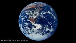
  • 1. BLUE MARBLE Dec 7 1972, Apollo 17
  • 2.
  • 3. Summary for Policymakers Climate Change and Land An IPCC Special Report on climate change, desertification, land degradation, sustainable land management, food security, and greenhouse gas fluxes in terrestrial ecosystems WG I WG II WG III WG I WG II The Ocean and Cryosphere in a Changing Climate This Summary for Policymakers was formally approved at the Second Joint Session of Working Groups I and II of the IPCC and accepted by the 51th Session of the IPCC, Principality of Monaco, 24th September 2019 Summary for Policymakers
  • 4. Figure ES.4. Global GHG emissions under different scenarios and the emissions gap by 2030 EmissionsGapReport2019 2°C range 1.8°C range 1.5°C range Turquoise area shows pathways limiting global temperature increase to below 2°C with about 66% chance Green area shows pathways limiting global temperature increase to below 1.5°C by 2100 and peak below 1.7°C (both with 66% chance) Current policy scenario Cond.NDCcase Uncond.NDCcase Cond.NDCcase Uncond.NDCcase Remaining gap to stay within 2°C limit Remaining gap to stay within 2°C limit Remaining gap to stay within 1.5°C limit Conditional NDC scenario Unconditional NDC scenario 15GtCO2e 32GtCO2e 29GtCO2e Median estimate of level consistent with 2°C: 41 GtCODže (range 39-46) Median estimate of level consistent with 1.5°C: 25 GtCODže (range 22-31) 2005-Policies scenario Current policy scenario Conditional NDC scenario Unconditional NDC scenario 2005-Policies scenario 2°C range 1.8°C range1.5°C range GtCO2e 12 20 30 40 50 60 70 2015 2020 2025 2030 0 10 20 30 40 50 60 70 2010 2020 2030 2040 2050 GtCOǖe (median estimate and 10th to 90th percentile range). I Emissions Gap Report 2019 Emissions Gap Report 2019
  • 5. P oliticians, economists and even some natural scientists have tended to assume that tipping points1 in the Earth system — such as the loss of the Amazon rainforest or the West Antarcticicesheet—areoflowprobabilityand little understood. Yet evidence is mounting thattheseeventscouldbemorelikelythanwas thought,havehighimpactsandareintercon- nected across different biophysical systems, potentiallycommittingtheworldtolong-term irreversible changes. Herewesummarizeevidenceonthethreat of exceeding tipping points, identify knowl- edge gaps and suggest how these should be plugged. We explore the effects of such large-scale changes, how quickly they might unfold and whether we still have any control over them. In our view, the consideration of tipping points helps to define that we are in a climate emergency and strengthens this year’s chorus of calls for urgent climate action — from schoolchildren to scientists, cities and countries. The Intergovernmental Panel on Climate Change (IPCC) introduced the idea of tipping points two decades ago. At that time, these ‘large-scale discontinuities’ in the climate system were considered likely only if global warming exceeded 5 °C above pre-industrial levels. Information summarized in the two most recent IPCC Special Reports (published in2018andinSeptemberthisyear)2,3 suggests that tipping points could be exceeded even between1and2 °Cofwarming(see‘Tooclose forcomfort’). Ifcurrentnationalpledgestoreducegreen- house-gas emissions are implemented — and that’s a big ‘if’ — they are likely to result in at least 3 °C of global warming. This is despite the goal of the 2015 Paris agreement to limit warmingtowellbelow2 °C.Someeconomists, Thegrowingthreatofabrupt andirreversibleclimate changesmustcompel politicalandeconomic actiononemissions. Climatetippingpoints— tooriskytobetagainst Timothy M. Lenton, Johan Rockström, Owen Gaffney, Stefan Rahmstorf, Katherine Richardson, Will Steffen & Hans Joachim Schellnhuber assuming that climate tipping points are of very low probability (even if they would be catastrophic),havesuggestedthat3 °Cwarm- ingisoptimalfromacost–benefitperspective. However, if tipping points are looking more likely,thenthe‘optimalpolicy’recommenda- tionofsimplecost–benefitclimate-economy models4 aligns with those of the recent IPCC report2 . In other words, warming must be limited to 1.5 °C. This requires an emergency response. Icecollapse We think that several cryosphere tipping points are dangerously close, but mitigating greenhouse-gas emissions could still slow downtheinevitableaccumulationofimpacts and help us to adapt. Research in the past decade has shown that the Amundsen Sea embayment of West Antarcticamighthavepassedatippingpoint3 : the‘groundingline’whereice,oceanandbed- rock meet is retreating irreversibly. A model studyshows5 thatwhenthissectorcollapses,it coulddestabilizetherestoftheWestAntarctic icesheetliketopplingdominoes—leadingto about3metresofsea-levelriseonatimescale of centuries to millennia. Palaeo-evidence shows that such widespread collapse of the WestAntarcticicesheethasoccurredrepeat- edly in the past. The latest data show that part of the East Antarctic ice sheet — the Wilkes Basin — might be similarly unstable3 . Modelling work suggeststhatitcouldaddanother3–4 mtosea level on timescales beyond a century. The Greenland ice sheet is melting at an accelerating rate3 . It could add a further 7 m tosealeveloverthousandsofyearsifitpasses a particular threshold. Beyond that, as the elevation of the ice sheet lowers, it melts fur- ther,exposingthesurfacetoever-warmerair. Models suggest that the Greenland ice sheet couldbedoomedat1.5 °Cofwarming3 ,which could happen as soon as 2030. Thus, we might already have committed future generations to living with sea-level risesofaround10 moverthousandsofyears3 . But that timescale is still under our control. The rate of melting depends on the magni- tude of warming above the tipping point. At 1.5 °C, it could take 10,000 years to unfold3 ; above2 °Citcouldtakelessthan1,000years6 . 592 | Nature | Vol 575 | 28 November 2019 Comment An aeroplane flies over a glacier in the Wrangell St Elias National Park in Alaska. Researchers need more observational data toestablishwhethericesheetsarereachinga tippingpoint,andrequirebettermodelscon- strained by past and present data to resolve how soon and how fast the ice sheets could collapse. Whatever those data show, action must be takentoslowsea-levelrise.Thiswillaidadapta- tion,includingtheeventualresettlingoflarge, low-lying population centres. A further key impetus to limit warming to 1.5 °C is that other tipping points could be triggeredatlowlevelsofglobalwarming.The latestIPCCmodelsprojectedaclusterofabrupt shifts7 between1.5 °Cand2 °C,severalofwhich involve sea ice. This ice is already shrinking rapidlyintheArctic,indicatingthat,at2 °Cof warming, the region has a 10–35% chance3 of becominglargelyice-freeinsummer. Biosphereboundaries Climate change and other human activities risktriggeringbiospheretippingpointsacross arangeofecosystemsandscales(see‘Raising the alarm’). Ocean heatwaves have led to mass coral bleaching and to the loss of half of the shallow-water corals on Australia’s Great BarrierReef.Astaggering99%oftropicalcorals areprojected2 tobelostifglobalaveragetem- perature rises by 2 °C, owing to interactions betweenwarming,oceanacidificationandpol- lution.Thiswouldrepresentaprofoundlossof marinebiodiversityandhumanlivelihoods. As well as undermining our life-support system, biosphere tipping points can trigger abruptcarbonreleasebacktotheatmosphere. This can amplify climate change and reduce remaining emission budgets. Deforestation and climate change are destabilizingtheAmazon—theworld’slargest rainforest,whichishometooneintenknown species.EstimatesofwhereanAmazontipping pointcouldlierangefrom40%deforestation to just 20% forest-cover loss8 . About 17% has been lost since 1970. The rate of deforest- ation varies with changes in policy. Find- ing the tipping point requires models that include deforestation and climate change as interacting drivers, and that incorporate fire and climate feedbacks as interacting tipping mechanisms across scales. With the Arctic warming at least twice as quickly as the global average, the boreal forest in the subarctic is increasingly vulner- able. Already, warming has triggered large- scale insect disturbances and an increase “Theclearestemergency wouldbeifwewere approachingaglobal cascadeoftippingpoints.” FRANSLANTING/NAT.GEO.IMAGECOLLECTION Nature | Vol 575 | 28 November 2019 | 593 ning to irreversibly thaw and release carbon dioxideandmethane—agreenhousegasthat isaround30timesmorepotentthanCO2 over a 100-year period. Researchers need to improve their under- standing of these observed changes in major ecosystems, as well as where future tipping points might lie. Existing carbon stores and potential releases of CO2 and methane need better quantification. The world’s remaining emissions budget for a 50:50 chance of staying within 1.5 °C of warmingisonlyabout500 gigatonnes(Gt)of CO2.Permafrostemissionscouldtakeanesti- mated20%(100 Gt CO2)offthisbudget10 ,and that’s without including methane from deep permafrost or undersea hydrates. If forests are close to tipping points, Amazon dieback could release another 90 Gt CO2 and boreal forests a further 110 Gt CO2 (ref. 11). With global total CO2 emissions still at more than 40 Gt per year, the remaining budget could be all but erased already. Globalcascade In our view, the clearest emergency would be if we were approaching a global cascade of tipping points that led to a new, less habit- able, ‘hothouse’ climate state11 . Interactions clima of th from that e can in ers.S inter In obse is am warm ing a Atlan slowd ofthe latio salt t of th down West in Af AMO East upin erate Th such lion y andf 2001 2007 2013 2018 Year of IPCC report Globalmeansurfacetemperature(ºC) 1 2 3 4 5 6 0 Global average temperature: ~1 ºC above pre-industrial levels Level of risk Very high High Moderate Low Undetectable TOOCLOSEFORCOMFORT Abrupt and irreversible changes in the climate system have become a higher risk at lower global average temperatures. 594 | Nature | Vol 575 | 28 November 2019 Researchers need more observational data toestablishwhethericesheetsarereachinga tippingpoint,andrequirebettermodelscon strained by past and present data to resolve how soon and how fast the ice sheets could collapse. Whatever those data show, action must be takentoslowsea-levelrise.Thiswillaidadapta tion,includingtheeventualresettlingoflarge low-lying population centres. A further key impetus to limit warming to 1.5 °C is that other tipping points could be triggeredatlowlevelsofglobalwarming.The “Theclearestemergency wouldbeifwewere approachingaglobal cascadeoftippingpoints.” m- t- e, he s). he at ss ly ’s s- on es an . en ne st ne er is te si- en ng and‘hothouse’climatestatesshouldincrease confidenceintheirabilitytoforecastthese. the Potsdam Institute for Climate Impact Research, Germany. Owen Gaffney is a Tipping points Connectivity RAISINGTHEALARM Evidence that tipping points are under way has mounted in the past decade. Domino effects have also been proposed. Wilkes Basin, East Antarctica Ice loss accelerating Coral reefs Large-scale die-offs Permafrost Thawing Arctic sea ice Reduction in area Atlantic circulation In slowdown since 1950s West Antarctic ice sheet Ice loss accelerating Amazon rainforest Frequent droughts Boreal forest Fires and pests changing Greenland ice sheet Ice loss accelerating SOURCE:T.M.LENTONETAL.
  • 6. FLOODED FUTURE: Global vulnerability to sea level rise worse than previously understood October 29, 2019 Report by Climate Central Flooding in Jakarta, Indonesia, February 2017. Source: World Meteorological Organization / Flickr ARTICLE New elevation data triple estimates of global vulnerability to sea-level rise and coastal flooding Scott A. Kulp1* & Benjamin H. Strauss 1 Most estimates of global mean sea-level rise this century fall below 2 m. This quantity is comparable to the positive vertical bias of the principle digital elevation model (DEM) used to assess global and national population exposures to extreme coastal water levels, NASA’s SRTM. CoastalDEM is a new DEM utilizing neural networks to reduce SRTM error. Here we show – employing CoastalDEM—that 190 M people (150–250 M, 90% CI) currently occupy global land below projected high tide lines for 2100 under low carbon emissions, up from 110 M today, for a median increase of 80 M. These figures triple SRTM-based values. Under high emissions, CoastalDEM indicates up to 630 M people live on land below projected annual flood levels for 2100, and up to 340 M for mid-century, versus roughly 250 M at present. We estimate one billion people now occupy land less than 10 m above current high tide lines, including 250 M below 1 m. https://doi.org/10.1038/s41467-019-12808-z OPEN 1 Climate Central, Palmer Square #402, Princeton, NJ 08542, USA. *email: skulp@climatecentral.org NATURE COMMUNICATIONS | (2019)10:4844 | https://doi.org/10.1038/s41467-019-12808-z | www.nature.com/naturecommunications 1 1234567890():,;
  • 7. climate crisis is a water crisis 2018 wildfires California typhoon Mangkhut Philipines floods Japan droughts Africa
  • 8.
  • 10. Blue planet? All Earth's water, liquid fresh water, and water in lakes and rivers Spheres showing: (1) All water (sphere over western U.S., 860 miles in diameter) (2) Fresh liquid water in the ground, lakes, swamps, and rivers (sphere over Kentucky, 169.5 miles in diameter), and (3) Fresh-water lakes and rivers (sphere over Georgia, 34.9 miles in diameter). Credit: Howard Perlman, USGS; globe illustration by Jack Cook, Woods Hole Oceanographic Institution (©); Adam Nieman.
  • 11. Rising temperatures Desertification Water consumption 2010 versus 2050 in km3 Source: Utrecht University, PBL 2050 2010 Electricity Industry Households IrrigationDeveloped countries Latin America and Caribbean North Africa, the Middle East and Russia Sub-Saharan Africa South Asia and East Asia Pacific 0 300 600 900 1200 1500 Agriculture uses the most water, by far, with a water use of more than 80%. In particular, in South and East Asia, agricultural production heavily depends on irrigation. Groundwater abstraction Groundwater depletion Agri- culture Industry and power plants Urbanisation HouseholdsShrinking lakes 300 million Rural population 2050 Arid Semi-arid Dry sub-humid Humid Dryland areas are the most vulnerable Drylands’ rural population and food production will especially be affected by changes in water availability, as a result of climate change. Source: PBL Abstraction for irrigation Challenges Climate change, which brings higher average temperatures and changing precipitation patterns, combined with increasing compe- tition for water resources, may result in substantial increases in the number of people living under severe water stress. Between now and 2050, global water consumption is expected to increase by 25%, due to the growing number of households, the growth in industrial produc- tion and agricultural expansion and intensification. Growing water demand and —in some regions— declining precipitation will increase the pressure on the available water resources, resulting in high levels of water stress in many regions. Areas with increasing water stress 2010–2050 Source: Utrecht University No to low water stress Increasing compe- tition for water Water stress may have a negative impact on agricultural production and eco- nomic development. Moderate water stress High water stress Severe water stress Water consumption is increasing, especially that of households and industries. Agriculture will remain the largest user, though. High levels of regional water stress may limit agricultural production. WATER STRESS BY 2050 THE GEOGRAPHY OF FUTURE WATER CHALLENGES 2 MAPPING HOTSPOTS 3130 THE GEOGRAPHY OF FUTURE WATER CHALLENGES
  • 12.
  • 13. Source: CRED Ethiopia 2.5 million China 16.5 million India 17.5 million Bangladesh 5 million China 67 million India 19 million Flooding events 1996–2015 Flooding events lead to casualties, result in temporary dis- placement out of the area and high economic losses affecting both indus- tries and households. Number of occurrences 100 Source: CRED People annually affected by drought 1996–2015 Droughts lead to water scarcity for people, severe agri- cultural production loss, local food shortages, and wildfires. Number of people affected, annually 10 million Source: CRED People annually affected by flooding 1996–2015 Flooding occurs all over the world, but the majority of the people affected live in Southeast Asia. Number of people affected, annually 35 million Drought occurrences 1996–2015 Droughts occur on all continents, but predominantly in the southern hemisphere. Number of occurrences 10 Source: CRED THE GEOGRAPHY OF DROUGHTS AND FLOODS The impact of too much waterThe impact of too little water 1716 THE GEOGRAPHY OF FUTURE WATER CHALLENGES 1 SETTING THE SCENE THE GEOGRAPHY OF FUTURE WATER CHALLENGES
  • 14. Global Population growth Young adults population growth Urban population growth The Bangladesh Government expects to have 20 million migrants around 2050, if the worst-case sea level rise scenarios become a reality. Small islands in the Pacific Ocean are particularly vulnerable to sea level rise. Moderate High Very high Potential levels of migration Hotspots of potential migration due to 1 metre sea level rise People living below sea level + 1 metre Drylands Rest of the worldGlobal population distributionStrong population growth and urbanisation in drylands The population growth rate in drylands exceeds the global rate. The dryland population is projected to grow from 2.7 billion today to over 4 billion by 2050, an increase of 40% to 50%. Source: PBL Potential levels of migration Dryland hotspots of potential migration associated with water stress Between 2000 and 2010, an estimated 40 million people migrated out of drylands, mostly in South America, Africa and Asia. Moderate High Very high No data A high likelihood of water stress, strong population growth with a large share of young adults, and low income per capita, can be associated with water-stress-related migration. By 2050, these factors may all affect migration in many Sub-Saharan dryland regions. Drylands African drylands Millions of people live in coastal areas within the reach of 1m sea level rise. Sea level rise, therefore, will eventually become a potential driver of migration in areas without the capacity to help people adapt. Hotspots of migration may be found especially in Southeast Asia, the Small Island Developing States and in Africa, based on projected coping capacity and number of people at risk. 2015 2050 36% 64% 59% 41% 33% 2% 76% 42% 9% 96% 83% 64% 168% Drylands compared to global averages Strong population growth, especially in combination with a large share of young adults, affects migration processes. This is projected to be particularly the case for the African drylands. Source: PBL Source: PBL Source: PBL Migration from rural areas to cities is among other variables associated with a lack of rural economic perspective, population growth and increased water stress. For 2050, water availability and soil quality are particularly expected to deteriorate in the drier and poorer areas of the world. HOTSPOTS OF MIGRATION THE GEOGRAPHY OF FUTURE WATER CHALLENGES 2 MAPPING HOTSPOTS 7776 THE GEOGRAPHY OF FUTURE WATER CHALLENGES
  • 15. Somali refugees wait outside a UNHCR processing center at a refugee camp outside Dadaab, eastern Kenya, on Aug. 5, 2011. Climate change contributed to low rain levels in East Africa in 2011, making global warming one of the causes of Somalia's famine. Somali refugees displaced from their homes by floods cross a swollen river in Kenya
  • 16. Challenges As urban areas expand, trillions of dollars worth of infrastructure, industrial plants, office buildings and homes will be increasingly at risk of flooding. Latin America and Caribbean Annual economic damage in billion USD Annually exposed population, in millions North Africa, the Middle East and Central Asia Developed countries South Asia and East Asia Pacific Sub- Saharan Africa 2010 2050 2050 contribution due to climate change Between now and 2050, the focal point of economic damage will shift to Asia. 9 1.4 2.0 35 8 2.1 2.9 30 9 1.4 1.7 93 19 28.1 43.3 215 4 5.7 15.1 33 Most of the people at risk live in developing countries, especially in the South Asia and East Asia Pacific regions. Their numbers will increase. Source: Deltares, IVM 1,450 million people at risk in developing countries 200 million people at risk in developed countries 2050 Source: PBL Risks for people are unequally distributed While the developed countries will face most of the economic damage, the majority of people at risk live in developing countries. 2010 2050 Millions of people are living in flood- prone areas Deltas Coastal zones Rivers Source: PBL 1,095 1,650 People living in flood-prone areas 2010–2050: The Business-as-usual scenario projects a 30% increase in the number of people potentially exposed to flooding and a threefold increase in economic damage. Many more people are potentially exposed to river flooding than to coastal flooding. Soil subsidence Slums in risky locations Growing economy Extreme precipitation Disappearing mangroves Sea level rise River flooding Storm surges and coastal flooding Flood risk increases mainly due to population and economic development Overall, more extreme precipitation will increase the risk of river flooding. Without additional flood protection and following the projected strong increase in economic value in flood-prone areas, the focal point of damage will shift to Asia. In 2010, around 1 billion people around the world were living in flood- prone areas, potentially exposed to either river or coastal flooding. This number is projected to increase to over 1.6 billion by 2050. STRONG INCREASE IN POTENTIAL FLOOD RISKS THE GEOGRAPHY OF FUTURE WATER CHALLENGES 2 MAPPING HOTSPOTS 4746 THE GEOGRAPHY OF FUTURE WATER CHALLENGES
  • 18. Source: PBL Cities and population density, 2050 Cities 2010 Cities 2050 Inhabitants (millions) 10 20 30 Population density (number of people per 30'' grid cell) 1–100 101–500 501–1,000 > 1,000 Source: PBL Kinshasa will grow from 7.8 million to 28.3 million inhabitants By 2050 Mumbai will be the biggest city (31.6 million) 0 2,0002,000 4,0004,000 6,000 Delta Coast Drylands Global UrbanRural Millions Strong population growth in urban areas In deltas and drylands the urban population will almost double 2050 2010 Change in urban and rural populations, per type of area, 2010–2050 Fast urban growth, more than doubling city sizes, occurs especially in the developing countries of East and South Asia and Sub-Saharan Africa. URBANISATION CHANGES GLOBAL VULNERABILITY In the urbanising world, cities will increasingly become centres of population growth and economic development. By 2050, 70% of the world population is projected to live in an urban environment, and the 600 major cities in the world are expected to provide 60% of global GDP. The global urban area is expected to expand by more than 70%, not only in riparian and coastal areas and in deltas, but also in water-stressed regions, such as drylands. By 2050, 70% of the global population will be living on 0.5% of the global land area. The challenge of inclusive urban development Today, about one billion people are living in urban slums. The rapidly growing urban population strongly increases the pressure on local resources, local environmen- tal conditions, food availability, labour opportunities, and public services. Reducing inequality, inse- curity and poverty in cities may be some of the major challenges, on the path towards 2050. Because of continued global urbanisation, water-related risks will increasingly be concentrated in cities. 2120 THE GEOGRAPHY OF FUTURE WATER CHALLENGES 1 SETTING THE SCENE THE GEOGRAPHY OF FUTURE WATER CHALLENGES Cities Flood Risk Hotspots
  • 19. Rotterdam is #12 $ 82 B global flood losses coastal cities will tenfold in 2050 US$52 billion / year all losses global flood damage will cost US$1 trillion a year (OECD / WB)
  • 20. Flood-prone urban population, in millions Flood-prone rural population, in millions Deltas Coastal zones Deltas Coastal zones 2050 1,175305170 Most people potentially exposed to flooding live in cities along rivers. Source: PBL Built-up and flood-prone areas in Mumbai From 1990 to 2014, the built-up area of Mumbai expanded by 26%, with a relatively large share of the expansion in flood- prone areas. This trend is projected to continue towards 2050, by which time around 60% of Mumbai will be located in flood-prone areas. If sea levels would rise by one metre, the flood- prone area would become even larger and the num- ber of people potentially exposed would increase further. 2010 114 182 799 Rivers Rivers 0 100% Safe up to 1990 Built-up area in km2 Flood-prone built-up area in km2 Safe 1990–2014 Safe 2014–2050 Safe 2014–2050 Flood-prone built-up area in case of 1m sea level rise Source: JRC, PBL Water Built-up, up to 2014 Flood-prone area, 2050 2014–2050 Water 0 10 km Global population growth will concentrate in cities Globally, the population is increasingly concentrated in cities, most of which are located near rivers or the coast. This trend is projected to continue, between now and 2050. How flood risks and protection of formal and informal settlements will develop, depends on future flood-risk strategies. Informal settlements are the most exposed In many cities, especially in developing countries, the inhabitants of infor- mal settlements make up more than 50% of the urban population. Water- and climate-related disasters disproportion- ately affect people living in informal settlements. The number of people in flood-prone areas in the developing world is expanding rapidly. Without attention, flood protection inequality between urban formal and informal settlements will increase. Formal settlement Built on landfill Informal settlement Built directly on the riverbed RiverbedLandfill UNEQUAL FLOOD RISKS WITHIN CITIES THE GEOGRAPHY OF FUTURE WATER CHALLENGES 2 MAPPING HOTSPOTS 5150 THE GEOGRAPHY OF FUTURE WATER CHALLENGES
  • 21. Unsafe for human health Sewage pipes not separated from storm drains Safe for human health Threat to aquaculture, tourism, fishery and industry No water treatment Water pollution Sewage discharges to surface water Groundwater pollution Unsafe for riverine ecosystems and for human use Local farmland Access to clean drinking water Access to basic sanitation Present situation, safe drinking water and basic sanitation Percentage of population Developed countries Latin America and the Caribbean North Africa, the Middle East and Russia Sub-Saharan Africa South Asia and East Asia Pacific Average number of deaths per year, 1980–2015 x 1,000 0 20 40 60 80 100% Source: CRED, WHO Source: WHO, Unicef 75Conflicts 63Natural disasters 780Unsafe water Challenges A century ago, the dominant flow for nutrients was their reuse in agriculture. Today, nutrients mostly end up in surface water. The increase in nutrient emissions may lead to algal blooms and deoxygenation, affecting the ecological quality as well as economic activities in these waters, such as fisheries, aquaculture and tourism. Lack of access to clean drinking water and lack of sanitation are two of the major causes of human illness and mortality. In combin- ation, their impact leads to almost 800,000 human deaths, annually, in low- and middle-income countries. This is far more than the number of annual casualties from flooding, drought, or violent conflict. One in eight people in the world have no access to clean drinking water and almost one in three lack basic sanitation facilities Although access to clean drinking water and sanitation facilities has improved over the last decades, large differences remain between world regions. For instance, although since 1990, 2.6 billion people have gained access to clean drinking water, today 660 million people are still without, especially in Sub-Saharan Africa. In addition, at least 1.8 billion people around the world use a drinking water source that is faecally contaminated. Improving sanitation in Asian and African countries is one of the major challenges, for the coming decades. In Africa, diseases such as diarrhoea are mainly caused by contaminated drinking water and poor sanitation, and are responsible for over 10% of infant mortality, which is 25times higher than in developed countries. Although major improvements have been made, globally, one in eight people still lack access to clean drinking water, and one in three lack adequate sanitation facilities. DIRTY WATER: A THREAT TO HUMAN HEALTH THE GEOGRAPHY OF FUTURE WATER CHALLENGES 2 MAPPING HOTSPOTS 3938 THE GEOGRAPHY OF FUTURE WATER CHALLENGES
  • 22. Agricultural production in million tonnes dry matter per year Agricultural production 2010 Food and feed crops 3 Mt Grass and fodder 3 Mt Wood 1 Mt Energy crops 0 Mt Agricultural production 2050 Food and feed crops 5 Mt Grass and fodder 3 Mt Wood 2 Mt Energy crops 2 Mt Source: PBL Groundwater abstraction Abstraction for irrigation Gap in crop yields 0–20% 20–40% >40% Source: Wageningen University & Research Gap in crop yields rainfed agriculture, by 2050 Water shortages cause large yield gaps in many areas around the world. Improved water management may increase crop yields in rainfed agriculture, by 40% to over 60%. Gap in crop yields 0–20% 20–40% >40% Source: Wageningen University & Research Gap in crop yields irrigated agriculture, by 2050 Improved water management may also increase crop yields in irrigated agriculture. Under the Business-as-usual scenario, total agricultural production is expected to increase by 70%, mainly due to more food and feed production and more energy crop production. These increases are projected to be about 10% lower than they would have been without climate change. This is mostly due to water shortages and too high temperatures. Especially the agriculture in tropical and subtropical regions are projected to be affected. Twenty percent of the global agricultural area is irrigated, which represents 40% of the total in agricultural production. The remaining area (80%) fully depends on precipitation. Water is a prerequisite for crop production. Water shortages directly lead to reduced crop production. In water-stressed areas, agricul- tural production levels can be increased by improving water management and increasing water efficiency (‘more crop per drop’). Without improved water management, rainfed and irrigated agriculture are expected to experience substantial yield gaps by 2050. LOW CROP YIELDS REQUIRE WATER MANAGEMENT THE GEOGRAPHY OF FUTURE WATER CHALLENGES 2 MAPPING HOTSPOTS 3332
  • 23. Potential in PWh (per region) 0 0.25 0.75 0.50 1.00 Planned dams (capacity in MW) 10,000 Technical potential Economic potential Ecological potential Source: PBL Additional hydropower potential (PWh) by 2050, compared with 2010 Planned hydropower increase is especially large in the Amazon river basin, the Congo river basin, the Yangtze basin and the Himalayan river basins. Ecological requirements would substantially lower hydropower potential, in many places around the world. This is especially the case for the river systems of high ecological quality of the Amazon and Congo, where hydropower potential would be close to zero if ecological quality is to be pre- served. If all economic potential would be utilised, an estimated 8 million people could be at risk of displacement. In addition to the current 8600 larger dams, primarily designed for hydropower, 3700 new dams are planned, each with more than 1 MW capacity, over 500 of which are already under construction. PLANS FOR 3700 NEW DAMS THE GEOGRAPHY OF FUTURE WATER CHALLENGES 2 MAPPING HOTSPOTS 5958
  • 24. Level of loss in 2010 Decline in freshwater ecosystems with high biodiversity levels (in 1000 km2) Nutrient loading to coastal seas, 2050 Absolute, x 1000 kg N Nutrient loading, 2050 Relative No outflow areasHigh Low Loss by 2050 Remaining in 2050 Canada United States, Mexico Europe Central and South America North Africa, Central Asia Russia Sub- Saharan Africa South and East Asia 0 500,000 1,000,000 1,500,000 2 ,000,000 In the coming decades, most losses are expected to occur in the tropical and sub- tropical zones in Sub-Saharan Africa, Latin and Central America and South and East Asia. Catchment1,000,000 Quality of coastal seas threatened by increased nutrient loading The increase in nutrient emissions, towards 2050, will also result in an increase in nutrient loading to coastal waters, especially in the Asian region. This will increase the risk of toxic algal blooms and oxygen depletion in those waters, and will negatively affect biodiversity (e.g. coral reefs) and ecosystem functions, such as aqua- culture and fisheries. Projected quality of freshwater ecosystems, 2050 In the sparsely populated northern regions, the quality of freshwater ecosystems will be least affected. Source: PBL Level of original freshwater biodiversity (%) Low (0–20) (20–40) (40–60) (60–80) High (80–100) No data Under the Business-as-usual scenario, developments will result in further biodiversity loss in nearly 40% of the world’s freshwater ecosystems. Decrease in freshwater ecosystems with high levels of biodiversity Tropical regions include the most biodiverse river basins. High- quality ecosystems in these regions, however, are already severely affected and will further decline in quality, between now and 2050. The strongest decline in quality is projected for Sub- Saharan Africa and parts of Latin America and Asia. In developed regions, such as Europe, the United States and Japan/Oceania, most of the decline in quality has already occurred. Overall, natural biodiversity will be preserved in less than 60% of the world’s aquatic ecosystems, under the Business-as-usual scenario. Japan, Oceania World x 10 Source: PBL Source: PBL FURTHER BIODIVERSITY LOSS TOWARDS 2050 THE GEOGRAPHY OF FUTURE WATER CHALLENGES 2 MAPPING HOTSPOTS 6968
  • 25. We are the turning point Storm Intensity Temperature Rise Sea Level Rise Urban Growth 210020501900 1950 20001850 We are here
  • 27.
  • 28. What comes next is the massive task to undo these failing actions, mitigate their origins, adapt for their impacts and rethink the future and our responsibilities.
  • 29. business as usual is not enough lethal
  • 30. Storm Intensity Temperature Rise Sea Level Rise Urban Growth PRO-ACTIVE From pre-crisis to comprehensive solutions RE-ACTIVE From crisis to temporary solutions NON-RESPONSIVE From crisis to crisis Crisis Temporary Solution Comprehensive Solution 210020501900 1950 20001850 We are here
  • 31. UNDERSTAND WATER Commit to making evidence-based decisions about water, and cooperate to strengthen water data, such as through the HLPW World Water Data Initiative. VALUE WATER Use the HLPW Principles on Valuing Water to sustainably, efficiently, and inclusively allocate and manage water resources and deliver and price water services accordingly. MANAGE WATER Implement integrated approaches to water management at local, national, and transboundary levels, strengthen water governance, and ensure gender equality and social inclusion. FOUNDATIONS FOR ACTION s Water 1 2 3 4 5 6 7 8910 11 12 13 14 15 16 17 Goals related to water No poverty Zero hunger Good health and well-being Quality education Gender equality Clean water and sanitation Affordable and clean energy Decent work and economic growthIndustry, innovation and infrastructure Reduced inequalities Sustainable cities and communities Responsible consumption and production Climate action Life below water Life on land Partnerships for the goals Peace, justice and strong institutions Group 1 targets: New Urban Agenda Make cities and human settlements inclusive, safe, resilient and sustainable affecting water quality and biodiver- human health and well-being, clean n, food production, sustainable cities nd the quality of ecosystems, water is y also linked to many of the Sustain- oals (SDGs). Improving the protection d disasters is also covered under ork for Disaster Risk Reduction. The specifically concerns the sustainable es and encompasses the water-related art of the SDGs and the Sendai Water as Leverage
  • 33. 2018 Sustainable Development Goal 6 Synthesis Report on Water and Sanitation 2018SustainableDevelopmentGoal6SynthesisReportonWaterandSanitation The world is not on track to reach Sustainable Development Goal 6 (SDG 6) on Water and Sanitation by the deadline set for 2030. Today, billions of people lack safe water, sanitation and handwashing facilities.Ecosystemsandwatersourcesarebecomingmorepolluted, and funding for water and sanitation services is inadequate. In addition, governance and delivery systems are weak and fragmented. UN-Water’s Sustainable Development Goal 6 Synthesis Report 2018 on Water and Sanitation builds on the latest data available for the 11 SDG 6 global indicators. Representing a joint position from the United Nations family, the report offers guidance to understanding global progress on SDG 6 and its interdependencies with other goals and targets. It also provides insight into how countries can plan and act to ensure that no one is left behind when implementing the 2030 Agenda for Sustainable Development. ISBN 978-92-1-101370-2 Cover_SR_2018_june_ok.indd 1 26/6/18 11:37 The time to act on SDG6 is now. The world is not on track to achieve the global SDG 6 targets by 2030 at the current rate of progress. UN Water Synthesis report, July 2018 the bulk is necessary: gaps for the Agenda2030
  • 34. we need transformative capacity, upwards tipping points for sustainable development leapfrog our way out, incremental change is not enough A BLUE NEW DEAL
  • 35. incremental change is critical important for cultural change
  • 39. scale innovative approach: inclusive, collaborative, holistic, catalytic SDGs time catalyst / leverage change bend the trend Catalytic action climate change
  • 40. BLUE MARBLE Dec 7 1972, Apollo 17 A SYSTEMS APPROACH
  • 41. long term & comprehensive short term & innovative programmatic approach & institutional capacity ppp funding & accountability inclusive collaboration research & planning & design understand & value & manage
  • 44. We aspire that, by 2063, Africa shall be a prosperous continent with the means and resources to drive its own development, and where African people have a high standard of living and quality of life, sound health and well-being; Well educated citizens and skills revolution underpinned by science, technology and innovation for a knowledge society; Cities and other settlements are hubs of cultural and economic activities, with modernized infrastructure, and people have access to all the basic necessities of life including shelter, water, sanitation, energy, public transport and ICT; Economies are structurally transformed to create shared growth, decent jobs and economic opportunities for all… (Agenda 2063 - The Africa We Want) implementation enabling environment / capacity PEOPLE PROJECTS > Collaboration > Consistency > Capacity building > Commitment > Cross-cutting Invest in the process - we need millions to spend the billions (right)…
  • 45. LOW PERFORMANCELIMITED OPPORTUNITIES OPPORTUNITIES TIME CONCEPT PHASE IMPLEMENTATION PHASE MAXIMIZED OPPORTUNITIES HIGH PERFORMANCE Invest in the process - we need millions to spend the billions (right)… Opportunity-Performance Curve. The economic production possibility curve (PPC) shows possible combinations of two goods that can be produced with constant resources & technology, resulting in less production of it. Similar dynamics take place in development: it is important to keep opportunities open as long as possible. Delaying decisions too long can have a negative impact on the project if not managed right and recent studies show that the proper management of these options & opportunities has a clear positive impact on the value of the project’s performance. Investing more intensively in the concept phase and using that knowledge to actively engage in decision-making, guarantees a more extensive performance rate during implementation.
  • 46. © Cynthia van Elk | Water As Leverage Invest in the people - we need to change the billions…
  • 48.
  • 49. The Netherlands - culture of living with water Trade, negotiations and crafts, stubbornness, luck and faith. Managing risks and uncertainties. The Netherlands is made out of water Below sea level: 26% Liable to flooding: 59% Above sea level: 29% Outside the dykes: 3% Meuse outside the dykes: 1% County of Holland, 16th Century Woodcut by Sebastian Münster
  • 50. Dijkenatlas - LOLA / NAI010 1122 - the first collabora:on started in the Utrecht area, where 20 communi:es worked together on the local embankment
  • 51. “Water governance in the Netherlands has an excellent track record in several areas, and its management is a multi- level public responsibility” “A global reference for water management” “A robust and adjustable institutional and policy framework” - flood defense - water quantity - drainage - water quality - waste water treatment - drinking water supply WATER GOVERNANCE IN THE NETHERLANDS: FIT FOR THE FUTURE? © OECD 2014 (Article 3.9, Water Act) and the canal dykes of the regional water authorities, while this responsibility is now carried out by the central government. Third, muskrat and coypus7 control have recently been transferred to regional water authorities. Figure 1.4. Institutional mapping for flood defence ADVISORY GROUPS Regional water authorities (24) [Most of the primary and all secondary flood defence] National Water Authority [Small part of primary flood defence] EU (Flood Directive] Provinces (12) IPO Municipalities (408) VNG UvW Ministry of Infrastructure and the Environment PBL KNMI Advisory Committee on Water Research centres and think tanks Nature and environmental NGOs International Water Commissions [Rhine , Scheldt, Meuse, Ems] Management of flood defence structures (dikes, dunes, muskrats and coypus control) Regulation (safety standards) Financing of flood defence structures Data gathering and sharing OTHER ACTORS MAIN ACTORS INTEREST AND INFLUENTIAL GROUPS Advisory Committee on Legal Water and Public Work Affairs Council for the Environment and Infrastructure Agricultural organisations Consumers organisations VNO-NCW MKB Supervision of flood defence structures Strategic planning and advice EU European Union MKB Organisation of Entrepreneurs VNG Association of Netherlands Municipalities IPO Association of Dutch Provinces PBL Environmental AssessmentAgency Vewin Association of Dutch Water Companies KNMI Royal Netherlands Meteorological Institute UvW Association of Regional Water Authorities VNO-NCW Confederation of Netherlands Industry and Employers WATER GOVERNANCE IN THE NETHERLANDS: FIT FOR THE FUTURE? © OECD 2014 shortage in freshwater supply (see Chapter 2). Depending on geographical areas, these can be temporary or permanent and have different origins: aridness, changes in groundwater flows, or different chemical composition of groundwater. Managing the quantity of surface water and groundwater, and achieving and maintaining certain water levels is also a shared responsibility across levels of government. Figure 1.5. Institutional mapping for water quantity management Regarding surface water, the state manages the so-called “main water management system” (the IJsselmeer (Lake IJssel), the Wadden Sea, the river deltas, the major rivers and a number of large canals), while the regional water authorities manage the regional water system (Figure 1.5). The precise boundaries of the main water management system and the regional water systems are contained in maps included in the annex of existing water laws and regulations. The latest developments relate to groundwater management. In the Water Act, this area falls under the responsibility of the regional water authorities, with some specific duties allocated to the provinces and municipalities. For example, the provinces levy the ADVISORY GROUPS Provinces (12) [groundwater] Municipalities (408) [Urban groundwater] PBL KNMI National Water Authority [Main water system*] Regional water authorities (24) [Regional water systems and groundwater] Operational management for water systems Operational management for inland waterways Regulation (quantitative status and threshold values) Strategic planning and advice (groundwater quality policy, spatial functions) *The main water systems include the main rivers, Lake Ijssel, the Wadden Sea and the North Sea. EU [Water Directives] INTEREST AND INFLUENTIAL GROUPS IPO VNG UvWMAIN ACTORS Ministry of Infrastructure and the Environment OTHER ACTORS Delta Commissioner Advisory Committee on Water Research centres and think tanks International Water Commissions [Rhine , Scheldt, Meuse] Advisory Committee on Legal Water and Public Work Affairs Council for the Environment and Infrastructure Nature and environmental NGOs Agricultural organisations Consumers organisations VNO-NCW MKB Financing (general taxes, groundwater tax) Data gathering and sharing on ecological status (quantitative) EU European Union MKB Organisation of Entrepreneurs VNG Association of Netherlands Municipalities IPO Association of Dutch Provinces PBL Environmental AssessmentAgency Vewin Association of Dutch Water Companies KNMI Royal Netherlands Meteorological Institute UvW Association of Regional Water Authorities VNO-NCW Confederation of Netherlands Industry and Employers 38 – 1. INTERLOCKING WATER MANAGEMENT FUNCTIONS IN THE NETHERLANDS WATER GOVERNANCE IN THE NETHERLANDS: FIT FOR THE FUTURE? © OECD 2014 groundwater tax and issue licenses for three types of groundwater abstraction. Municipalities are responsible for the groundwater level in urban areas to preclude or limit, as far as possible, any structurally adverse influence on the water level (too high or too low). A unique function carried out by the regional water authorities consists in “keeping the territory dry”. This function is at the heart of the Dutch physical “polder – reclaimed land – approach”. The Dutch word polder refers to areas of ground that are lower than the surrounding waters where the water level is artificially regulated. In a broad sense, it may refer to all areas that have been reclaimed from the water. The Netherlands has 3 891 polders, and half of the total polder surface area in Europe is on Dutch soil.8 Intensive and systematic drainage has been critical to protect the Dutch population and economy in reclaimed areas. Such a function is separate but inherently linked to the existential risk of flooding of low-lying areas that the Netherlands faces. Regional water authorities are responsible for this backbone function of maintaining the watercourses, monitoring water levels and pumping to maintain the required level (Figure 1.6). Through this function, they also create the “natural infrastructure” for urban development, economic growth and recreation, effectively enabling, implementing and operating the communities’ spatial and land-use decisions. Figure 1.6. Institutional mapping for drainage ADVISORY GROUPS Regional water authorities (24) EU (Water Directives] Provinces (12) IPO Municipalities (408) [urban stormwater and groundwater] VNG UvW Ministry of Infrastructure and the Environment PBL KNMI Advisory Committee on Water Research centres and think tanks Nature and environmental NGOs Creation and management of drainage infrastructures Regulation (spatial and land use) Data gathering and sharing OTHER ACTORS MAIN ACTORS INTEREST AND INFLUENTIAL GROUPS Advisory Committee on Legal Water and Public Work Affairs Council for the Environment and Infrastructure Agricultural organisations Consumers organisations VNO-NCW MKB Implementation of spatial plans Strategic spatial planning and advice (Spatial Planning Act; Water Act; national, regional and local spatial plans; zoning plans) Construction and housing associations EU European Union MKB Organisation of Entrepreneurs VNG Association of Netherlands Municipalities IPO Association of Dutch Provinces PBL Environmental AssessmentAgency Vewin Association of Dutch Water Companies KNMI Royal Netherlands Meteorological Institute UvW Association of Regional Water Authorities VNO-NCW Confederation of Netherlands Industry and Employers 1. INTERLOCKING WATER MANAGEMENT FUNCTIONS IN THE NETHERLANDS – 39 WATER GOVERNANCE IN THE NETHERLANDS: FIT FOR THE FUTURE? © OECD 2014 Water quality management The protection and improvement of water quality falls under the state (main water management system) and the regional water authorities (regional waters).9 The national government formally co-ordinates and facilitates the implementation of the Water Framework Directive, and is responsible for national policy (e.g. setting national standards) (Figure 1.7). Regional water authorities are responsible for operational management, including planning, licensing discharges, enforcement and evaluation. They also oversee urban wastewater treatment. Responsibility for groundwater quality is linked to broader soil protection policy, the implementation of which belongs to municipalities and provinces. Figure 1.7. Institutional mapping for water quality management Sewerage and wastewater treatment Wastewater treatment has become a major component of regional water authorities’ tasks and revenues in recent decades. They currently manage about 350 wastewater treatment plants for the treatment of urban wastewater coming from households and businesses (van Rijswick and Havekes, 2012). They can contract out services (e.g. operation and maintenance tasks) to the private sector. In one specific case, a wastewater treatment plant has been based upon a BOT (Build, Operate and Transfer) contract. To carry out these responsibilities, regional water authorities charge a wastewater treatment fee, and both regional water authorities and the state charge a pollution tax for direct discharges into surface water. INTEREST AND INFLUENTIAL GROUPS ADVISORY GROUPS National Water Authority [Main water system*] EU [Water Directives] Provinces (12) [groundwater] IPO VNG Regional water authorities (24) [Regional water systems] UvW Municipalities (408) [groundwater] PBL KNMI Delta Commissioner Operational management for water systems (licencing discharge, enforcement, monitoring, evaluation) Regulation (quality standards and emission-based measures) Data gathering and sharing on ecological status of water (qualitative) *The main water systems include the main rivers, Lake Ijssel, the Wadden Sea and the North Sea. Ministry of Infrastructure and the Environment MAIN ACTORS Advisory Committee on Water Research centres and think tanks International Water Commissions [Rhine , Scheldt, Meuse, Ems] Advisory Committee on Legal Water and Public Work Affairs Council for the Environment and Infrastructure Nature and environmental NGOs Agricultural organisations Consumers organisations VNO-NCW MKB Strategic planning and advice (groundwater quality policy, spatial functions) Financing (general taxes, pollution tax, regional water authority tax) VEWIN EU European Union MKB Organisation of Entrepreneurs VNG Association of Netherlands Municipalities IPO Association of Dutch Provinces PBL Environmental AssessmentAgency Vewin Association of Dutch Water Companies KNMI Royal Netherlands Meteorological Institute UvW Association of Regional Water Authorities VNO-NCW Confederation of Netherlands Industry and Employers 40 – 1. INTERLOCKING WATER MANAGEMENT FUNCTIONS IN THE NETHERLANDS WATER GOVERNANCE IN THE NETHERLANDS: FIT FOR THE FUTURE? © OECD 2014 Responsibility for sewerage is entrusted to the 408 municipalities in the Netherlands, by the Environmental Management Act, compelling them to draw up a sewerage plan, the preparation of which must involve regional water authorities (Figure 1.8). The same regulation obliges each municipality to ensure that wastewater discharged from premises situated within its territory is collected in a public sewer and transported to the wastewater treatment plant. The municipality can cover the costs incurred by means of a sewerage tax. This municipal responsibility is closely linked to the regional water authorities’ duties associated with water quality and wastewater treatment as the public sewer is connected to regional water authorities’ wastewater treatment plant (the so-called wastewater cycle). Figure 1.8. Institutional mapping for sewerage and wastewater treatment Recently, targets for wastewater treatment have been increasingly influenced by the river basin management plans developed under the EU Water Framework Directive, instead of independent national and provincial policies. The 2011 Administrative Agreement on Water Affairs includes options for a more cost-effective organisation of wastewater treatment, ranging from further co-operation between municipalities and regional water authorities in the collection, transport and treatment of wastewater, to joint collection of taxes. Regional water authorities and municipalities have self-regulated benchmarking for sewage collection and wastewater treatment. ADVISORY GROUPS EU [Water Directives] Provinces (12) Ministry of Infrastructure and the Environment Advisory Committee on Water Research centres and think tanks Regional water authorities (24) Municipalities (408) Collection and transport of sewerage water Treatment of wastewater (350 wastewater treatment plants) Regulation – requirements for urban wastewater discharge Financing (regional water authorities’ tax, municipal sewerage tax) Strategic planning (sewerage plans) INTEREST AND INFLUENTIAL GROUPS IPO VNG UvW MAIN ACTORS OTHER ACTORS Advisory Committee on Legal Water and Public Work Affairs Council for the Environment and Infrastructure Nature and environmental NGOs Agricultural organisations Consumers organisations VNO-NCW MKB Benchmarking – monitoring – performance evaluation Data gathering and sharing EU European Union MKB Organisation of Entrepreneurs VNG Association of Netherlands Municipalities IPO Association of Dutch Provinces PBL Environmental AssessmentAgency Vewin Association of Dutch Water Companies KNMI Royal Netherlands Meteorological Institute UvW Association of Regional Water Authorities VNO-NCW Confederation of Netherlands Industry and Employers 1. INTERLOCKING WATER MANAGEMENT FUNCTIONS IN THE NETHERLANDS – 41 Drinking water supply The Drinking Water Act sets up the organisation of the drinking water supply in the Netherlands and entrusts government bodies with the responsibility to ensure the sustainable security of the public drinking water supply (Figure 1.9), with the central government playing a central role. The responsibility for supplying drinking water is entrusted to ten drinking water companies (previously more than 200). These are semi-public bodies operating under private law with their shares owned by the provinces and municipalities. Therefore, rather than levy a “tax” they charge a “price” for the drinking water they supply to households and firms. In 2004, parliament banned private sector provision from water supply, but in practice, drinking water companies contract out many services (e.g. customer relations and repairs) to the private sector. Figure 1.9. Institutional mapping for drinking water supply Linkages across water management functions and beyond Interdependencies Water management functions are intrinsically interlinked and mutually dependent and EU [Water Directives] ADVISORY GROUPS Provinces (12) Municipalities (408) Ministry of Infrastructure and the Environment Research centres and think tanks Drinking water companies (10) Vewin National Institute for Public Health and the Environment Production and distribution (treatment, supply, maintenance, financing and compliance with quality standards) Protection and financing of drinking water resources (tariffs for households and firms) Regulation – drinking water standards Shareholders of drinking water companies Strategic planning and advice (supply plans, policy documents) Benchmarking – monitoring – performance evaluation National Water Authority INTEREST AND INFLUENTIAL GROUPS IPO VNG Advisory Committee on Water Advisory Committee on Legal Water and Public Work Affairs Council for the Environment and Infrastructure UvW Nature and environmental NGOs Agricultural organisations Consumers organisations VNO-NCW MKB MAIN ACTORS OTHER ACTORS Regional water authorities (24) Data gathering and sharing EU European Union MKB Organisation of Entrepreneurs VNG Association of Netherlands Municipalities IPO Association of Dutch Provinces PBL Environmental AssessmentAgency Vewin Association of Dutch Water Companies KNMI Royal Netherlands Meteorological Institute UvW Association of Regional Water Authorities VNO-NCW Confederation of Netherlands Industry and Employers Watergovernance in the Netherlands is culture
  • 52. Overview of OECD Principles on Water Governance The OECD Principles on Water Governance are expected to contribute to improving the “Water Governance Cycle” from policy design to implementation. TRUST & ENGAGEMENT Clear roles & responsibilities Capacity Policy coherence Appropriate scales within basin systems Regulatory Frameworks Data & information Financing Innovative governance Trade-offs across users, rural and urban areas, and generations Integrity & Transparency Monitoring & Evaluation Stakeholder engagement WATER GOVERNANCE The OECD Principles on Water Governance are expected to contribute to improving the “ Governance Cycle” from policy design to implementation. The Water Governance Cycle Source: Forthcoming, OECD Working Paper, 2015, Water Governance Indicators Trade-offs across users, rural and urban areas, and generations Stakeholder engagement WATER GOVERNANCE Formulation of policies and strategies Implementation Monitoring Evaluation From good water governance To better water governance Bridging the gap Assessing the gaps Indicators Actions Principles New instruments or improvements Watergovernance - OECD
  • 53. two principles : SAFETY and QUALITY
  • 56. Verenigde Staten New York: advies over resilience en klimaat, samenwerking met Rockefeller Foundation. Verenigde Staten Boston: samenwerking voor klimaatadaptatie. Verenigde Staten Miami: samenwerking helpen opzetten in de regio, ook met Nederlandse waterbedrijven en universiteiten. Verenigd Koninkrijk Adviseur parlementaire commissie na overstromin- gen 2015 voor integrale wateraanpak. Argentinië Samenwerking gericht op de waterveiligheid (klimaat) in de Parana Delta. CanadaAdviseur resilience Adviseur resilience voor Toronto Waterfront en economische diplomatie voor de Nederlandse watersector. Verenigde StatenAdviseur Betrokken bij Great Lakes Initiative voor rights on nature. Verenigde StatenAdviseur San Francisco: initiator en jurylid Bay Area Resilient by Design Challenge. Verenigde StatenAdviseur Los Angeles: samenwerking met Frank Gehry voor LA River Project. Mexico Samenwerking met de regering voor resilient cities en het mede opzetten van een plan voor kustveilig- heid met pilot in Cancun. Panama Samenwerking met de locoburgemeester van Panama City op het gebied van disaster response, water, klimaat en stedelijke ontwikkeling. Peru Adviseur van de regering bij aanpak overstromingen en reconstruction by change, economische diplomatie met Nederlandse water- bedrijven. Chili Adviseur van de regering over water governance, kennisuitwisseling en vergroten waterbewustzijn, economische diplomatie met o.a. Deltares. Verenigde StatenAdviseur New Orleans: samen- werking voor resilience en waterveiligheid. Colombia Adviseur van de burgemeester van Bogota over water, klimaat en stad. Zuid-Afrika Adviseur van de minister over waterbeleid, met o.a. Unie van Waterschappen, economische diplomatie met Nederlandse bedrijven in waterdata. Zuid-Afrika Adviseur Kaapstad voor stedelijke ontwikkeling en water/klimaat. Mozambique Stedelijke ontwikkeling, masterplanning, klimaat en water, economische diplomatie met Nederlandse bedrijven in haven- ontwikkeling. Myanmar Adviseur van de regering en Yangon over water, klimaat en verstedelijking, Delta aanpak met andere internationale partijen. Singapore Samenwerking op het gebied van water, fellow van Center for Liveable Cities, economische diplomatie Nederlandse watersector. Australië Internationale samenwer- king en hulp bij opzetten trilaterale samenwerking in Zuidoost-Azië op het gebied van water. Vietnam Adviseur van de regering over Mekong Deltaplan. Japan Hulp bij opzetten van samenwerking in Zuidoost-Azië op het gebied van water. India Adviseur van de stad Chennai na overstromin- gen, met o.a. Rockefeller Foundation, Word Bank, ADB, Deltares en Arcadis. Egypte Samenwerking op het gebied van water, klimaat en waterveiligheid Middellandse Zeekust. Bangladesh Adviseur van de regering over Bangladesh Delta Plan. De waterdreigingsmeter laat zien welke regio’s kwetsbaar zijn voor watergerelateerde rampen zoals droogte of overstromingen. De meter is samengesteld op basis van de Aqueduct Water Risk Atlas. hoog risico laag risico Natuurrampen in 2016 Landen met, soms ook gewelddadige, politieke conflicten die met water te maken hebben. Waterdreigingsmeter Klimaatgerelateerde rampen extreme temperaturen, droogte, natuurbranden Hydrologische rampen Overstromingen, aard- verschuivingen Meteorologische rampen Tropische stormen, tornado’s en andere extreme stormen Politieke conflicten
  • 57. POLICY PERSPECTIVES OECD ENVIRONMENT POLICY PAPER NO. 11 Financing water Investing in sustainable growth THE ROUNDTABLE ON FINANCING WATER. 15 1 Estimating investment needs Estimating capacity to finance Typology of investments in water security Typology of financ ers 2 3 Mapping and estimating n n in o Analysing po i i t t ff t investment o P o otin p t ys and pp o t t f i it t investment 3 pillars for action B ended finance Approaches to valuing the benefits o ater invest ents  Long-term strategic planning to facilitate investment Policies that help or hinder invest ent flo s Policies that spur innovation The role of information in stimulating demand for investment oun t on in n in ater
  • 58. Delta Coalition - launched at UNISDR Sendai DRR Conference March 2015 The Netherlands, Japan, Colombia, Philippines, Vietnam, Bangladesh, France, Korea, Egypt, Indonesia, Myanmar, Mozambique, Argentina, …
  • 59. An Agenda forWater Action Making Every Drop Count
  • 60. ADAPT NOW: A GLOBAL CALL FOR LEADERSHIP ON CLIMATE RESILIENCE #AdaptOurWorld
  • 62. © Alex MacLean © Fred Boltz © Fred Boltz © Fred Boltz© Nature Sustaining an Earth system suitable for humanity to thrive Build the resilience of human systems – agriculture, energy, cities, economies
  • 63. Preparedness Resilient basins Resilient cities
  • 65. Dutch River Region 4 million Rural Just above EUR 2.3 billion Extremely high water levels. That is the greatest challenge the river region in the Netherlands faces today. In 1993 and 1995, water levels in the Netherlands reached a critical level, weakening the dikes to the point of collapse. A quarter of a million inhabitants had to be evacuated, along with one million cattle. As heavy rainfall is becoming more common – and will become even more so in the future – the Dutch government is continually working on ensuring the safety of the river regions through programmes such as Room for the River. Reinforcing dikes is not an adequate solution. In order to drain excess water into the sea, measures must also include widening and deepening rivers. At more than 30 locations, the Room for the River Programme allows rivers more space, for example by moving dikes, digging secondary channels and deepening flood plains. The Room for the River Programme uses a globally innovative approach to protect areas against river flooding. Giving the river more room not only protects the river regions from floods but also improves the overall quality of the area, with new nature and recreational areas as an added bonus. In short, an integrated approach improves both safety and spatial quality. Multiple Dutch partners including central government, and local provinces, municipalities and water boards, companies and NGOs are implementing the Room for the River Programme. This close cooperation between national and regional governments ensures support and reduces the risk of delays. Room for the River is a pilot programme for the Dutch Delta Programme, which is designed to prepare the Netherlands for extreme natural events. The main objective of this programme is to make water safety and freshwater supplies sustainable and predictable by 2050. The Dutch Delta approach is based on five Ds: Delta Act, Delta Fund, Delta Commissioner, Delta Decisions and Delta Programme. The so-called Delta Decisions, for example guide the concrete approach to the Rhine- Meuse delta with regard to water storage and drainage, and the need for new dams or dikes. www.ruimtevoorderivier.nl/english THE NETHERLANDS ROOM FOR THE RIVER Integrated approach governance and cooperatIon wIth stakeholders 12
  • 66. Bangladesh Delta 155 million Rural, with several rapidly urbanising cities Just above EUR 7.65 million Bangladesh, encompassing the Ganges-Brahmaputra- Meghna river systems, can in many respects be considered one of the most dynamic deltas in the world. Huge amounts of water and sediment often exceed the carrying capacity of Bangladesh’ rivers. Cyclones and coastal floods, intensified by climate change effects, and a range of socio-economic trends, pose additional challenges. The Bangladesh Delta Plan 2100 (BDP2100) attempts to address these issues by developing a long term, holistic delta vision and adaptive strategy. Amongst socio-economic trends are a rapidly increasing population and a growing demand for food. The already high pressure on available land adds to the complexity of water-related problems in the Bangladesh Delta, which all need to be addressed in order to support sustainable living conditions and continued economic growth. The Bangladesh Delta Plan aims to deliver an umbrella development vision, strategy and implementation plan that can act as a frame of reference for new governmental policy, thereby supporting the integration of existing sectoral development plans. At the same time it aims to provide anchorage for numerous on-going projects and no-regret measures to delta challenges in the short term. A range of stakeholders is involved in an interactive manner, ensuring the necessary institutional support for the development and implementation of the programme. BDP2100 links with the Five Year investment plans, which are coordinated by the Government of Bangladesh. Importantly, the Bangladesh Delta Plan will build on insights from the Dutch Delta Programme and the Mekong Delta Plan. www.bandudeltas.org BANGLADESH INTEGRATED DELTA PLANNING long-term approach vs. short-term measures cooperatIon wIth other government levels and stakeholders Integrated approach 13
  • 67. Nile Delta 10 million Urban and rural Just above EUR 2.4 million The Nile delta is heavily populated, with up to 1,600 inhabitants per square kilometre. The Nile delta coastal zone encompasses more than 40% of Egypt’s industries and hosts vital centres for tourism, agriculture and fish farms. By the year 2075, a coastal area of about 500 km2 will be vulnerable to flooding. The sandy barrier, separating the inland lakes from the sea, is very narrow and low lying, presently subject to strong erosion. A UNDP report on climate change impacts estimates that hundreds of billions of Egyptian pounds, about 2 to 6% of future gross domestic product, could be lost from effects of climate change on water resources, agriculture, coastal resources and tourism. Thousands could die from air pollution and heat stress. Millions could lose jobs in agriculture as the result of climate change. In a middle scenario of sea-level rise, about 40 km2 of agricultural land will be lost by the year 2060. The Egyptian-Dutch High Level Water Panel, established 38 years ago, addresses these very urgent coastal zone challenges. Dialogues, knowledge exchange sessions and preparatory studies led to a public procurement for the development of an Integrated Coastal Zone Management strategy (ICZM) and a shoreline management plan for the Egyptian Mediterranean Coast from the Libyan border to the Gaza border. It should recognise, incorporate and address the concerns of all stakeholders through a well-defined and structured participatory approach. Next to the tremendous natural challenges there are also a number of institutional and legal challenges. The institutional framework for addressing responsibilities in Egypt is complex and sometimes unclear. Cooperation among agencies is limited. The ICZM strategy must incorporate all required legislative and institutional changes that would facilitate the adoption, buy- in, and seamless development and implementation. The project, with a total budget of EUR 2.4 million, will be funded by Europeaid and should start by the end of 2014 and be finished within 30 months. EGYPT NILE DELTA NEEDS A SHORELINE MASTER fInance and ImplementatIon Integrated approach legIslatIon and depolItIsatIon governance and cooperatIon wIth stakeholders 15
  • 68. Ayeyarwady Delta 6.6 million +3 m Rural The Ayeyarwady Delta in Myanmar is extremely fertile. The area, which is plagued by floods, salinity and erosion, can play an important role in the economic development of this Southeast Asian country. The first step is to assess the vulnerabilities and, in particular, the resilience of the delta. At about three metres above sea level, the delta’s sediment plays a dominant role in the large-scale cultivation of rice. The delta region is densely populated and is dotted with fishing communities in villages and market towns, mostly located along the rivers and streams. That is why the destruction caused by Cyclone Nargis in May 2008 was so catastrophic, causing nearly 140 thousand casualties and severe economic damage. Myanmar has asked the Netherlands to take the lead in drawing up an adaptive, integrated water management plan for both the delta and the rest of the country to cope with Myanmar’s expected huge economic growth and increasing pressure on water resources as a result of this. Delta Alliance Partners Deltares and Alterra are conducting a Vulnerability and Resilience Assessment Ayeyarwady Delta study, which is financed by the Global Water Partnership (GWP) and Bay of Bengal Large Marine Ecosystem (BOBLME). The Ayeyarwady Delta is currently still, for the most part, underdeveloped. Uncoordinated exploitation of its resources in some areas may pose serious threats to the health of the delta. Effective, cross-sectoral management of the water system, in which local stakeholders are involved, will lead to sustainable solutions in the long term. The list of problems may seem long: Mangroves are cut down for fuel, there is overfishing, river bank erosion and deterioration of water quality as a result of salinisation. However, by applying Integrated Water Resources Management (IWRM), the delta can be used by the local people without compromising the integrity of these systems or overexploiting their natural resources. MYANMAR MAKING USE OF THE RESILIENCE OF THE DELTA Integrated approach sustaInabIlIty, flexIbIlIty, solIdarIty supported analysIs 17
  • 69. Beira 0.6 million Urban Just above Approx. EUR 2 million Beira and Rotterdam: two low-lying cities in densely populated deltas with ports serving a massive hinterland. People keep flocking to Mozambique’s seaport and settling in low-lying areas that are not fit for habitation. Waterborne diseases, especially malaria, are rampant and the city’s infant mortality rate is dramatically high. What can Beira learn from its Dutch counterpart? Focusing solely on water safety and water supply in these neighbourhoods means you are only addressing part of the problem. In addition to water safety, the integrated approach of the Beira Master Plan 2035, which has been commissioned by the Beira Municipality and drawn up in consultation with all stakeholders in the city, aims to stimulate both land development and economic growth. One important insight and result gained during the development process of the Beira Master Plan is the need for a public- private Land Development Company (LDC). A company responsible for site preparation and for allocating suitable parcels of land for housing and business purposes. The Beira Municipality drew up the master plan in association with a Dutch consortium, aided by funding from the Dutch Global Water programme. The establishment of the LDC, again with help from the Netherlands, is currently underway. The next step is preparing land development business cases aimed at generating concrete investment projects. At the request of the Beira Municipality, Dutch experts will remain actively involved. Detailed financial engineering and the inclusion of crucial development partners will be the next step after that. MOZAMBIQUE A MASTER PLAN FOR BEIRA Integrated approach, fInance and ImplementatIon cooperatIon wIth other government levels and stakeholders 18
  • 70. Vistula and Oder Delta 2 million Urban and rural -1.8 m to +2.5 m Poland is a country of water, although it does not have a reputation as such. Almost all major Polish cities are located by the sea or a river and are directly influenced by water. Sometimes, as is the case with the Vistula and Oder Rivers, which run from the mountains in the south to the Baltic Sea and the low- lying, flat deltas in the north, the influence of water is too great. The one-dimensional river system set up in the past is highly susceptible to flooding. In the last century, various Polish rivers were canalised and subsequently poorly maintained. Water management was considered an architectural problem, with concrete as the solution. Little attention was paid to the natural behaviour of rivers, resulting today in flooding problems causing annual flood damages of up to EUR 3 billion in 2010 alone. In addition, cities such as Warsaw and Cracow are unable to exploit the social, economic and ecological potential of their rivers to the full. Awareness that things can and must change is gaining ground in Poland, which is also being affected by climate change. Economically, the Central European country is doing well. Poland is reaping the fruits of EU membership, also in terms of knowledge exchange. There are valuable lessons to be learned from the Netherlands and the Dutch Delta Programme in terms of its holistic, integrated approach to spatial planning and water management. In the coming years, aided by Dutch knowledge and innovation and European funding, efforts will focus on ensuring water safety in the form of infrastructure, retention and limiting building in areas susceptible to flooding. This alternative approach will make room for nature while creating opportunities for tourism, recreation and nature development, both in flood plains and on city shores. POLAND WATER KNOWLEDGE HAS ECONOMIC POTENTIAL Integrated approach cooperatIon wIth other government levels and stakeholders fInance and ImplementatIon 19
  • 71. Mekong Delta 17 million (expected shrink to 15 or growth to 30 million) Urbanisation 28% Greater parts + 1.5 m In the past decades, the Mekong Delta, with its rich land and water resources, successfully developed into the granary of the country and turned Vietnam into one of the leading rice exporters globally. On the other hand, the economic development of the delta lags behind other regions in the country. In its present state, the Mekong Delta is very vulnerable. Floods, droughts and salinity are dominant problems, hampering a prosperous and sustained economic development. Inspired by the experiences in the Netherlands, the Government of Vietnam expressed the strong intention to work towards a Mekong Delta Plan for a safe, prosperous and both economically and environmentally sustainable development of the delta. It presents a vision to use the comparative advantages of the delta and focus on agro-business industrialisation. Organisation of the agricultural producers enables a better position to reduce transaction costs, platforms for more sustainable land and water resources management, improvement of product quality and competitiveness. Diversification over the provinces is necessary to adapt as much as possible to available land and water resources. Important examples are a saline coastal zone with room for aquaculture integrated with mangrove restoration and in the upper delta controlled flooding with water retention and fish farming in the flood season instead of a third rice crop. Still, large-scale measures to guarantee flood protection and fresh water availability may be required when climate change causes persisting sea level rise and droughts. The plan offers an assessment framework for government, donors and international financial institutions for moving from planning to implementation. The plan enjoys broad support – from the World Bank, the Asian Development Bank, the United Nations and countries such as Australia and Germany. VIETNAM MEKONG DELTA PLAN: LONG-TERM VISION AND STRATEGY Integrated approach sustaInabIlIty, flexIbIlIty, solIdarIty supported analysIs cooperatIon wIth other government levels and stakeholders 20
  • 72. Upper valley of the Cauca River 4,5 million Rural and urban +1,000 to +1,200 m Approx. EUR 2.5 million Inundation in the Cauca Valley has caused major socio- economic damage. As the valley is an important agricultural region representing the heart of Colombia’s sugarcane industry, flooding also affects Colombia’s national economy. The challenge is to limit the risk of flooding from the river and tackle the problem of insufficient drainage while paying sufficient attention to river ecology recovery. This requires balancing the interests of a large number of stakeholders. Due to the flat nature of the Cauca Valley, the area suffers from fre- quent flooding, the last of which occurred in 2011. The ministry, the local councils and the farmers own- ing land adjacent to the river are all responsible for flood safety, which makes the process of reaching agreements far from easy. The economic interests of the sugarcane farmers are great. To strike the right balance between the desired level of safety and a healthy river ecosystem it is vital that all stakeholders participate in the development and implemen- tation of a flood risk management plan. The Regional Autonomous Corpora- tion of the Cauca Valley (CVC) plays a central role in this initiative. With support from a Dutch consortium, CVC experts analyse present water safety levels and assess the effects of potential measures. They draw up a master plan using the experience from the Dutch Room for the River Programme. This includes an active participation of stakeholders and an integrated approach. Dutch experience has shown that stakeholders need to be involved in an active and timely manner. It is important to provide the right level of detail during the develop- ment process, moving from general concepts to concrete actions. Ulti- mately, the individual landowners and local councils are responsible for the implementation of structural or physical measures. The CVC can assist in the implementation of non- structural measures such as subsidy programmes, training programmes, regulation and enforcement. The project also includes searching for funding from external sources, such as the World Bank or the Inter- American Development Bank. COLOMBIA BALANCING INTERESTS AROUND THE CAUCA RIVER Integrated approach cooperatIon wIth other government levels and stakeholders fInance and ImplementatIon supported analysIs 21
  • 73. North East region USA NYC 9.5 million, New Jersey 8.8 million Urban 2.5 metres (lowest point NYC) USD 930 million Hurricane Sandy painfully clarified the implications of climate change for the north-eastern region of the United States, exposing the vulnerabilities of the area. Since then the affected region has not just been rebuilt, but solutions are being sought that are in line with the natural and socio-economic characteristics of the region. Not a plan, but a culture change. In the autumn of 2012, 650,000 homes and hundreds of thousands of companies in the largest metropolis of the nation were damaged or destroyed. In response, President Obama appointed the Hurricane Sandy Rebuilding Task Force in order to deliver aid, help and respond effectively and coordinate the rebuilding of the New York – New Jersey region. To become more resilient to climate change the Sandy Task Force, together with philanthropy, set up an ambitious project: Rebuild By Design (RBD). After Hurricane Sandy revealed alarming infrastructural, environmental and social vulnerabilities, RBD assembled 10 teams (out of 148) of architects, engineers, planners and environmental scientists to undertake a regional research-intensive design process, identifying environmental concerns and developing strategies that will have a significant impact on the region and its communities. RBD is positioned not just to rebuild after the storm, but also to design a more sustainable and resilient region over the long term. The designs combine innovation and regional strategy with location- specific, customised solutions. Each design team is made up of a coalition of local stakeholders including government officials, entrepreneurs, residents, researchers, NGOs and other organisations. This level of cooperation is unprecedented and has a strong Dutch flavour. The same is true for the innovative designs – with members in six out of 10 teams, the Dutch are well represented here, too. The winning Rebuild by Design projects were announced in June 2014. The city of New York and the states of New York and New Jersey are responsible for implementation of the projects. An initial billion dollars of federal funding has been received for the realisation of the six projects. www.rebuildbydesign.org Integrated approach InnovatIon fInance and ImplementatIon supported analysIs NEW YORK (USA) REBUILD BY DESIGN AFTER HURRICANE SANDY 16
  • 74. © New Jersey Governor’s Office/Tim Larsen Hurricane Sandy, October 29, 2012
  • 75. Launch June 20 2013 Select 10 Teams August 8 2013 Present Research and opportunities October 28 2013 Present final designs April 3 2014 Research DesignCompete Implement Select 6 winners June 2 2014
  • 77. “…building on the successful model set forth by HUD’s Rebuild by Design competition.” REPLICATE NATIONALLY
  • 78. Sandy, NY USA: post disaster clean up the mess >> pre-disaster, prepare, be ready, resilient!
  • 79. “…building on the successful model set forth by HUD’s Rebuild by Design competition.” REPLICATE INTERNATIONALLY
  • 81. Climate change adaptation benefits InThe San Francisco Bayareaare maintained several monitoring networks bydifferent organizations, e.g.waterqualityin some Nature reserves bythe U.S. Natural Park services,waterqualityand sediment of the Bay Area by SFEI, water levels of the Bat area by the Army Corps of Engineers, groundwater levels at random locations bythe USGS and many more. Monitoring efforts could be improved after a discussion about needed monitoring objectives, followed by evaluating the existing networks. It’s clearthat monitoring need to be improved in this time of Climate Change and Sea Level. Therefore all organizations should worktogether and design one ‘water and subsurface’ network, strengthen each otherandinagreementwiththeobjectives.Inthefollowingtableallmonitoringtopicsaresummarized. Of course, an optimized integral monitoring can be partly based on existing sites. Eutrophication of the Bay Area example: To understand this process Bay water need to be sampled at different locations and depths (condition monitoring). To understand this condition several other impacts need to be monitored at the same time: the amount and quality of waste water discharge into the Bay, the amount and quality of stream discharges, the influence of Sacramento River, the temperature of the Bay, and the interaction with Bay dredge. Towards one integrated and public accessible monitoring network for all water and subsurface data Rain, evaporation, groundwater recharge • E.g. Lysimeter network (monitoring groundwater recharge) Groundwater • Design Bay area wide groundwater network for: – Groundwater levels and hydraulic heads – Groundwater quality – Fresh-salt gradients Rivers, streams • Design Bay area wide network: – Discharge quantities in time – Quality – Aquatic ecology Storm drainage pipes at Bay shoreline • Map and categorize outlets: – Monitor quantity and quality of selection Urban flooding (including transport lines) • Where, how much and when (camera’s) Bay water • Optimize level, quality, salinity, temperature, water depth and sediments monitoring sites if needed. Making use of Bay model • Monitor ecological and morphological state of marshes and mudflats Waste water treatment plants • Map locations WWTP’s and pipe outlets. Monitor: – Discharge , quality and temperature Groundwater pumping • Map all locations and categorize: drinking water, industrial, irrigation, infrastructure (BART tunnels, basements, parking garages) – Determine discharge quantity. quality and outlet Subsidence • Using Lidar or satellite images and extensometers All data in one web based database. Clear visualizations of the meaning of monitoring results. Agreements about consequences of monitoring results.
  • 83. rgb 225 0 0 rgb 0 0 255 rgb 225 0 0 rgb 0 0 255 rgb 225 0 0 rgb 0 0 255 rgb 225 0 0 rgb 0 0 255 rgb 225 0 0 rgb 0 0 255 10/12/2018 Global Center on Adaptation About the rgb 0 0 255 rgb 225 0 0 rgb 0 0 255
  • 84. The great diversity of water issues in Asia’s coastal regions means that challenges are also opportunities extreme wet bulb temperatures water pollution landslides drought stress salination typhoons salt intrusion sea floods sea level rise land subsidence river floods EXTREME WEATHER EVENTS LONG TERM EFFECTS water extraction compression water level rise water logging siltation increased salinity canalization embankement evaporation extreme wet bulb temperatures water pollution landslides drought stress salination typhoons salt intrusion sea floods sea level rise land subsidence river floods EXTREME WEATHER EVENTS LONG TERM EFFECTS water extraction compression water level rise water logging siltation increased salinity canalization embankement evaporation Extreme weather events Long term effects River Floods Sea Floods Typhoons Landslides Drought Stress Salination Salt Intrusion Sea Level Rise Land Subsidence Extreme Wet Bulb Temperatures Water Pollution River Basins Urbanizing Inland River Basins Urbanized Deltas Sinking Land RIVER BASINS URBANIZING INLAND RIVER BASINS SINKING LANDS URBANIZED DELTAS EXTREME WET BULB TEMPERATURES WATER POLLUTION LANDSLIDES DROUGHT STRESS SALINIZATION TYPHOONS SALT WATER INTRUSION SEA FLOODS SEA LEVEL RISE LAND SUBSIDENCE RIVER FLOODS EXTREME WEATHER EVENTS LONG TERM EFFECTS LANDSCAPES OF PROBLEMS
  • 85. WATERAS LEVERAGE Water as Leverage Rethinking the approach for urban climate resilience The World Economic Forum ranked water crises number one in its 2015 assessment of global risks. Traditional project management cannot keep pace with the impact of climate change on global water supplies. A new approach is needed. THE TRADITIONAL APPROACH Confidence is very high that the window of opportunity – the period when significant change can be made, for limiting climate change within tolerable boundaries – is rapidly narrowing.” International Organisations STAKEHOLDER Government NGO Civil Society Finance Private Sector Climate related challenge Research & analysis of problem Feasibility study of solutions Project development Financing Multiple stakeholders involved at different times Long project preparation timescales with narrow focus on short term solutions Difficult to respond to change once project is underway Solution only available at the end of the project Implementation Inadequate solution User IPCC report August 2019
  • 86. THE WATER AS LEVERAGE APPROACH All stakeholders involved from day one Responsive to changing environment Scalable and replicable in multiple environments Risk of failure reduced ALL STAKE HOLDERS ENGAGED FINANCE I N TEGRATEDAPPROACH RESEARCH & DEVE LO PM ENT IM PL EM ENTATION FUTURE-PROOF SOLUTION CLIMATE RELATED CHALLENGE PR O B LEM DEFINITION SOLUTIONDEVELOPM EN T Water as Leverage is an initiative of the Government of the Netherlands Water as Leverage ©2019 www.waterasleverage.org People Combine the world’s best expertise with local talent. R&D Catalyze innovative processes to understand vulnerabilities to future risks and uncertainties. Integration Co-ordinate closely with local communities and governments in an agile working environment. Process Ensure Government and com- munity stakeholders work closely with experts from day one. Finance Source innovative project funding through public private partnerships, blended and private finance initiatives.
  • 87.
  • 88.
  • 89. ADAPTIVE BUILDINGS FORESTRY CONSTRUCTED WETLAND BIOSWALES NEW TANKS HISTORIC TANKS RENATURALIZED RIVER + CANAL MYLAPORE CHITRA NAGAR MAMBALAM KOYAMBEDU SOLID WASTE RECYCLING FLOOD PREVENTION DROUGHT PREVENTION SANITATION IMPROVED URBAN ENVIRONMENT NATURE BASED SOLUTIONS TARGETS MEASURES PROJECTS CITY OF 1000 TANKS © 2019 OOZE and Team
  • 90. NATURE & BIODIVERSITY 4a 6.6 12.8 15.1 15.5 IMPROVED URBAN ENVIRONMENT 8.9 11.1 11.7 12.b11.6 SANITATION 1.5 3.3 6.2 6.3 11.6 12.4 12.5 14.1 HERITAGE&PARTICIPATION 11.3 11.4 SUSTAINABLE LOCAL BUSINESSES 6.3 8.3 12.5 14.1 IMPROVED WATER SUPPLY 6.1 6.4 6.61.4 5.4 6b IMPROVED HEALTH 3.3 3.9 1.5 2.1 2c 11.5 FLOOD RESILIENCE 13.1 REDUCED CARBON EMISSIONS 13.2 SUSTAINABLE DEVELOPMENT GOALS KOYAMBEDU CHITRA NAGAR MYLAPORE MAMBALAM © 2019 OOZE and Team $221M FOUR FLAGSHIP PROJECTS $10M CHITRA NAGAR DISASTER-RESILIENT HOUSING PROGRAMME $40M KOYAMBEDU GREEN INDUSTRIES PROGRAMME $155M MAMBALAM SMART WATERWAYS PROGRAMME $16M MYLAPORE HERITAGE PROGRAMME © 2019 OOZE and Team
  • 91. REPLICABILITY CITY OF 1,000 TANKS 14 million beneficiaries 3,630 MLD JAL SHAKTI ABHIYAN CHENNAI SCHOOL PROGRAMME 415 schools 250,000 students SCHOOL PILOT for 1,000 students 72,000 litres/day Feasibility Study Detailed Project Report Water Detention Water conveyance + Recharge Greywater Treatment Eco-literacy Centre Public Events Knowledge Building + Training Inclusive engagement Social Media Campaign MYLAPORE FLAGSHIP PROJECT 70,000 beneficiaries 4 MLD JAL SHAKTI ABHIYAN INDIA SCHOOL PROGRAMME 1.5 million schools 260 million students Scale and replicate across India ADAPTIVE BUILDINGS FORESTRY CONSTRUCTED WETLAND BIOSWALES NEW TANKS HISTORIC TANKS RENATURALIZED RIVER + CANAL MYLAPORE CHITRA NAGAR MAMBALAM KOYAMBEDU SOLID WASTE RECYCLING FLOOD PREVENTION DROUGHT PREVENTION SANITATION IMPROVED URBAN ENVIRONMENT NATURE BASED SOLUTIONS TARGETS MEASURES PROJECTS CITY OF 1000 TANKS © 2019 OOZE and Team
  • 92. act now organize & prioritize step up, scale up & replicate put your money where your heart is
  • 93. NO SILVER BULLET - NOT EASY © Cynthia van Elk | Water As Leverage
  • 94. Have Rising orld Is ng w York Times n these we are ure that xt storm region r and pared an TOO BIG to Ignore. The Biggest Challenge Ever TOO BIG to Simplify. Embrace Complexity TOO BIG for Our Systems. Create a Free Place TOO BIG to Go Alone. Be Radically Inclusive TOO BIG for Fragmentation. The Power of Design Act Now
  • 95. © Cynthia van Elk | Water As Leverage
  • 96. BLUE MARBLE Dec 7 1972, Apollo 17